RE:SETTLE
Rethinking Resettlement Strategies for
Urban Housing and Flood Mitigation

ABSTRACT
The rapid population growth of cities affects the acquisition of land tenure, land security, and production of good quality housing. The constant pressure of living in highly urbanized cities forced the working class to live in lower-quality housing. In return, these people have reverted to living in areas within the poorer residential districts of the city.
Due to the low enforcement of zoning laws in some cities, people living in such conditions tend to build housing resettlements in no-build or high-risk flood zones to survive, making the community vulnerable to disasters.
So the question is:
Is there a need to rethink these communities’ current housing development strategies?
Rethinking current housing designs can be a platform for architects and planners to provide new innovative solutions. Understanding the current housing conditions can be used as a learning tool to achieve the effectiveness and efficiency of new housing design strategies.
The project aims to create a tool to analyze housing strategies by employing machine learning to predict the performances of different housing iterations and democratizes the design process by deploying the parametric model to the web. The participatory approach to design would hopefully empower the users and planners with the ability to infer, analyze, and improve on different possible solutions interactively.

THE PROBLEM
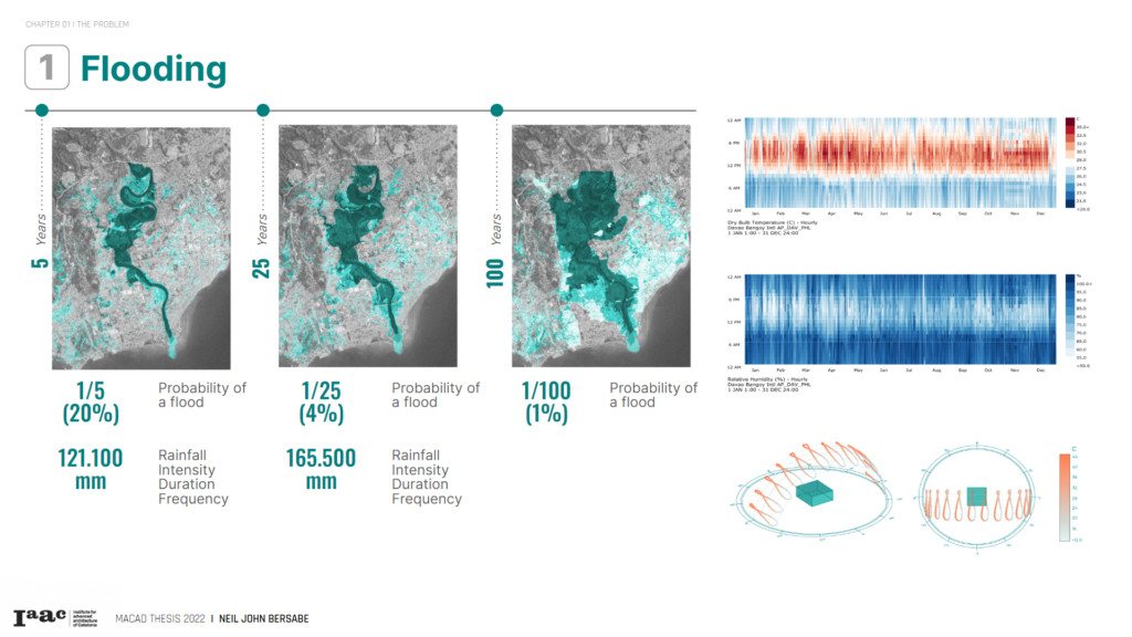
1. FLOODING
Davao City is densely populated, with approximately 800 people per square kilometer. The city is rapidly progressing with developments already underway.
However, despite the census, Davao City is prone to heavy flooding because it sits atop an alluvial flood plain. Unfortunately, these developments produce some adverse issues.
Urban Flooding is one of the perennial problems that affect the city. The cause is the lack of drainage systems, constriction of waterways, and encroachment of natural drainage paths.
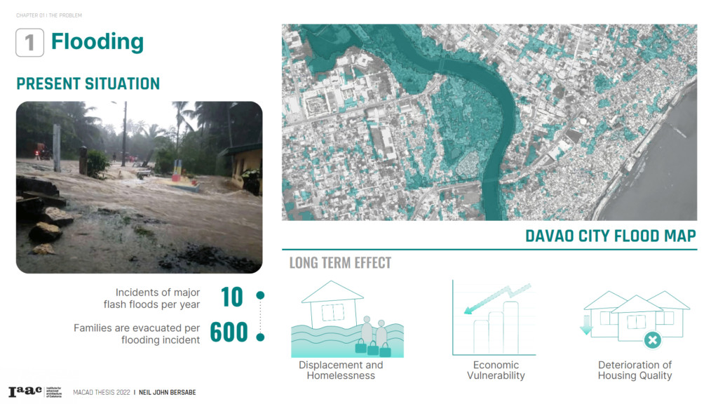
The disruption caused by flooding poses an immeasurable setback to the progress and economic growth of the community.
The immediate impact of flooding includes displacement and homelessness. Similarly, the damage to livelihood and infrastructure can cause long-term disruptions that can lead to economic vulnerability and deterioration of housing quality.
The economic setbacks hinder progress for communities. The proliferation of the settlements in
hazardous zones of the city causes adverse sustainability impacts on its residents.
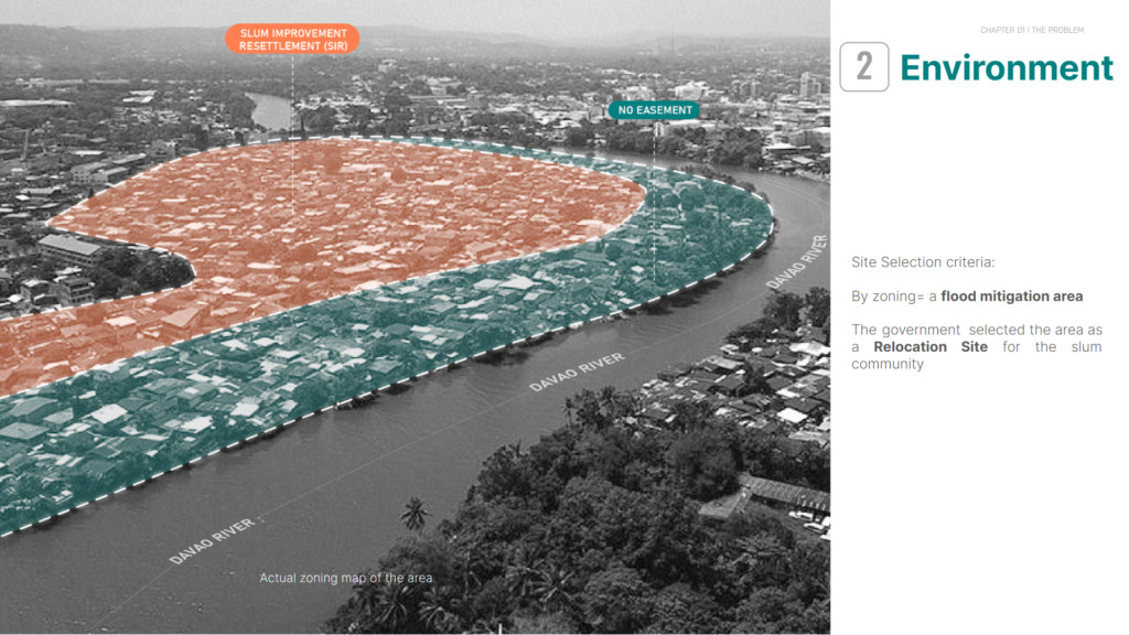
2. ENVIRONMENT
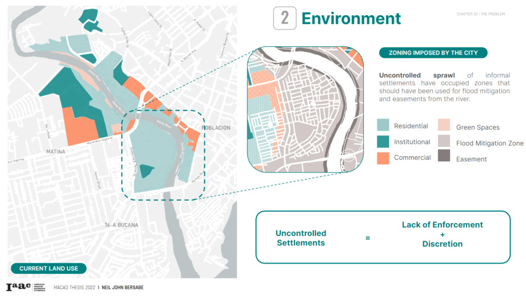
Uncontrolled sprawl of informal settlements have occupied zones that should have been used for flood mitigation and easements from the river.
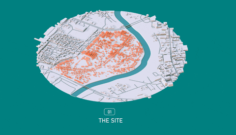
The site used for the study is a 30 hectare socialized housing community that is located near the riverbank and highly susceptible to flooding.
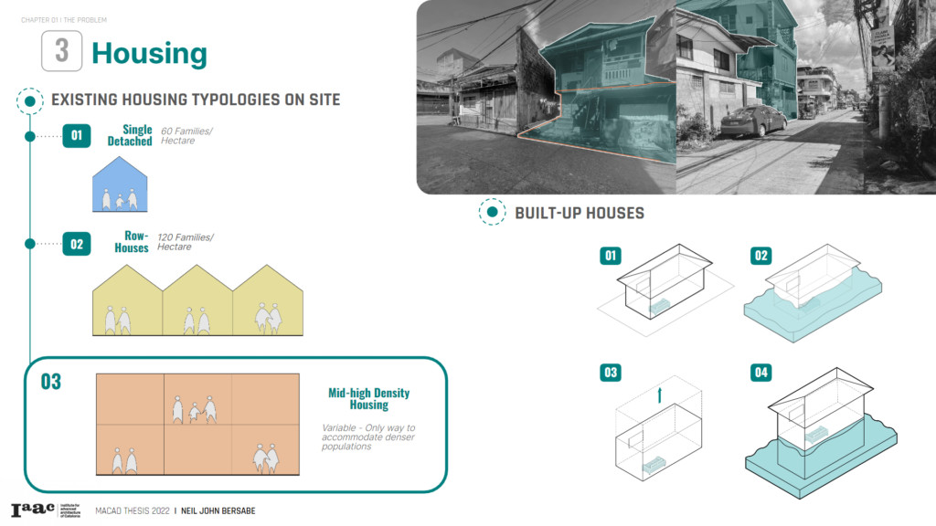
3. HOUSING
The linkages between poverty and environmental factors led to the emergent need for housing. The lack of adequate dwellings urged the proliferation of the slum community that developed into factions of illegal and unplanned settlements.
Although the slum community may have created temporary dwellings, the poor living environment exposes it to harsh environments such as heavy rains and floods, posing a threat to the security of their shelters. These communities pose a threat to the housing economy, but taking a step back to rethink design strategies for these communities might be the only solution.
4. COMMUNITY BEHAVIOR
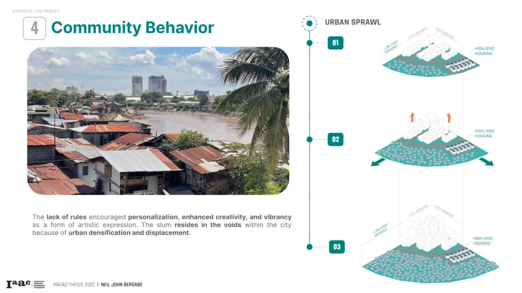
The majority of the slum community is often generalized as poor. On the contrary, the slum community comprises diverse cultures and characters. The people are compelled to build make-shift houses, creating a space based on personal specifications and needs.
The lack of rules encouraged personalization, enhanced creativity, and vibrancy as a form of artistic expression. The slum resides in the voids within the city because of urban densification and displacement.
The focus of the study is to create new design strategies that elevate the way of living. The current housing and resettlement design strategies require a series of metamorphoses and are precursors to understanding the social dynamics and housing structures that are impactful to innovation.
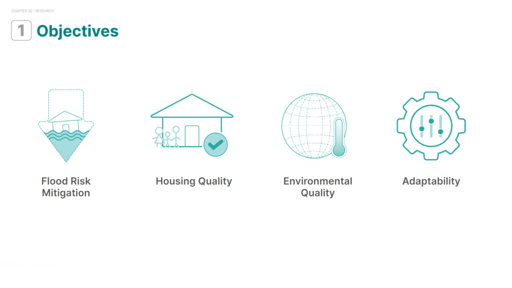
GOALS
Understanding different environmental, societal and economic problems surrounding housing typologies is essential. The goal is to propose new resettlement strategies by addressing relevant issues categorized by the four main objectives and creating a parametric model driven by performance metrics.
METHODOLOGY
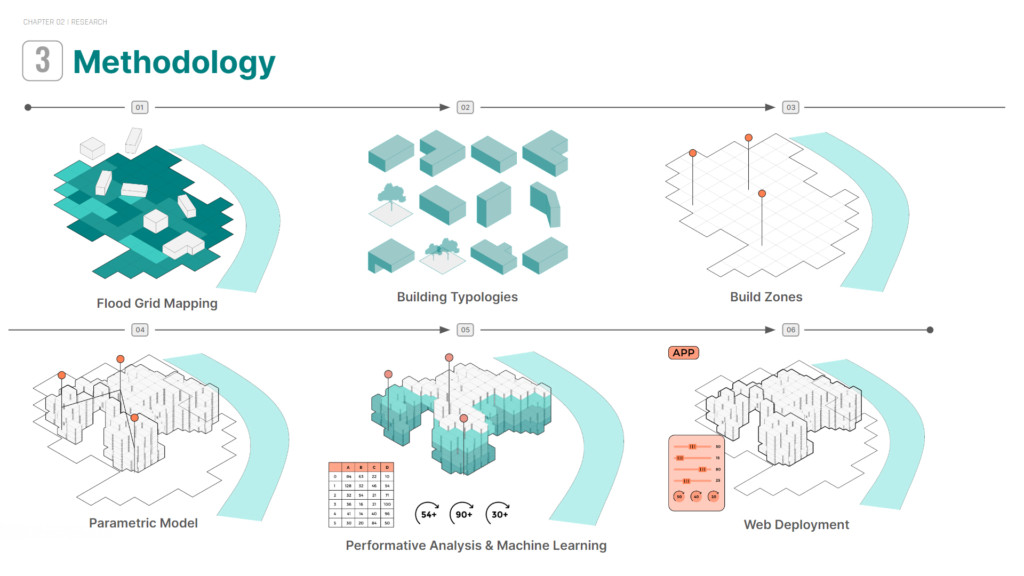
DATA AND ANALYSIS
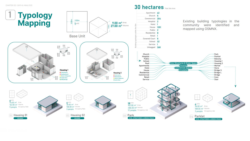
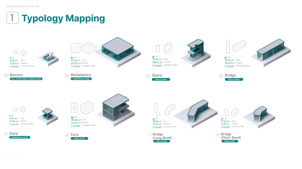
1. TYPOLOGY MAPPING
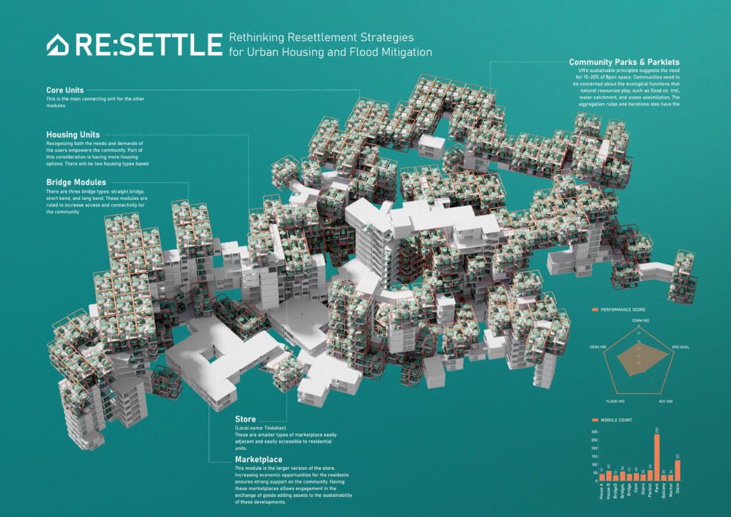
Existing building typologies in the community were identified and mapped using OSMNX. Synthesizing them into key categories, we are able to create different modules for the proposed community aggregation.
The proponent used the base unit of a 3m x 3m x 3m cube grid as the base building block to design the different modules to define a modular system of construction.
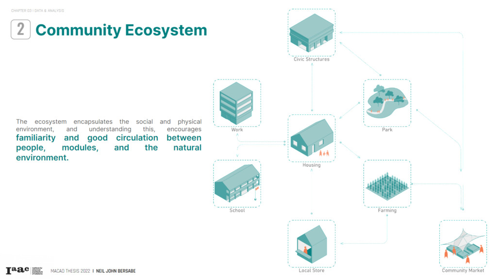
2. COMMUNITY ECOSYSTEM
The ecosystem understands the community’s lifestyle and way of living. The structure of the ecosystem encapsulates the social and physical environment, and understanding this, encourages familiarity and good circulation between people, modules, and the natural environment. Additionally, the proposed ecosystem allows the community to strive independently as different modules complement each function and promote sustainability.
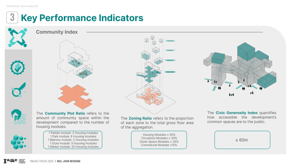
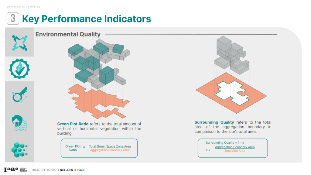
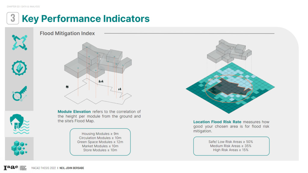
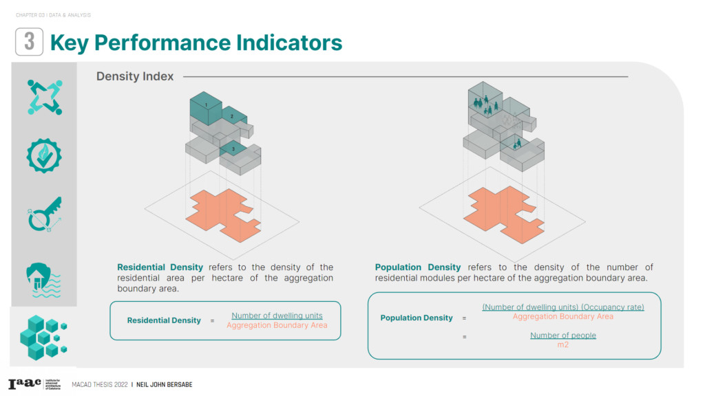
3. SYNTHESIS: KEY PERFORMANCE INDICATORS
A good assessment of building performance will heavily anchor the proposal’s success.
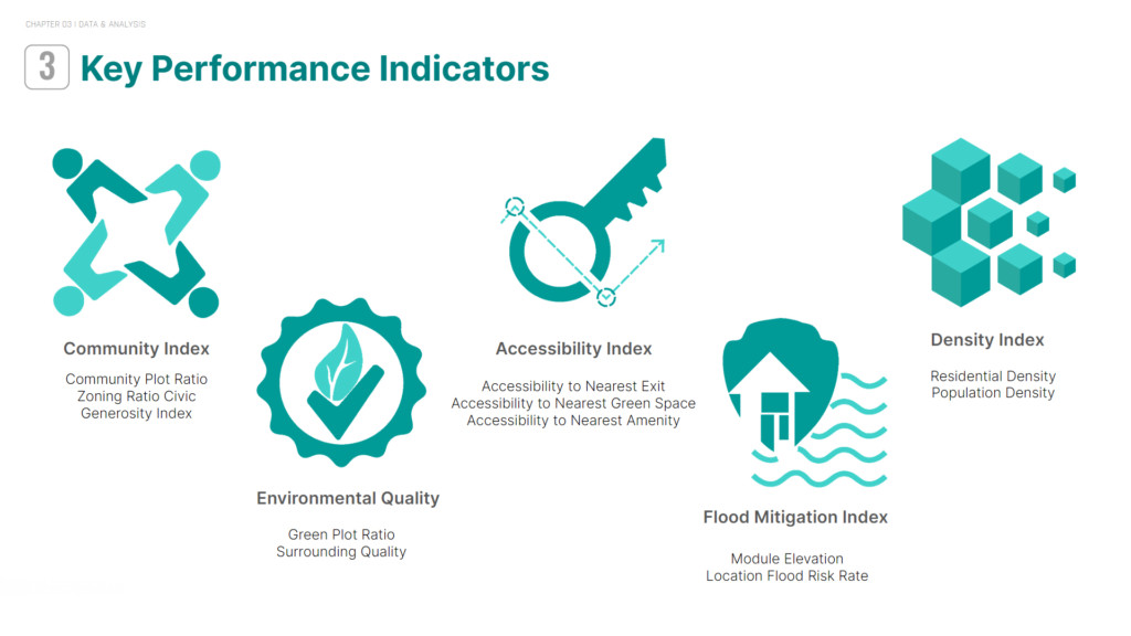
- COMMUNITY INDEX
- ENVIRONMENTAL QUALITY
- ACCESSIBILITY INDEX

- FLOOD MITIGATION INDEX
- DENSITY INDEX
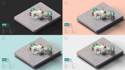
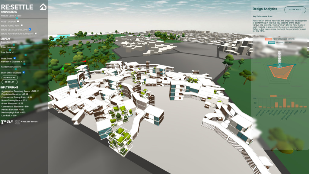
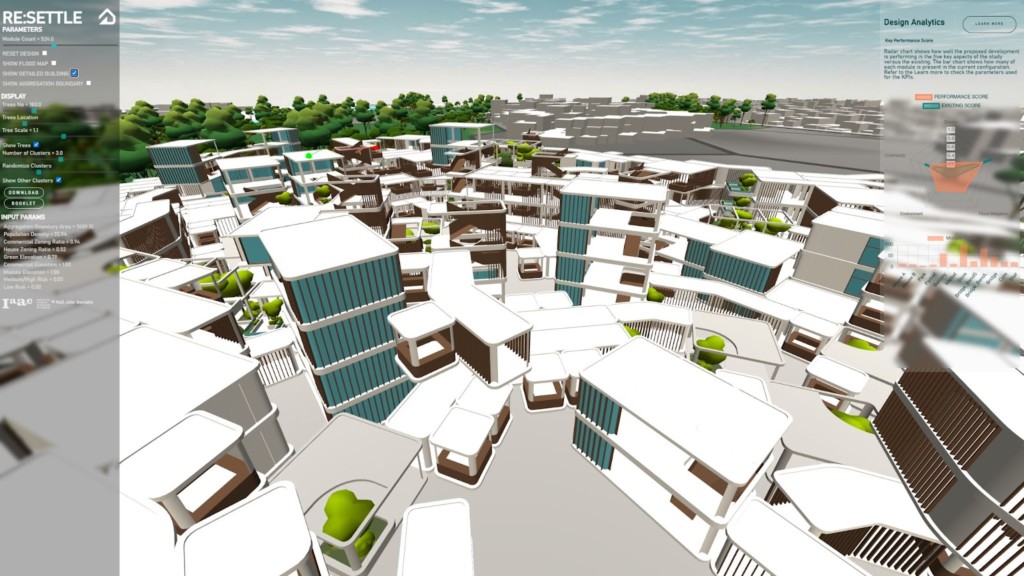
THE PARAMETRIC MODEL
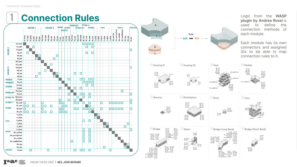
1. CONNECTION RULES
2. RULES GRAMMAR

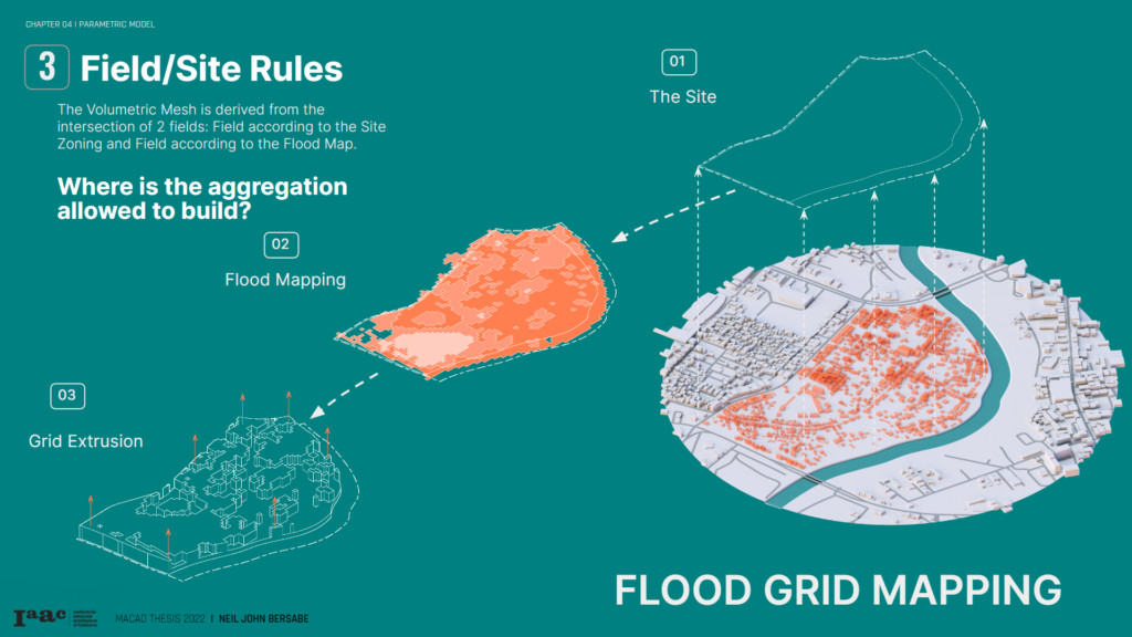
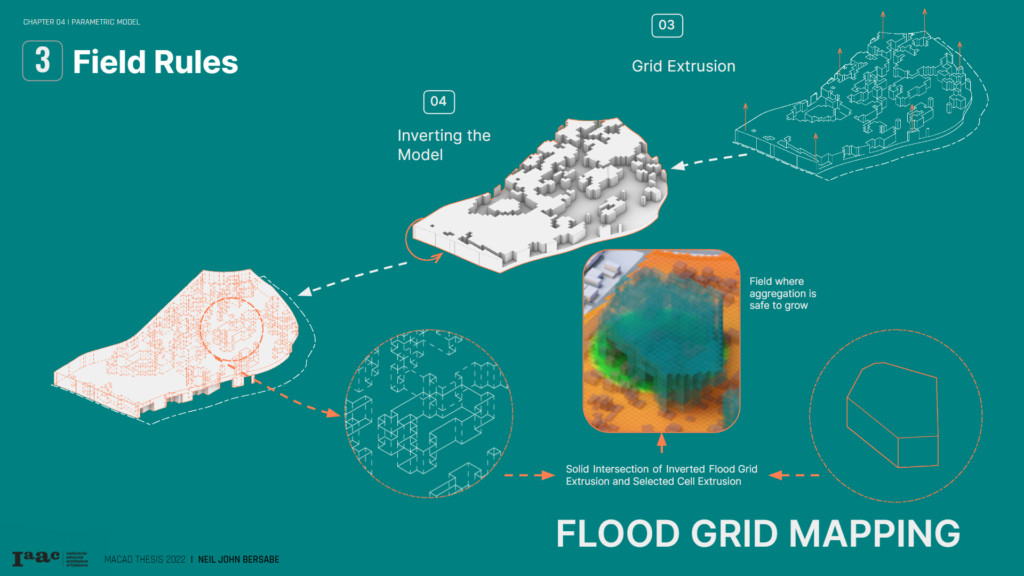
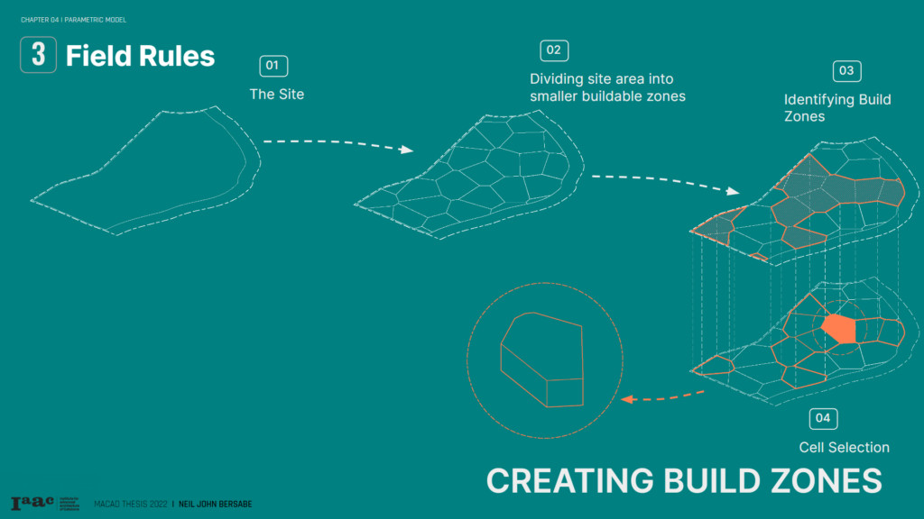
3. FIELD RULES
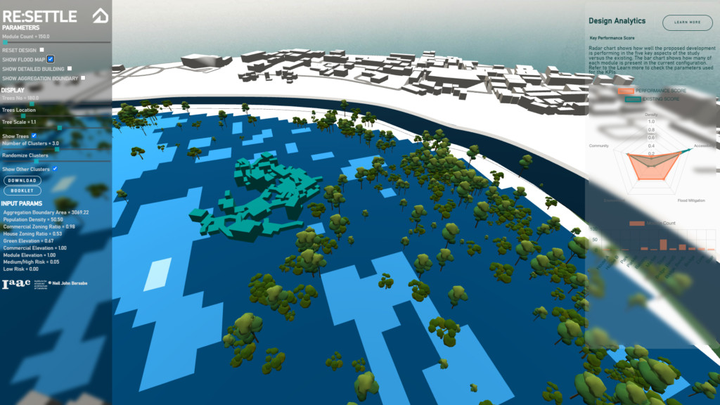
The Volumetric Mesh is derived from the intersection of 2 fields: Field according to the Site Zoning and Field according to the Flood Map. The Site Zoning Field was created by extruding one of the cells within the built zone upwards, creating a polysurface. This was then intersected by another polysurface created by the Flood Map via setting extrusion values on grid cells based on the Flood Map of the site . The resultant geometry was then extracted as the Volumetric Field for the aggregation.
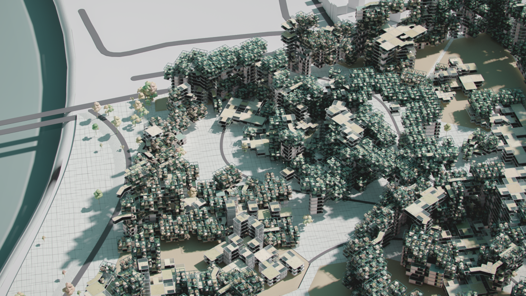
4. COMMUNITY AGGREGATION
5. NEIGHBORHOOD CLUSTERING
The function of each neighborhood is defined by its dominating module. Hence, three neighborhood types shall be identified: farming, commercial, and residential. If such instances occur where there is more than one dominating module, it will be classified as a mixed-use neighborhood with the main functions of the dominating modules.
MACHINE LEARNING & WEB DEPLOYMENT
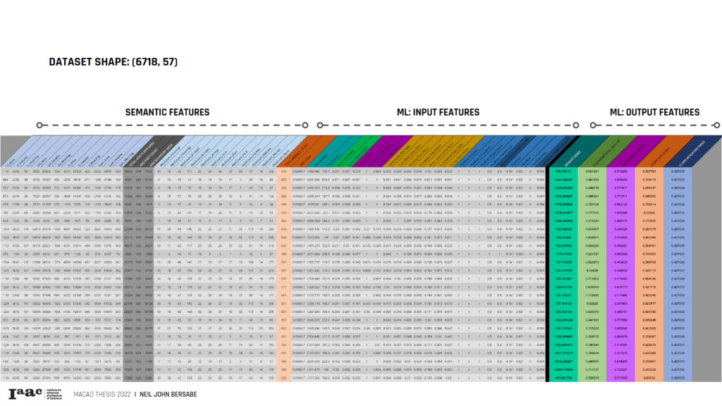
1. DATASET
The dataset is comprised of numerical data gathered from the grasshopper definition getting the input data, semantic features, and output. The current dataset has around 6700 samples with 57 columns.

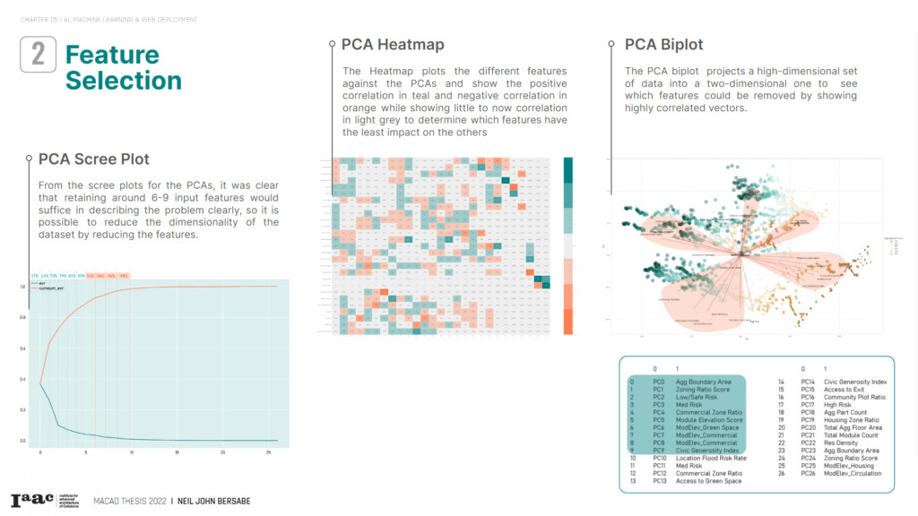
2. FEATURE SELECTION
The dataset currently has a variety of input features. For feature selection, a better understanding of each feature must be visualized and understood to reduce the dimensionality and drop unnecessary features. This step ensures a concise model that minimizes the chances of overfitting. Finding correlations through plots and reducing dimensionality with PCA (Principal Component Analysis) will be used to identify and drop correlated features.
CORRELATION HEATMAP
The correlation heatmap shows which attributes are related either proportionally or inversely. This plot shows the lighter-colored cells have little correlation between them and gives an insight into which features linearly influence the features we want to predict.

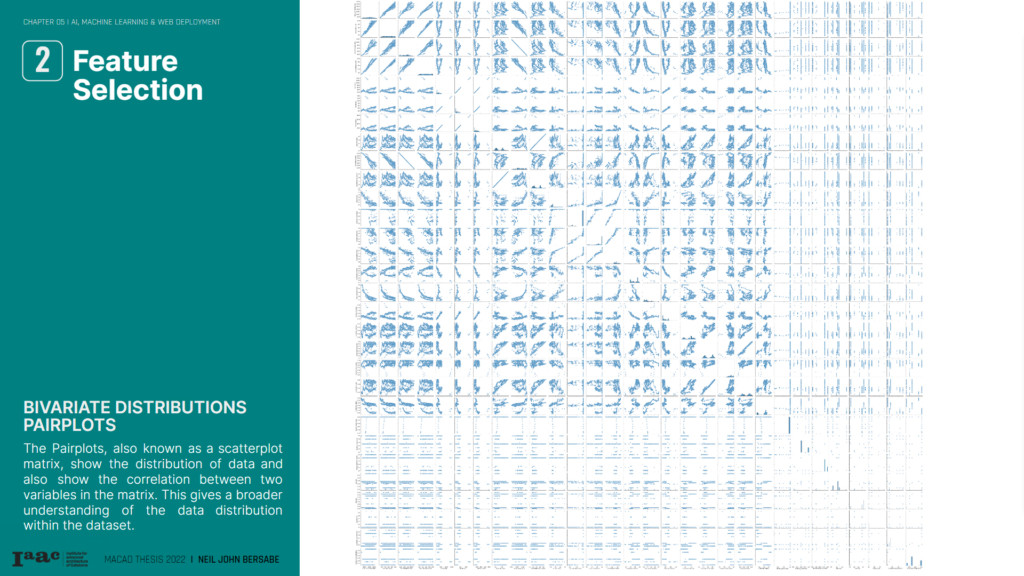
BIVARIATE DISTRIBUTION PAIRPLOTS
The Pairplots, also known as a scatterplot matrix, show the distribution of data and also show the correlation between two variables in the matrix. This gives a broader understanding of the data distribution within the dataset.
 \
\
PRINCIPAL COMPONENT ANALYSIS
The Pairplots, also known as a scatterplot matrix, show the distribution of data and also show the correlation between two variables in the matrix. This gives a broader understanding of the data distribution within the dataset.
The Heatmap plots the different features against the PCAs and show the positive correlation in teal and negative correlation in orange while showing little to now correlation in light grey to determine which features have the least impact the others
The PCA biplot projects a high-dimensional set of data into a two-dimensional one to see which features could be removed by showing highly correlated vectors.
SUPERVISED MACHINE LEARNING: LINEAR REGRESSION
Supervised machine learning: linear regression will be used as the machine learning model.
From the dataset, we have 6718 rows of samples. Using feature reduction strategies like Principal Component Analysis, We have also managed to reduce the number of feature columns from 51 to 9 entries.
The first training model architecture results turn out to be slightly overfitting. This might be due to the fact that there are too many parameters in the architecture even with the application of a dropout layer. For the next iterations, some options for optimizing this loss function could be increasing the dropout percentage or reducing the number of parameters in the model architecture
The second training model improved slightly better with the reduction of the loss value. Succeeding iterations would play around the reduction of the parameters more and tweaking the model architecture.

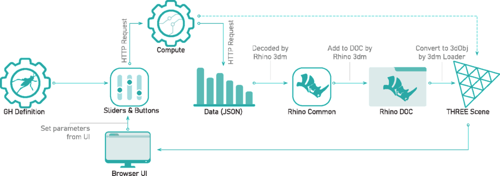
WEB DEPLOYMENT
The website RE: SETTLE uses a Graphic user interface. It is an interactive website containing carefully selected topics to educate the users regarding the Study’s creation, formation, and end product using multiple software and applications.
PUBLICATION
© RE:SETTLE is a project of IAAC, Institute for Advanced Architecture of Catalonia developed at
Master in Advanced Computation for Architecture and Design (MaCAD) in 2021/2022
by student: Neil John Bersabe and Faculty: Angelos Chronis
