Antarctica is a place driven by science. Majority of the people engaging in this frozen continent are scientists.
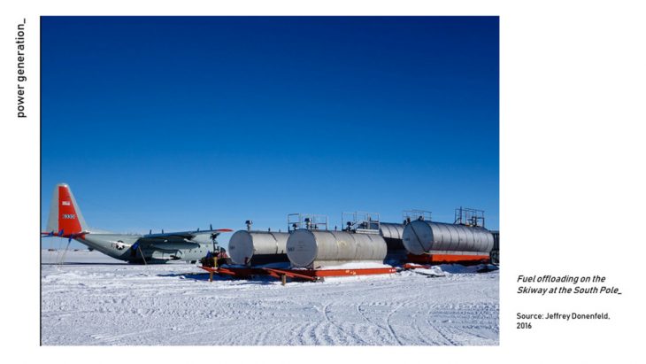
However, having extreme conditions such as harsh climate, living in Antarctica is tough. One example is the use of energy. Fossil fuel is the main source of energy, which in return damages the pristine environment of Antarctica.
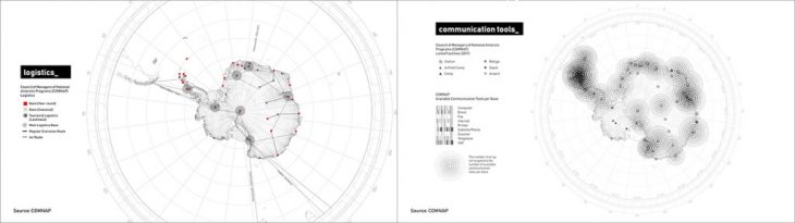
Digital connectivity and logistics also display a problem in Antarctica. As a scientist performing scientific activities in this frozen continent, it is important to have a stable supply of resources and goods in order to survive. Alongside, a good connection also plays a role for knowledge transfer.
With all the conditions stated above, the goal of the group is to identify the knowledge and efficiency index of Antarctica using hexagonal grids.
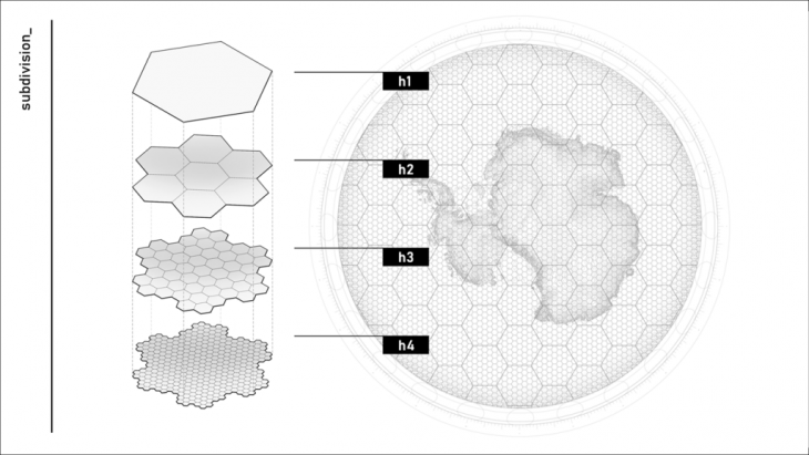
The group used the hexagonal grid as its guides in analyzing and optimizing potential use of areas of Antarctica. It is scaled down into 3 layers which each has dedicated role: 1) Scientific research, 2) Energy, and 3) Digital connectivity.
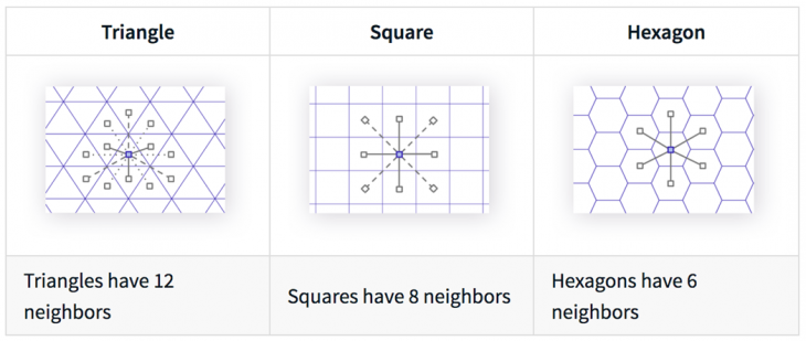
Using hexagons is a great tool for clustering and analyzing territorial fabrics as it has more connections to dissect. At the same time, it is equidistant from one center of hexagon to the other which makes it fair and free from bias.
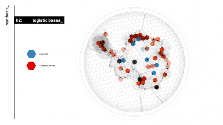
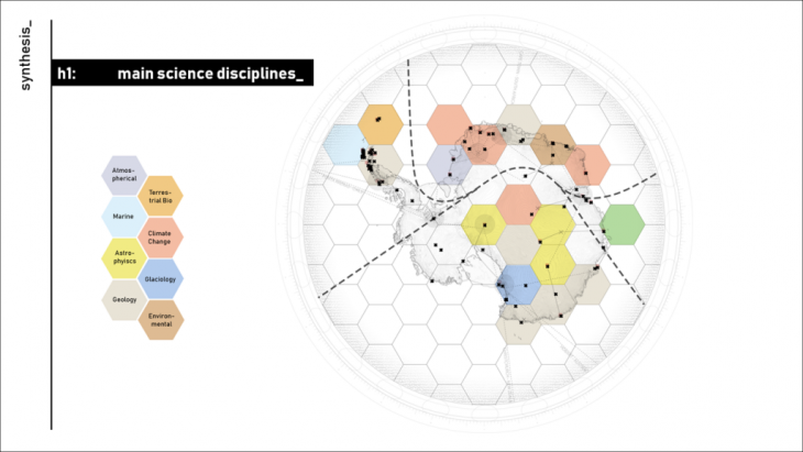
The group started by identifying the total number of communication tools each base has. At the same time, the logistics per base by how close one is to the main points of transfer of goods. Lastly, the group clustered the bases based on the most practiced science disciplines per main hexagons.
After analyzing the existing conditions, the group was able to see that there were indeed voids. With these voids, the group used this as an opportunity to formulate a new potential map for Antarctica in the future using scientific activities as its basis.
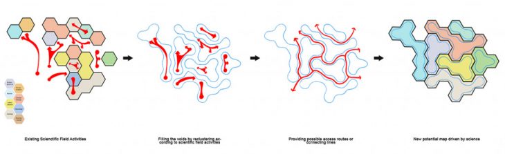
By reclustering the current hexagons into a more compact areas arranged according to existing scientific fields, it could maximize the potential of Antarctica, making it a network of science.
Prospecting Strategy in Antarctica – Hexagonal Hierarchical Spatial Index is a project of IaaC, Institute for Advanced Architecture of Catalonia
developed at Master in City & Technology in (2019/2020) by:
Students: Aryo Dhaneswara, Jianne Libunao, Rovianne Santiago
Faculties: Manuel Gausa, Nicola Canessa