INTRODUCTION
The following grasshopper script shows the coverage or influence of the municipality urban gardens and the educational urban gardens (space to promote the sustainable agriculture) in the urban area of Barcelona. The purpose of this code is determine which areas lack agricultural space and shows the size of each urban garden.
Grasshopper Script
URBAN GARDENS
Barcelona has urban gardens around the city, these spaces are promoted by the municipality to promote the agriculture and the consume of organic products, the following image show the influence or coverage of the urban gardens plots, with this map is easy to see which areas have better accessibility to the urban gardens.
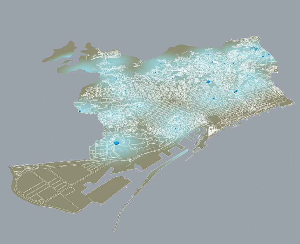
BCN Urban Gardens – Influence
EDUCATIONAL URBAN GARDENS
The municipality of Barcelona has different projects like Pla BUITS and the Eje Montaña Project, to promote the social participation in the society, in the case of Pla BUILTS the municipality give to the citizens empty lots inside the city to do temporal interventions. The Eje Montaña project seeks to bring citizens closer to the Collserola farming area to rescue the agricultural identity of the area. These educational social spaces give to the citizens to chance to exchange knowledge and culture, to create a sustainable city.
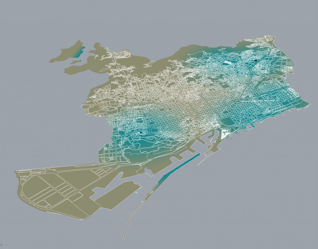
Educational Urban Gardens
SYSTEM INFLUENCE
The image shows the influence of urban gardens in the city, the red color shows the lack of these spaces and the green the areas that have the greatest influence. In this script the parameters can be changed according to the importance of each element, in this case the educational gardens are more important than the urban gardens.
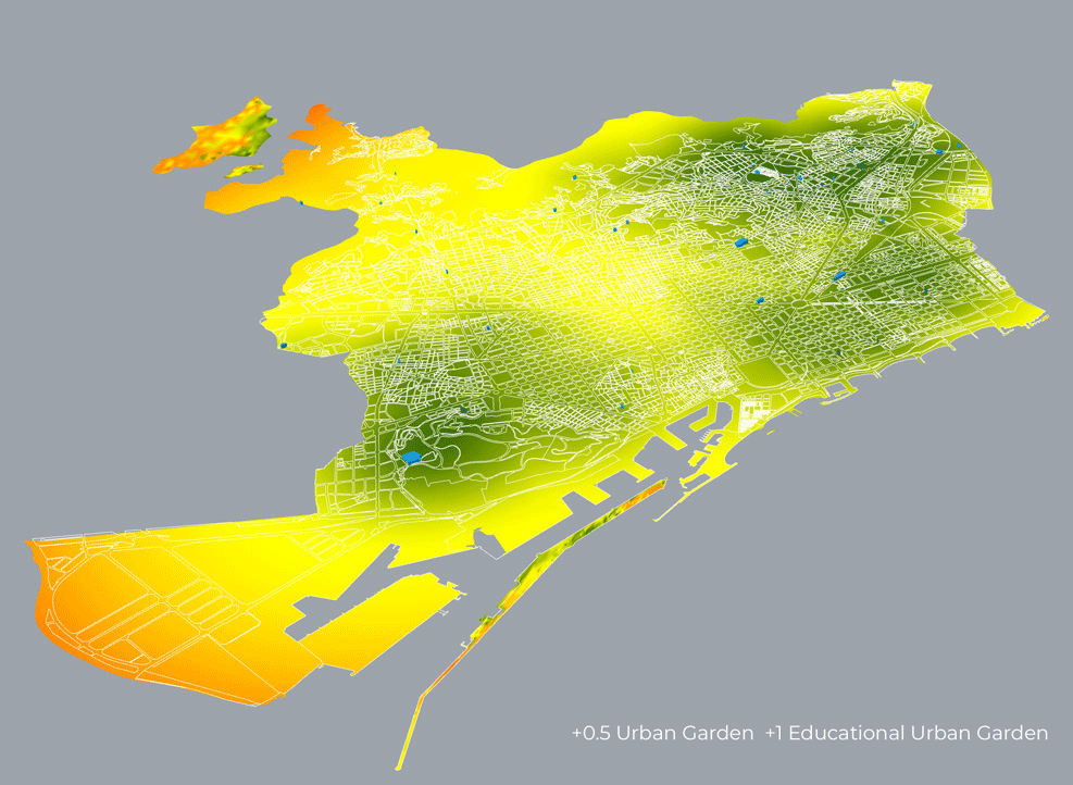
System Parameter
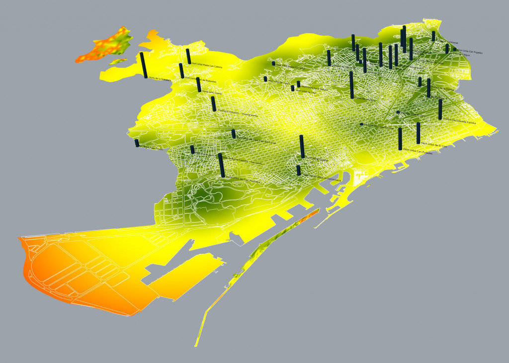
URBAN GARDENS SIZE
The image shows the size of each plot to determine the spatial influence that each urban garden has in the city. The script allows to include the name of each urban garden, for a better representation.
Urban Gardens / Educational – Size
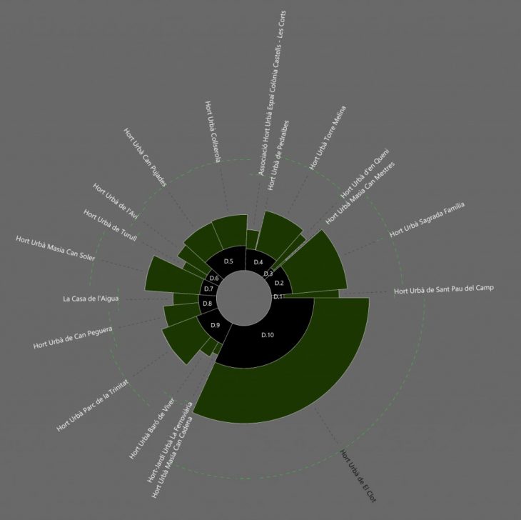
PIE CHART
The pie chart shows the size of each Urban Gardens by district in Barcelona.
Urban Gardens Pie Chart
VIDEO
SOURCE
The data was gathered in QGIS from:
The Institut Cartogràfic i Geològic de Catalunya.
Influence of Urban Gardens in Barcelona, is a project of IAAC, Institute for Advanced Architecture of Catalonia developed at Master in City & Technology in 2020/21 by student: Kevin Aragón, and faculty: Eugenio Bettucchi & Iacopo Neri.
