Manifesto
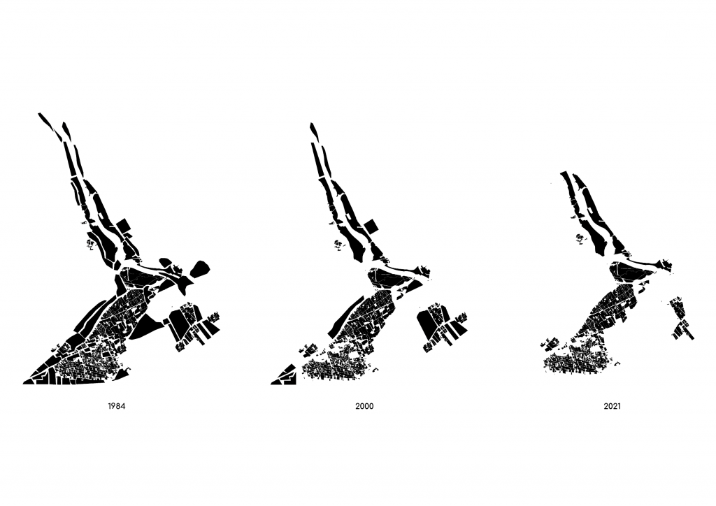
The goal of the project is to implement a holistic solution to the urban invasion into the Parc Agrari del Baix Llobregat and with time potentially start to reverse the invasion and bring agriculture and nature into the city. In the current situation of the park, the rapid expansion of urban development has caused a conflict of interests and a manifestation of a linear way of thinking.
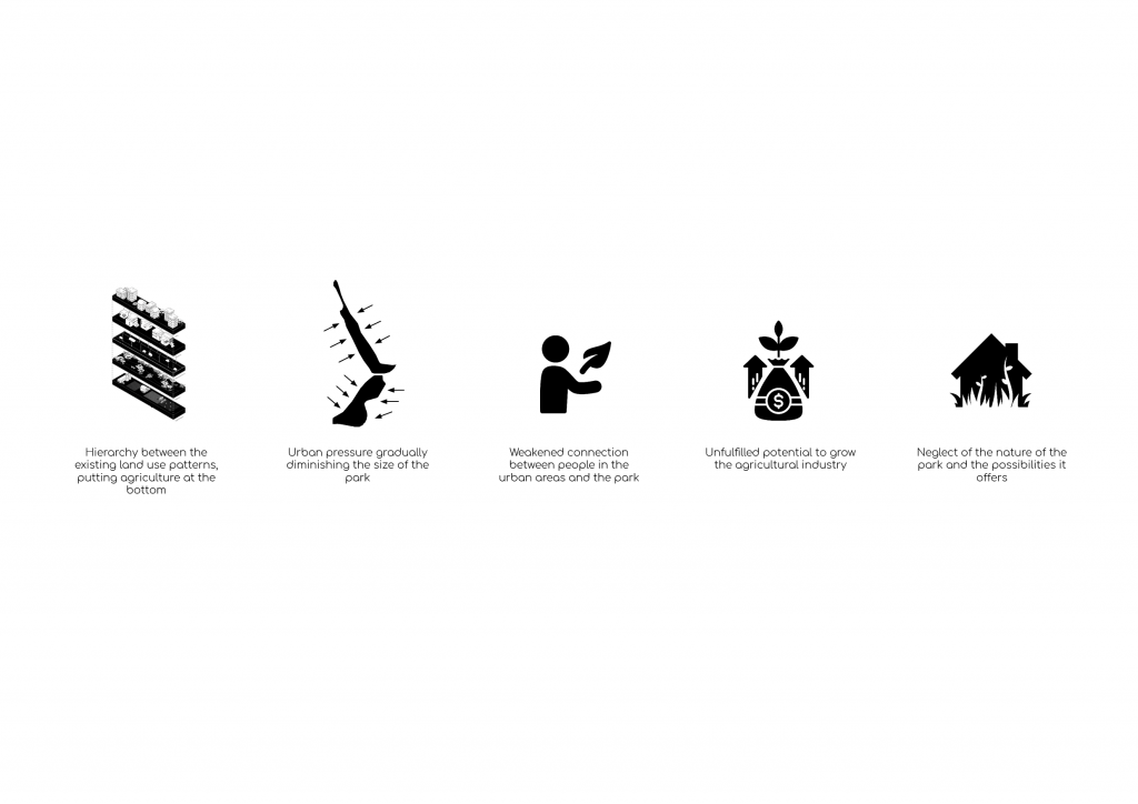
A hierarchy of land use patterns has formed, which places agriculture at the bottom, causing neglect and reduction of the scale of the park. These mechanisms have not brought an environmental purpose or awareness and have placed the importance of large-scale development strategies over the importance of human quality and connection to the park. The approach, chosen to tackle these problems, is an investigation of the different existing land use patterns within the park and around its borders and to design a coherent solution to the issues deriving from the urban pressure put on the park.
The aim is to develop a grid system that allows for developing site-specific solutions to the problem areas of the border at different scales, depending on the specific typologies. This approach presents opportunities that implement a large set of new programs into the grid – “agropixels”, and populate the agro-urban resolution.
Contextual Situation
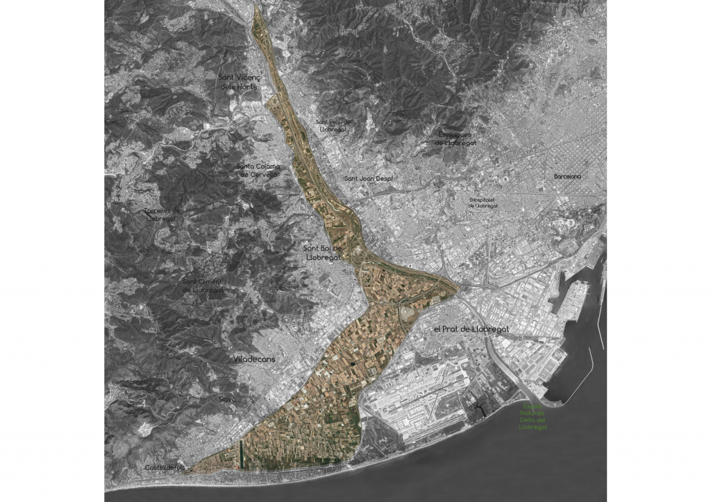
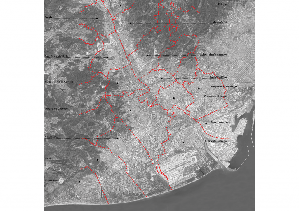
Parc Agrari del Baix Llobregat is located in the alluvial plains of the delta and the lower basin of the Llobregat River, in close proximity to the metropolitan region of Barcelona. The territory of the park is part of fourteen municipalities which add up to 730,000 inhabitants of the more than 4 million in the metropolitan region. The agricultural park has an area of 2,938 ha.
Urban Centers
Agriculture is experiencing difficulties related to the world markets, climate change, and others, however, close to the city, it encounters even more problems. This makes the economic situation of peri-urban farms uncertain and threatens their viability over time.
Urban Invasion
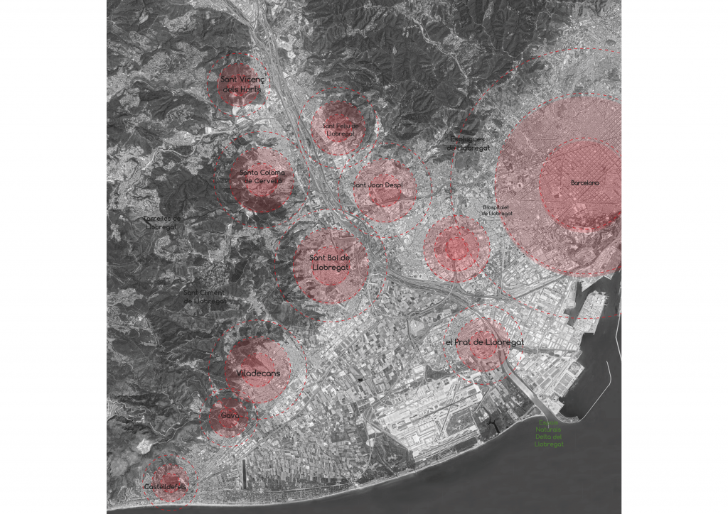
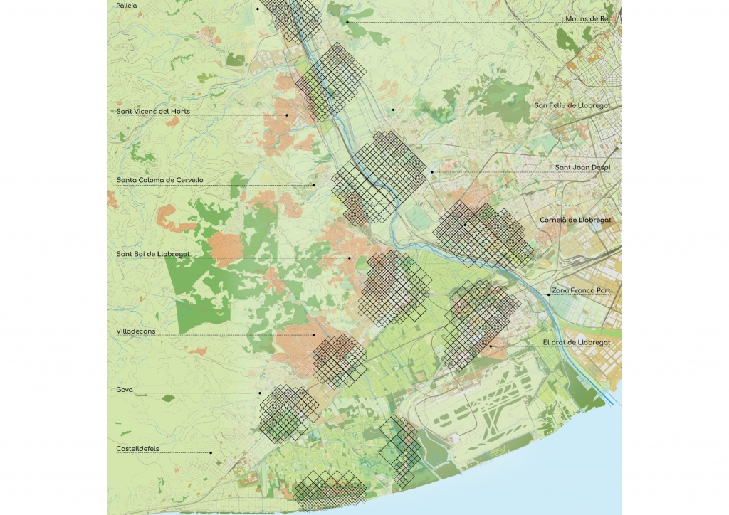
Municipalities
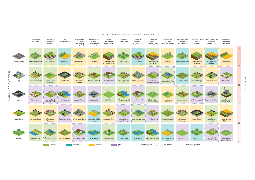
The territory of the park is part of 14 municipalities: Castelldefels – Tourism, Cornellà de Llobregat – Sports, Gavà – Culture & History, Hospitalet de Llobregat – High Density Cities, Molins de Rei – Culture (Traditions & Festivals), Pallejà – Low-Density Cities, Papiol – Natural Park, El Prat de Llobregat – Industry and Tourism, Sant Boi de Llobregat – Industry and Trade, Sant Feliu de Llobregat – Culture & Religion, Sant Joan Despí – Green Cities, Sant Vicenç dels Horts – Culture, Santa Coloma de Cervelló – Agriculture, Viladecans – Logistics & Services.
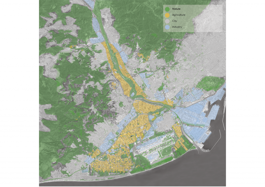
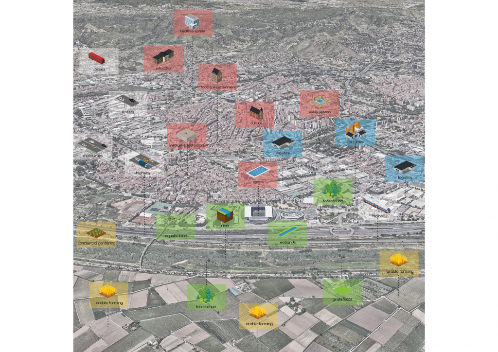
Land Use Patterns
Specific to the park is the pressure of the industry, which is directly related to the density and scale of Barcelona. The airport and the industrial harbor area striking features and a large zone between the city and the park.
Problems
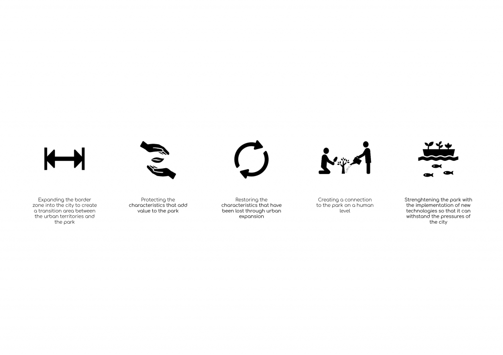
Objectives
Methodology
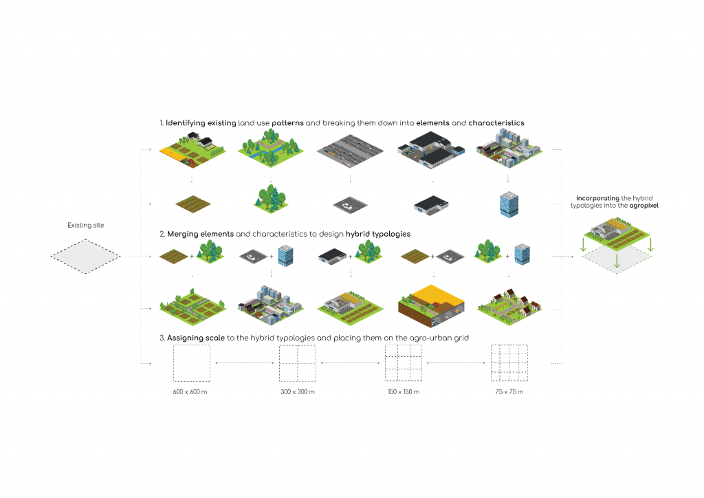
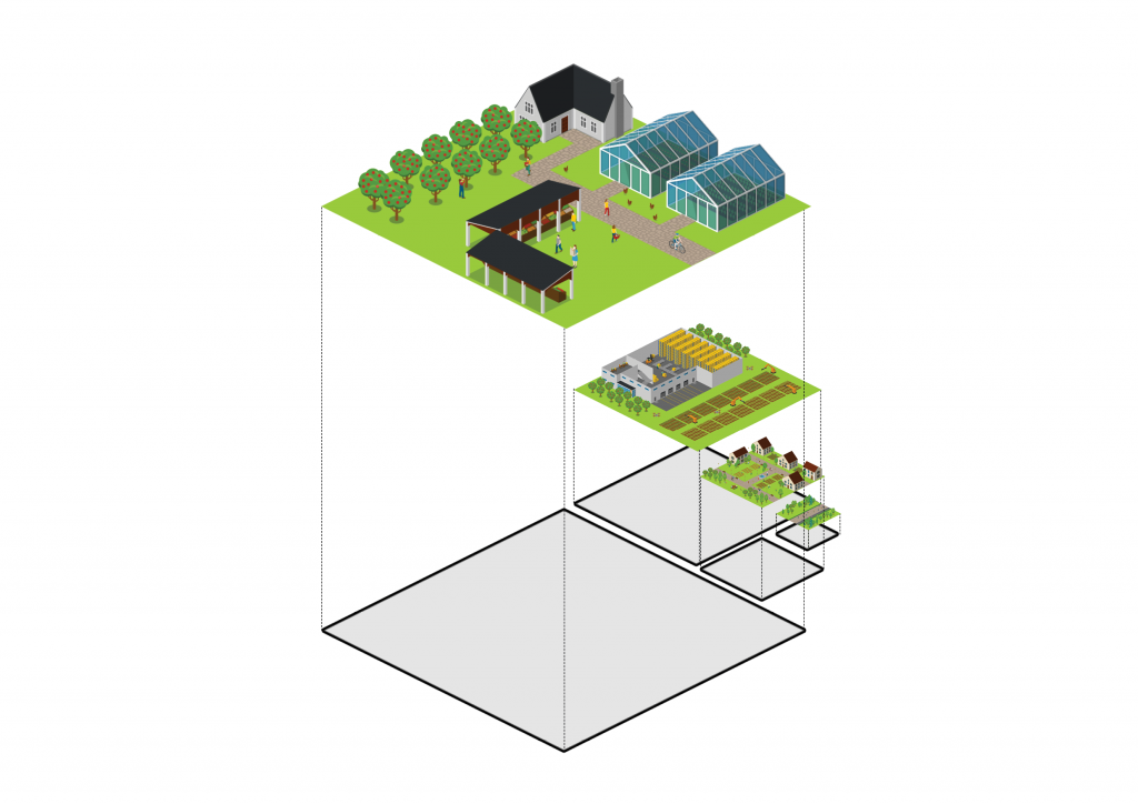
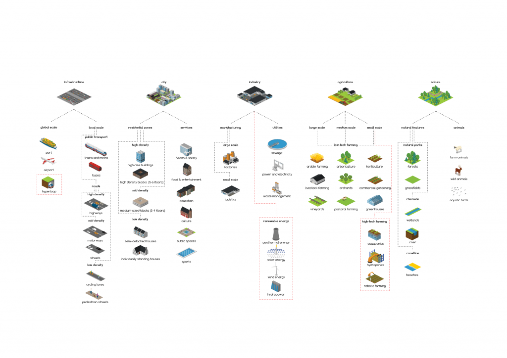
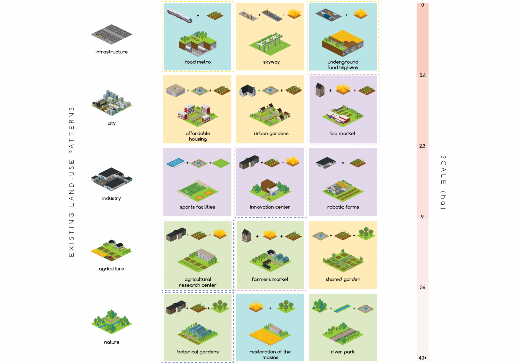
Toolkit
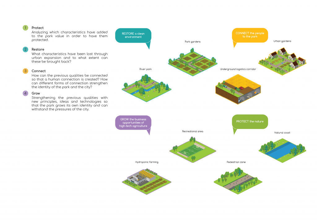
Protocols for Development
Agropixels Catalogue
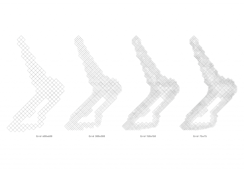
Grid Resolution and Scales
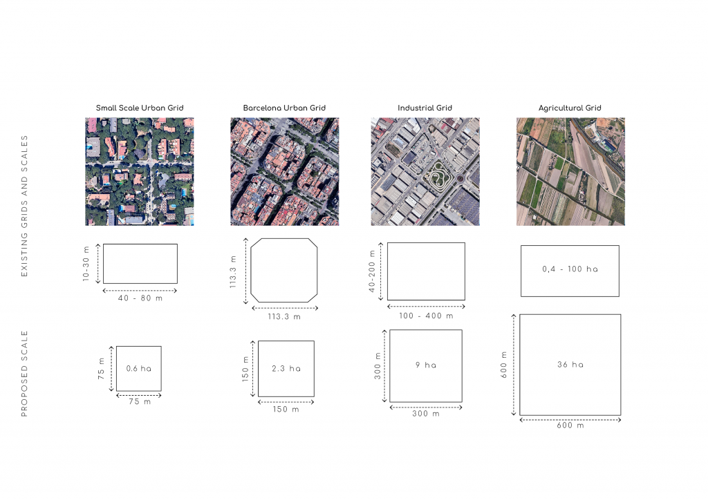
Grid-Scale Implementation
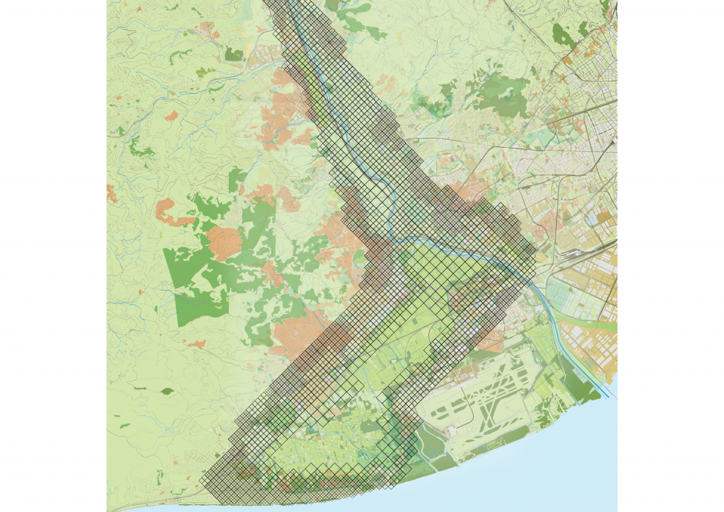
Grid Application
The expansive trend of the city developed over the years is being reversed and the park is being expanded towards the city. Due to natural barriers such as the sea and the mountains, the expansion is not uniform in size. There is a greater expansion potential towards Barcelona.
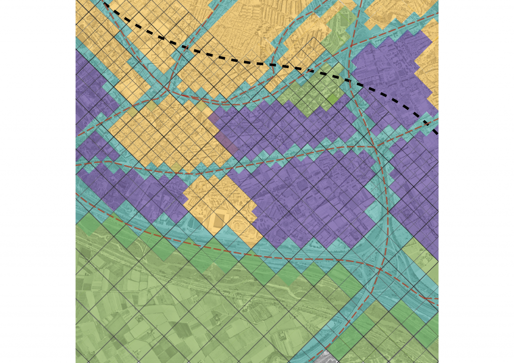
The grid system is completed over the entire expansion belt of the park. There is a transition from the large scale to the small scale. This makes it possible to create a transition zone that contains different hybrid land use patterns.
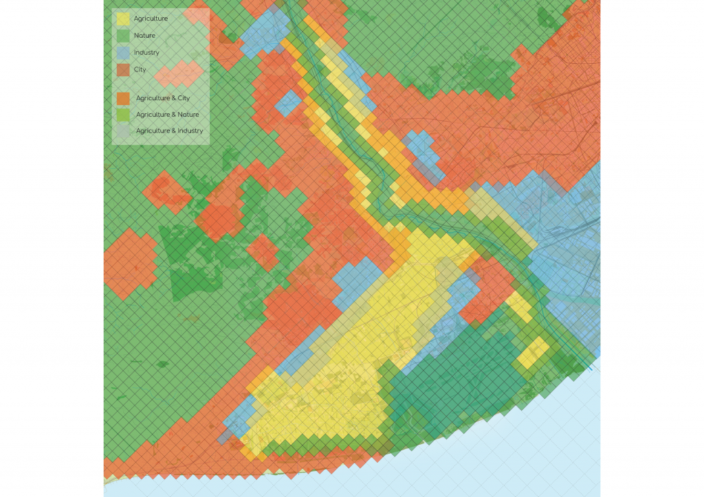
Landuse Merger
Using the pixel format, land-use is considered. With the expansion of agriculture and nature, these will overlap with the already existing forms of land use. New colors are created that indicate hybrid land-use possibilities.
Municipality Grid
Specific zones where the municipalities touch the park and the biggest problems arise. The zones are considered the first step of the intervention in order to create a specific district that is created in cooperation with the characteristics and elements of the specific municipality.
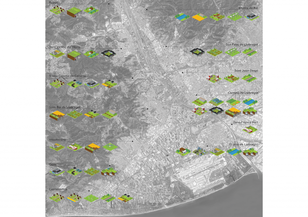
District Proposals
Using the catalogs, specific pixels are used to represent the district. These pixels are representative of the characteristics that already exist in the respective zone.
For example, some districts have a greater focus on the relationship between industry and agriculture and other districts have a greater focus on the relationship between the city and agriculture.
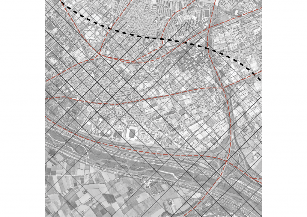
District Cornellà de Llobregat
The further development of the project takes place in the Cornelà de Llobregat district, as this is a good representation of the park. This is where all land-uses come together and forms an opportunity to create a sample study to represent the rest of the park.
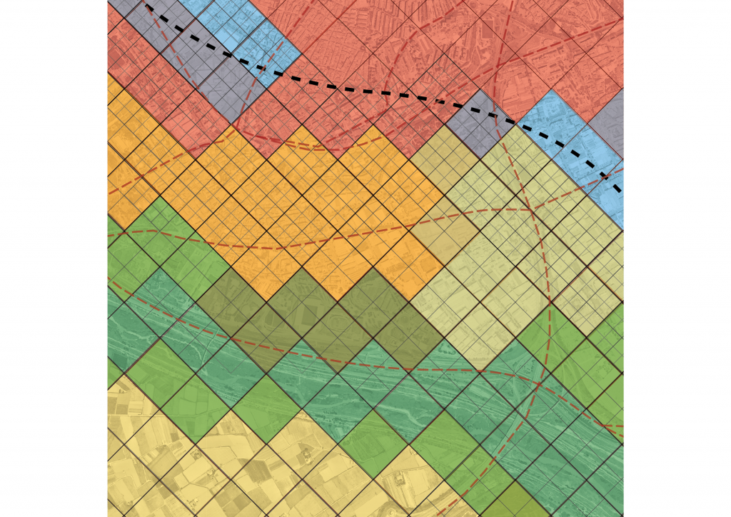
Land use Merger
Cornellà de Llobregat is a good example where different forms of land use come together. There is no transition between the different forms and a large barrier between the city industry formed by the infrastructure.
The expansion of nature and agriculture has created several overlaps in the use of the land. These overlaps are the positions for intervention where both land uses can be mixed and the barriers removed.
Toolkit Extraction
Using the toolkit, the different elements and characteristics in the existing landscape are extracted. This character of the area forms the base for the intervention merger with agriculture and nature.
Project Catalogue
After analyzing the elements that exist on-site, they are merged to create hybrid typologies which are placed on the agro-urban resolution of the site. These new typologies enable the transition between the different land uses.
Protocols
The protocol points out the attitude towards the development of the area. Certain elements in the landscape are more valued than others. This creates different areas that have different attitudes towards redevelopment.
Final Proposal
Implementing different projects that merge the different land uses into a unified where agriculture plays a central role. Agriculture is connected and merged with the city, industry, nature and the barriers are bridged.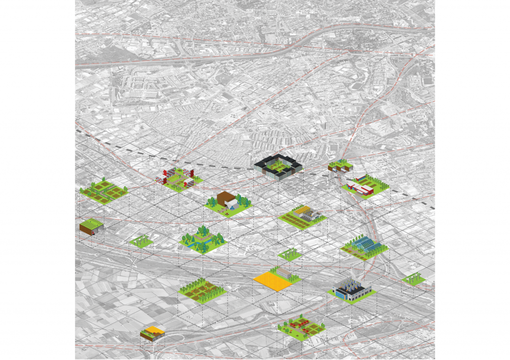
Agropixels // The Resolution of the Agro-Urban Fabric is a project of IaaC, Institute for Advanced Architecture of Catalonia developed at Master in Advanced Architecture in 2020/2021 by:
Students: Tsvetelina Bogdanova & Alexander Dommershausen
Faculty: Willy Müller & Manuel Gause
Assistant: Camila Álvarez
