VIDEOMAPPING VITORIA-GASTEIZ
The following project is an exploration through digital fabrication and interaction techniques in order to create a final videomapping project in a model based on the city of Vitoria Gasteiz, in the basque country.
In order to do the final exercise, during the course, we explored different manufacturing techniques to create our final model: Laser cutting, 3D printing and CNC.
LASER CUTTING
The aim of this exercise was to create different layers of data in transparent acrylic with diverse techniques: engraving, marking and cutting. These layers were introduced in an MDF box containing led stripes that allowed to illuminate the layers in a controlled way.
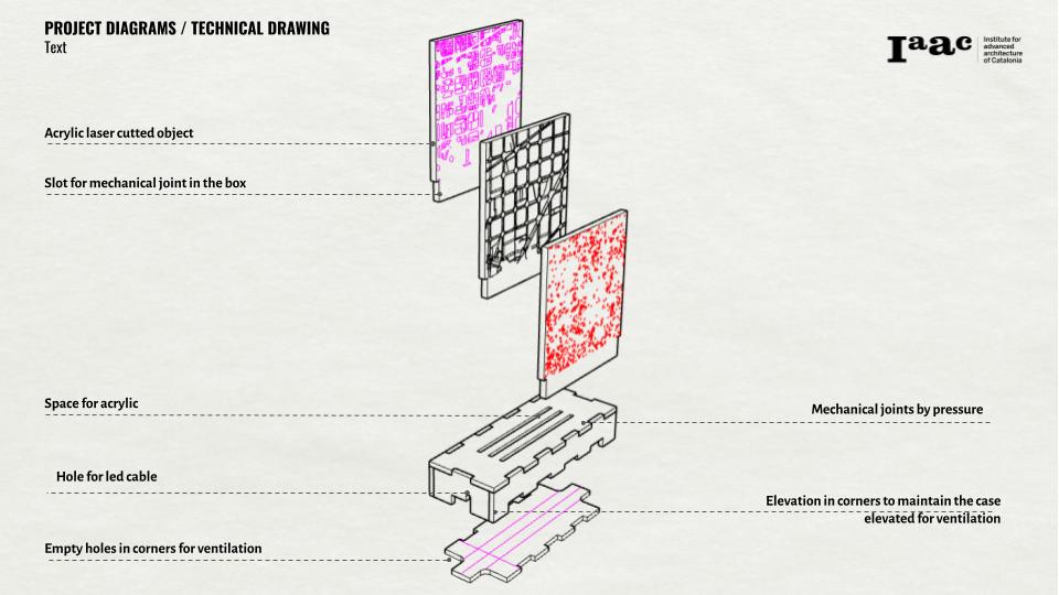
Technical drawing of conceptual diagram
The box, to prevent the overheating inside produced by the leds was controlled by elevating the box and creating a hole in each corner to allow natural ventilation. All of the project was ensambled through mechanical joints and the layers of data could be reordered changed.
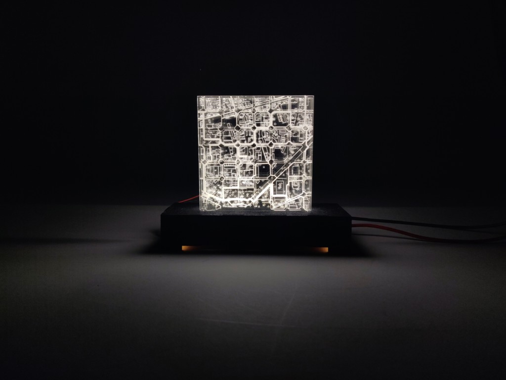
Final model
3D PRINTING
The objective of this exercise was to create an interactive object. Thanks to a till switch, the main purpose was to rotate the object and switch it on and off with movement. The main driver of the chosen form was, on one side, to save the most possible material by creating an enough strong structure that would allow not to use the infill with the intersection of 2 rotated hexagons. This rotation created a double empty skin shell. Thanks to this doubled skin shell, the thikness managed to create different visual effects in the object by allowing more or less the light to trespass the skin.
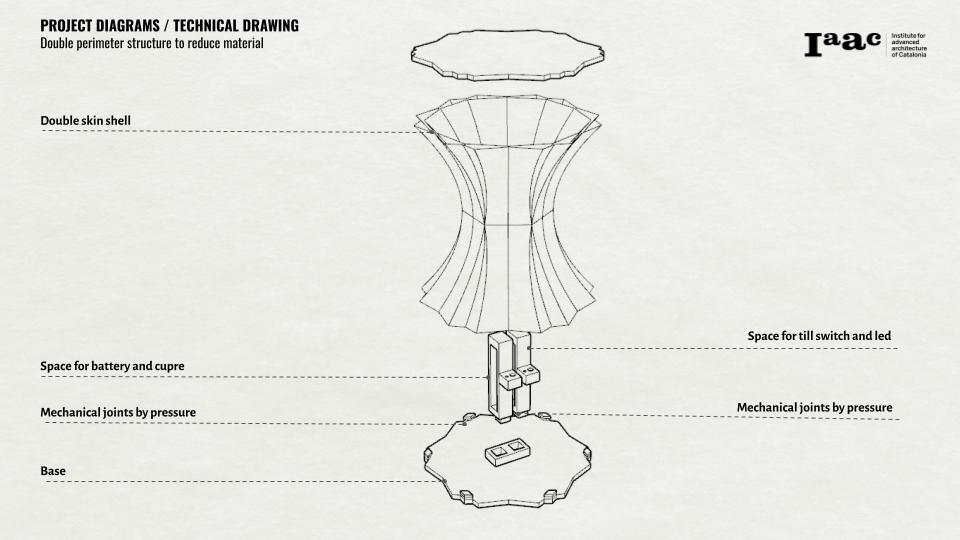
Technical drawing for conceptual diagram
In order to create the interactive part, the base could be extracted thanks to the tabs that worked by pressure. The mechanism could be removide thanks to the mechanical joints proposed. The electric circuit that enabled the lighting of the object had a battery, a till sensor (to respond to movement) and a led light)
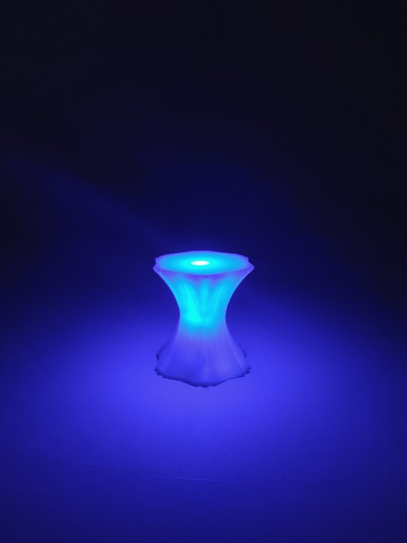
Final model
CNC
The last exercise’s objective was to explore the potential of CNC. In order to maximize this exploration, an area of study with high topography differences was chosen. The data chosen to be represented was: the terrain, the buildings and the roads.

Technical drawing of conceptual diagram
To achieve the complete model, parallel finishing was used to create the terrain, and horizontal roughing was used to create the roads and the buildings.
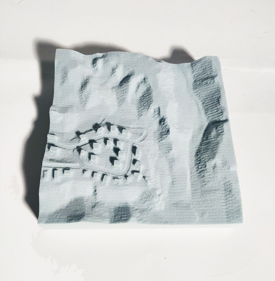
Final model
VIDEOMAPPING
By learning all these techniques, a model for the final exercise of videomapping was proposed. The area chosen was the city of vitoria and its surroundings to be able to represent the whole municipality itself but also its surroundings.
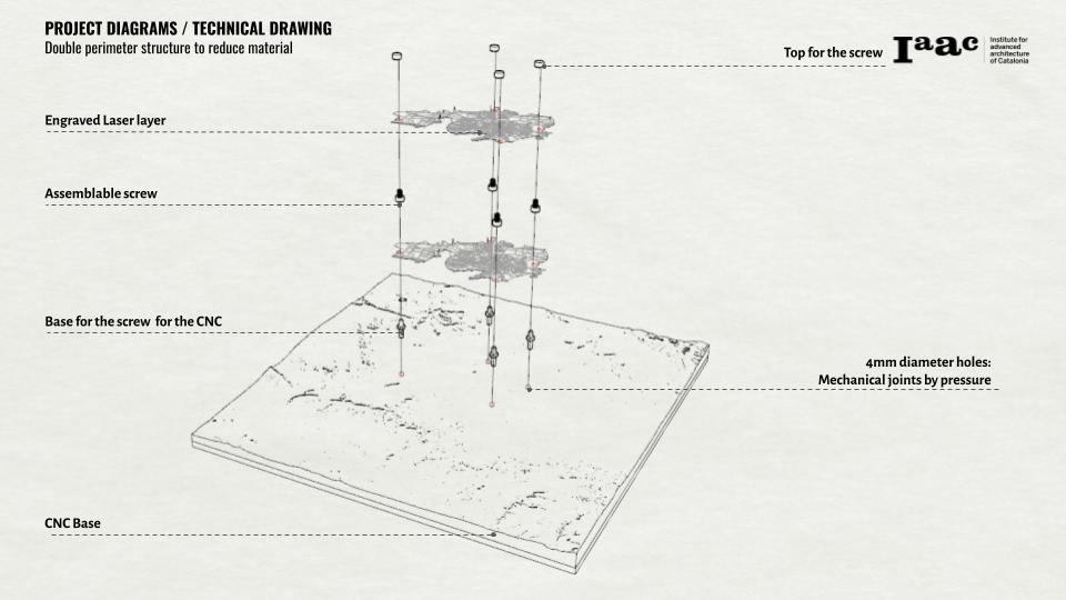
Technical drawing of conceptual diagram
The main idea that drived this model was to be able to be readapted through time. For achieving this aim, the terrain was created in plywood with CNC by using parallel finishing technique in both directions to create a smooth surface. The plywood structure helped to represent the topography lines in the material and increase the readibility of the terrain. On the other side, several holes were proposed to attach with mechanical joints two data layers printed in laser cutting. These two layers contained the buildings and parcels information. Ensamblable 3D printed screws were created to be able to add or change the laser cutted layers in the future.
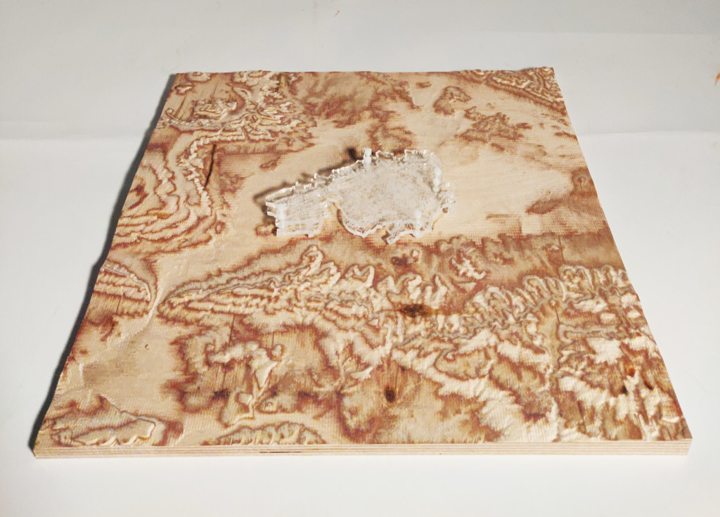
Final Model
The videomapping of the model showed the land use of the city of Vitoria Gasteiz with a storytelling in the legend in order to be readable by itself without the need of any additional support.
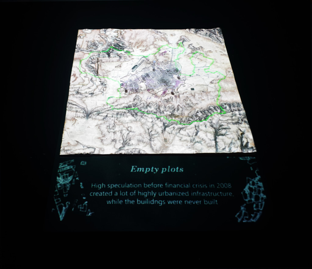
Final Videomapping
Videomapping Vitoria-Gasteiz is a project of IAAC, Institute for Advanced Architecture of Catalonia developed at Master in City & Technology in 2021/22 by student: Adriana Aguirre Such and faculty: Cristian Rizzuti, Shyam Francesco Zonca.
