– Abstract –
For ages, Venice has fascinated people for a multitude of reasons, including, of course, its architecture and urban design. Venice is a city in northeastern Italy, situated on the Venetian Lagoon, a shallow enclosed bay between the Po and Piave River mouths. The lagoon, as well as a portion of the city, is designated as a UNESCO World Heritage Site.
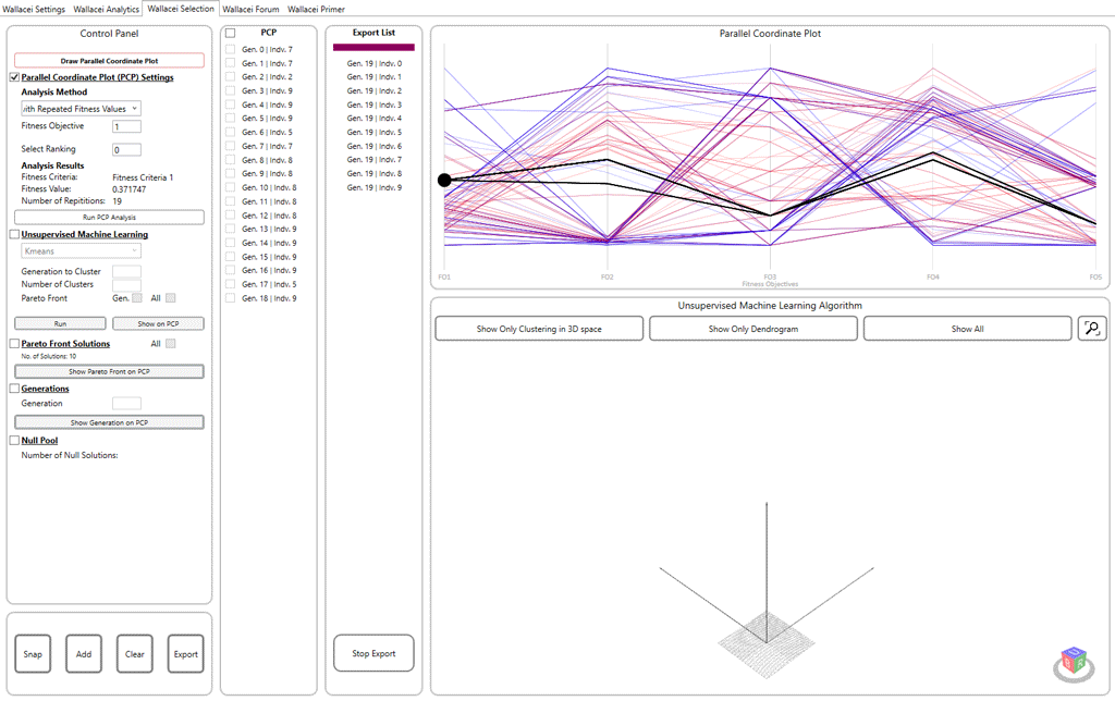
The Venice Alta project aims to optimize the urban fabric of a sinking city by improving Canals’ connectivity between blocks, providing more open spaces linked by continuous pedestrian pathways. The whole process is based on the implementation of an evolutionary algorithm and the generative design process in urban design using the Wallacei X component for the optimization process.
– Urban Morphology –
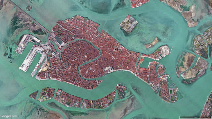
Venice is a good place for typology research. The external environmental conditions, elevation difference, and therefore the relationship between the built environment and water play a fundamental role in shaping its urban morphology. Walking in the city of Venice, people shuttle through water roads, narrow pathways, bridges and campi with the same function however in completely different forms.
The water road scatters Venice into several islands that are connected by bridges that bridge the height difference. Because there are no other modes of transportation on the island besides boats, the city is extremely walkable. People avoid dark and narrow roads when the sky-to-built-environment ratio is low, according to footfall statistics. Walking in the narrow streets and alleys of Venice, churches and squares as open spaces attract and gather people. Tourists also notice the shift in spatial rhythm from narrow to wide, and sometimes they feel suddenly enlightened.
– Site Selection –
Water levels in Venice can rise dangerously high during an acqua alta, with the latest numbers showing a maximum water depth of 184cm. During the record-breaking acqua alta of 1966, the city’s deepest water level was 194cm, or over six feet four inches. San Marco square is most affected by sea rise levels, according to the chart of the most flood-prone location, but because it is concentrated in one area, we chose the entire San Marco neighborhood as our study case.
– Challenges –
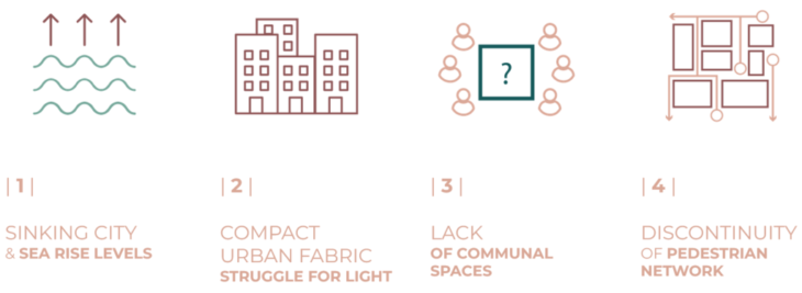
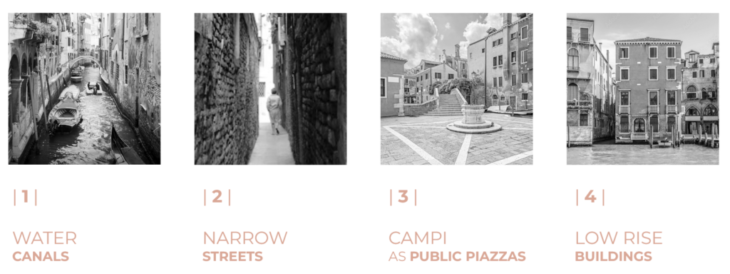
The main issues confronting Venice can be divided into four main categories:
1 | “Is Venice sinking or is the water rising?”. Venice confronts serious environmental and infrastructure problems. Flooding from acqua alta (very high tides) has always occurred, but the frequency has risen. The city is gradually eroding. Buildings are increasingly subsiding into the lagoon waters due to a lack of appropriate foundations.
2 | The urban fabric’s opaque nature prevents access to sun, wind, and light resources.
3 | The ever-increasing tourist load outside of the main tourist attractions has heightened tensions between inhabitants and visitors in Venice. The city’s social fabric has been actively eroded by the invasion of local places.
4 | The maze-like urban structure makes exploring the city a pleasurable experience. However, the pedestrian network’s discontinuity, which is enforced by unexpected dead ends, produces a sense of insecurity.
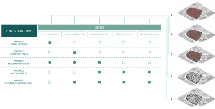
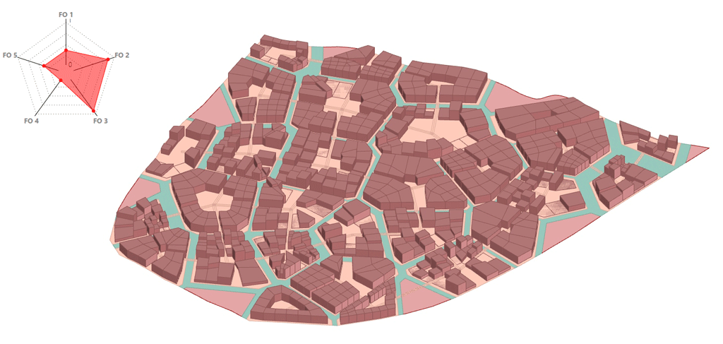
– Fitness Objectives –
We defined five fitness objectives for our site after learning about urban morphology and the challenges that the city model we’re examining faces:
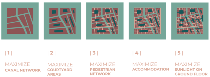
1 | Maximize Canal Network
Given that Venice will rely heavily on waterways on one hand, and given the city’s ongoing flooding risk on the other, this objective focuses on the size of the islands, which is influenced by the canal’s width and relies on the boat network to improve accessibility and water flow through the city.
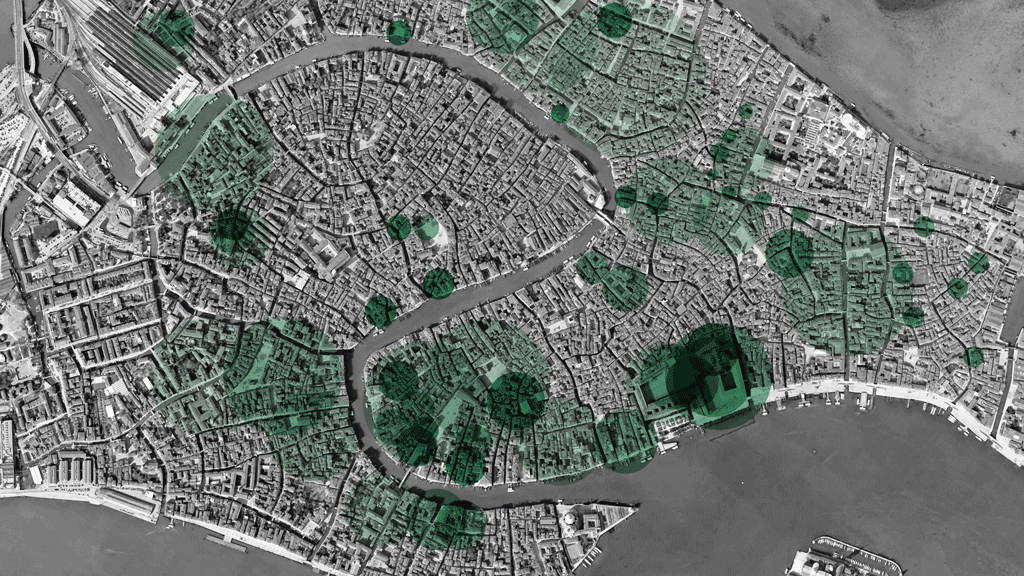
2 | Maximize Squares Areas
City Squares have long been the heart of Venice’s communal life: the goal is to cover 40% of the island’s surface area, as well as calculate the distance between each center for better distribution across the city.
3 | Maximize Pedestrian Network
This objective not only aims to ensure connectivity between city squares and patios using safe and pleasant routes but also breaks the compact fabric and widens existing pathways
4 | Maximize Accommodation

The major goal is to maintain the same level of building density without sacrificing pathway width or the ability to insert larger squares. This goal facilitates the distribution of density weight while providing a gradual effect towards the city squares, as it relates to the sinking city legacy.
5 | Maximize Sunlight on Ground Floor
The purpose is to ensure the sunlight hits the ground floor and all levels, resulting in healthy living in these areas, while alternating building heights and built-Unbuilt play.
– Optimization Methodology –

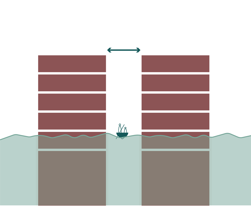
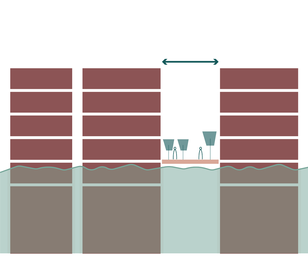
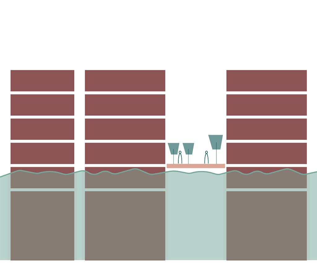
Our initial step is to tackle the waterways and create a new continuous canal network, splitting the space into distinct islands. To preserve hierarchy and ease of boat movement, their perimeters will change based on the width of the routes.
Second, city squares will be built in each island-centric location, ranging from a minimum of 20% to a maximum of 60% of the overall area. These variations ensure different levels of intimacy and types of interactivity in the campi. Following these modifications, we will filter the largest plots for the built environment and the smallest plots (less than 2000 m2) for green patios.
In the next step, the Campo will be connected by pedestrian walkways based on the nearest neighboring open spaces
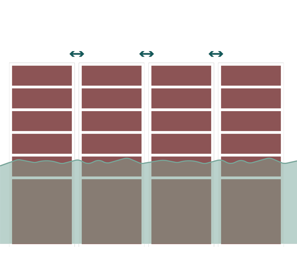
Once the urban structure is shaped, the plot division will adopt diverse configurations once the urban structure is shaped, resulting in buildings overlooking canals and others encircling city squares. The plots will be large enough to accommodate practical residential dwellings. To attain the same FAR and volumetric density, these newly generated building footprints will be asserted by optimized building heights.
Finally, we used the occlusion component to evaluate sun radiance on the lowest floor and maximize exposure in the public space.
– Evolutionary Matrix –
– Results of the Evolutionary Simulation –
The simulation is run for a population with a generation size of 10 and a count of 20, giving us 200 solutions. This resulted in the standard deviation charts.
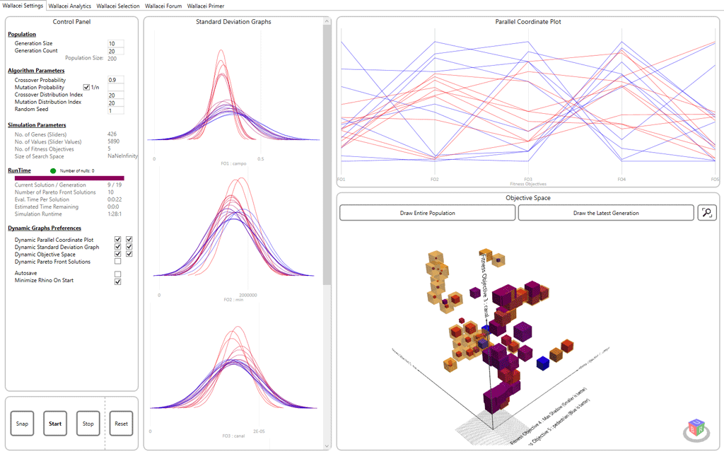
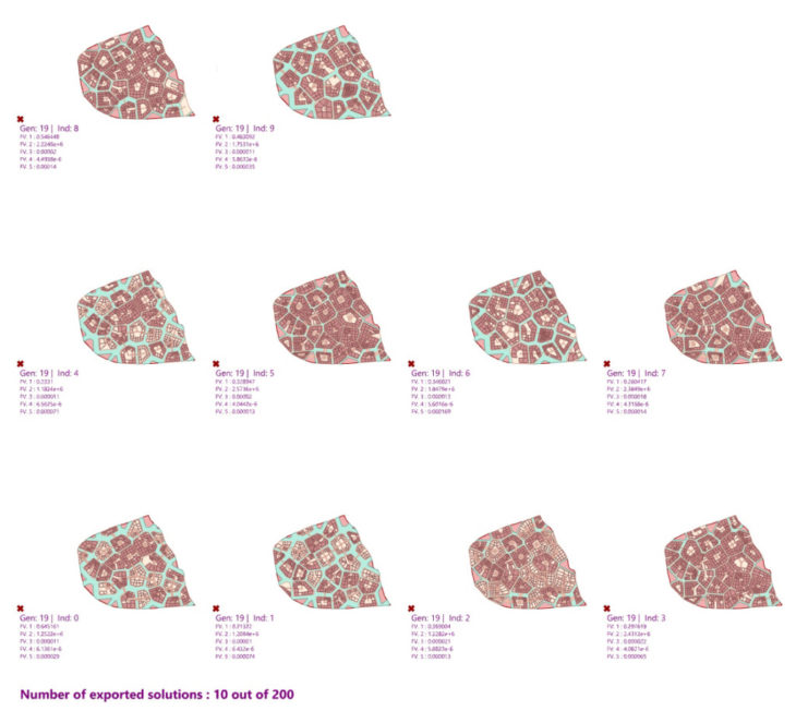
– Pareto Front Solutions –
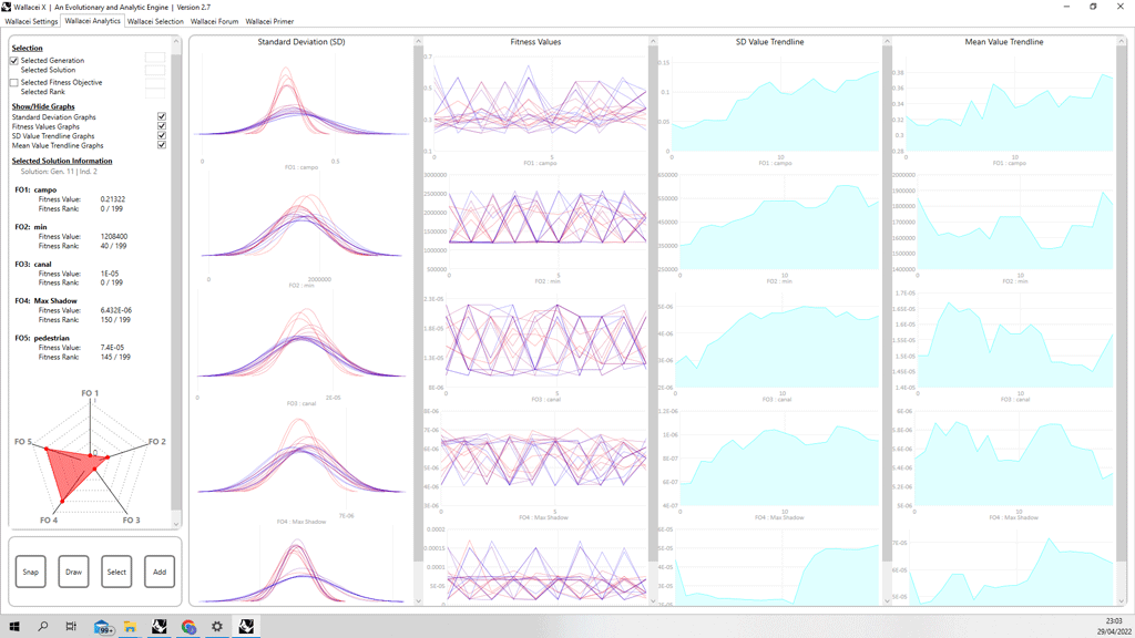
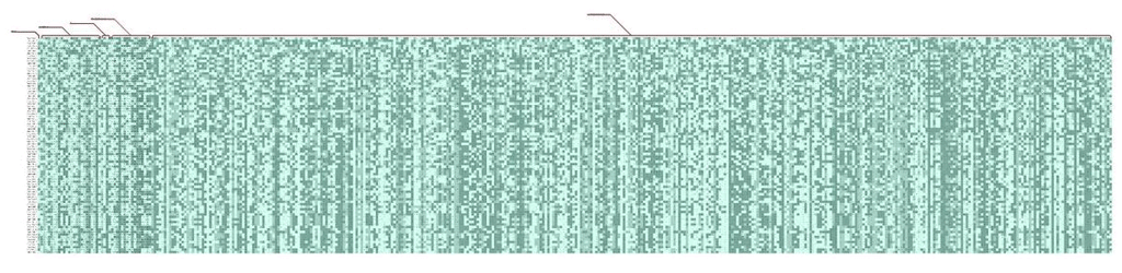
– Genomic Sequencing –
In some fitness criteria, the clustering is more obvious, while in others, it is less so. The colors begin to repeat more at the completion of the sequence, indicating that Wallacei is building and generating patterns. These patterns show that the evolutionary algorithm is attempting to attain the best possible outcome based on our fitness requirements, highlighting the conflict happening in between.
“Venice Alta” is a project of IAAC, Institute for Advanced Architecture of Catalonia developed in Master in City & Technology, 2021/2022 by Students: Dimitris Lampriadis, Joseph Bou Saleh, Julia Veiga; Faculty: Milad Showkatbakhsh