The Urbanization seminar focused on the analysis of urban change dynamics and the complex nature of cities around the world. For this, different types of streets in different cities where chosen and documented using predefined tools and templates. We worked on two major topics during the discourse: urban fabrics and streets. During the process of analysis, various parameters were introduced using which the analyzed streets were designed for future advanced concepts.
The topic we chose as a group was high traffic streets and for the same 2 streets – Delhi and Bulgaria were compared. Both the streets had common issues with regard to traffic congestion and accidents whereas both had a different context and setting because of which the approach of design for both would be different for the same set of issues.
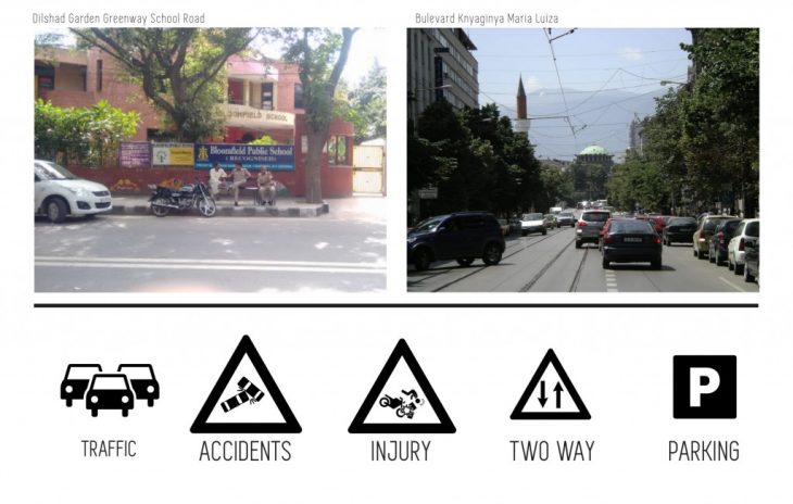
LOCATION
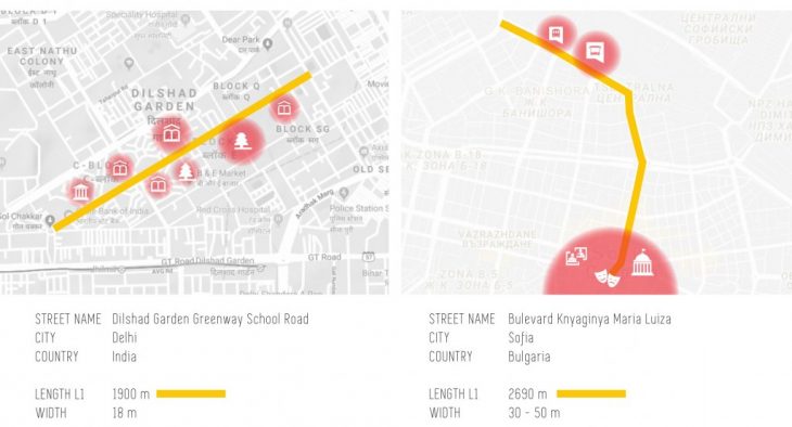
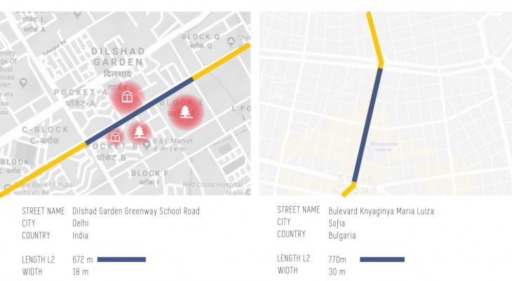
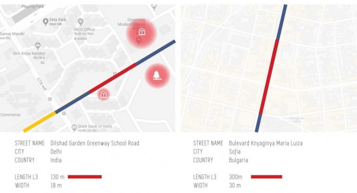
CURRENT STATE
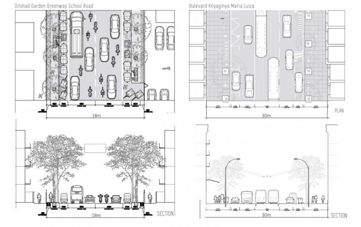
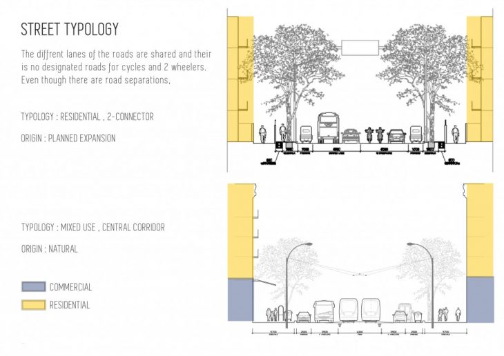
COMPARISON
CONCLUSIONS
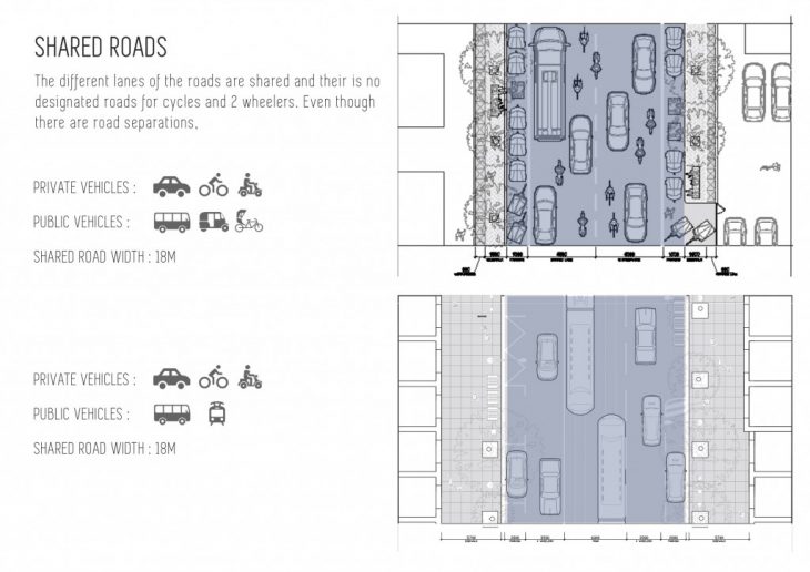
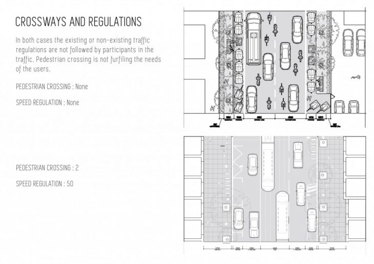
-Lack of designated lanes leading to traffic congestion
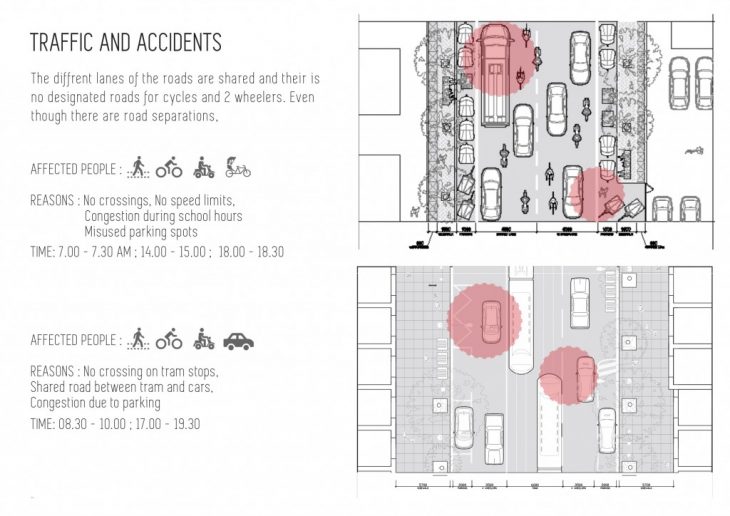
-Poor or no traffic regulations for vehicles and pedestrians leading to accidents and collisions.
DESIGN AIM
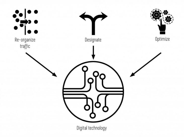
-Re-arrange the existing lanes of the roads in terms of width and position, to provide designated and clearly separated lanes to facilitate traffic free movement of vehicles.
-Integrate responsive road surfaces and technologies that acts as an interface between the pedestrian and the vehicles to reduce the chances of accidents and traffic congestion.
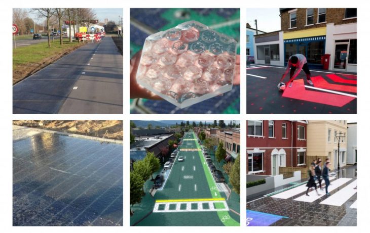
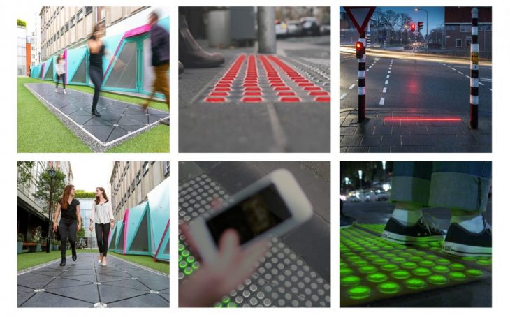
SOLUTIONS AND CONCEPTS
- Energy-harvesting smart street pavements
- Solar Roadways
- Interactive LED Surfaces
- Ground level traffic signals
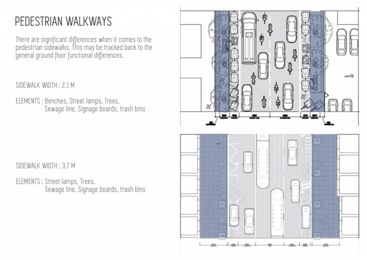
Roadbed
Sidewalks
PROPOSAL
One of the streets (DELHI) was chosen and reworked for a conceptual design proposal. Different scenarios and iterations were analyzed to map the flow of traffic at different phases using the digital technology concepts.
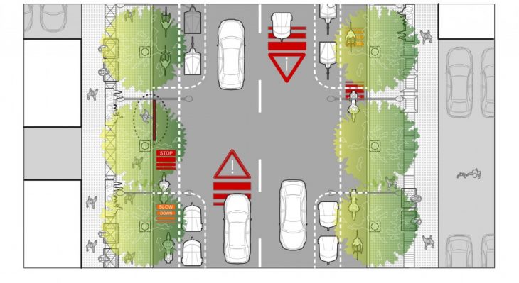
Scenario 01a – Pedestrian crossing
Crossing pathway in orange appears when either 3 or more people stand at the crossing point OR if a person stands for more than 5 minutes in an attempt to cross.
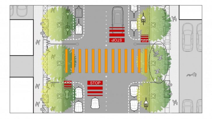
The vehicles are prompted 2 mins before the crossing signal
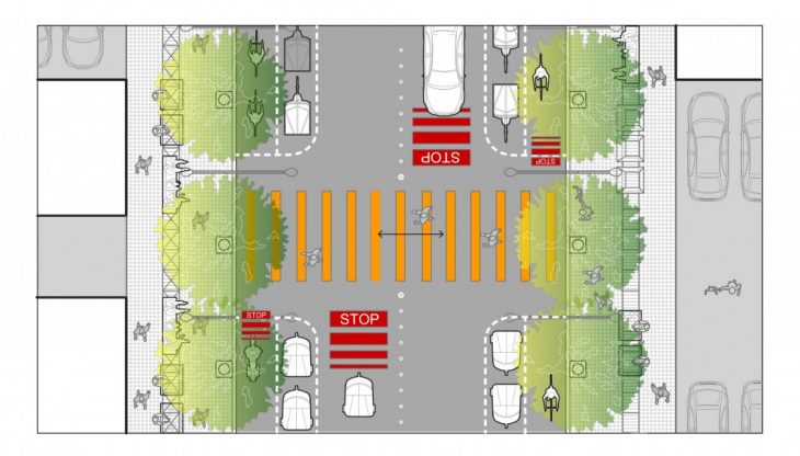
Scenario 01b – Accidental Crossing
If a person attempts to cross by mistake before the crossing signal appears, the vehicles are prompted and alerted with a signal to slow down
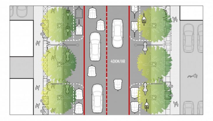
Scenario 02a – High Traffic
During the peak traffic hours, automated bollards would crop in the middle of the road to clearly separate 2 lanes and the vehicles would be alerted of the traffic congestion and speed limit by signaling continuous red marking on the road, along with the lanes.
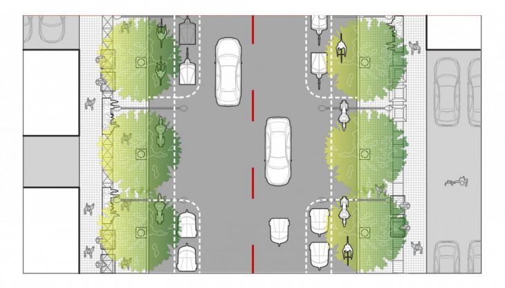
Scenario 02b – Low Traffic
During low traffic hours, the automated bollards would go down and the continuous red lines along the lanes would change to broken red lines indicating, no speed limit.
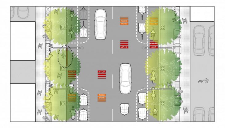
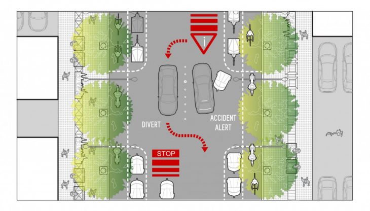
Scenario 02c – Accidents and Vehicle Breakdowns
In case of accidents and vehicle breakdown on the road, the bollards would come up to isolate that spot and red signals would emerge on the road to divert the traffic movement.
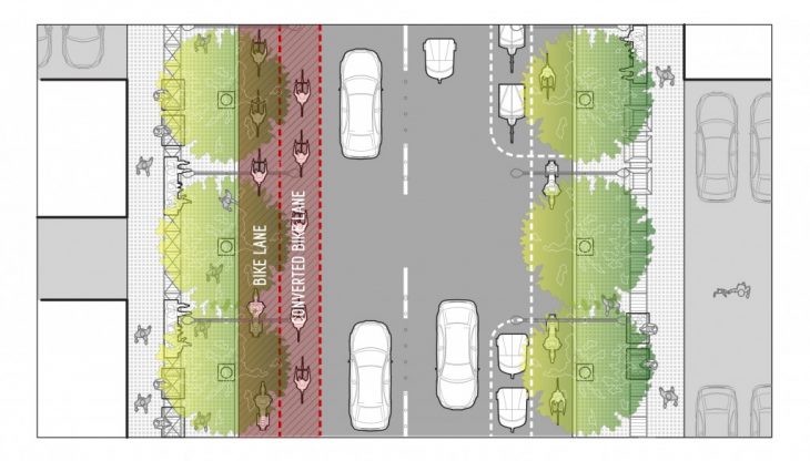
Scenario 03a – Increased Bike lane
The parking spot for rickshaws would be turned into bike lanes on one side from 7.00 to 7.30 AM in the morning
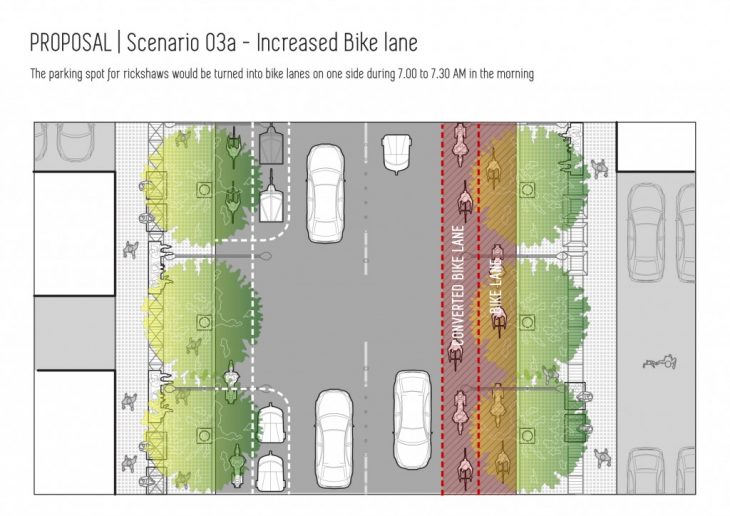
The parking spot for rickshaws would be turned into bike lanes on the other side during 6.00 to 6.30 PM in the Evening
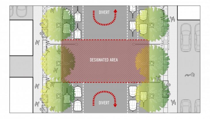
Scenario 04 – Festivals
In case of festival celebrations or temporary markets happening on the road, space would be clearly demarcated, and the vehicles would be prompted of the blockage 500m before, with a divert sign
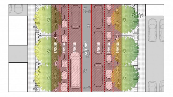
Scenario 05 – Emergency
During cases of emergency, like earthquakes or fire hazards, the different lanes would be converted into parking zones and the section on the middle of the road would become the safe zone for people to evacuate.
“RESPONSIVE STREETS” is a project of IAAC, Institute of Advanced Architecture of Catalonia, developed as part of the Urbanization course at the Master in Advanced Architecture program in 2017/18.
Student: Kavya Jose, Nikol Kirova
Faculty: Vicente Guallart, Honorata Grzesikowska