URBAN RE//COGNITION
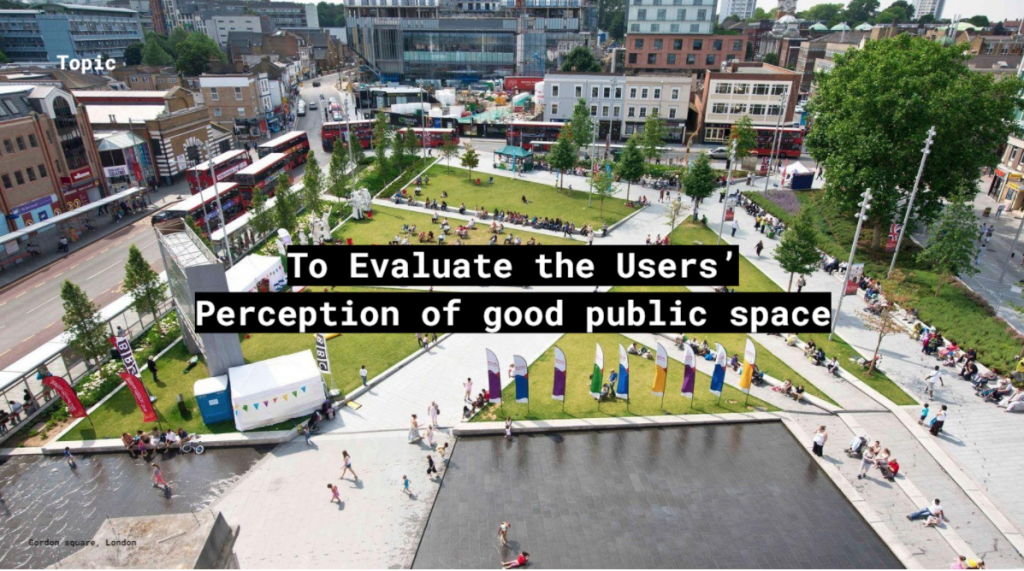
image credits: Landscape Institute
ABSTRACT
Human civilization is turning into a global network of cities: urbanization and globalization are the two key trends of development. People are agents within this network, animating it with the activities. The form of activity, which is the real heartbeat of this network, is the migration: people all over the world move from the rural areas to the cities and between them, seeking the upgrade of their lifestyle, and cities, in turn, compete to attract people. The attractiveness, therefore, is one of the key features to be used for the estimation of a certain city’s success. But what makes the cities good or bad, attractive or unattractive, comfortable or uncomfortable, busy or empty? Can we understand from the city users about its public spaces? The project deals with identifying these patterns focussing on Public squares under the social networks of the city and the people. Concentrating on the analytical outcome of the AI application: we have run the semantic analysis of the user reviews to extract the quality assessment of the urban spaces, then trained the neuron network to recognize the spatial features from the satellite photography and visual graphs based on the space syntax technology to derive conclusions about the relationship between spatial qualities and attractiveness expressed by the verbal assessment.
LIKENESS AND IMAGE
Mimicry is one of the key evolution inventions used by many species. Humans don’t have disruptive coloration, they can’t mimic other species to cheat their enemies but they have mastered another much more powerful means of mimicry: learning. The ability to copy and repeat successful life scenarios is one of the key factors of human victory in natural selection. The very evolutionary success of primates and homo sapiens in particular is based on the exceptional ability to learn quickly by following the example, copying the behaviour and the way of doing of the more experienced fellows. It is quite natural, therefore, that the practices of reproduction and re-application of successful scenarios are widely spread throughout most of the cultures worldwide. The intercultural exchange is the extension of this practice: people rapidly accept alien habits which they find attractive, the urban lifestyles being no exclusion.
Mimicry is the foundation of style. Likeness is one of the fundamental cultural factors, the key media of transferring knowledge in generations. Over several thousand years of urban history humanity has practiced many ways of encoding ideas into built forms. The review of the ancient semantic reproduction practices reveal interesting overlaps with the modern machine learning algorithms. The concept of likeness was very important for the monotheistic cultures of Europe and Near East in the middle ages for God has created man in his own image and likeness. This had a great effect on the entire visual culture, including architecture: in fact, all significant buildings had to be built according to the certain iconographic program, so that they would be the representation of some hierarchically high prototype – Holy Sepulchre, Hagia Sophia or the mystic Heavenly Jerusalem. It is important that simply naming the new object after the prototype was very often sufficient to create likeness, in spite of total visual mismatch between the model and its “copy”. In other cases the numerical matching of the dimensions was important while the details didn’t matter.
PROJECT
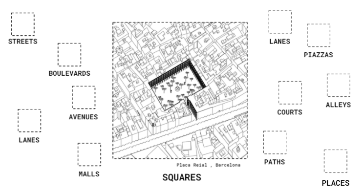
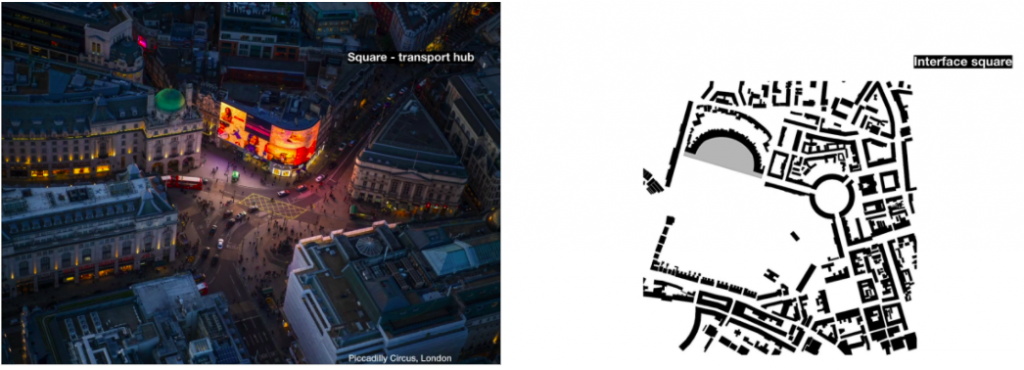
The objective of this project was to create a method of analyzing a public space and transferring its features to another location. In order to narrow down the field of research we decided to focus on only one type of public space, namely the squares. We have selected a number of squares in Spain (located in Madrid, Barcelona, Bilbao and Granada) and around the World in US, UK, France etc.
The method is based on a few assumptions:
- The successful social scenarios are related to the formal characteristics of a public space.
- The importance of certain features can be estimated through the analysis of social media, in addition to conventional social surveying methods.
- Those characteristics can be parametrized and replicated.
- Complex analysis of those features and their assessment can be performed by using the ML technologies and an optimal public space can be further predicted by the neural network trained to recognize features of attractiveness.
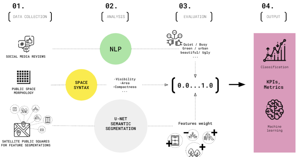
METHODOLOGY
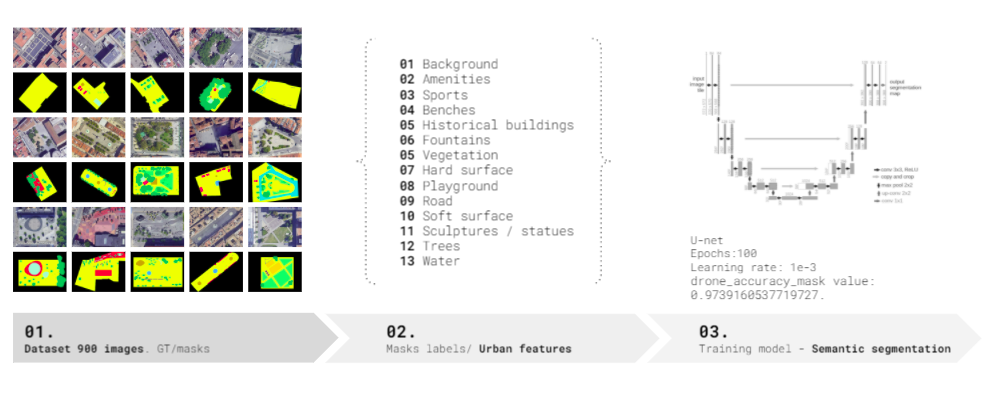
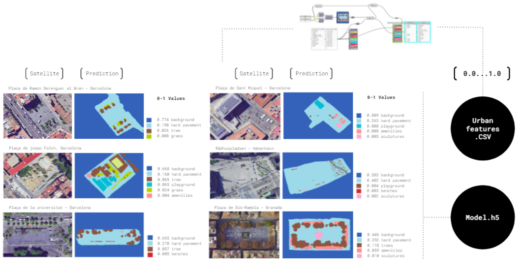
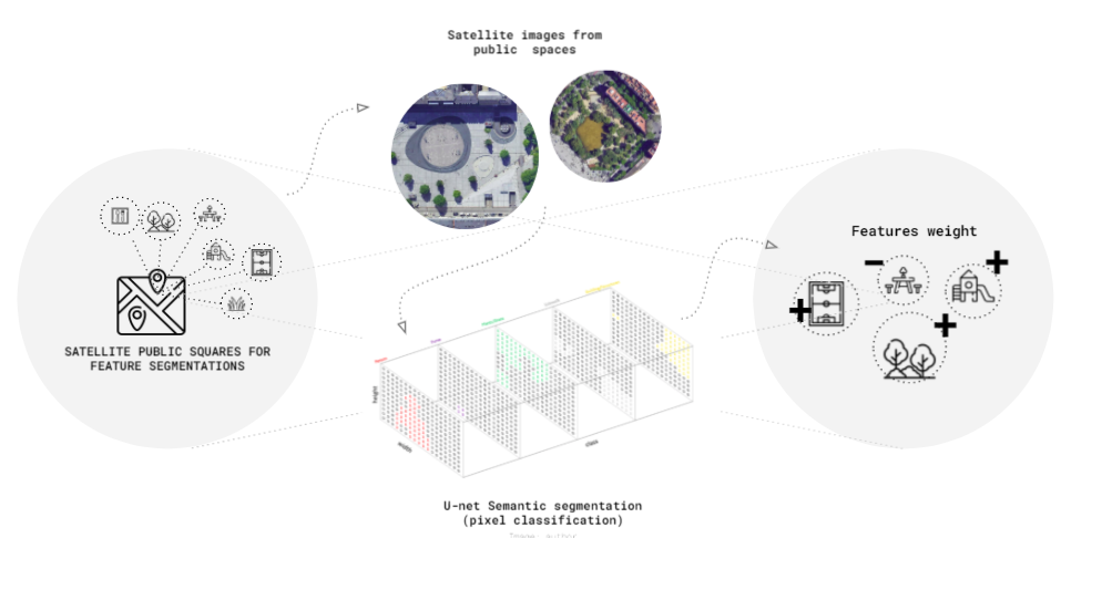
The first assumption is driving a connection between the formal qualities of the space and its attractiveness for the social activities. In order to formalize the assessment we have selected a number of urban features: benches, fountains, vegetation, hard surface, water etc. We have further masked them out on fragments of satellite images of the chosen squares and run the semantic segmentation training of the model.
DATA COLLECTION

Data collection for semantic segmentation
Data collection for semantic segmentation
Data collection for semantic segmentation
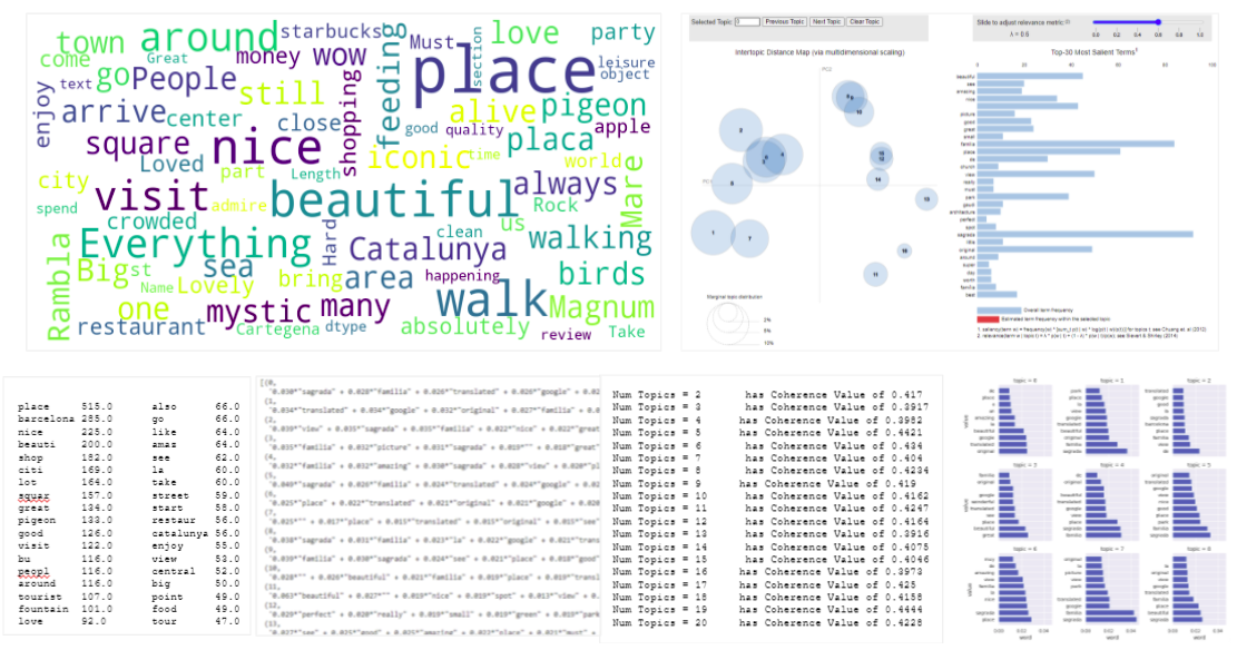
Data collection for Reviews
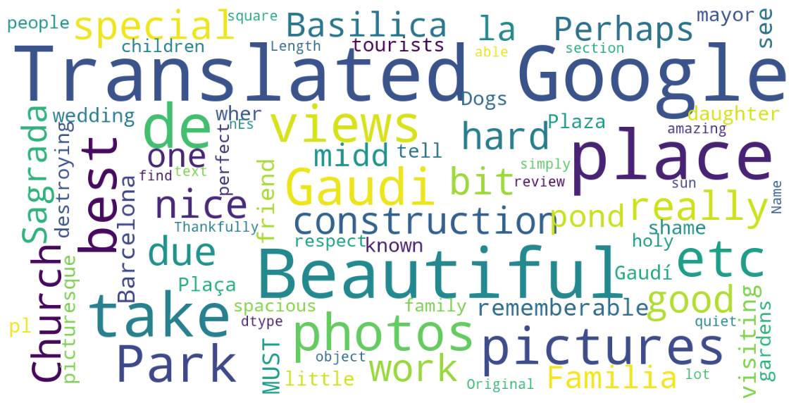
Wordcloud – Plaça de Gaudi
PROCESS
NATURAL LANGUAGE PROCESSING (NLP)
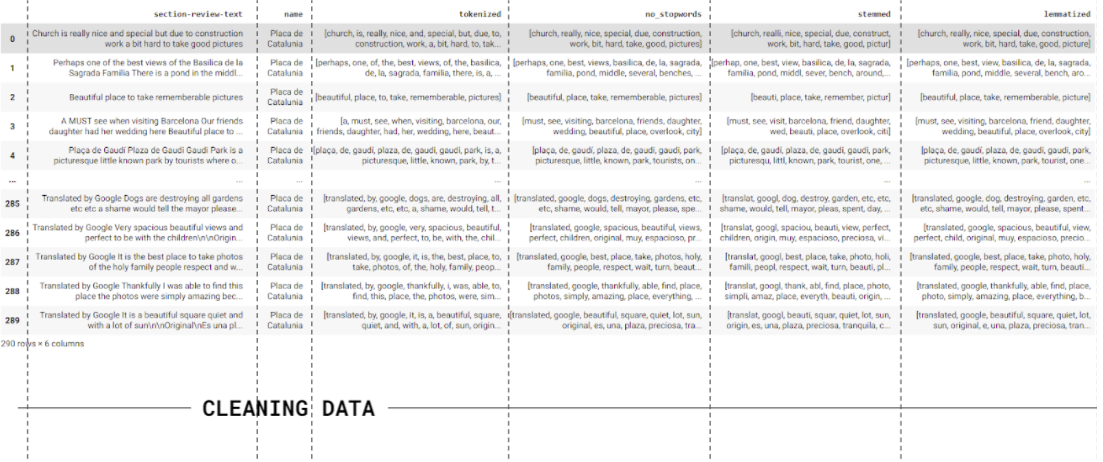
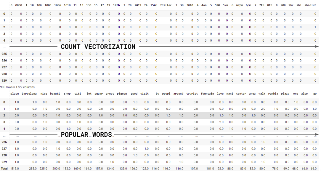
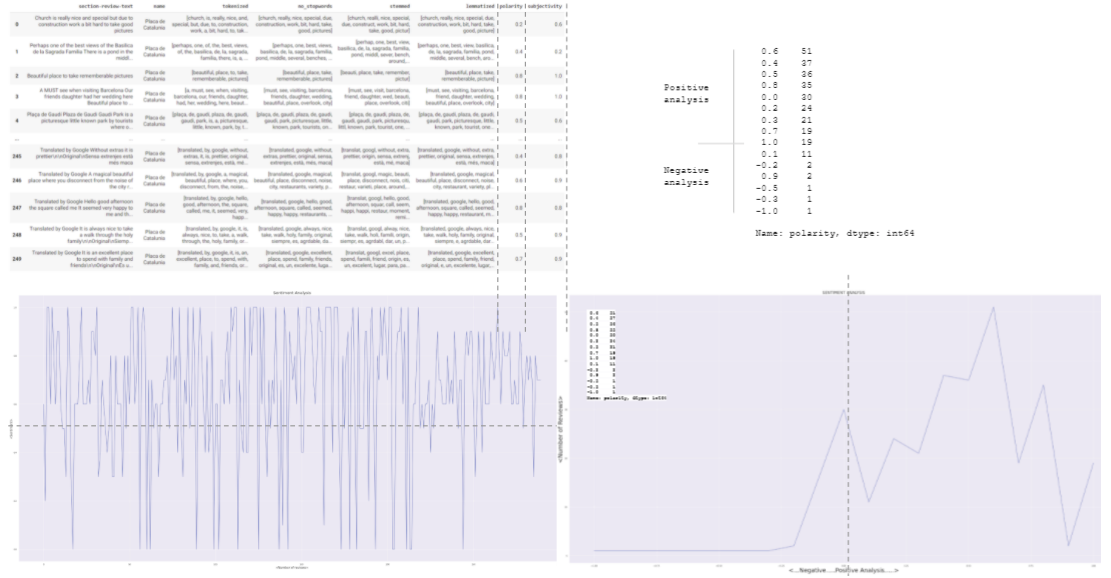
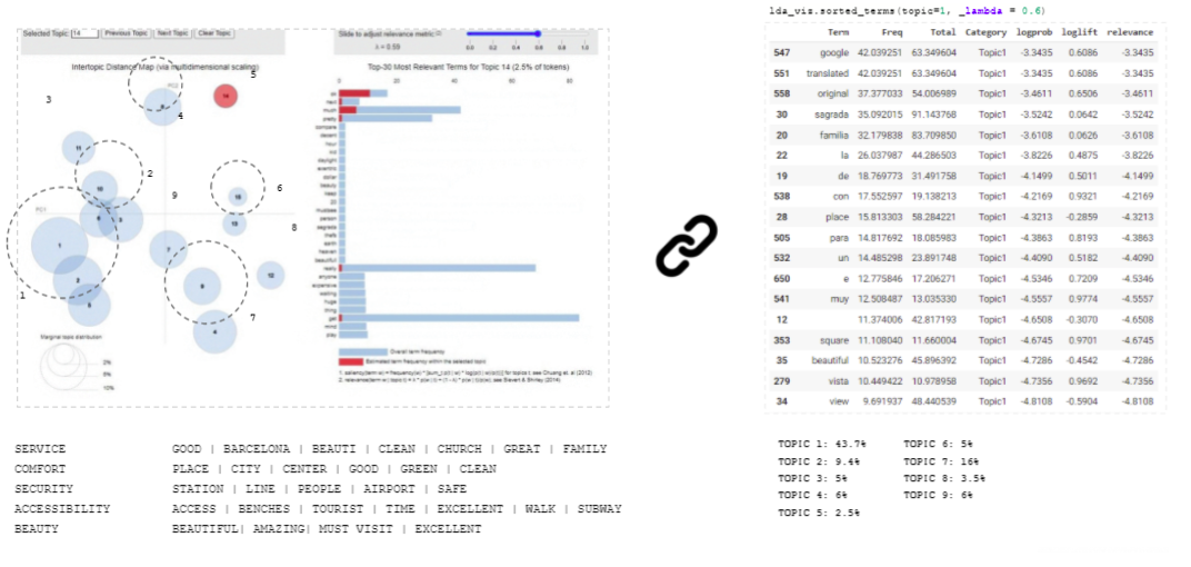
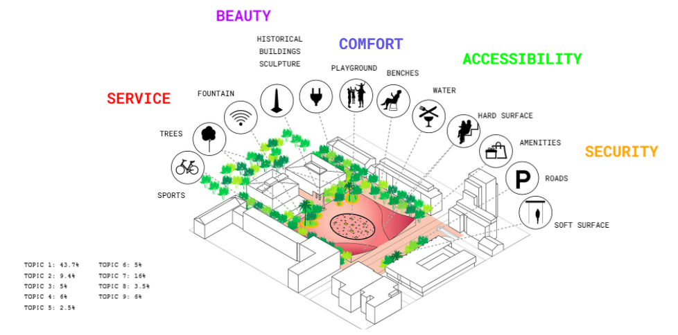
We ran the Polarity/ Subjectivity Analysis onto the Dataset for each Public Square to get the overall popularity scores. Here, you see the example of Placa de Catalonia that shows the Positive Sentiment for most of the reviews. But this method needed to still be refined in order to extract meaningful data that could be related to the features of the image segmentation. Hence we trained a LDA model to get coherence values for the number of topics in the data and identified the most popular words in each topic. The PCA analysis showed us which are the most distinctive topics from the dataset and we could extract 5 main categories from the data based on PCA. This was the first part of the analysis. In order to link this data to the features of the image segmentation , we identified the frequency of each popular word in each topic and assigned a value between 0 to 1 based on token values that we got from the PCA analysis. Here you can see the 14 categories of image segmentation that are relatable to the 5 categories of NLP.
SEMANTIC SEGMENTATION FOR URBAN SQUARES
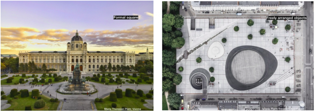
Public spaces are different. Some are open and quiet while others are busy and compact, others wide and empty, while others are full of amenities and features. Having in mind the idea of creating a replicable method, we have chosen to work with semantic segmentation for satellite imagery which refers to the process of linking each pixel in an image to a class label – our urban features. By identifying these features – benches, trees, vegetation, pavements, fountains, etc. – we were capable of understanding the percentage of each one in a certain space, measuring the ones with more impact and understanding the proportions between them. By doing so, our perception from the spaces could be, in a better way, connected to the user experiences and their perception of the space.

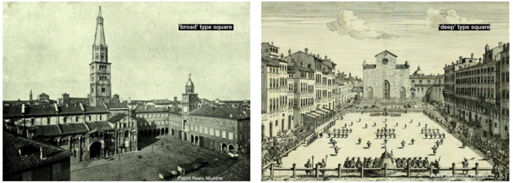
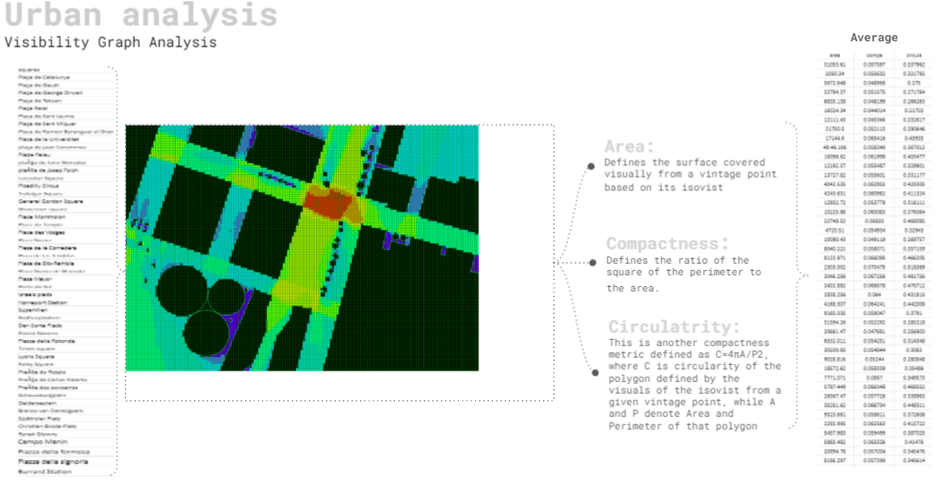
SPACE SYNTAX
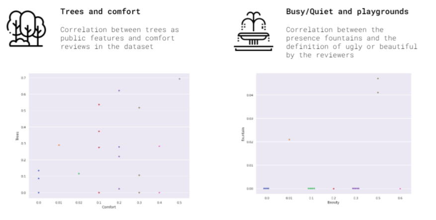
Space Syntax has been explored to add a layer of contextual urban information to better understand the nature of urban squares. Values of urban squares are generated for three space syntax analysis criteria using the plugin DecCodingSpaces Toolbox. Space Syntax values provide information about eye level visibility graph derived from the public square spatial layout in three aspects. The average visibility area of a public square, the compactness which defines the ratio of the square of the perimeter to the area, and finally the average value of circularity in a public square. As a result, these space syntax values were then compiled with both sentiment analysis as well as image segmentation analysis for all the public squares to better understand the correlation between these different analyses and draw through graphs conclusions and understanding for what characterizes a good square from a less preferable one.
CONCLUSION
We believe that the result of our quick research proves that the attractiveness of a public space is a measurable category. Yet, we regard our methodological experiment as the very beginning of a long path to be walked. The workflow we have created is in no way a substitute to the conventional surveying, analysis, briefing and design workflow but rather an addition to it. Social media is a huge source of data. Their key advantage is that they contain unmoderated collective expression and provide, therefore, a valuable addition to the data collected by the conventional means of surveying. However, one must be careful using them because they represent a certain strata of the population and data collected from social media must not be taken as fully coherent and complete. At the same time, social media aids representation of some groups within the population who have not been given voice before. Be it as it may, social media must not be neglected as an important source of data, although it has to be examined critically and carefully.
Another important reason why the suggested method is valid is the very nature of the analyzed data. Nowadays the entire initial phase of the design workflow has changed completely: previously the design was driven equally by the designers knowledge and sense, while now we are often designing without even visiting the site. Basing the design on the information from the internet has somewhat become a professional standard. Google street views seem to suffice and EPW-based simulation substitutes breathing the air of the future building or urban area. Since everything on the internet is digital data, it is totally appropriate to incorporate the data science tools into the design practice. Once again the design becomes a reflection of an image.
Progressive city administrations throughout the world are keen to make their cities attractive and invest a lot in upgrading the urban environment. We have attempted to create an analytical and design tool to facilitate the process of recognizing and transferring the successful urban scenarios. However, so far we have mostly concentrated on the analytical outcome of the AI application, while the design tool is still to be developed. There are a few directions for further experimenting: style GANs can be used to create an automated tool which will be adding certain formal qualities to the design. It can work in different ways: contextualize the design proposal or, on the contrary, translate it into the formal language of the prototype. Alternatively, a context reader can be created, which would generate surface textures for the urban interventions based on the context images interpolated in latent space. 2D-to-3D algorithms can be used to generate geometry from the raster patterns of the satellite or context photography etc.
BIBLIOGRAPHY
- Notes on the synthesis of form , Christopher Alexander
- Perception and computer vision, Markus Vincze, Sven Wachsmuth, and Gerhard Sagerer
- The second digital turn, Mario Carpo
- Programming After Program, Kazys Varnelis
- AI Aesthetics, Lev Manovich
- The Incongruous Figure, Rachael McCall
- Suggestive drawing among human and artificial intelligence, Nono Martínez Alonso
- Towards Hallucinating Machines – Designing with Computational Vision , Matias del Campo, Alexandra Carlson, Sandra Manninger
- Drawing with Bots: Human-computer Collaborative Drawing Experiments , Hao Zheng
- Intensive Science and Virtual Philosophy, Manuel DeLanda
REFERENCES
- Public Spaces: Luisca Correa and katya Vititneva
- NLP Analysis:
https://github.com/adashofdata/nlp-in-python-tutorial
Faculty:
Angelos Chronis – Lead studio Mentor & Lea Khairallah – Studio Assistant
Students:
Sachin Dabas, Pedro Ribeiro, Yara Gadah, Sergey Kryuchkov