Urban Fuse
urban fuse is a visualization tool for city stakeholders to measure and assess the optimization of land use patterns through existing transportation network for interventions toward the city’s goal of creating a resilient and active neighborhoods.
Background:
Land use patterns can have diverse economic, social and environmental impacts: some require less impervious surface (buildings and pavement, also called sealed soil) per capita and so preserve more open space (gardens, farmland and natural habitat), and some are more accessible and so reduce transportation costs to businesses and consumers.
Transportation planning decisions influence land use directly, by affecting the amount of land used for transport facilities, and indirectly, by affecting the location and design of development. For example, expanding urban highways increases pavement area, and encourages more dispersed, automobile-oriented development (sprawl), while walking, cycling and public transit improvements encourage compact, infill development (smart growth).
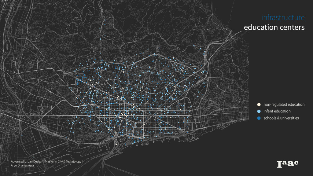
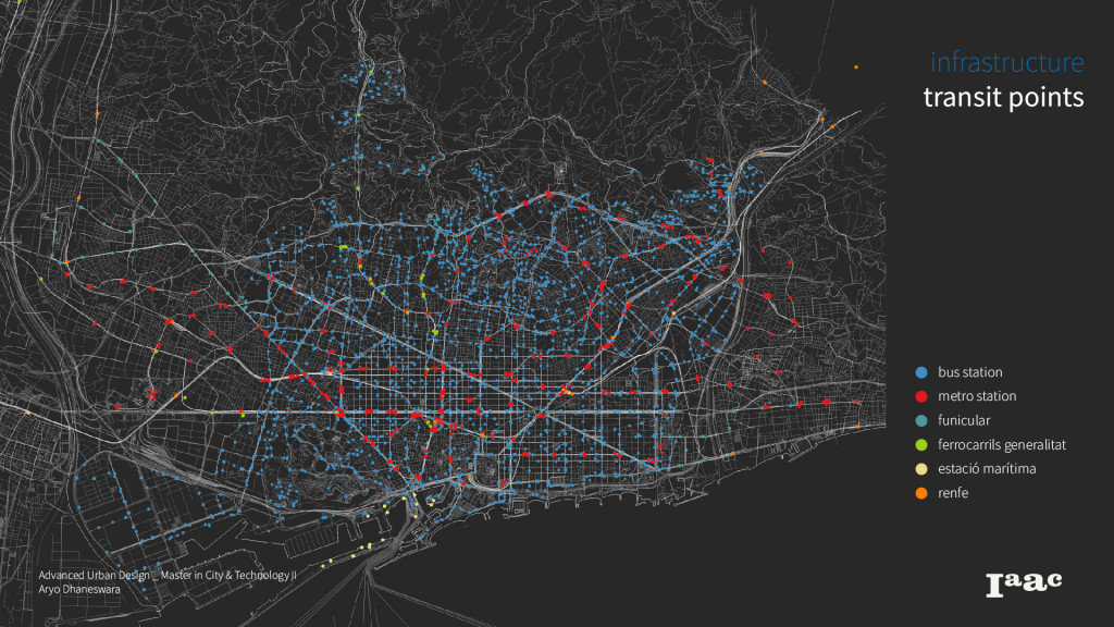
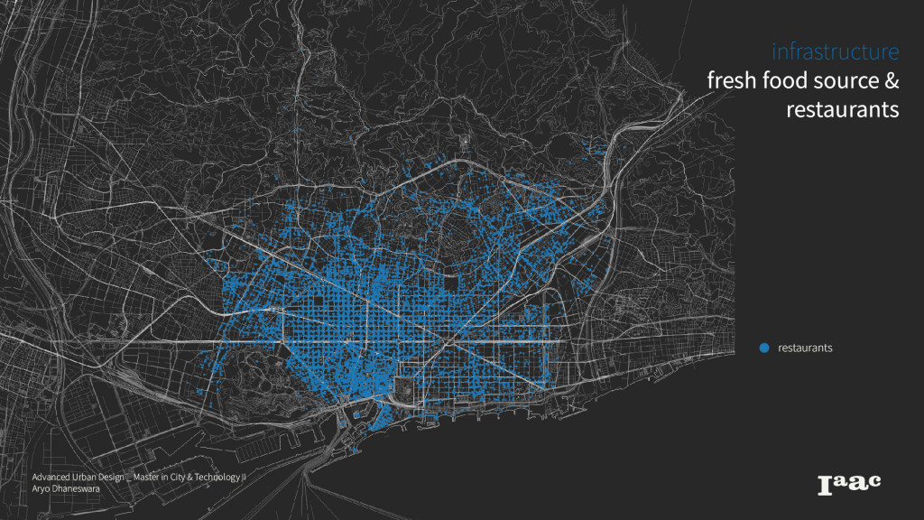
To understand the landscape of land use of Barcelona, first thing to understand is the proportion and allocation of land use types within the city.
Methodology:
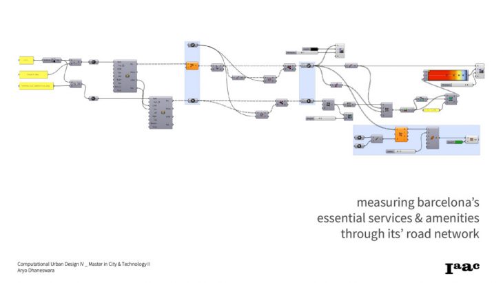
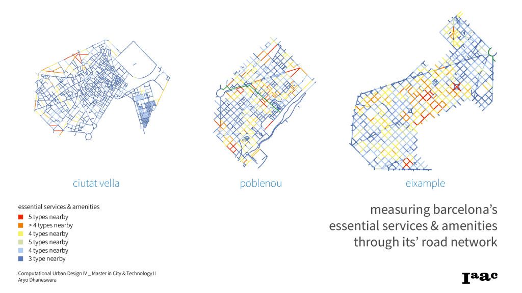
In this experiment, I wanted to measure the level of closeness each road has in Barcelona to an essential amenities and services. This experiment is following the direction towards the current urban planning concept of 15-minute city, which its aim is to make sure its resident live by 15 minutes away to essential services like hospitals, schools, food market, jobs, or parks.The attempted trial is made using ‘Shortest Walk’ plugin in Grasshopper.
Urban Fuse is a project of IaaC, Institute for Advanced Architecture of Catalonia
developed at Master in City & Technology in (2019/2021) by:
Students: Aryo Dhaneswara
Faculties: Eugenio Bettucchi