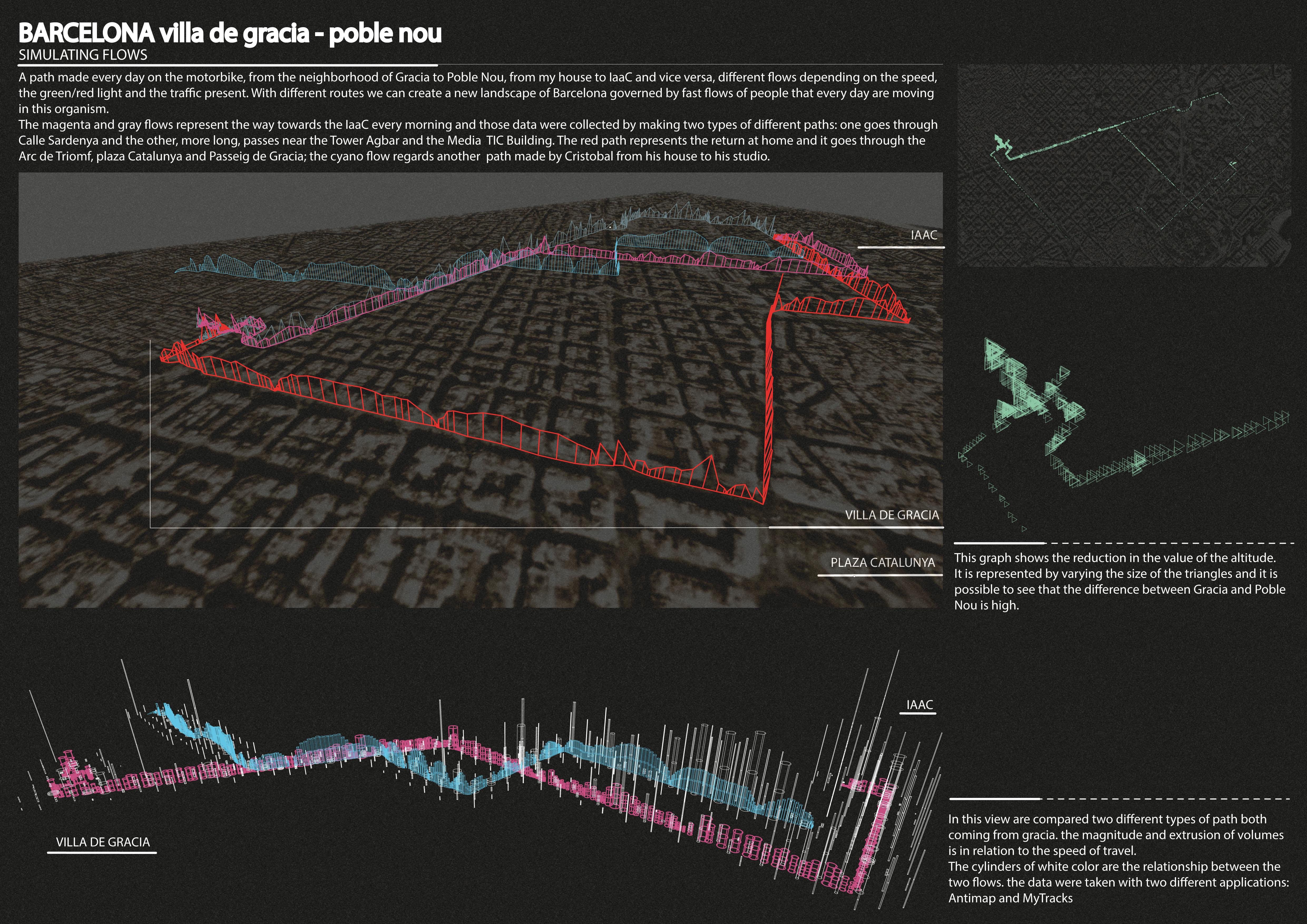
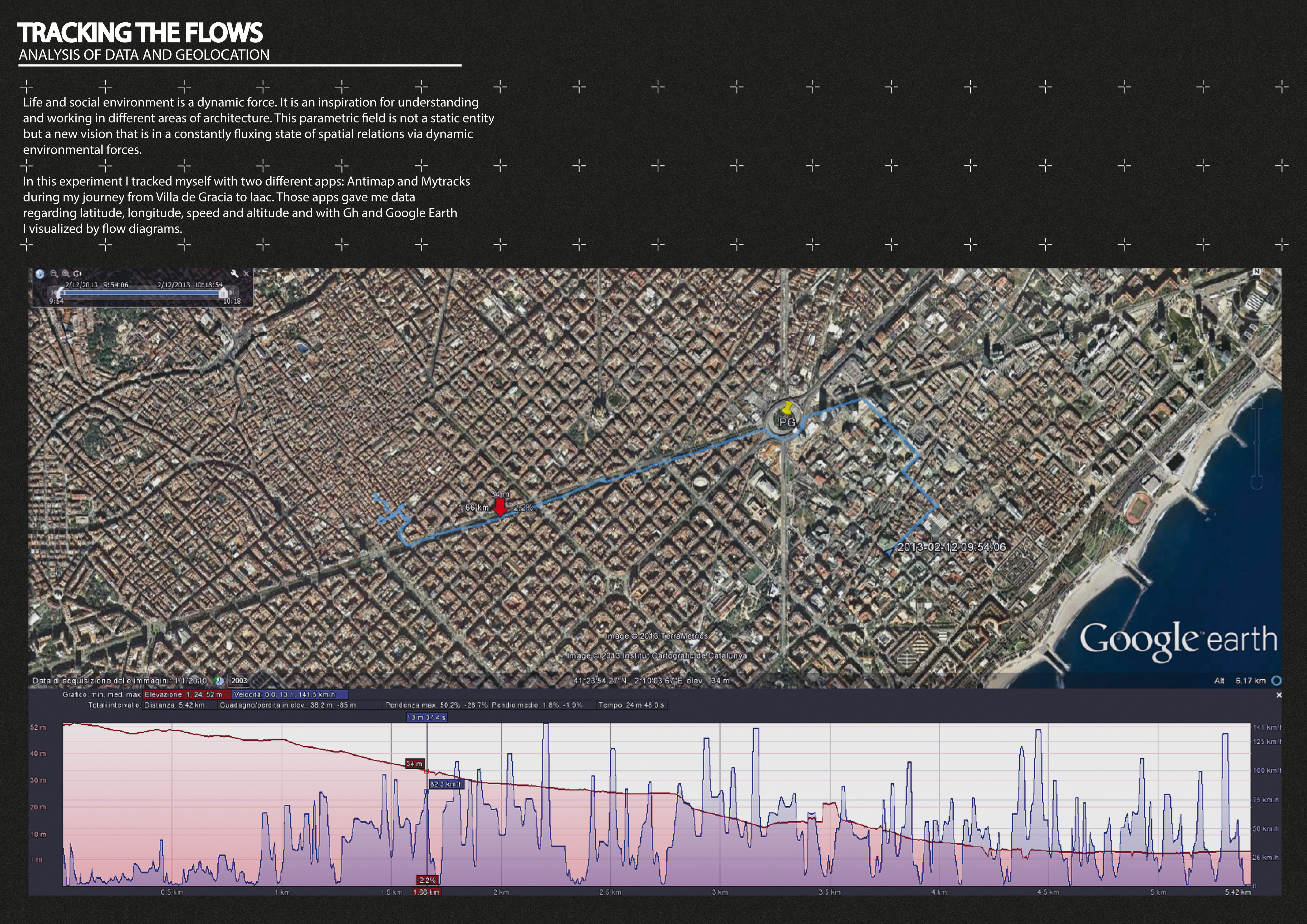
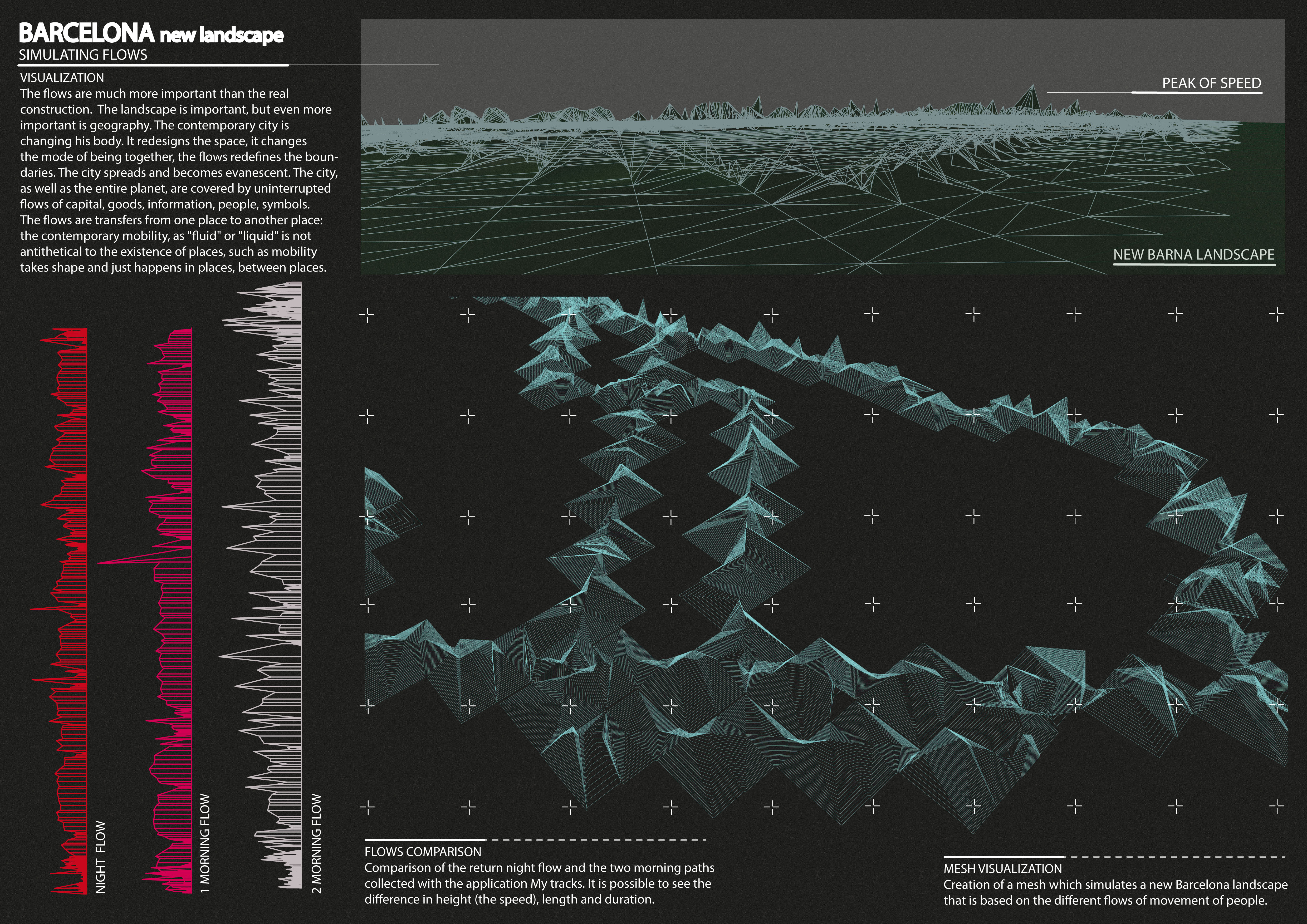
ANALYSIS OF DATA AND GEOLOCATION Life and social environment is a dynamic force. It is an inspiration for understanding and working in different areas of architecture. This parametric field is not a static entity but a new vision that is in a constantly fluxing state of spatial relations via dynamic environmental forces. In this experiment I tracked myself with two different apps: Antimap and Mytracks. Those apps gave me data regarding latitude, longitude, speed and altitude and with Gh and Google Earth I visualized by flow diagrams. A path made every day on the motorbike, from the neighborhood of Gracia to Poble Nou, from my house to IaaC and vice versa,different flows depending on the speed, the green/red light and the traffc present. With different routes we can create a new landscape of Barcelona governed by fast flows of people that every day are moving in this organism.