How long is the route 68?
The route 68 is linked with the largest highway in America which is the Pan American Highway and ends its journey in Santiago. We have approached the project from general to specific, global to local.
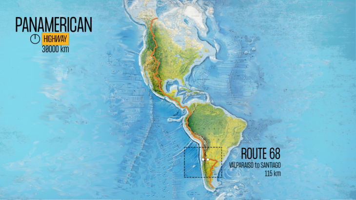
Scaling down and getting into Chile we can see this same importance connecting the mountain and the sea through the city of Santiago and the route 68. This becomes an important axes of the city, that carries goods and people and has a huge potential towards Santiago development.
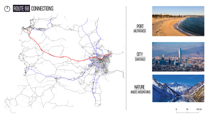
Santiago de Chile.
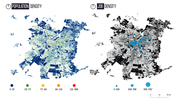
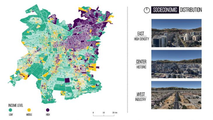
Several maps have been developed to better understand the city of Santiago. Among them, an income map and a socioeconomic map speaks out about the diversity of the city and how the East part of it has been more developed than the West. This is clearly visible through the different street maps pictures and makes the lack of development of the West side of Santiago and the route 68 an opportunity for a future development as mobility as a driver of change.
The goal will be connecting these two elements, ocean & mountain together through the site of the intervention. This would potentially transform the site from a more segregated one to a more equal through mobility, uses and equipment.
How?
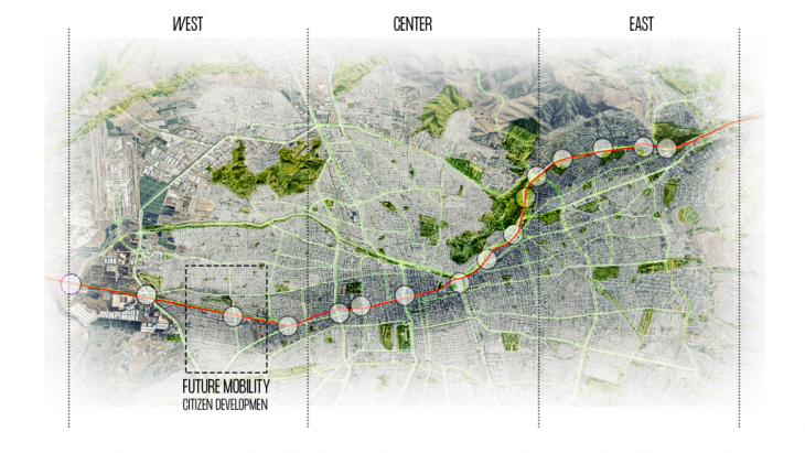
By connecting nature and transforming equipment like big scale industrial developments to economic centers of developments. These spine connecting natural resources has a significant impact but also will have when we approach it from a transversal point of view. To analyse this we have detected the green areas and the different building typologies, mobility options and land use through the spine. By doing so we have identified specific potential points where this could be applied. Hence, a green corridor connects the two parts of the city “divided” by the route 68 and boost the opportunity to create a new mobility interchange center. A specific point has been taken as representative of the area to develop the intervention.
Future mobility: We have imagined mobility development applied into 3 possibles scenarios:
2020 (existing)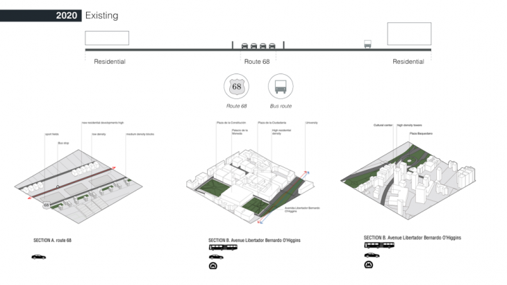
As existing infrastructure, we just have the four lines route 68 and small and medium scale residential areas connected with bus systems.
2025 – 2050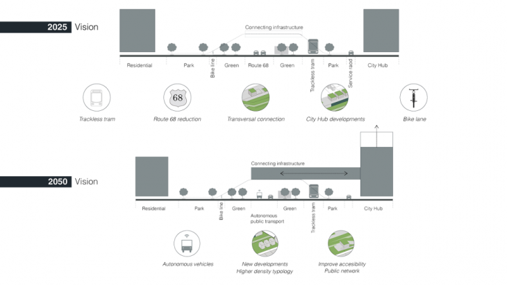
As a vision for 2025, the following strategies would be implemented:
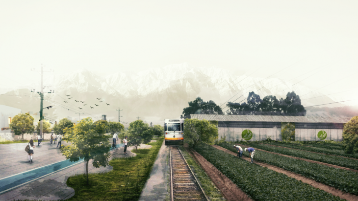
- Reduction of the route 68 line
- Trackless Tram
- Creation of green spaces
- Creation of City Hub or City Laboratories that brings jobs to the area
- Implementation of bike lane
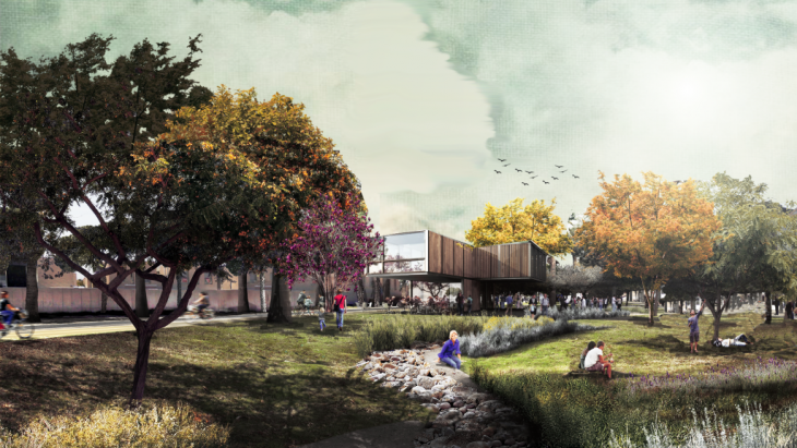
As vision 2050, autonomous vehicles would appear into the scenario and the improvement of connected infrastructure and accessibility. This could bring an increase in the residential density, allowing more people and decentralizing the center of the city.
2070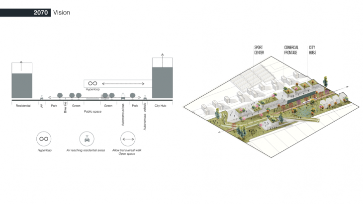 Finally in a more holistic scenario, route 68 could disappear being replaced for high speed systems as the Hyperloop or a High Speed train, and the space would be open for a direct transversal direction, allowing the creation of public equipment. Moreover, AV vehicles could get into a less dense residential areas increasing the network.
TOD 2025 SANTIAGO
TOD 2050 SANTIAGO
TOD. SANTIAGO NEW URBAN CORREDOR is a project of IaaC, Institute for Advanced Architecture of Catalonia developed at Master in City & Technology in (2019/2020) by:
Students: Byron Cadena, Alejandro Quinto, Jianne Libunao
Faculties: BuroHappold- Sebastiano Scacchetti