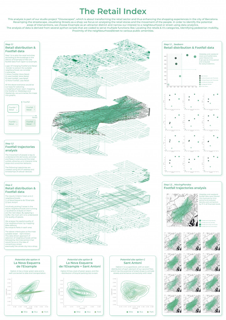
The Retail Index
This analysis is part of our studio project “Glovoscapes”, which is about transforming the retail sector and thus enhancing the shopping experiences in the city of Barcelona. Revamping the streetscape, visualizing Streets as a shop; we focus on analyzing the retail stores and the movement of the people. In order to identify the potential areas of interventions, we choose Eixample as an attractor district and narrow our interest to a neighborhood or street using data analytics. The analysis of data is derived from several python scripts that are coded to serve multiple functions like; Locating the retails & it’s categories, Identifying pedestrian mobility , Proximity of the neighborhood/street to various public amenities.
ANALYSIS
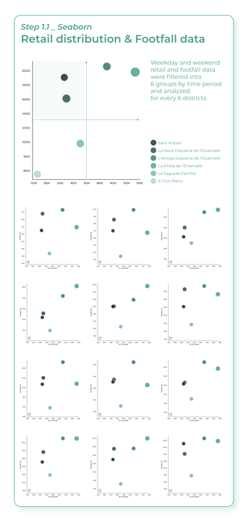
Criteria 1.1 Retail distribution & Footfall data
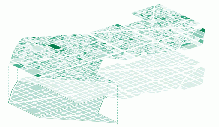
Step 1 is to plot the retail activities according to the buildings in the district of Eixample & Filter the footfall data from Spain to Eixample.
Logic Of merging Footfall and Retail in order to extract the suitable neighborhood, we consider 4 scenarios:
1) More Footfall, More Retail
2) Less Footfall, More Retail
3) Less Footfall, Less Retail
4) More Footfall, Less Retail
All the above scenarios would be our base for selecting a neighborhood. Upon mapping the footfall on Weekdays and Weekends, we summaries the maps into graphs.
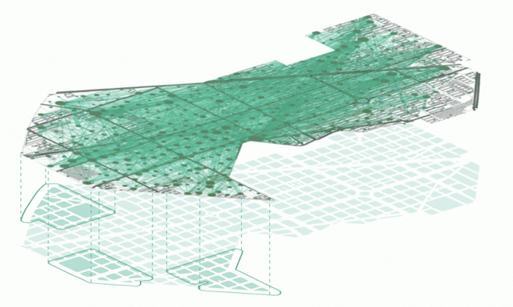
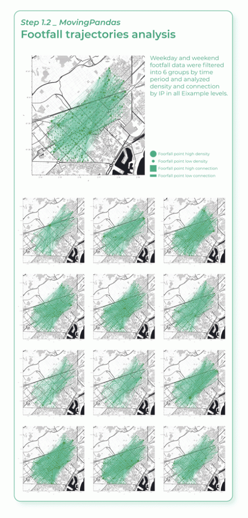
Criteria 1.2 Footfall trajectories
The movement of people is key to understand the demands, activities and flows in and around the retail outlets, allowing us to interpret time stops and consumer behavior. The following trajectories are created using the IP address and timestamps of cellular devices.
Criteria 2
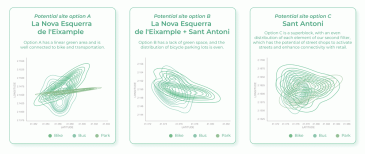
The results Criteria 1 lead us to 2 neighborhoods: 1) La Nova Esquerra de l’Eixample 2) Sant Antoni
Intuitively picking 3 areas in the above neighborhoods and running a qualitative analysis on them are the next steps. By applying a buffer, the main aim is to understand the quality of spaces. We analyze the spatial quality of the neighborhood by mapping Bike stations, Bus stops & Parks in each area.

Conclusion
The above criteria give us the most suitable street – Sant Antoni. This data driven approach of selection of neighborhoods will be followed by the intervention that would focus on the idea of converting a street (eventually the whole city) into a shop.
Data Source: inAtlas, Open Data BCN
‘The Retail Index’ is a project of IAAC, Institute for Advanced Architecture of Catalonia developed in the Master in City & Technology 2021/22 by Students: Jiyun Lee, Kriti Nirmal, Julia Veiga and Yohan Wadia with Faculty: Diego Pajarito, Assistant faculty: Tugdual Sarazin.