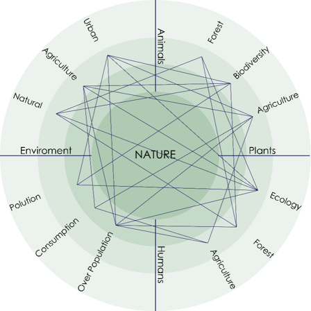
“Nature”, the term for most has now become a romantic concept. As the population of city dwellers increase, the demand to get away for a vacation to a place of “nature” increases. Therefore establishing that humans are being more successful with each day in disconnecting from the “natural” spaces and creating more “artificial” environments. Since we are one of the major players of nature itself, when we detach from nature, we detach from it’s other key players, such as plants and animals. The system is cyclical, hence the effects are directly correlated. As the population in urban area increases, so does consumption, pollution, etc.
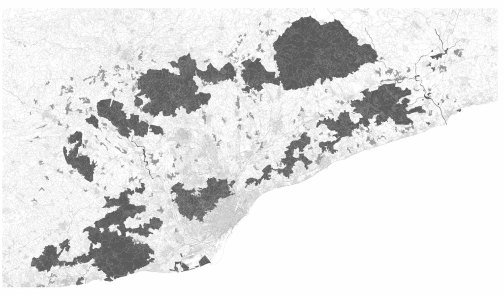
What impact does the built environment have on nature? Amongst many others, we looked at the effect of air pollution, noise pollution, urban heat island effect and percentage of green in the city of Barcelona. For both the air and noise pollution, the city center along the Diagonal is mostly where the pollution is the highest. The heat island effect happens right at busy center of the city, as the city expands out reaching towards the forests in the north the temperature starts cooling. A difference of six degrees can be found between the extremes. The green cover in the city is fragmented and seggregated with the two main chunks being the Collserola Park in the north and the Montjuic Park along the coastline.
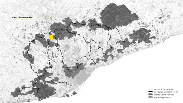
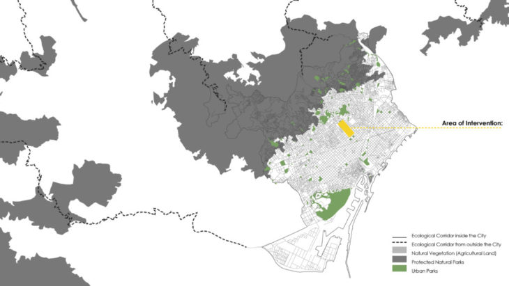
From understanding the impacts of less green in the city, the project looks at the macro scale to understand the distribution of land use and how and where the green areas are located?
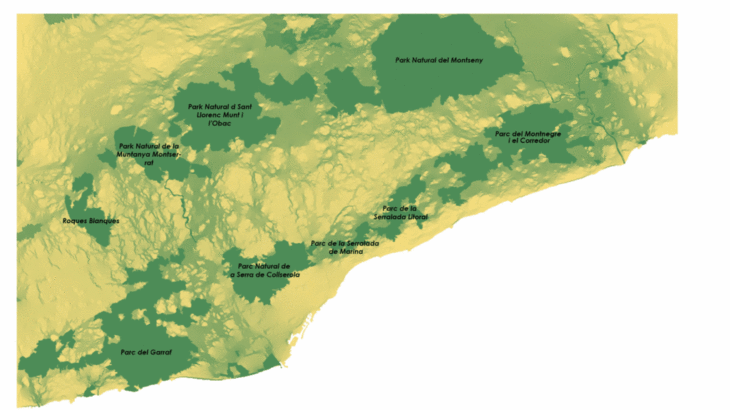
The Forest areas are fragmented and not continuous. They are divided by the highways and the agriculture lands. Thus the continuation of green into the city is almost non-existent. The project therefore explores on how to filtrate more green into the city of Barcelona. In response to this, we looked at two scales. On a macroscale, the protected natural parks were identified and their common wildlife was studied.

Catalogue of Common Flora & Fauna in the Protected Natural Parks
From that catalogue we found that the wildlife was bounded by the limits of each park, as there were no paths for them to travel. For these connections, we designed the “ecological corridor”. The secondary or tertiary roads travelling between the parks would be transformed into these corridors.
To understand which of the roads would be best for travel, we used Circuitscape to understand the connectivity levels first, then used Space Syntax to generate the low cost path. As the distances between the parks was very high, the corridors used lands that are mainly natural vegetation. This resulted in a new connection network.
Existing Connectivity compared to Proposed Connectivity using the Ecological Corridors
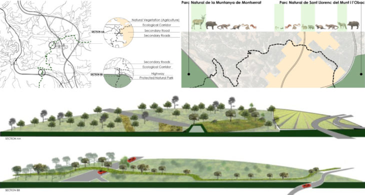
To visualize how this ecological corridor would work we selected a specific zone. Here the corridor was connecting from Parc Natural de la Muntanya de Montserrat to Parc Natural de Sant Llorenc del Munt i l’Obac. The corridor start from one park, crosses over a highway then continues through the natural vegetation area before reaching the other park. We then identified which of the wildlife could now use the corridor to travel to the other park. For example, the Spanish Ibex can be found in Montserrat but not in Obac. The corridor becomes an opportunity for increasing biodiversity.
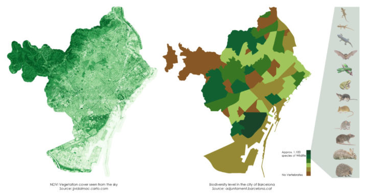
On a smaller scale, we then returned to the city of Barcelona. Now that a new network has been established with the use of corridors, the chances of increasing green in the city is higher. To understand the existing condition a comparison between two maps were made. One being an NDVI map (vegetation cover) and another showing levels of biodiversity based on the types of flora and fauna found in different parts of the city. Interestingly the green cover shows more areas in the Collserola Park whereas the biodiversity map indicated Parc Montjuic to have the highest level of biodiversity. Further north, some parts of Collserola indicated having no vertebrates at all.
From the connection network made in the large scale, there were three corridors coming into the city. These corridors then propelled a new network for the interior of the city by connecting the existing urban parks. The goal being to connect areas of high to medium levels of biodiversity with each other. A similar exercise as the one used in the larger scale was applied here again.
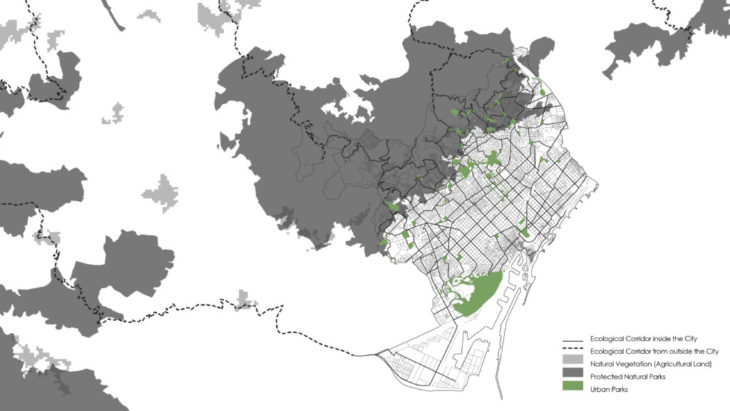
Ecological Corridors connecting Urban Parks
How would these ecological corridors manifest themselves into the urban fabric?
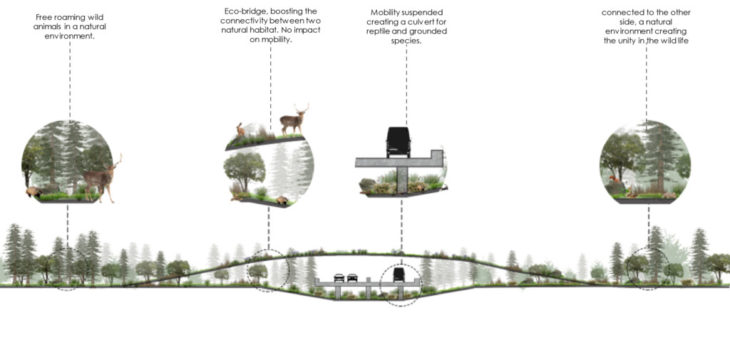
Visualizing a typical intersection where the ecological corridor becomes an overpass
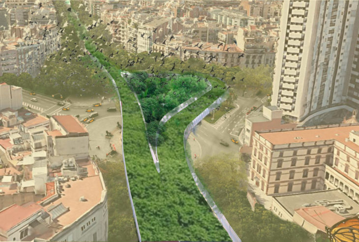
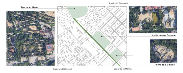
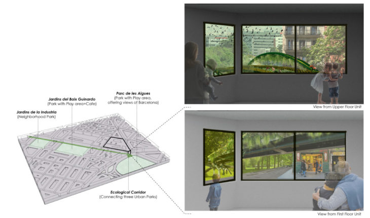
To further understand the ecological corridor in the city, a specific zone was taken into consideration. Here there are three urban parks and gardens of different scales: Jardins de la Industria, Jardins del Baix Guinardo and Parc de les Aigues.
The street running through all three points is Carrer de la Marina. This street is proposed to become one of the ecological corridor.
The corridor winds through the two gardens and then lands into the larger park. To understand how this corridor may be viewed and used by the citizens, the visualizations below are made looking out of the window at two different levels from the corner building. The garden which we cannot find at our doorstep in the city but is a walk away has now been brought to our windows within arm’s reach.
“The Green Lines” is a project of IAAC, Institute for Advanced Architecture of Catalonia developed in the Master in City & Technology, 2021/22
Students: Karim Abillama, Aida Hassan and Maria Magkavali
Faculty: Mathilde Marengo, Eduardo Rico and Iacopo Neri