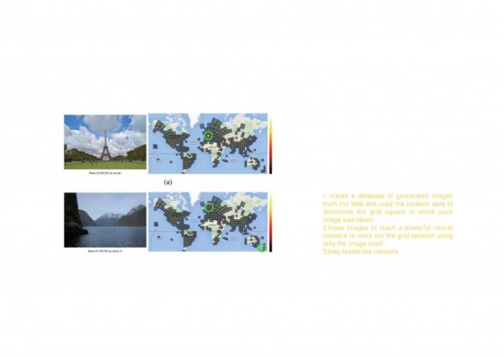
Artificial intelligence is being used to understand cities and build new types of structures – and it’s becoming clear that there’s a lot we can study. In the city, we not only catch the physical environment but also transfer them to digital data. Artificial Intelligence is one of these technologies, we use satellite images and street cameras to grab information by AI, such as different types of objectives by Pictures(BMP.GIF.PNG), Video, Tiff(geolocation) and so on.
Three tests with AI
1. TEST IN DIFFERENT ANGLES
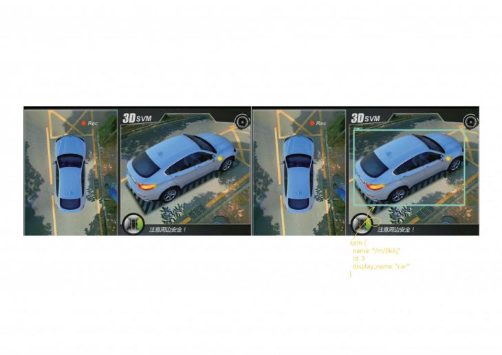
When we test objectives in AI, we can use satellites or street cameras to take pictures, tiff, or video from different angles, so when we will try to transfer them to digital data in coding, we need to create different models’ settings to test. On this page, I tried to use street camera coding to distinguish objectives, however, it cannot catch objective in top view. The limitation: when in the top view and street view, they need to create different models.
2.SATELLITE IMAGES
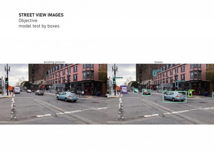
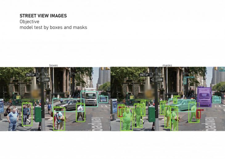
3.STREET VIEW IMAGES
Conclusion
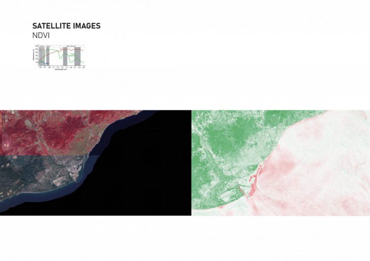
SATELLITE IMAGES
Satellite is a good way to observe the natural change by region, such as topography, trees, rivers, tides, no man’s land, temperature, humidity, the flow of people and so on, but when we try to observe small elements that it is hard to catch everyone because of pixels of images.
So work with other different data, such as traffic, lights, noise, people, and other layers, it is easier to make a new strategy for the city. Cooperate with drones, it is much easier to find an emergency.
STREET CAMERA IMAGES
The street camera is much more simple to catch people’s views and objectives. when we use video to analyze, it is to count the number of people, vehicles, colours, emotions and analysis potential dangers to change immediately, such as behaviour -in model’s setting, we can set up lots of lists. Compared with satellite images, it can grab all the objectives on the streets in a small area. Cooperate with sensors and drones, it can delivery conditions and also existing around environments. When I grab identity by mask, there are many more objectives that can be caught. So in artificial intelligence, there are also lots of methods to analyze pictures.
ARTIFICIAL INTELLIGENCE IN URBANISM is a project of IaaC, Institute for Advanced Architecture of Catalonia developed at Master in City & Technology 02 in (2019/2020) by:
Student: Xinyu Zhang
Faculty: Diego Pajarito