Augmented Reality for community building
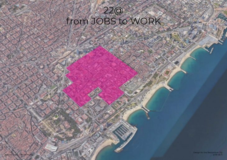
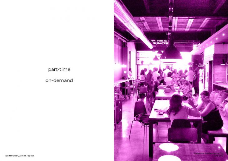
The Superilla is located in the 22@ area of Poblenou. 22@ is an urban renewal initiative to transform Poblenou from an industrial, working-class neighborhood into a hub of innovation, full of startups and flexible coworking spaces. The area is attempting to redefine “work” for the 21st century on-demand economy.
The big ex-factories and large spaces have now turned into places for creative endeavors and co-working spaces.
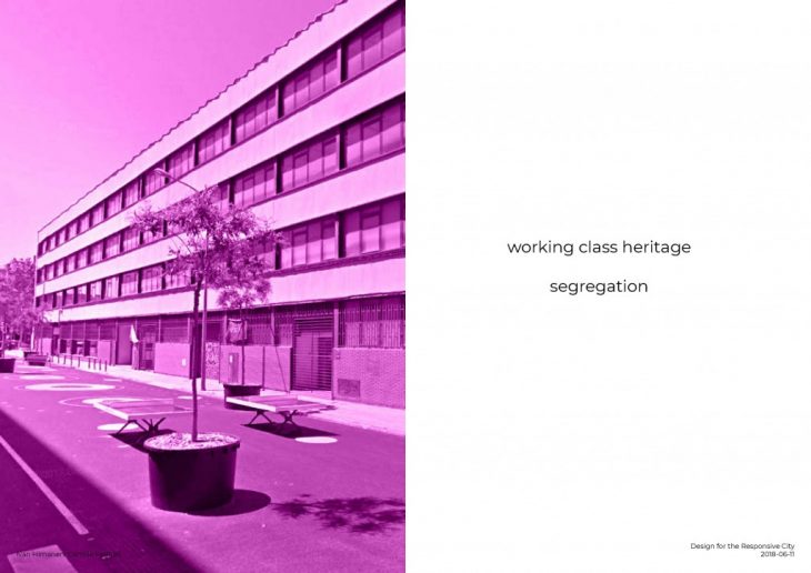
The new communal paradigm is a dichotomy between creatives (huddled inside the newly renovated buildings) and residents of the area.
The purpose of this exercise is to see how augmented reality technology can serve in the activation of public spaces, bridge communities, and how can it feedback for future urban planning strategies.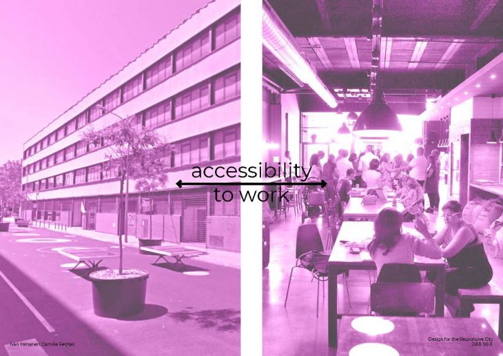
Superlink is a augmented reality application developed using the Unity game engine.
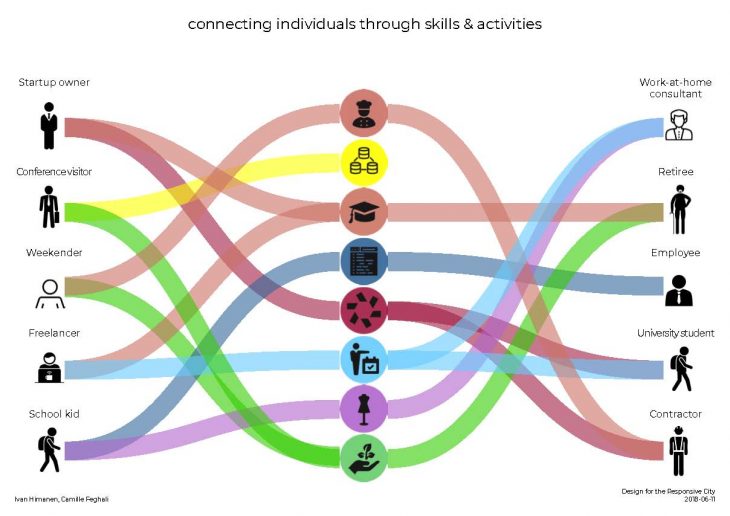
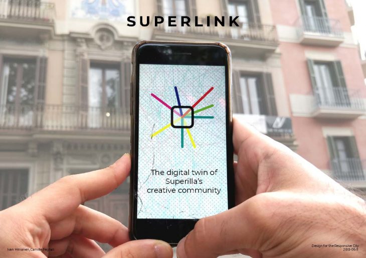 It’s a combination of what Facebook, LinkedIn, the Yellow Pages and the Traces app offer, but instead of considering traditional profile characteristics, Superlink relies on the fact that communities are made up of individuals regardless of employment status, and that each individual has a set of skills and activities that define their identity. People foster new interactions and relationships, through their skills and activities.
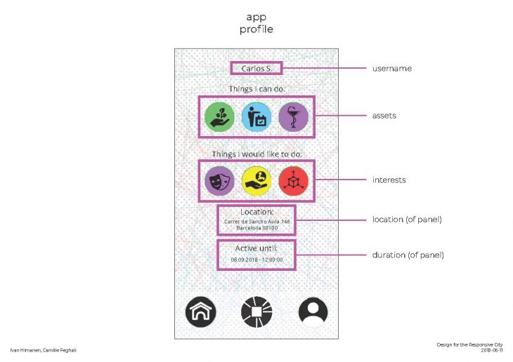
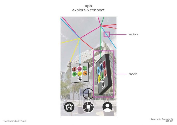
Superlink allows users to leave a digital trace, a marker, a panel in the virtual public space, which is connected to their identity: their name, the skills that they posses, and the skills that they are interested in learning. This panel is visible to all other users of the app who open the virtual space.
In order to access the virtual space, each user has to set up a panel, complete with username, skills, and interests. Each panel is placed in the location where the user is standing in the moment that the panel is configured, and a duration that the panel will remain in place.
 Each user is allowed only one panel. Therefore, individuals have to be strategic about where their panel is located. Do they locate it in already popular places? Or do they place it in emptier places for more exposure?
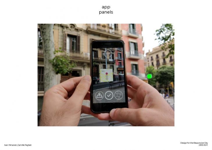
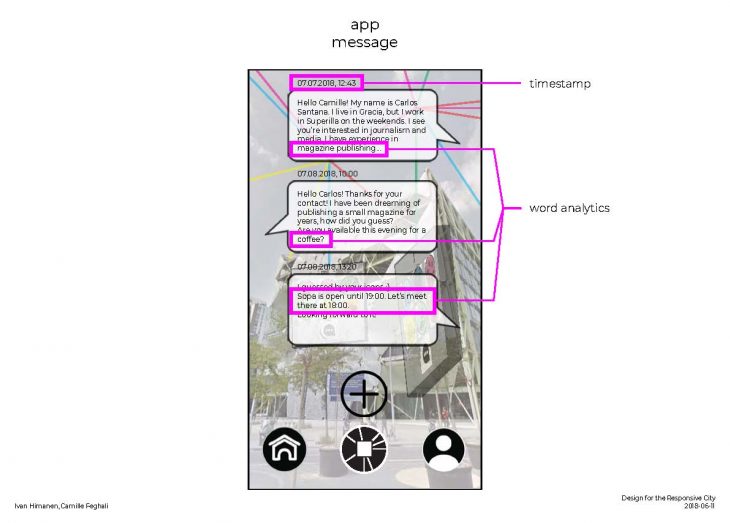
Once placed, other users can scan the digital-public space and see your panel. Each panel has a button that allows you to contact the individual with an in-app messenger. The frequency and constituent words of these messages can be analyzed in order to determine the nature of each collaborative contact. Did the individuals meet just once for a consultation? Did they begin a project together? Did they simply network?
Furthermore, each time contact is established between two individuals, a vector line is generated in the virtual space which connects the panels of the users. This is how the dynamic collaborative network gets visualized.
The most exciting data to gather overlays the skills and activities of people with the existing land use. Do coding geeks like to use this particular intersection? Do schoolchildren mostly change their panel locations during lunchtime, or dinnertime? Which activities are most compatible with others? Another potential layer of data tracks the conversations in the messenger, and includes them in the virtual space (e.g., there are many conversations about horticulture happening on this bench….)
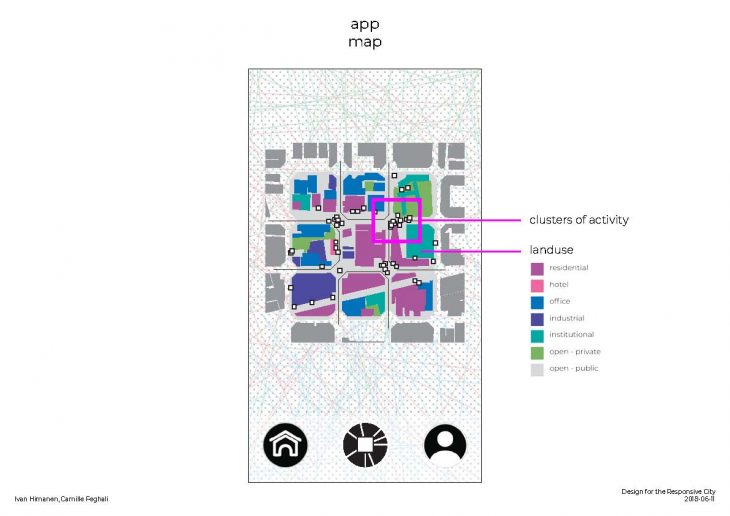
One specific outcome of these patterns is in the concept of micro-zoning, by which certain small areas are given certain special permissions of use which respond to the activities of Superlink users. These micro-zones can be temporal (restricted to certain active times of day), or functional (prescribing certain urban furniture for example, or allowing food trucks to enter an area).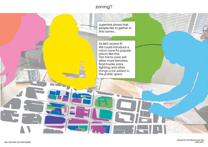
</p>
Superlink is a project of IAAC, Institute for Advanced Architecture of Catalonia, developed at MaCT (Master in City & Technology),
2017-18 by:
Students: Camille Feghali, Ivan Himanen
Faculty: Areti Markopoulou, Starsky Lara, Marco Ingrassia