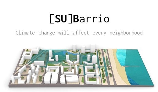
//GOAL
Create an experience that connects the sea level rise with the local conditions of a neighborhood, enabling locals to understand the short and medium term impact of the climate change, and conceptualize the long term impact.
There’s only one way to halt climate change, and that’s by experiencing it.
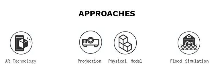
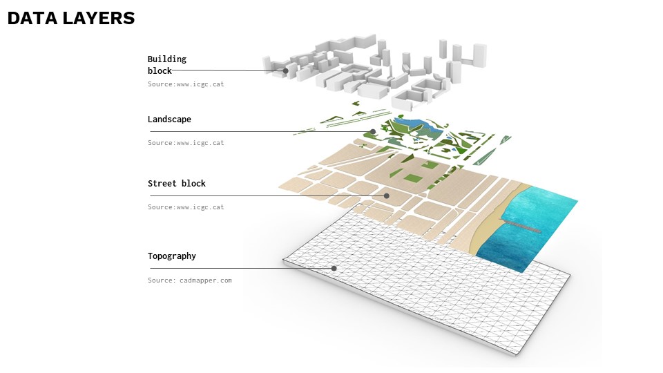
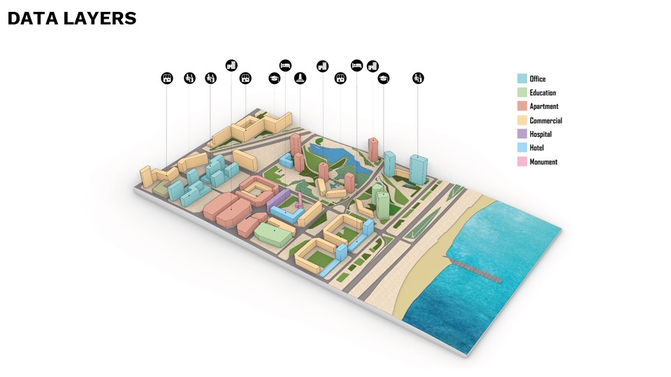
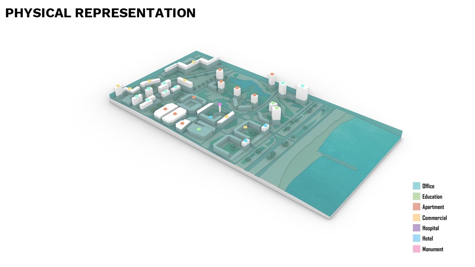
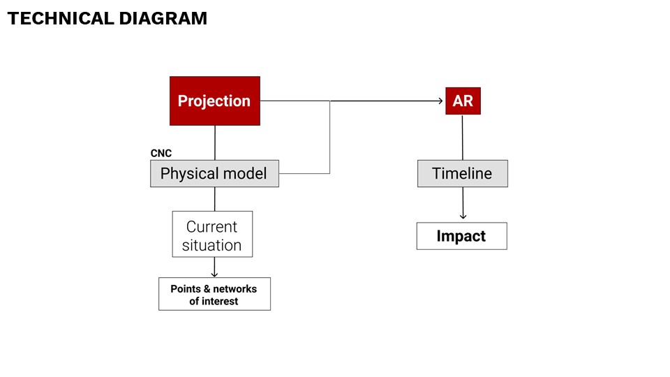
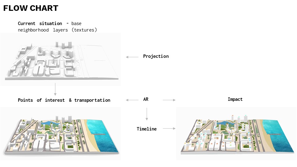
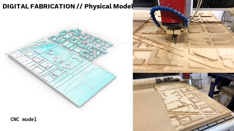
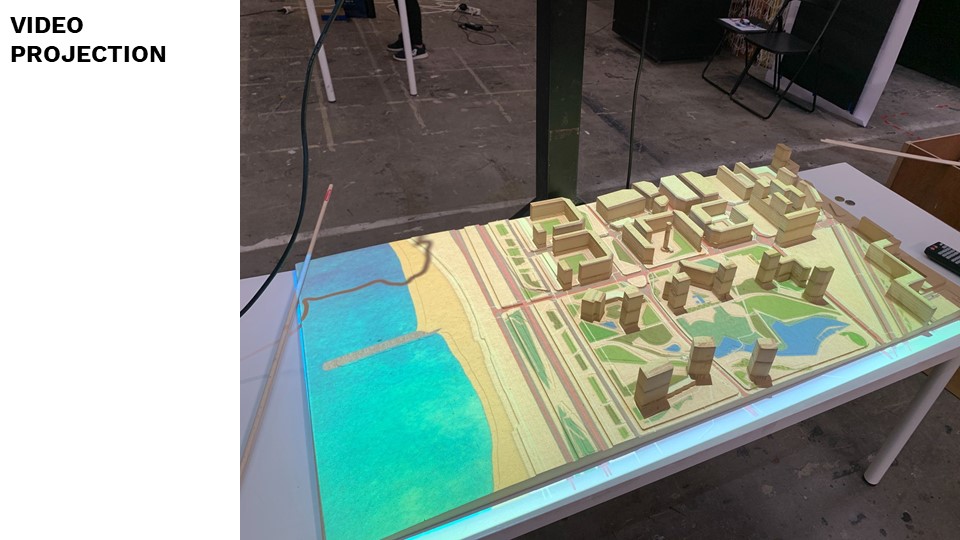
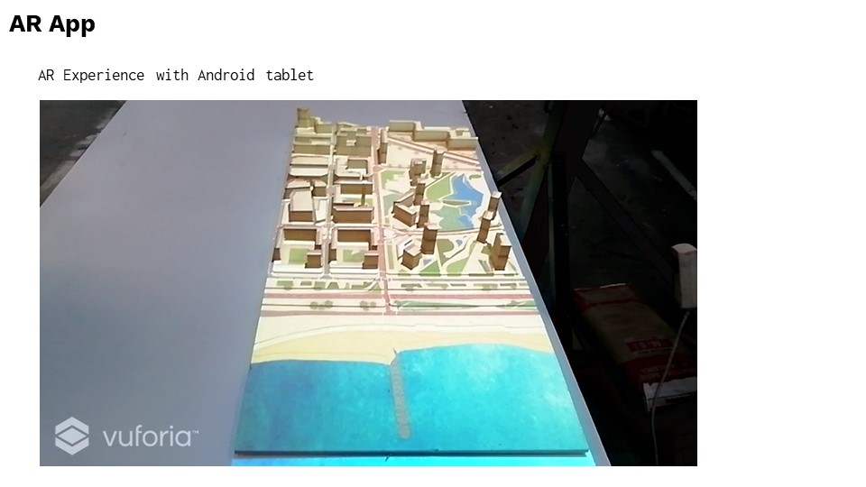
We combine AR technology with the physical mock-up of selected area of Barcelona to create an interactive visualization of the flood’s impact on the city fabric. We also use the projector to visualize the sea rise based on the data collected.
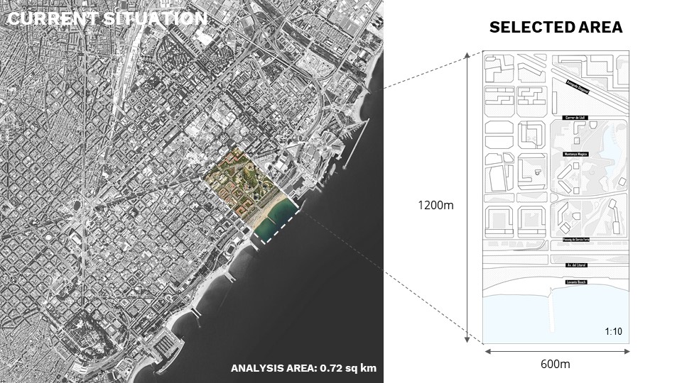
By focusing on a specific area, we intent to highlight visually how the flooding affects important sites and the urban infrastructure.
//STORY BEHIND
Barcelona is a coastal city that is going to be severely impacted by climate change in the coming decades and centuries.
It is hard, however, for the public to conceptualize the actual impact on their lives.
By visualizing how the chosen urban community will be affected by different levels of flooding from a series of categories, we help the locals see the impact of sea level rise in the environment they experience every day.
This interactive experience will also allow for an easier understanding of the long term effects of the sea level rise.
//Flood Data Sources
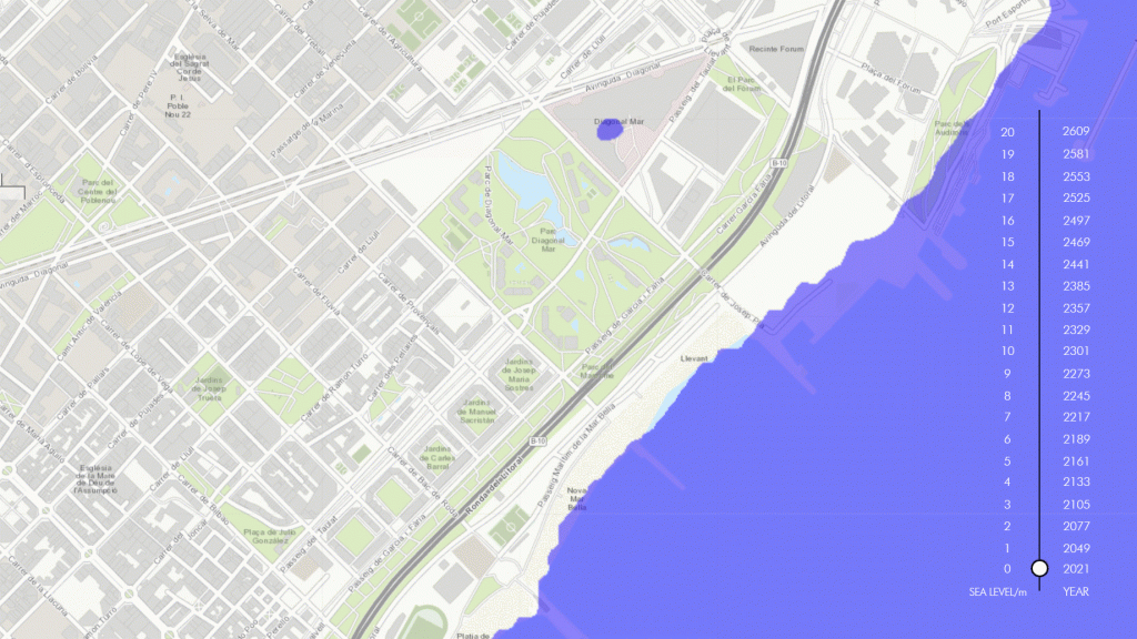
source:
https://www.floodmap.net/pro/
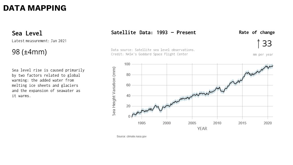
https://climate.nasa.gov/vital-signs/sea-level/


[SU]Barrio is a project of IaaC, Institute for Advanced Architecture of Catalonia developed at Master in Advanced Architecture in 2020/2021 by:
Student: Nan Yin, Ziying Zeng, Elizaveta Veretilnaya, Christos Trompoukis
Faculty: Daniil Koshelyuk, Mery Glez, Gus Zúniga