OVERVIEW
Artificial intelligence is widely used in today’s society, it is also applied to different degrees in various branches of urban planning.
Computer vision is a branch of artificial intelligence that has made great progress in recent years, at the same time, computer vision has gradually gained importance in the analysis and prediction of cities.
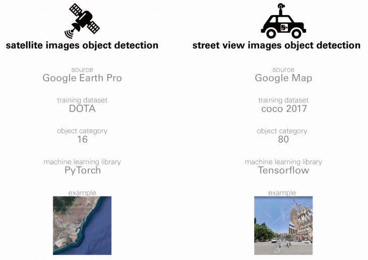
This time I mainly performed object detection on satellite images and street view images to study the different uses of computer object detection in different urban visual media.
METHODOLOGY
OBJECT DETECTION
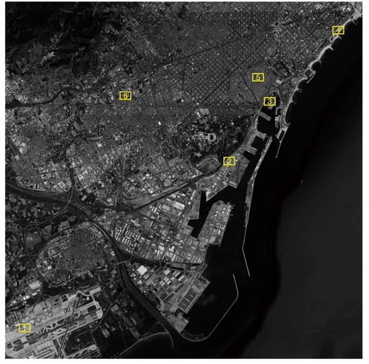
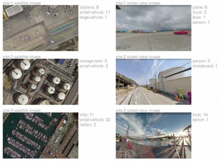
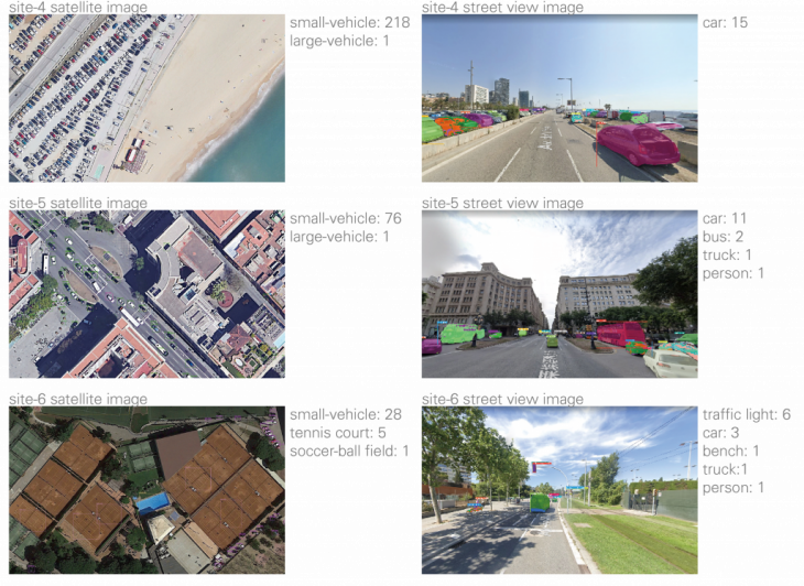
Pick six sites in Barcelona, ??get their satellite image and a street view image for object detection.
CONCLUSION
Satellite image analysis
Through object detection on satellite images, I found that computer vision does have a certain degree of difficulty in detecting small and dense objects. Although it is difficult, I think object detection in satellite images is very useful.It is very helpful for the analysis of the traffic distribution of the whole region. If we acquire satellite images in different time periods and detect different types of vehicles, we can analyze the traffic distribution situation that changes with time. This analysis is difficult to do with traditional data, because traditional data itself is difficult to obtain.
At the same time, not only can do object detection, but also can do semantic segmentation and so on, combined with demographic, economic, educational and other data, may find the inherent laws and problems of cities.
Street view image Analysis
Compared with satellite image object detection, street view image object detection technology is more mature and simple. And the object detection of street view image is more suitable for detailed analysis in a small area, because the analysis of street view image is computer vision analysis based on human perspective. Through detailed analysis of the street view with a certain area, it is possible to obtain the inherent problems of the area and also to obtain improved guidelines.
This is an important part of people-oriented urban analysis and decision-making.
Artificial intelligence
Computer vision is only one part of the application of artificial intelligence in urban planning. Combining various sensors, monitoring and other equipment, I think artificial intelligence can play an important role in detecting the real-time state of the city, performing city analysis, and predicting the change of the city. I think forecasting is very important. It helps to prepare in advance and not be caught off guard when you encounter problems.
In particular, I see that the recent Corona virus is spreading rapidly around the world. If you combine the virus’s spread data with the population’s migration data, it should be possible to predict the spread of the virus, and it may be possible to do advance prevention work. More effective control of the spread of the virus. I think this sudden emergency situation should also be considered by urban planners, and artificial intelligence should play a greater role in this situation.
STREET VIEW VS SATELLITE is a project of IaaC, Institute for Advanced Architecture of Catalonia
developed at Master in City & Technology 02 in (2019/2020) by:
Students: Luyang Zhang
Faculties: Diego Pajarito