Sense Mobility
The project started with the interest of now how do people interact in the public space and how does it affect mobility, so first we start to define mobility as a good connection between public spaces, which is not only physical but also psychological and social, supports an inclusive mobility scheme.
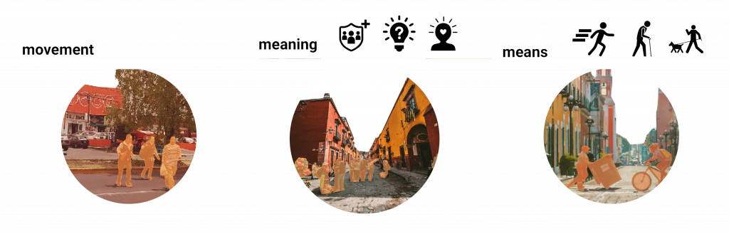
“Pedestrian mobility = movement + meaning + means”
(Tim Cresswell 2013)
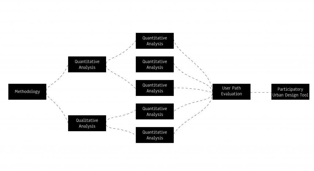
The methodology for the analysis was defined as a hybrid between quantitative and qualitative to have a better understanding of the user perspective – sense behavior in the public space for that reason we define the following steps as the procedure:
Universities collaboration
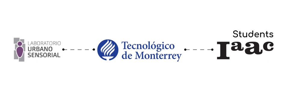
In order to analyze a place in Mexico, we ask professor Talia Gonzalez Cacho to work with Tecnologico de Monterrey and her students from the bachelor program of urbanism in the subject of cities and life quality. She is also in charge of Laboratorio Urbano Sensorial (LUS) which is a city lab for Puebla city, multidisciplinary independence from the university
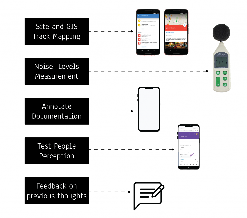
They accept to work with us, so we start to define the tools that students can use for the survey and also for the measurements inside the site, the tools need to be easy to use for everyone that’s why we choose to use an open-source map like google my maps, for the formulary we use google forms and LUS give to the students decibel-meters for noise measurement.
Site: Atoyac river
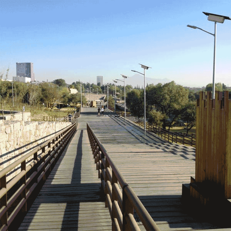
Atoyac River Corridor is one of the most recent urban interventions by the government of Puebla. It is well-surrounded by green infrastructure and consists of a series of designed pedestrian networks. In 2014 Government’s estimated budget was 5.4 $ millions mx (about ?225,000.00), in order to create this corridor, but total investment in a corridor for transportation and recreation in 2016 in 5.2km was 19.9 $ millions mx (about ?805,000.00)
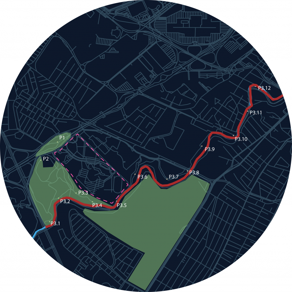
For the closeness with the university, they agreed to analyze the Atoyac corridor for that reason we create 2 points as a control as a comparison then we selected 12 more points to analyze the path, most of them are located into parks from the corridor, just 3 points were located into transition parts.
Does the heavy investment create a good social gain?
Despite the beautiful infrastructure, the Atoyac corridor has not the impact as the government expected, just a few users are using the place for recreation or mobility, for that reason Tecnologico de Monterrey – LUS asked to work on the analysis of the path in order to get a better panorama about why it became into a nonplace project? Do the users really like Atoyac path?.
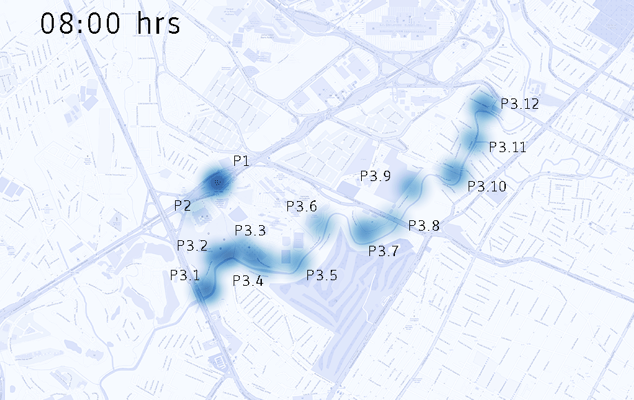
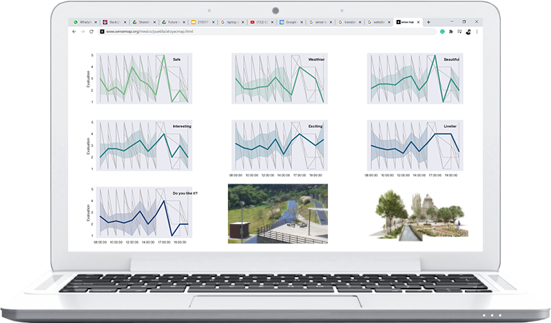
For that reason, the students analyze thought time sound measurements during different periods of time, in order to see how does the noise changes during the day, and then to see if it is related to security, in the survey that students made, they found that people feel safer in places where sound loud is in normal ranges and they feel very insecure in places where the sound noise is really low or too high.
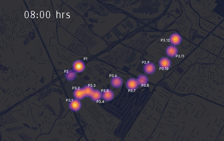
Then, the Students has to count the concurrence during the day by counting how many people do they see by establishing measurement of time periods in the point site, most of the people that they see were interview as part of the survey investigation, to know how do the users feel using this public space.
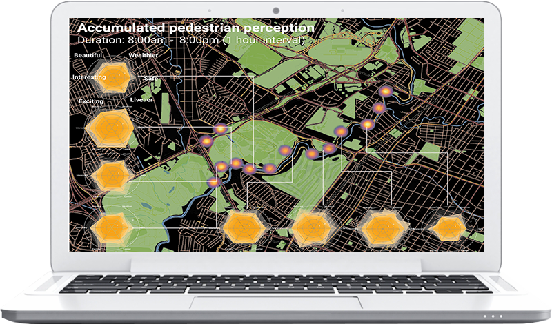
Sense Map:
For that reason, we decide to bring an app to share qualitative and quantitative analysis, for citizens, politicians, decision-makers, and urban planners. In this platform, the user can see the fluctuation of people feel in public space through time, the information is filled by the citizens who want to say something about their current spaces in their cities
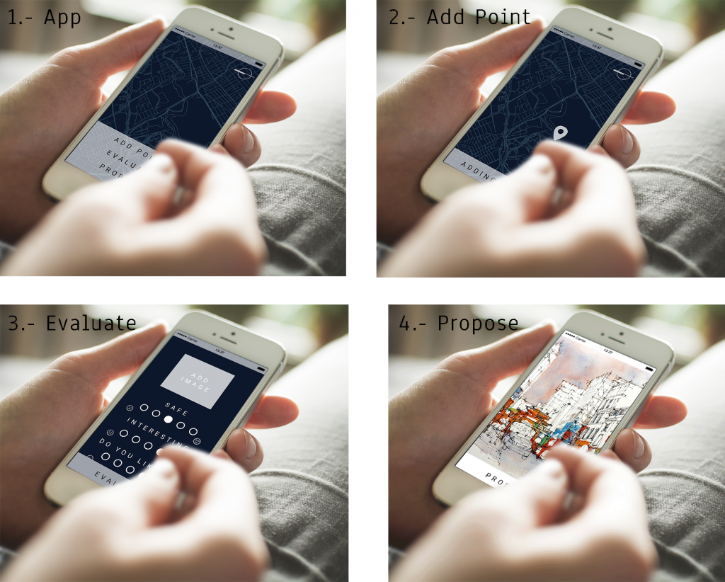
Creating an open-source map, it is not necessary to download an app to map or evaluate, with this we tried to be accessible for all people who want to say something about the public space in their cities. In four steps users can open the map, add a point to evaluate, can upload an image, fill the survey, and finally add a proposal, with this we want to create engagement and also flip the model into a bottom-up design.
The results are shown as graphs where the current evaluation space appear and also the proposal of the users, with this urban planners and politicians can have a better panorama about the citizen’s needs
The Sense map is a tool for improving spaces considering psychology in the public space, in order to create consciousness about the psychology in the space and how to improve participation between citizens, decision-makers, urban planners, and government.
Special Thanks:
M.A. Talia González Cacho
Adriana Arenas Espinosa
Sense Map is a project of IAAC, Institute for Advanced Architecture of Catalonia developed in the Master in City & Technology in 2020/21 by Students: Dongxuan Zhu, Miguel Angel Tinoco & Ivan Reyes and Faculty: Federico Parolotto & Francesca Arcuri