Content
Syllabus
Context
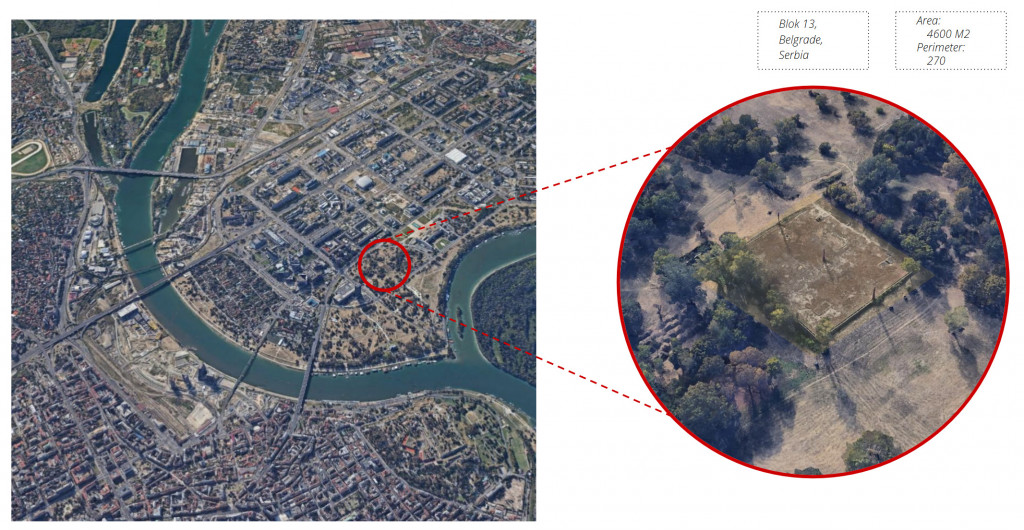
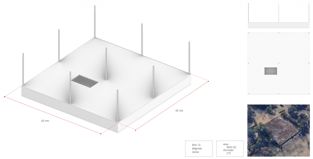
Location information
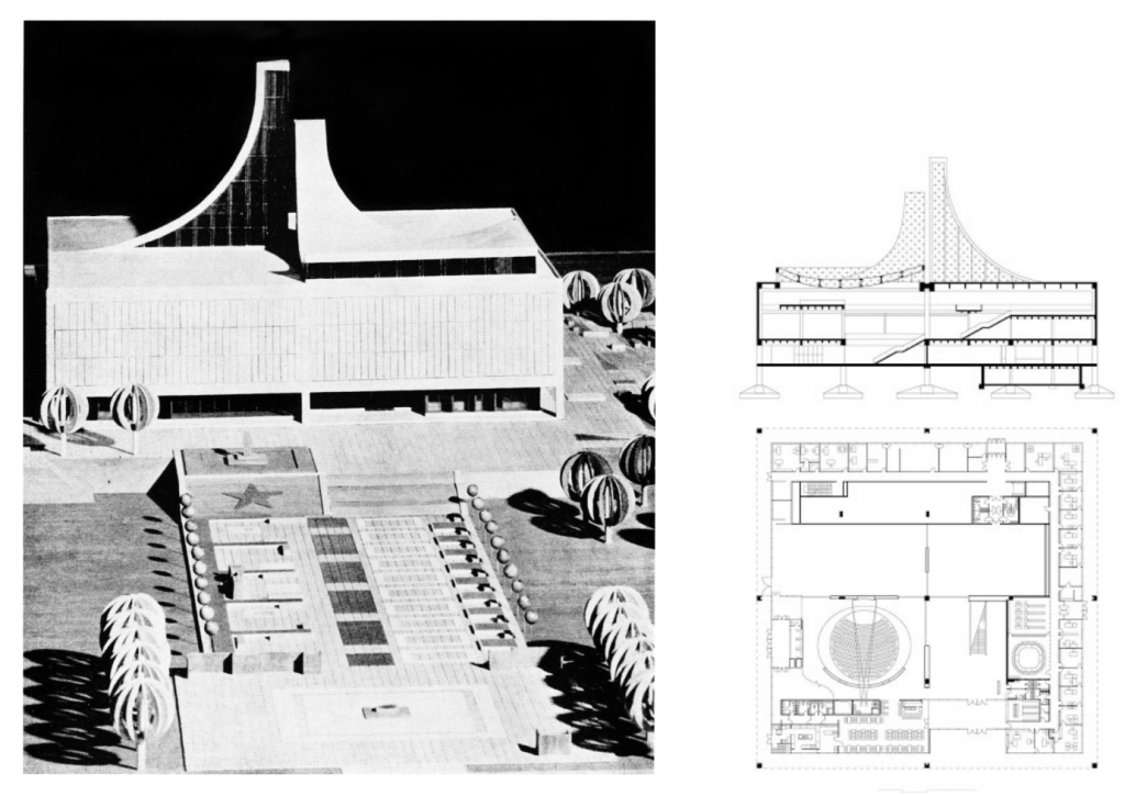
Previous project
Current situation
Objectives
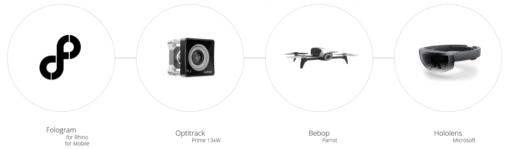
Design tool
Strategy
Test 01
Test 02
Test 03
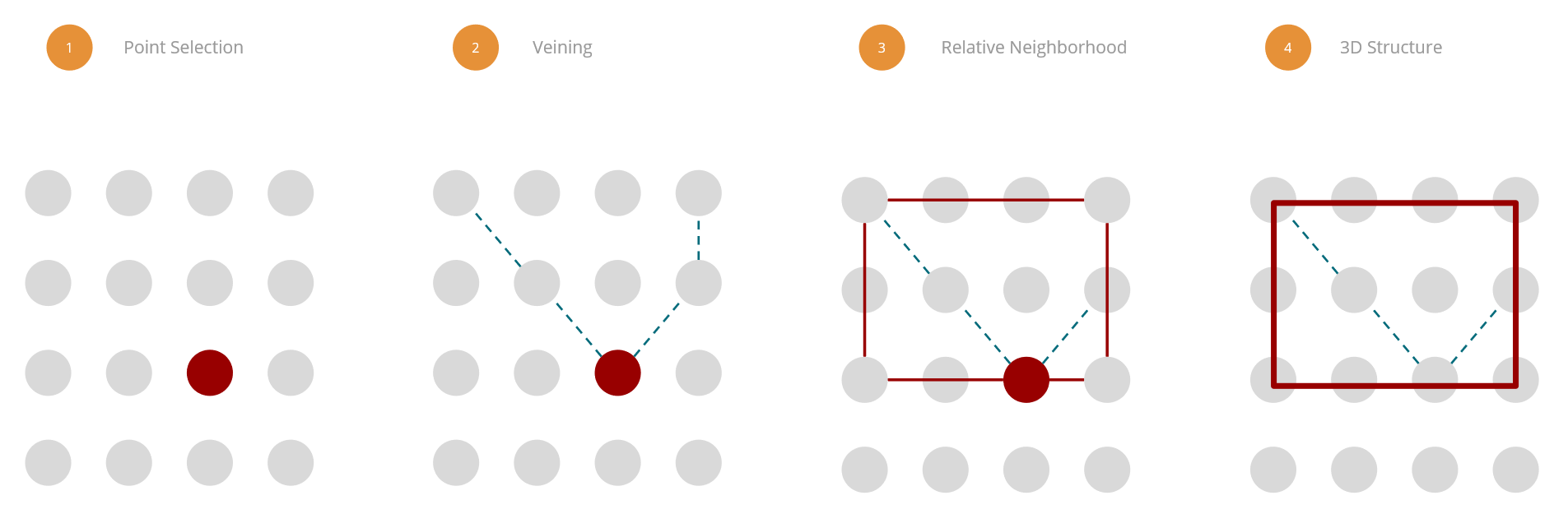
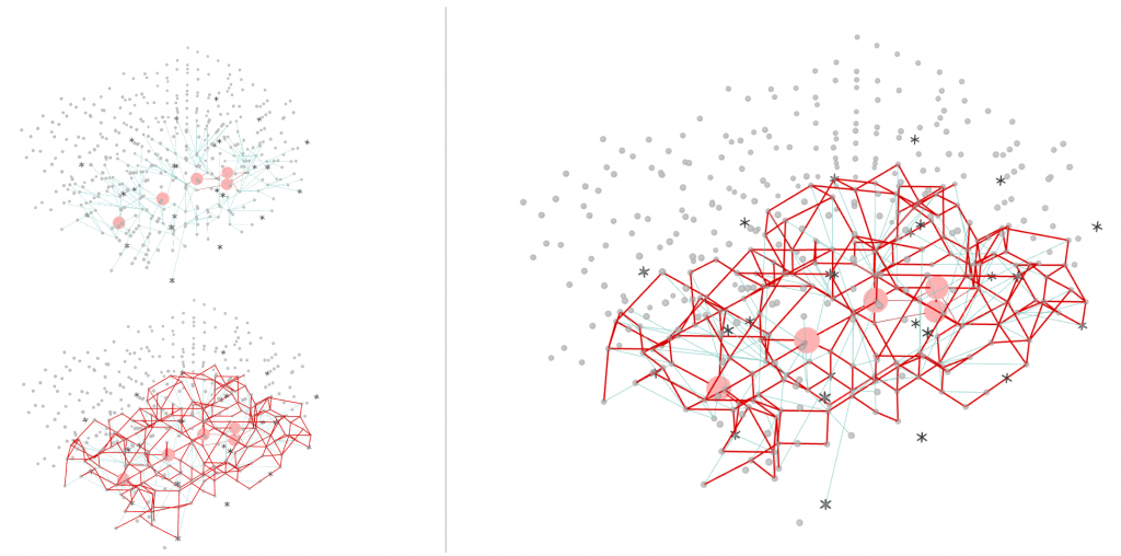
Diagrams
Assembly
Fabrication
Syllabus
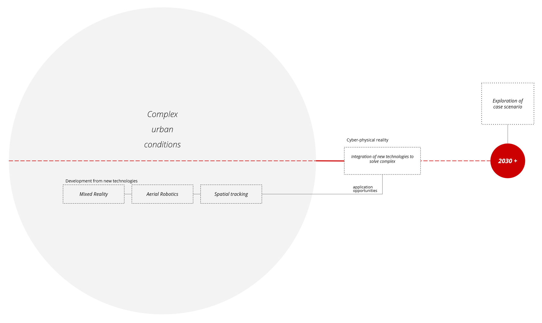
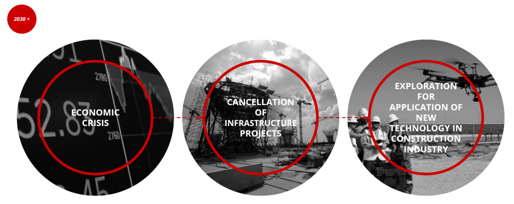
As aerial robotics, mixed reality (MR), spatial tracking and intelligent components progressively permeated design professions and construction practices throughout the 2020s and into 2030, design activists throughout the globe initiated and executed renegade architectural actions that simultaneously combatted urgencies of the era while providing a host of spatial civic bonuses. Expanded collaborative modes of hyper-localized design engagement were facilitated by increased access to interactive multisystems, which coupled computational black box applications and deployable gear with augmented low-tech construction approaches. Through the lens of this thickened cyber-physical reality, complex and complicated urban conditions were seen afresh as opportunities for impactful transformation, prompting new modes of practice that produced an incredibly rich array of new architectural operations and typologies.
Abstract
LOCATION Information
Previous project
 Current state
Design tools
First Concept Clusters
Computational Approach Clusters
TEST 01
Design Strategy Growing Structure from points
First Implementation Growing Structure from points
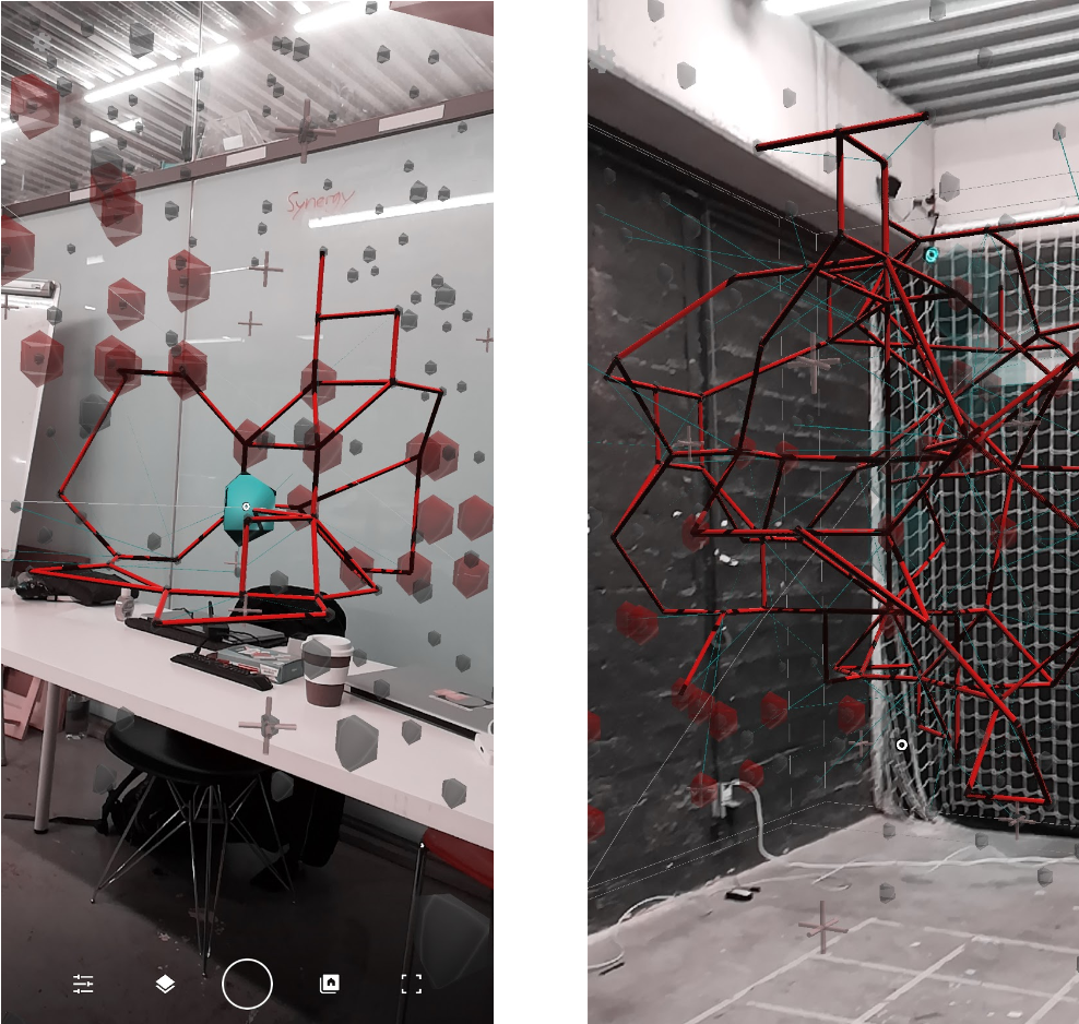
TEST 02
UI Options
TEST 03
Different density
TEST 03
Same points – Different density
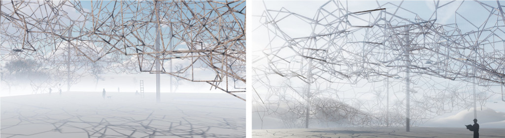
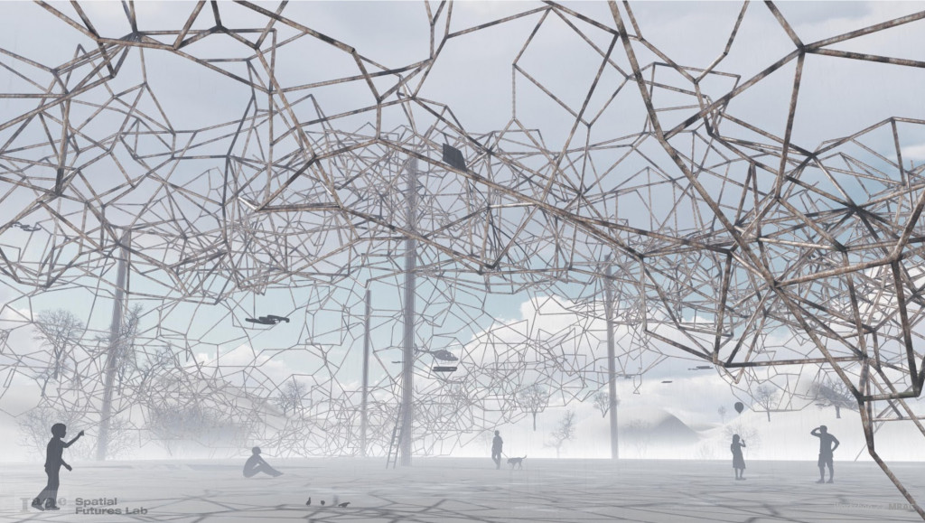
Final Design
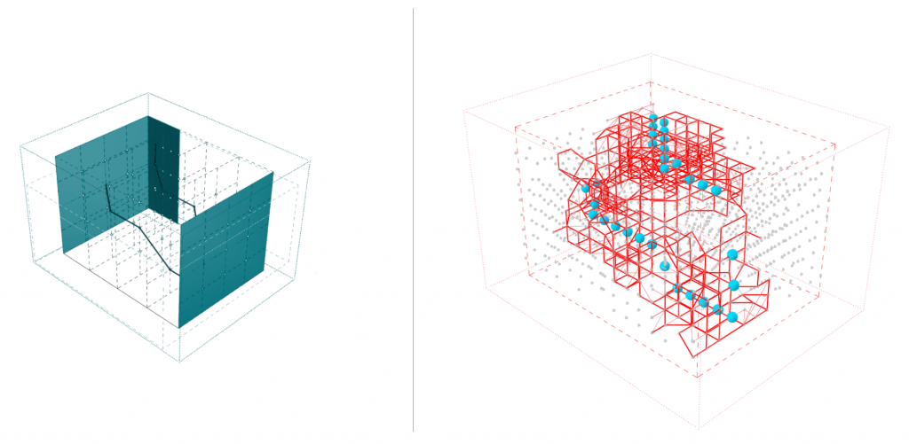
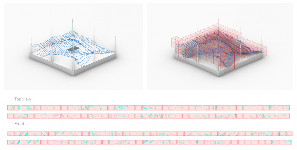
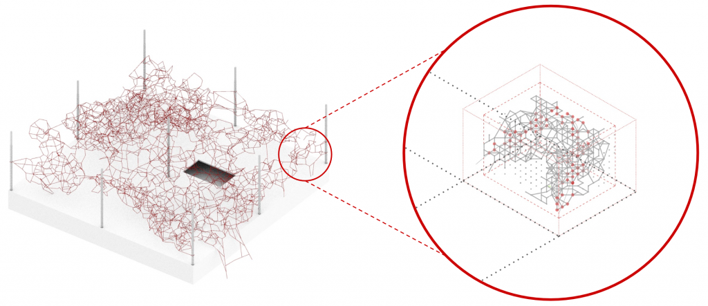
Bounding Structure Topological optimization
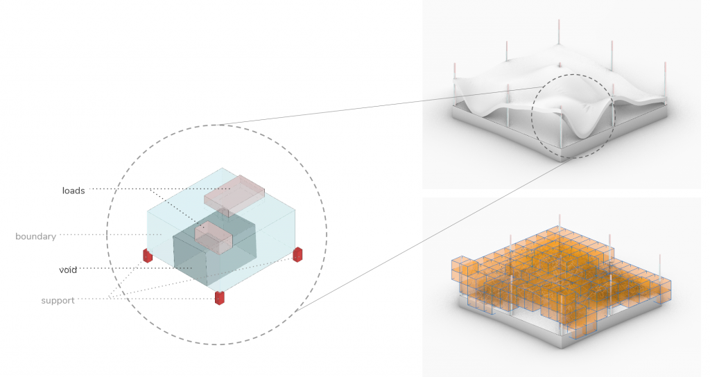
Voxelization & Segmentation
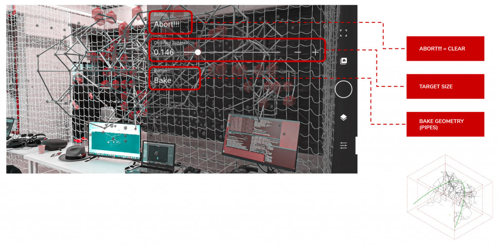
Design process Test 02 Cluster baking
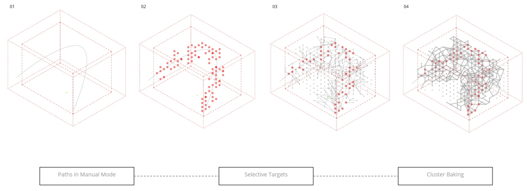 Design process Test 02 Cluster baking
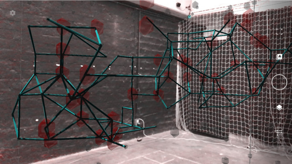
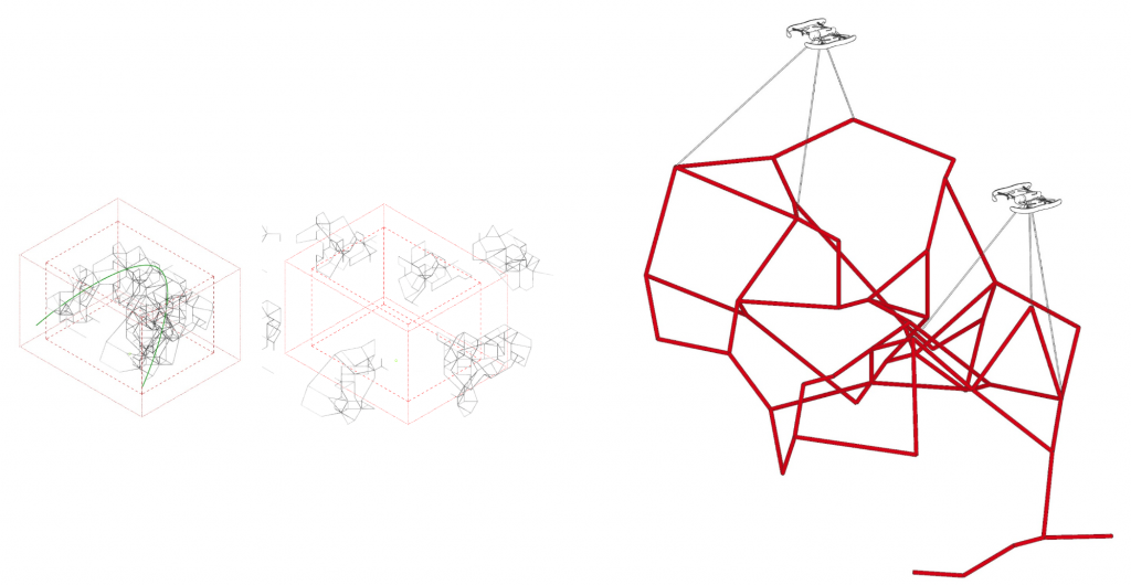 Cluster Assembly
SENSE: Digitizing the physical world is a project of IaaC, Institute for Advanced Architecture of Catalonia developed at Masters of Robotics and Advanced Construction in collaboration with Georgia Tech Spatial Futures Lab in 2019-2020 by Students: Lorenzo Masini, Luis Jayme Buerba, Elena Jaramazovic & Roberto Vargas Calvo, Faculty: Keith Kaseman, Soroush Garivani & Daniela Marquez.