SAFE STREETS
for pedestrians and cyclists
INTRODUCTION
Dealing with people’s emotions is not an easy job, in particular if it concerns the urban environment and you represent the public administration. Municipalities should be interested in the quality of life of citizens, especially when we talk about safety along city streets and this is the aim of our project.
The topic is not new and in the literature we can find exemplary works, just thinking about concepts like Jan Gehl’s “safe city” (in “Cities for people”, 2010) and Jane Jacobs’ “eyes on the street” (in “The death and life of great American cities”, 1961).
Considering these elements we tried to offer the public administration a tool useful to tackle the problem.
In most car-centered-designed cities, pedestrians and cyclists are two of the most at-risk categories of users of the street. Their safety depends especially on traffic conditions and crime prevention. On the one hand because it is related to the risk of accidents to these users, on the other hand because it concerns the security of walking/biking at any time of the day.
So, in the framework of urban mobility, we have tried to analyze which elements of mobility could influence safety on city streets, in order to get initial feedback of the situation.
METHODOLOGY
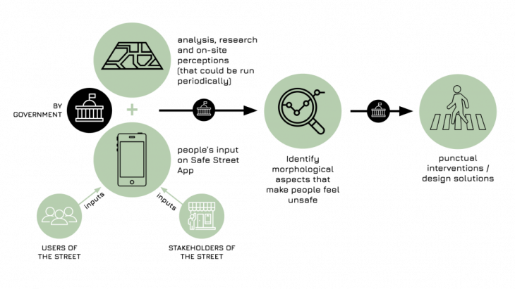
Our proposal combines analysis, research and on site perceptions with inputs that come directly from users and stakeholders of the street, collected through a platform that is the core element of our project.
Thanks to this combination, we are able to identify the morphological aspects of the urban environment that make people feel unsafe and give to institutions specific guidelines for projects addressed to the solution of the problem.
ANALYSIS
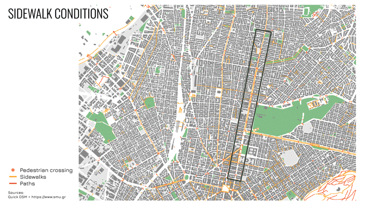
Patission Street in Athens represents our pilot project. We applied our analyses combining different sources of information that helped us to lead a sort of remote site visits, despite our idea is to include in this process also desk and field research, with the specific purpose to analyze those elements of urban mobility that can affect the feeling of security in pedestrians as in cyclists.
One of the elemental characteristics regards sidewalks conditions. We focused our attention on several aspects, like for example taking into account the space dedicated to pedestrians, that in some cases is very limited and situations of overcrowding are likely to occur. Unfortunately, this implies another common issue that is related to the lack of visibility, especially for people waiting for public transport. They are forced onto the road, and this represents a clear safety problem. In addition we have detected another common issue along the street, that has to do with poorly visible (if existent) pedestrian crossings.
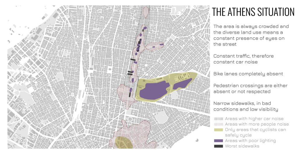
The situation for cyclists is not so much better. Near the examined area we found only two cycling paths, and this lack of infrastructure forces them to ride in the street. Only confined areas, like Pedion tou Areos Park, offer cyclists a safe zone, far from cars and other vehicles.
Traffic noise is another element that can affect people’s quality of life and in particular their feeling of safety. The study area is heavily trafficked and the direct repercussion is highlighted by the level of noise measured during the day and during the night. A feature that does not give the feeling of being protected from vehicles.
On the other hand, people’s noise generates a feeling of protection that makes us think of not being alone. In this case, noise level during day and night is based on the concentration of amenities that create aggregation points.
Street lighting in the same way affects the feeling of security, reason why it should be included in these analyses.
Lastly, following Jane Jacobs’ concepts we analyzed the main land uses widespread in the area, in order to understand whether it is possible to count on different types of “eyes on the street”: workers during the day and dwellers during the night.
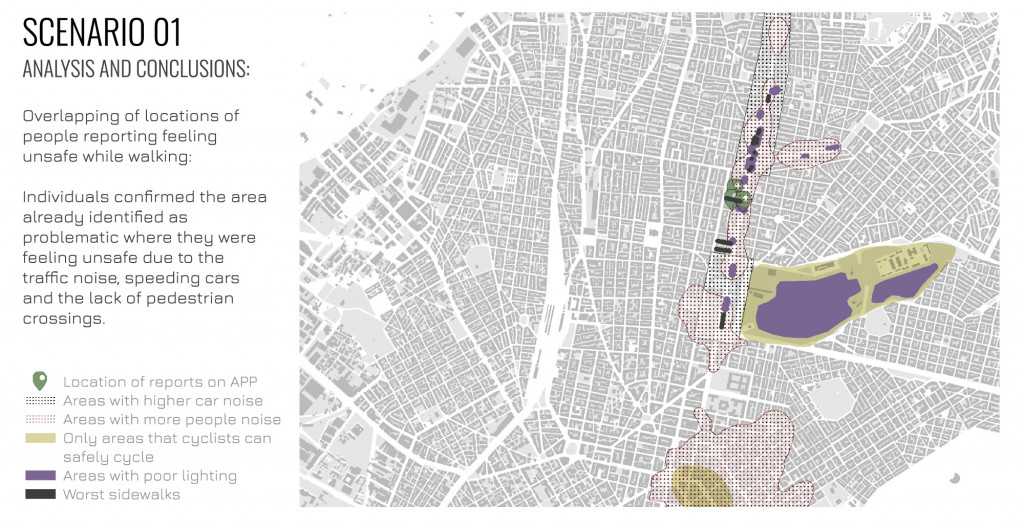
In conclusion, combining all the results of the previous research, it is possible to draw a cumulative map that summarizes the situation in this part of the city of Athens. We can understand the main problems and in particular it is possible to highlight, directly on the map, the points where we have worst cases that require more attention.
PROPOSAL
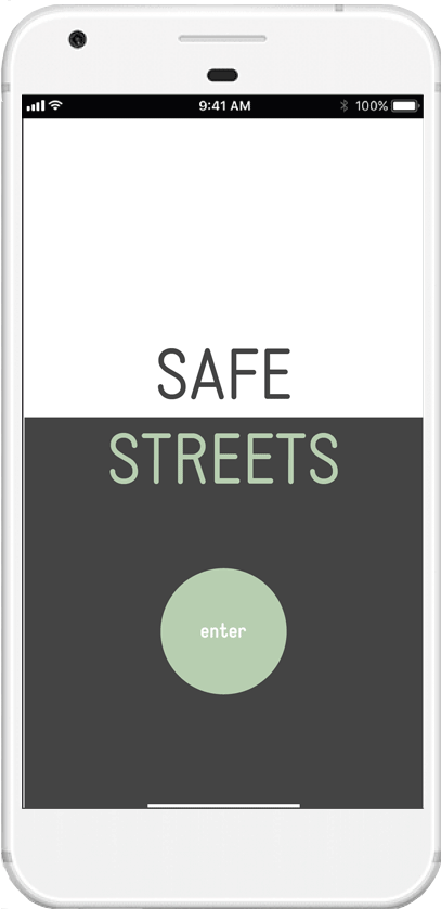
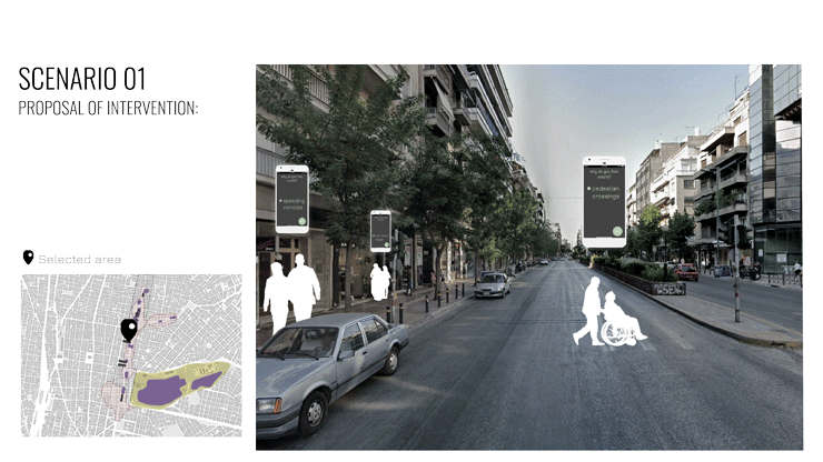
We thought about an app in order to involve citizens and obtain their direct feedback regarding the safety of streets they travel every day. We believe that the simplicity and the ease of use of the platform can be a plus point for our project. Users can quickly choose among different arguments which are the main issues they experienced during their walk or their bike-ride. Moreover they will also have the possibility to have their say, given the complexity of the topic.
The analysis of the collected data can take place in two different ways. In both cases, the first step involves filtering inputs by users (pedestrians/cyclists), following will be possible to filter inputs according to their location or to a common issue. Once the data has been collected, it can be analyzed and the situation to be improved can be identified.
We ran two experiments, depending on the typology of users.
In the first case we collected data from pedestrians and we filtered their inputs according to the locations specified on the map. Among 15 surveys, we have pointed out that in a specific area there were different issues related to the lack of pedestrian crossings, their poor visibility and difficult access, too much traffic noise and speedy cars. Moreover, overlapping users’ locations with previous analyses, individuals confirmed the area already identified as problematic.
So, combining insights from both sides it has been possible to elaborate a proposal that can effectively respond to the necessities of people in that area.
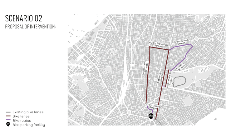
The second part of the experiment involved cyclists. Their inputs proved to be very useful because filtering them by issue gave us an idea of streets and places where cyclists felt more unsafe.
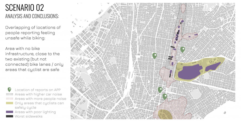
Previous analyses already highlighted the scarcity of bike paths, but only through the results of the application it has been possible to design a new track bike-friendly, proposing two different kinds of infrastructure. A bike lane in wider streets that generally are also the ones with more car traffic, and bike routes for narrow streets.
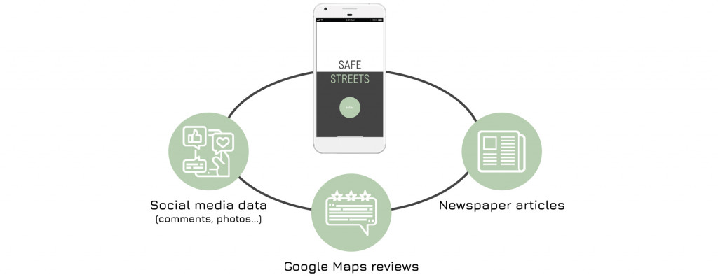
FUTURE POSSIBLE ADDITIONS
The right functioning of the entire process is strictly related to the number of active users of the app, so for this reason we believe that in the future it can be enhanced with new and different sources of data, that can be analysed in different ways. Data that are already available and that can give great support to the project.
Safe Streets is a project of IAAC, Institute for Advanced Architecture of Catalonia developed in the Master in City & Technology 2020/21 by Students: Diana Roussi, Laura Guimarães, Matteo Murat, Sridhar Subramani, Stephania-Maria Kousoula and Faculty: Federico Parolotto & Francesca Arcuri