The Road to Wetlands | Connecting education with nature
Abstract
This project focuses on generating Grasshopper definitions to generate the shortest paths between two given points, in order to identify the walkable paths between them that can be a 1-hour and a 2-hour walk, as well as visualize them in map and in diagram.
Introduction
This project is developed in relation to the Internet of Cities studio and the challenge of Rewilding Luxembourg. The main concept of the studio project is to increase wetland connectivity through the Luxembourg landscape. Our key strategy is to cooperate with beaver, one of the few species that can actually manufacture his environment. In order to increase social engagement and educate citizens through time, we have decided to work with kids as our main stakeholder of our interventions; acting as citizen scientists.
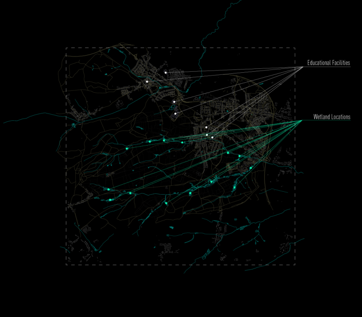
Bertrange area | area of study
In our area of study, Bertrange in Luxembourg, we have identified 14 wetland locations. The 8 of them are existing already while at the other 6 areas we are creating artificial dams to introduce beavers and let them expand the wetland ecosystem. Following our stakeholder strategy, we have also identified the 7 education facilities of our area.
This project aims to calculate the shortest paths from each education facility to each wetland, and categorize them accordingly to the time someone needs to walk them. Given that an 1h walk is almost 2,5 km and accordingly, a 2h walk is almost 5 km, the grasshopper definition created calculates and categorizes in diagram and in map which are the shortest walkable paths from each educational facility.
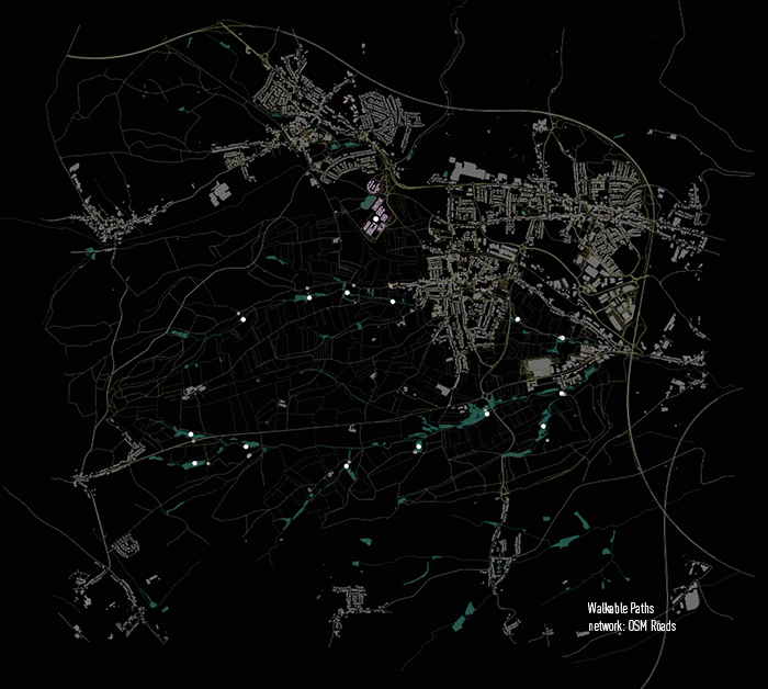
Walkable paths between every educational facility and each wetland locations | network: OpenStreetMaps Roads
The first definition created focuses on generating those shortest paths using the Shortest Walk component and using as network, the network of roads extracted from Open Street Maps.
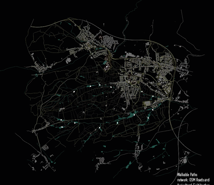
Walkable paths between every educational facility and each wetland locations | network: OpenStreetMaps Roads and Borders of Farmlands
After generating these shortest paths, we decided to examine another network, setting as walking paths the roads merged with agricultural farmlands borders. So, the second definition focuses on generating the shortest paths using as network the roads from OSM merged with the farmland borders. In this case, the paths are profoundly shorter.
The last part of the definition focuses on creating a script to identify which are exactly these paths that from each school allow 1-hour and 2-hour walk to the wetland areas. Using the “Smaller Than” component set it to less than 2500 km and 5000 km accordingly, we can generate a map and a diagram identifying these paths.
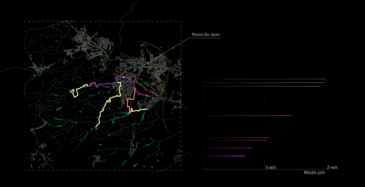
Walkable paths between Maisons de Jeunes and wetlands’ locations
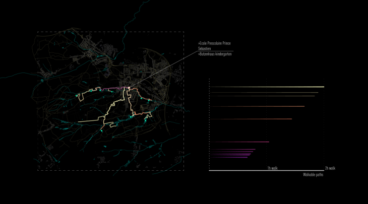
Walkable paths between Ecole Prescolaire Prince Sebastien and Butzenhaus Kindergarden and wetlands’ locations
The Road to Wetlands | Connecting education with nature is a project of IAAC, Institute of Advanced Architecture of Catalonia developed at Master in City and Technology in 2020/21 by student: Stefania-Maria Kousoula and faculty: Eugenio Bettucchi and Iacopo Neri