Abstract
Luxembourg is a country with dispersed population density as well as settlement patterns. The following maps investigate the relationships between such residential density pattern and other factors. Demographic data and residential building cover is combined and graded. It is discovered that both proximity to railway and housing cover restriction have relation to this pattern.
Spatial pattern of residential compactness
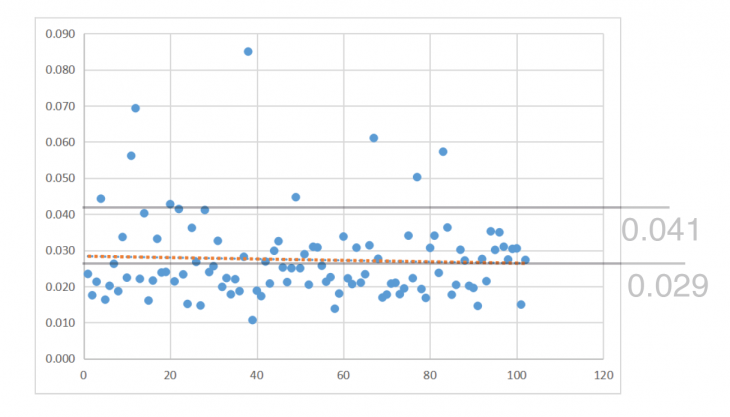
Fig.1 Distribution pattern of population density level by municipality (person/m2)
This investigation does not integrate the building level data. However, the trend of residential density at 0.029 person/m2 (1 person per 34m2 residence) reveals a comparatively low building level pattern.
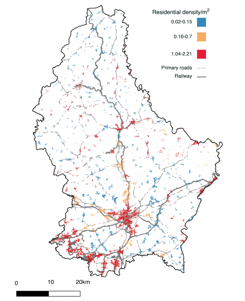
Fig.2 Population density by residential building cover (m2) per municipality
A series of residence along the rail way has high grade in residential compactness. However, some detached region is also high in residential compactness with limited relation to transport.
Residential compactness and population growth pattern

Fig3. Comparison between population density (2020) and population growth rate by municipality(1991-2020)
Some municipalities detached to the railway also has similar pattern as population growth. There could be a potential relation to housing cover restriction policies in Luxembourg.
Residential Density Pattern of Luxembourg is a project of IAAC, Institute for Advanced Architecture of Catalonia developed at Master in City and Technology(MaCT01) in 2020-2021 by Student: Dongxuan Zhu and Faculty: Diego Pajarito