Abstract
The whole project in the glance is capturing CO2 and We have defined different sites in Luxembourg and chose one to focus which is wetland and it is resilient sink for Carbon Dioxide,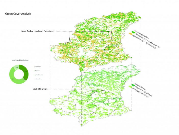 Urban AI, Strategies for carbon sequestration in Luxembourg
In Urban Artificial Intelligence we used 2DNeural Style Transfer Algorithm in which a base file and a style file are merged with a number of iterations which is a variable to produce a resultant image. The resultant image was turned into a 3D image in z brush. The exercise was carried out on the ongoing Studio project Carbon Capture in Luxembourg to create and analyze the 2D Neural Style transfer as a design tool to address the Carbon Capture Analogies. Tests were done with different parameters looking for results that could be used for the carbon sequestration project in Luxembourg in which the results were the following.
Experiments
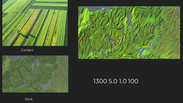
The following image presents the usage of the style transfer algorithm on 2 simulations of Normalized Vegetation Index and Animal movement in the whole of Luxembourg.

We used historic wetland in site to give an impression of how the area can be regenerated: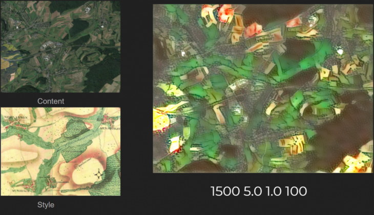
We started analyzing the terrain to uncover ways in which the country had the capability to sequestrate more carbon. At first, we identified geological differences between north and south, the north being a mountainous terrain with steep slopes, low agricultural use. Already protected by natural areas. One opportunity we identified was to adapt already existing forests to sequestrate more carbon, and use the already rocky and difficult geography to plant more trees.
Yet different Experiments
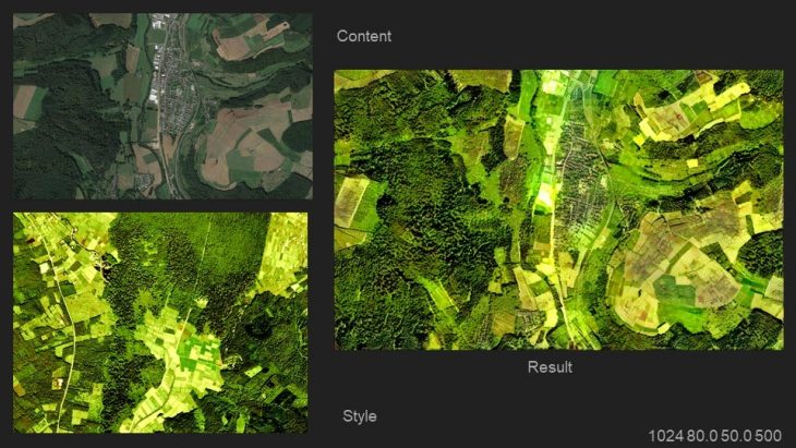
We then Style transfer the remote sensing of NDVI color map with agriculture remote sensing from 10/10/2020 to 11/10/2020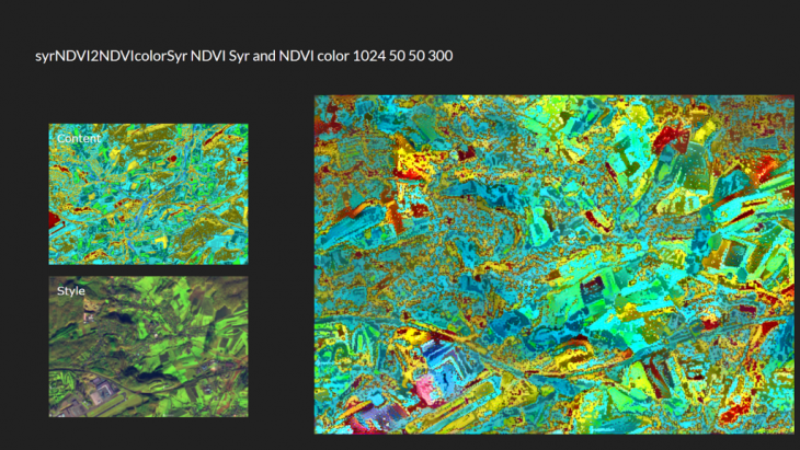 Then the animal movement has been skeletonized and transferred with google satellite
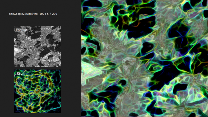
There are two simulations we have from animal movement on the site plus the river flow ran through the algorithm to finding the better connection for connecting wetland which is pretty useful.
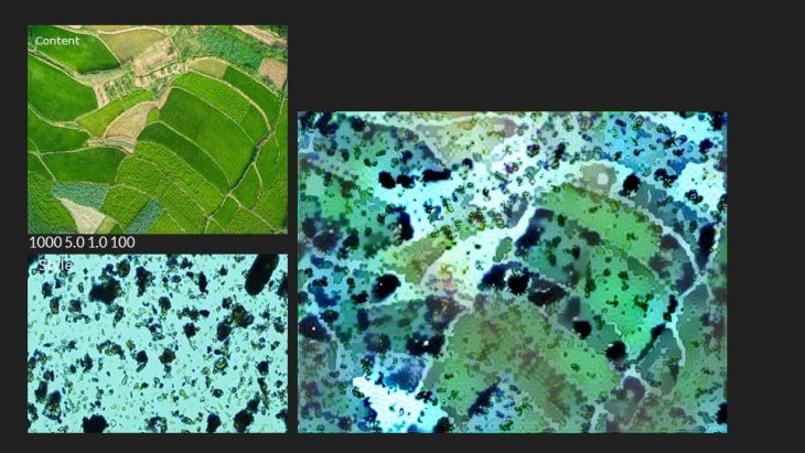
The following is the micro to macro scale transfer for there is a microscope view of a rich soil which go to macro scale in order to search a pattern of cropland diversification…
We used different contours in Luxemburg and forested areas to show potential land transformations:
 In the south, we have more agricultural land and clearly monogamous farming practices that have had a negative effect on soil. Also as the terrain is flatter the rivers have more impact on the area. We see an opportunity in the synergy between rivers, and agriculture. Better agricultural practices need to be applied. One of these opportunity areas is the Syr valley floodplain, on which the area was drained to grow grasslands to sustain cattle, which is a great contributor to C02. Wetland areas need to be restored, adding more humidity to the area, and carbon sequestration.
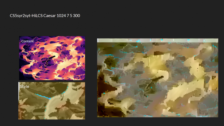
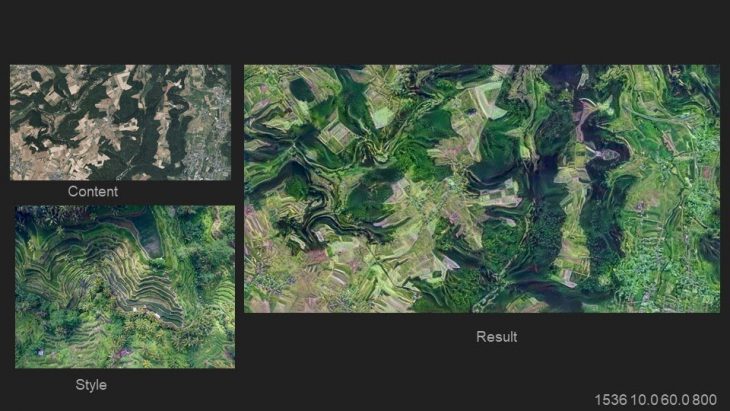
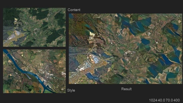 The wetland strategy for carbon sequestration was further developed to find the intervention between the greens, the water connections, and the animal movement. The resultant image of the intervention was merged with the existing landscape to find possible connections through landscapes.The following transfer depicts the site that has intervention
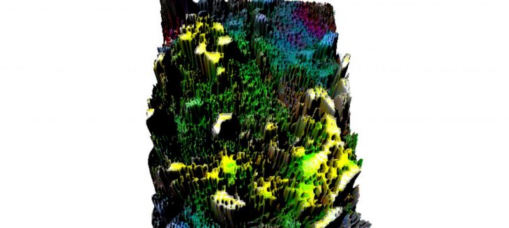
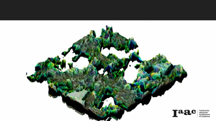
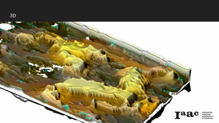
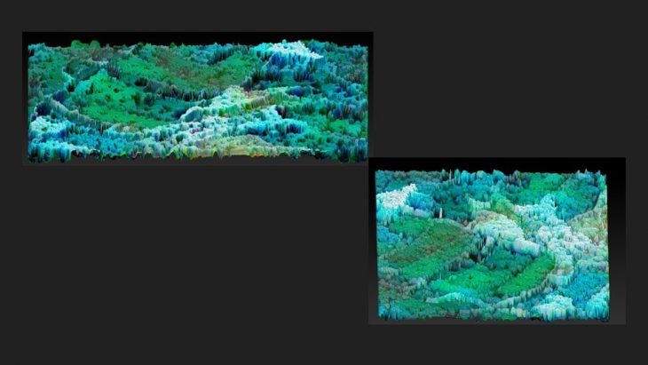
 3D image of the above-generated landscape below are the experiments generated in a look
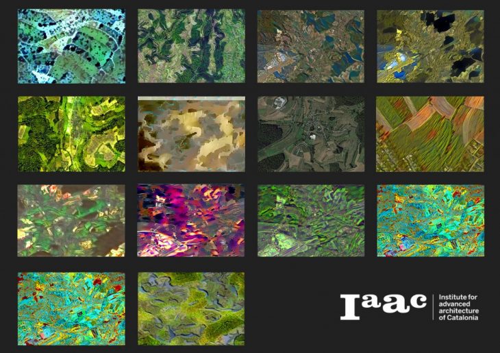 And a 3D Catalogue
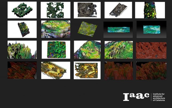
The pursuit of Wetland Connection with Neural Network is a project of IAAC, Institute for Advanced Architecture of Catalonia developed at MaCT in 2020/21 by students: Sasan Bahrami, Juan Pablo Miranda, Miguel Angel Tinoco Hernandez, and Kshama Patil and faculty: Dr.Matias Del Campo and Sandra Manninger.