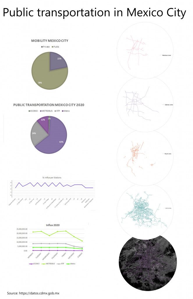
Vibrant capital city with a metropolitan area of 22 million inhabitants, Mexico City public transportation system must sustain 80% of its population, new routes and metro lines are always being built against time. Multiple layers of infrastructure are essential for the daily commuting of its inhabitants. Extensive network of roads follows check pattern at the center of the city followed by bicycle lanes and subway lines. As the distance from city center increases, the topography transforms into hills and swampy areas, making it difficult to engineer easy solutions. From this point, on the only way to come and go are vehicles, bus routes and corridors.
Understanding of daily commuting, and modes of transportation are essential to have better urban policies and better capital allocation for projects. Other factors get in play, Mexico City has high pollution levels, the change from private modes of transportation to public ones means less vehicle congestion and less pollution overall.
CDMX portal has data of 2020 public transportation in the city, using this data set I represented basic statistics on graphics. We see that bus has the biggest number of users, something that can be seen in the map, as its infrastructure has the most reach. Second and third are subway and metrobus means of transportation, followed by a recent extension in bicycle lanes.

Public Transportation in Mexico City is a project of IaaC, Institute for Advanced Architecture of Catalonia developed at
Master in Advanced Architecture in 2020/2022 by:
Students: Juan Pablo Pintado
Faculty: Diego Pajarito