Introduction
We all know by now that more and more people are moving to cities, and this means that people will be taking more trips, across longer distances, in urbanized cities across the globe. And if we look closely, in Barcelona, transportation and services sector are the two biggest sector that contributes to CO2 emission annually in Barcelona. And last year, all of those activities had to be paused for a while because of the COVID-19 pandemic, which raises fundamental questions across equality, accessibility and mobility spectrum.
As a result, Barcelona is now experiencing a sharp decline in the retail trade sector, which in turn, causes Barcelona to have 5.300 empty commercial spaces, totaling in 1,5 million square meters distributed throughout the city. As a response to the economic crisis caused by the pandemic, the Barcelona city council has bought the empty commercial spaces in order to help the micro-small-medium enterprises that are hugely affected by the closure of businesses and shops.
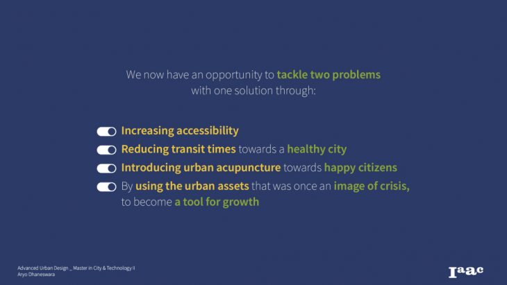
Thus, with the stated facts, we have the opportunity to tackle two problems, with one solution.
Current Issues, Framework & State of the Art
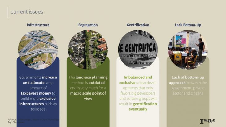
Within the current approach to increase urban accessibility, there are four main issues which are potentially destructive if these methods are continued in the long term. Those include unnecessary infrastructure development, the use of outdated land-use planning systems, Imbalanced developments, which causes gentrification, and lastly the planning process itself. We tend to see very few bottom-up approaches when it comes to planning for cities.
Methodology
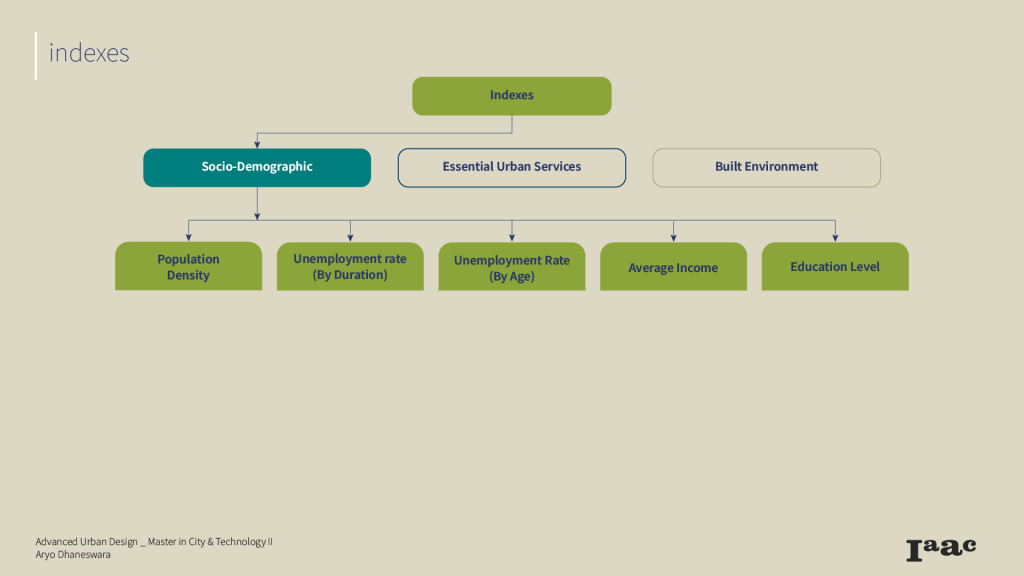
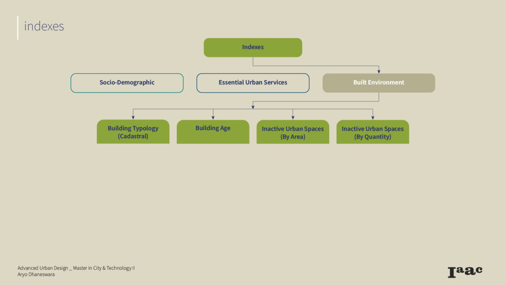
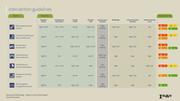
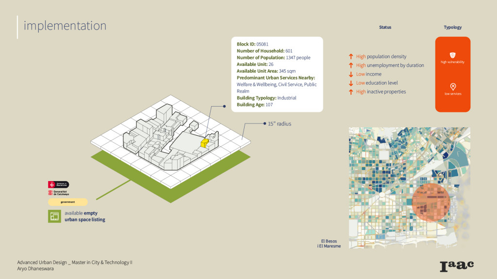
In the spatial analysis part , 3 indicators were used to determine urban areas that are vulnerable, in respect to improving neighborhood resiliency. Firstly, the socio-demographic indicator, datasets about population density, average income and education level were chosen to influence the decision making related purchasing power, and lifestyle of its inhabitants. Whereas the datasets about unemployment rate are to see which neighborhood has the most population that is available and would benefit for new employment or entrepreneurship opportunities.
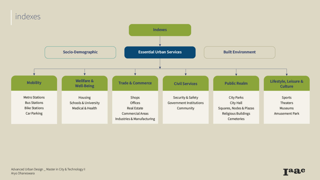
The second indicators are the essential urban services. So for this research, I have created my own categorization of what is considered essential urban services which I can explain in the next couple slides.
And the last indicator is regarding the built environment. Parameters such as building typology and building age are important indicators which can help consider the decision of the host typology.
Urban Analysis
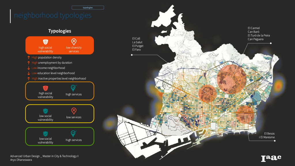
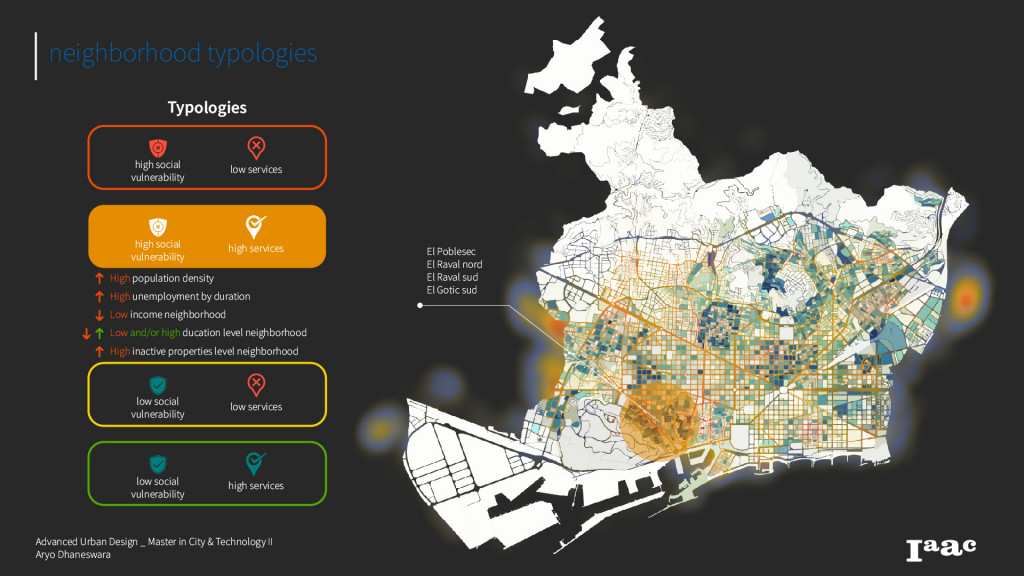
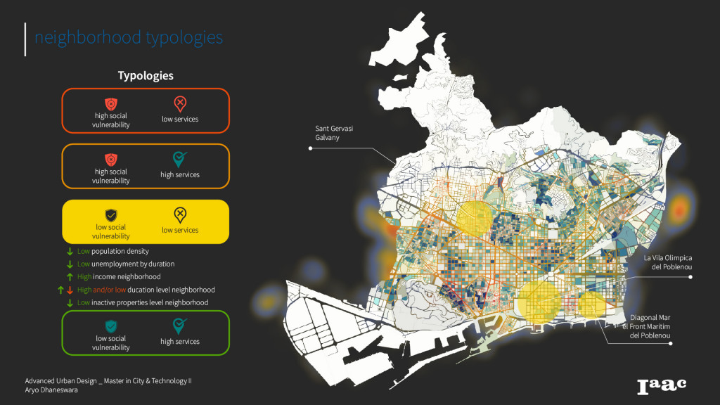
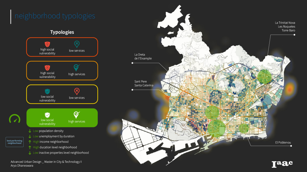
by overlapping all the analysis together, we come up to a map to identify the vulnerable neighborhoods by defining neighborhood typologies, based on the indicators that we have analysed. For this research, the result has shown that there are 4 different typologies of neighborhoods, which is distinguished by its level of social vulnerability, and the diversity of its services.
In the map below, you can identify that the dark color blocks means that it has a high level of social vulnerability, while also having a lot of empty spaces available. Whereas the color of the road network shows you the intensity of services diversity that are nearby.
Proposal & Implementation
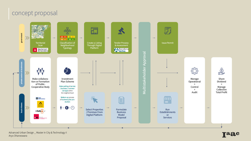
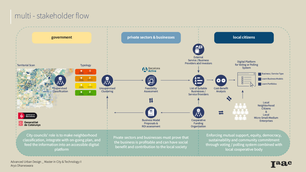
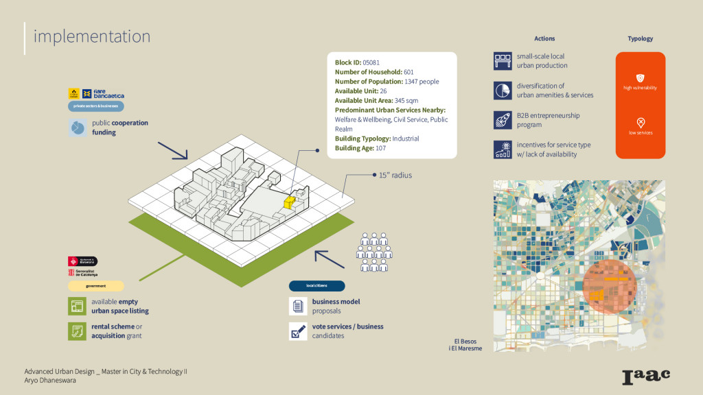
Furthermore, to enable those stated interventions, we need multiple collaborations from different stakeholders, which involves Ajuntament de Barcelona and Barcelona Activa as the government. And in the public sector, we should include Cooperative funding organizations (such as Coop57 or Fiare Bancaetica in the context of Barcelona), which can help manage and fund projects). And of course there’s also Local Citizens.
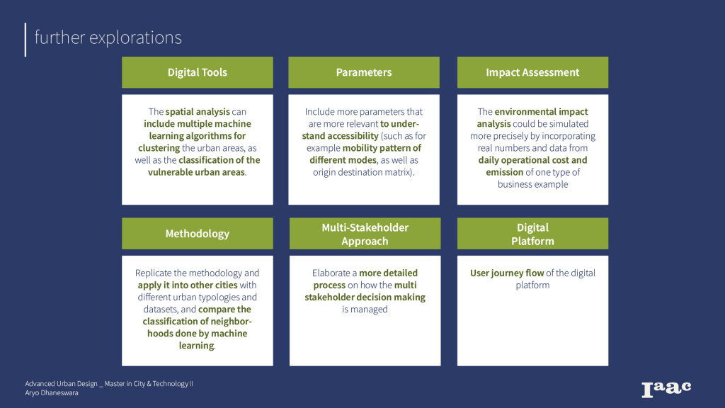
Further Explorations
Proxi.topia is a project of IAAC, Institute for Advanced Architecture of Catalonia
developed at Master in City and Technology,
Advanced Urban Design Thesis Studio in 2021 by:
Student: Aryo Dhaneswara
Faculty: Areti Markopoulou, Mathilde Marengo, Iacopo Neri