PEOPLE, PUBLIC SPACE & GREEN INFRASTRUCTURE
Abstract
This project uses the definition of “Plaza Dura” to observe the connectivity between people conglomeration and vegetation concentration and density. The project starts with the aim of depicting the density of the people that are close to vegetation, however, we achieve some interesting results that were just contrary to our hypothesis. The deep learning computer vision algorithm helped us count the number of people using a GIS tool to illustrate that the density is more happening to the place where there is a low amount of vegetation. For good conduction of the research, we recorded a total of 24 videos, during weekdays and during weekends, at different times of the day (10:00, 15:00, and 20:00) and from two different angles, for better site coverage. According to the definition of plaza dura, our case study was “Plaza Sant Miquel” and “Pla de Palau” on the contrary, with similar characteristics but full of vegetation.
Definition
In terms of urban design, a “plaza dura” is deemed to be a solution for the urban planning of public space with a large surface area, generally made of granite or concrete, with hardly any vegetation and limited street furniture.
Definition of “use of public space”
The purpose of our study is to understand if and in which way the presence of vegetation in public spaces affects people’s behavior. So, to discover this relationship, we need at first to define how we want to measure the use of space. Our translation of this concept is in terms of occupancy of the space, so we looked at where people used to gather, but also how much time they spend in those places, trying to understand their activities, or if they just go through these squares.
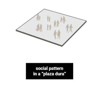
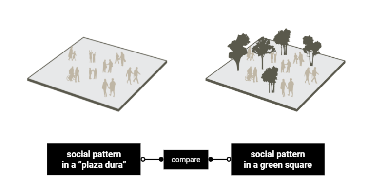
Comparison
The two locations “Plaza Sant Miquel” which played the role of Plaza Dura and the second “Pla de Palau” played the role of social pattern in a green square.
Variables and Metrics of Comparison
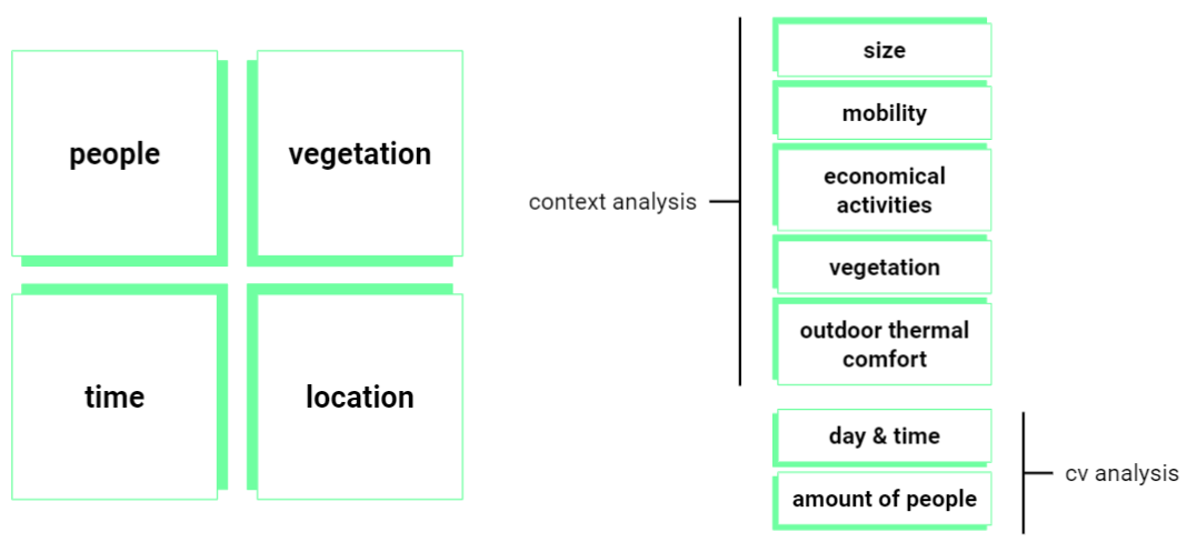
So, the variables we are playing with are people and vegetation, together with time, because we took our videos in the same hours for weekdays and for weekends for both places and the fourth variable is location, because we chose squares in the same district, with similar characteristics (with the only exception of vegetation) – for example, in both squares we have a playground for children.
These characteristics represent our metrics of comparison. They are fundamental because to compare these two sites, we conducted a previous analysis, looking at the size, mobility infrastructure, economical activities, vegetation, and outdoor thermal comfort. All to understand the context and then, once we were made sure that the two places were effectively comparable and considered in a way similar, we moved to the detection of users through computer vision technique.
Use of public space definition
variables
We take into account 4 variables of People, Vegetation, Location, and last but not least Time which these four affecting the result of the research.
context analysis
distance
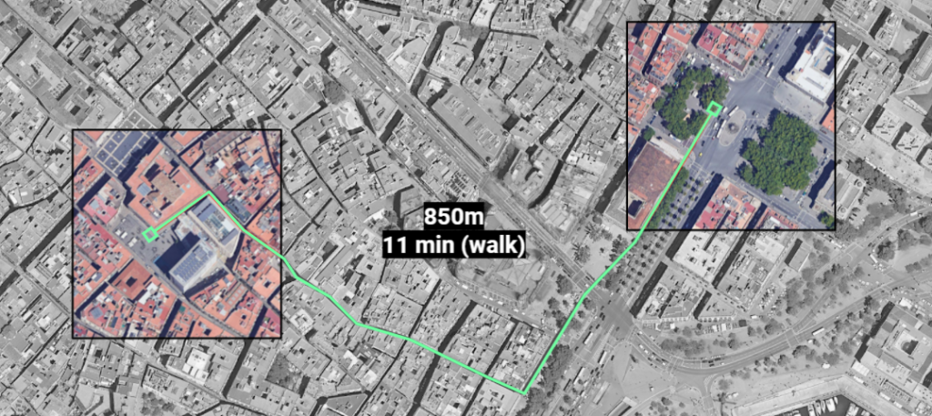
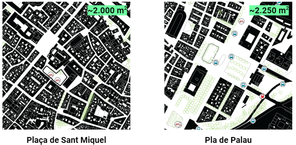
The two locations selected have a distance of 850 meters which is almost 11 minutes by walk from each other, one with more economical activities the other with more vegetation.
Size & mobility infrastructure
The location in Placa de Sant Miquel can be accessed by walking or bike, 2 bicing stations are located in the polygon area of the site, even that there’s no other type of mobility connection near, on the other hand, Pla de Palau is really close to a metro station and bicing station, finally, one bus stop is inside of our site analysis.
Economical activities
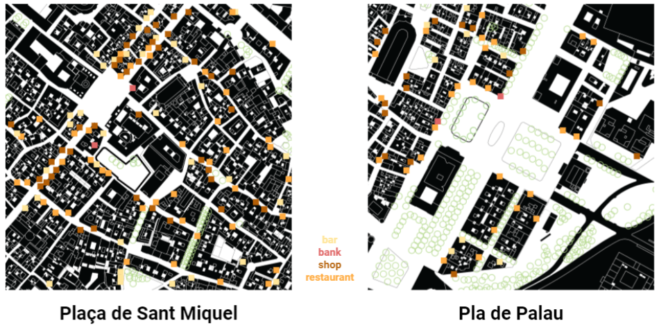
The two sites are surrounded by bars, banks, restaurants, and shops, also we can find a kids’ playground on both sites, even though the main difference is the City Council building which is in Sant Miquel square.
Vegetation
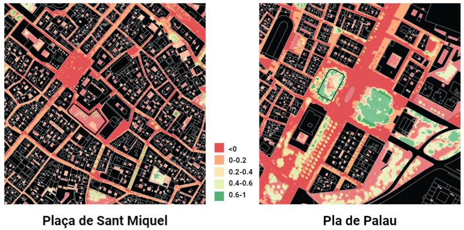
As a previous analysis, the team compares the vegetation of the sites by using NDVI (Normalized Difference Vegetation Index) which allows us to understand the quantity and the quality of the green areas and trees inside and near the site, creating a preview panorama of differences.
Outdoor Thermal Comfort
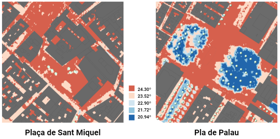
To see the relationship between trees and Outdoor Thermal Comfort we run an analysis by using the component called “ladybug” in grasshopper, by using a georeference model to subtract the correct data which were tested by using EPW (EnergyPlus Weather data file), to simulate the hottest day in Barcelona.
data acquisition conditions
We used a GoPro camera to take footage in two different locations, “Plaza Sant Miquel” and “Pla de Palau” on weekdays and weekends each day from 2 angles at 10:00, 15:00, and 20:00 hrs, creating a total of 24 footage containing 8000 frames.
Weekday Observation
Plaça de Sant Miquel
- The volume of visitors throughout the day seems to be very constant
- The activity is concentrated in the playspace
- The location of the activity is in the center of the plaza.
Pla de Palau
-
- The volume of visitors varies throughout the day;
- The activity is concentrated around the bus stops;
- The location of the activity is, almost exclusively, on one side of the plaza and extends southward beyond the plaza.
Weekend Observations
Placa Sant Miquel
-
-
-
- The volume of visitors increased significantly in comparison to weekday activity;
- The activity is concentrated in the playspace;
- The location of the activity is in the center of the plaza.
-
-
Pla de Palau
-
-
-
-
-
- The volume of visitors has reduced significantly when compared to weekday activity;
- The activity is concentrated around the bus stops;
- The location of the activity is, almost exclusively, on one side of the plaza.
-
-
-
-
Conclusion
-
-
-
-
-
-
-
-
- The data gathered in this study did not suggest a strong relationship between the presence of vegetation in the plazas and the spatial behavior of users.
- The plaza without vegetation had a steady volume of people using the playspace even without trees.
- The plaza with vegetation’s main point of activity had no relation to the playspace or the tree cover,
- We also believe that other variables (historical/cultural significance, neighborhood demographics, the spatial hierarchy of playgrounds or bus stops in the area) define spatial behavior.
- We believe that further research is needed to fully understand the possible effects of vegetation on the use of public spaces.
-
-
-
-
-
-
-
future work
Considering the important effect tree cover has in mitigating heat in the urban microclimate, a cross-seasonal study should be conducted to study the uses of public space and their relation to vegetation.
PEOPLE, PUBLIC SPACE & GREEN INFRASTRUCTURE is a project of IAAC, Institute for Advanced Architecture of Catalonia developed at Master in City & Technology in 2020/21 by students: Sasan Bahrami, Matteo Murat, Miguel Angel Tinoco Hernandez, Mario Gonzales, and Ivan Reyes Cano, and faculty: Aldo Sollazzo, Iacopo Neri & Soroush Garivani.
