Projects like the Superilla in Barcelona were conceived with the best of intentions. The idea to take cars off the roads and give the space back to the people as public space is golden. It improves environmental quality, social interactions and enhances the quality of our cities. However, in reality, the Superilla is mostly vacant and unused. How did an idea targeted at publicness fail to appeal to the public?
What is OpenUV (Open Urban Vision)?
Our project, Open UV aims to create a more simplistic and efficient way of understanding public spaces. Open UV would be an open street database, a localized system that tracks the activity of public spaces. Its integrated camera would record the street activity and quantify the number of pedestrians, bicycles and cars on a street over a fixed period of time. Through interactive capacitive touch sensors the public can access this information from the Open UV panel itself. Moreover, the rear face of the panel would have a survey of how the public want the street to be transformed. Open UV, therefore is aimed at facilitating public space transformations by giving the public a voice and at the same time giving administrative bodies access to the public opinion enabling a more informed decision making system.
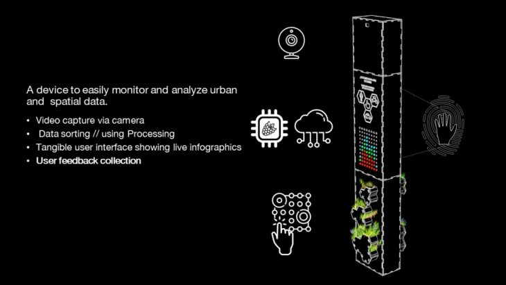
Components & Function
How does OpenUV work?
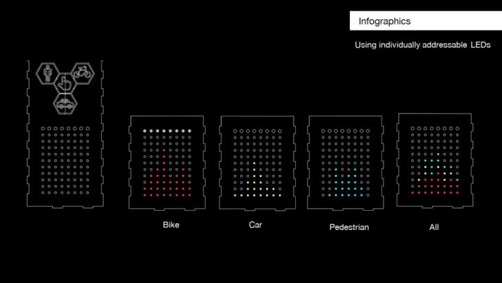
Open UV is a system that recognises and differentiates between diffferent modes of transport, but the system first has to be trained to do this. We first did a mock recording of a street and then trained cascades to efficiently analyses that data by supplies positives and negatives for each type of data we wanted to record. Next, using processing, we developed a code that would enable the system to sort this data based on the cascades it matches into the desirable categories. Each category is further subdivided based on fixed time intervals to have a more detailed understanding of street activity and the time of day. The interactive elements are that the Open UV panel is capable of displaying this stored data in real-time to the passers-by who are interested in accessing this information. This is done by using capacitive sensors to activate LED lights that show the percentage of activity over time. On the back panel is a survey for the changes the public would like to see in the neighborhood.
Cascade Training
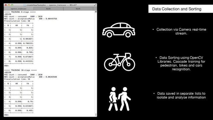
Data Collection & Sorting
Differential quantifying
The Scope of OpenUV
OpenUV is only a singular prototype now but spread out in different parts of the city, country or world and linked to cloud storage and an app interface OpenUV could be a great database for localized public space information easily accessed by all. The Public can use it to voice their opinions easily and the authorities can also use it to gauge public opinions before implementing drastic changes.
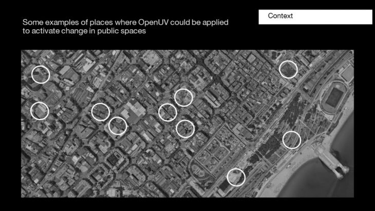
Areas where OpenUV could assist Urban Planning
Moreover, in this project, we have used OpenUV to track modes of traffic but the real beauty of the system is that via cascade training the same methodology can be applied to virtually any kind of tracking and data collection project. It can be applied indoors too.
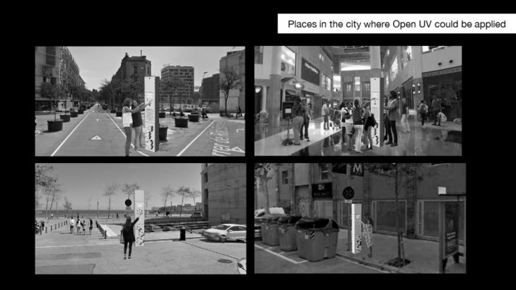
OpenUV in the city
Tools:
Processing 3; Arduino; OpenCV; Java.util Package; Java.awt Package; NeoPixel Library; CapacitiveSensor Library
OpenUV is a project of IaaC, Institute for Advanced Architecture of Catalonia developed at Master in Advanced Architecture, MAA 01 in 2017 – 2018 of the Studio SE.5 Physical Computing by :
Students:
Shruti Jalodia
Mohor Bose
Nikol Kirova
Ozge Tektas
Tutors:
Angel Muñoz
Cristian Rizzuti