Office & Bike Dynamics Barcelona
In it’s aim of improving its infrastructure, Barcelona has introduced a public bike-sharing scheme that makes it easier for the general public to make regular journeys by bicycle, in a sustainable, healthy and economical way. This project is a study to understand the distribution of these shared bike services in relation to office space.
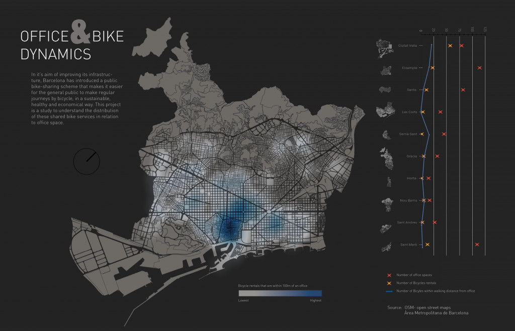
Using data from Open Street Maps, all office buildings and bike rental stations in Barcelona were first geolocated as points on QGIS. Then using the geoprocessing tools, a buffer zone of a 100m radius is created around each office space. To be able to identify any bike rentals that fall within this 100m radius, an intersection is calculated between the two layers. The resulting points are then reflected on the shown heat map of Barcelona.
It is also important to not only understand the distances between offices and bike stations but also to see the number in each district. Hence, a scatter plot is created to communicate this information. Using the attribute table, the number of points per district were calculated and reflected on a scatter plot. We can now understand this information in parallel.
The poster gives us a visual analysis of the distribution of bike rentals per block and allows us to identify any areas of potential improvement and intervention in the city.
Office & Bike Dynamics is a project of IAAC, Institute for Advanced Architecture of Catalonia developed at Master in City & Technology in 2020/21 by student: Hebah Qatanany, and faculty: Diego Pajarito.