MOBILITY DEFINED BY A NEW TELECOMMUTER TRASPORTATION SYSTEM
Framing the future
Growing cities face many challenges among which are transportation and mobility. These transformations are driven by multiple factors. Technological trends will change the mobility industry. A shift in demography with a change in work behavior will affect where and how the active population commutes, and environmental concerns will drive design and planning.
According to a recent survey at the Global Leadership Summit in London, 34% of business leaders said more than half their company’s full-time workforce would be working remotely by 2020. Consequently, the telecommuting workforce will increase in numbers, With this increase, we will see a shift in peak hour driven mass transportation and a reduction of car purchases.
Context

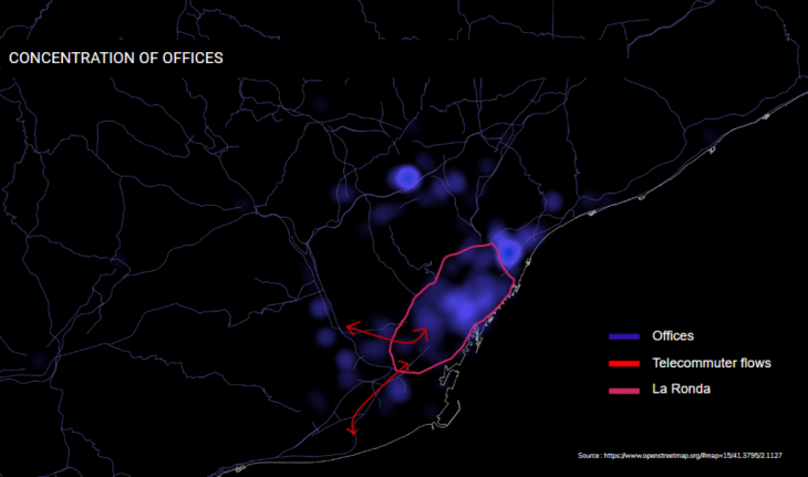
Traffic flows indicate that 32% of connections into ring road from Highway B-23 are vehicular. That traffic is distributed between the port and la Diagonale. It is our speculation that this is due to the concentration of offices in the city center. Understanding that in the future telecommuters will tend to live further out, there will be a need for a good public transportation leading to the center to avoid an increase in car usage.
Opportunity
The opportunity here would be to recover public space for the city, join two neighborhoods, activate a key gate into the city through the creation of a transit hub allowing for eco-mobility (public transportation, last mile automated vehicles hub, plus journeys made on foot or by bicycle) and diversify the land use to include more commercial spaces and offices. These new land uses will serve the population now living out of the densely populated inner ring road.
Pre-existing conditions
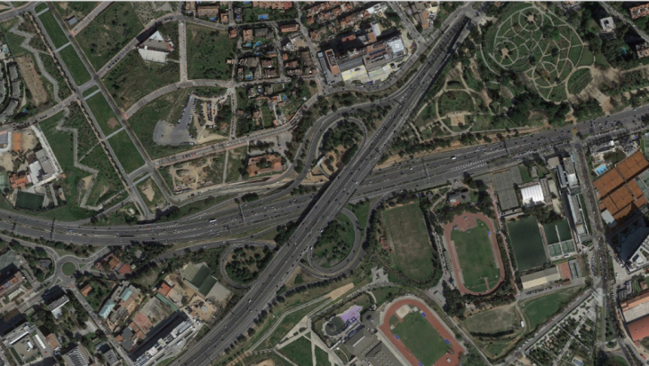
The interchange at this location is a modified Cloverstock exchange. It occupies an area of 218,181 m² which is the equivalent to 12 ½ city blocks. On the top lane, there are 8 lanes plus two emergency lanes. On the bottom lane, there are 9 lanes plus 2 emergency lanes. The land use around this area can be divided into 4 main categories: Hospitals, Sports facilities, Academic institutions and parks.
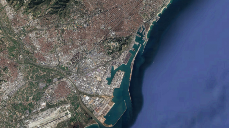
 Source: Google Earth
Intervention
How might we adapt la Ronda to fit Barcelona´s vision of a hyperconnected neighborhood at human scale by adapting the interchange model to fit a future with new telecommuter behavior? We will be focusing on how the interchange will change in morphology.
Metropolitan Scale Diagram
 Source: Google Maps
On a macro level, we will extend the current tram line on la diagonale up to the interchange and beyond opening up a new directional flow for public transportation outside the city. Moving towards the llobregat river, there seems to be a need for porosity of public transportation from La Ronda across the Llobregat river. An interesting solution would be to reimagine the riverfront with multiple bridges stiching one side to the other. Land use on the macro scale is divided into Agriculture across the river, industrial, residential and parks East of the river.
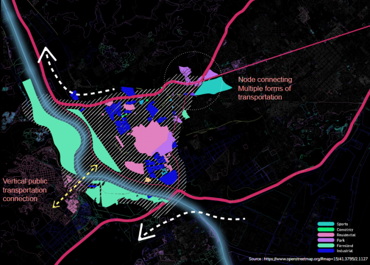
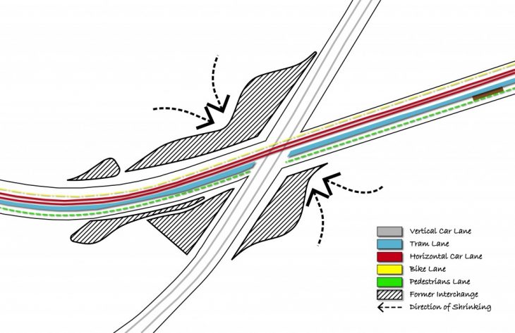
Neighborhood scale
On a neighborhood scale, the interchange will be flattened into an x intersection in order to minimize footprint. La ronda de Dalt will be shrunk into a 2 by 2 lane in opposite directions. At the intersection, of La Diagonale, La Ronda and Highway B-23 we will be creating a transit hub allowing a change in public transportation appropriate for the selected distance of travel (bike, personal electric vehicles or last mile automated vehicles).