Abstract
A changing climate has caused coastal cities around the world to reflect on their relationship with water. The UN estimates that over 40% of the global population lives within 100km of the coast, and many more live on freshwater bodies like rivers and wetlands. The conversation around flooding is of critical importance; both for local quality of life and for the larger geopolitical context. Low-lying nations in the developing world may face near-insurmountable odds over the coming decades. It will require a collective effort, lead primarily by the coastal cities of wealthy nations, to develop and quickly implement the urban design solutions required to adapt.
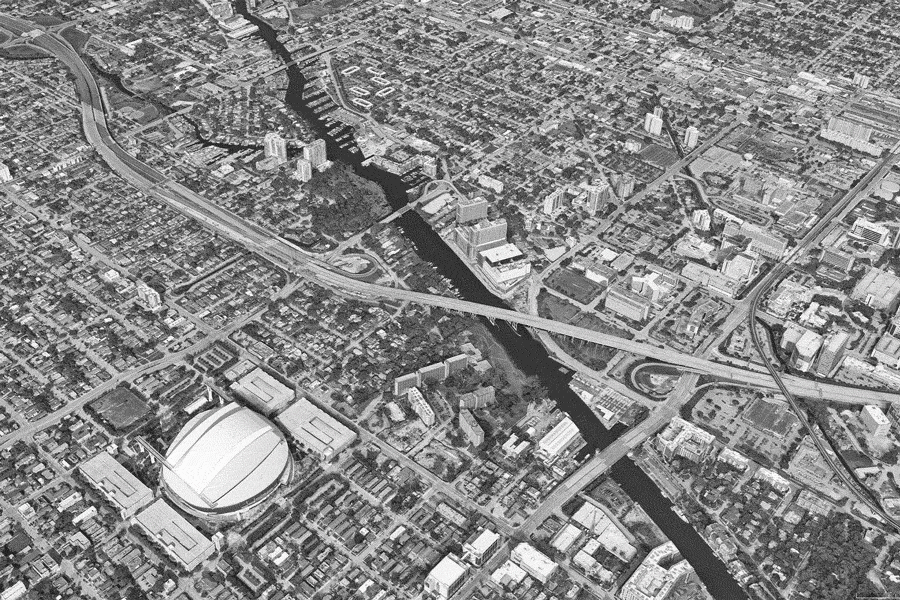
Nowhere is this all more evident than in Miami. The South Florida metropolitan region is a perfect case study in flood water mitigation. It’s wealthy, highly developed, and under siege from the water. In this project we dive into the Miami region, peering through the lens of conceptual mapping to analyze the challenges ahead for the tropical metropolis. After all, if solutions can be pioneered here, they may be implemented across the globe to the benefit of billions of people.
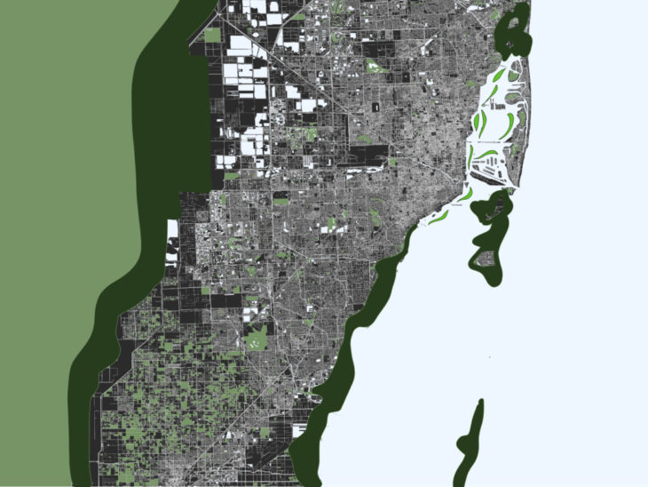
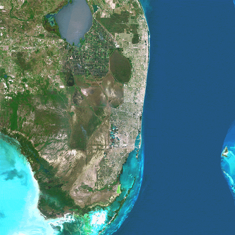 The Miami region is an urban peninsula bordered by the Atlantic Ocean to the East, and the Western Hemisphere’s largest mangrove ecosystem to the West.
Analysis
Unlike many cities which may be inundated by rising seas, Miami is uniquely pressured by both salt water and freshwater. In terms of salt water, the sea level surrounding the Florida panhandle is rising faster due to changes in the gulf stream. The gulf stream, which flows in a North-Eastern direction around South Florida, is warming up and slowing down at the same time. This is causing a gravitational effect which produces a localized sea level rise effect along the East coast of Florida. Miami is now one of many cities on the Eastern Seaboard which regularly experiences so called “sunny day flooding” due to high tide waters inundating the city. This effect is compounded by frequent storm surge during the wet hurricane season.
Miami is not only built along the coast, but also long the banks of one of the largest wetland ecosystems in the world. The Florida mangroves ecoregion is a vast freshwater drainage basin centered along the Kissimmee River, which flows South from Lake Okeechobee into Florida Bay. During the wet season the drainage grows to over 90km wide and 160km long. Additionally, multiple rivers flow from these wetlands in the West, across the South Florida metro, into the sea in the East. Hence, the entire urban area is highly prone to freshwater flooding during the wet season.


To complicate things further, the geological substrate of South Florida is comprised of a limestone shelf which forms a freshwater aquifer. The porous limestone aquifer means a fluctuating groundwater table. Increased saturation in the aquifer during the wet season induces a third source of additional flooding which originates from the groundwater itself. These three aquatic pressures describe Miami’s precarious position and unique relationship with water. The triple threat is demonstrated below by using QGIS to layer data on existing bodies of water, residential land use, density, and flood risk zones around the CBD.
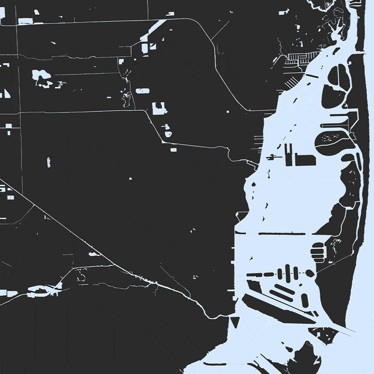 Existing water bodies, residential built environment, density, densely populated areas at high risk of flood.
How will the city deal with these environmental pressures moving forward? What solutions will be deployed to defend the urban tissue? In our analysis we felt compelled to address the worst case scenario, in which the entire urban form must adapt to dramatically rising seas by evolving into an urban archipelago.
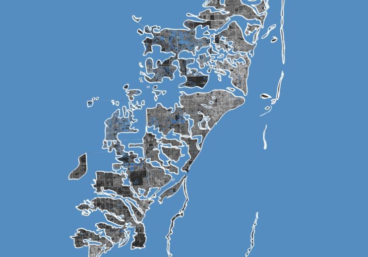 Reimagining the metropolis as an urban archipelago if all the current-day, high-risk flood zones were completely subsumed by water.
The map above is an exaggeration for conceptual emphasis, but if dystopian outcomes are to be avoided, intervention must be effective, swift, and innovative. Moreover, interventions should always work with nature- intelligently harnessing natural forces to the benefit of the urban tissue and the fragile ecosystems which surround it.
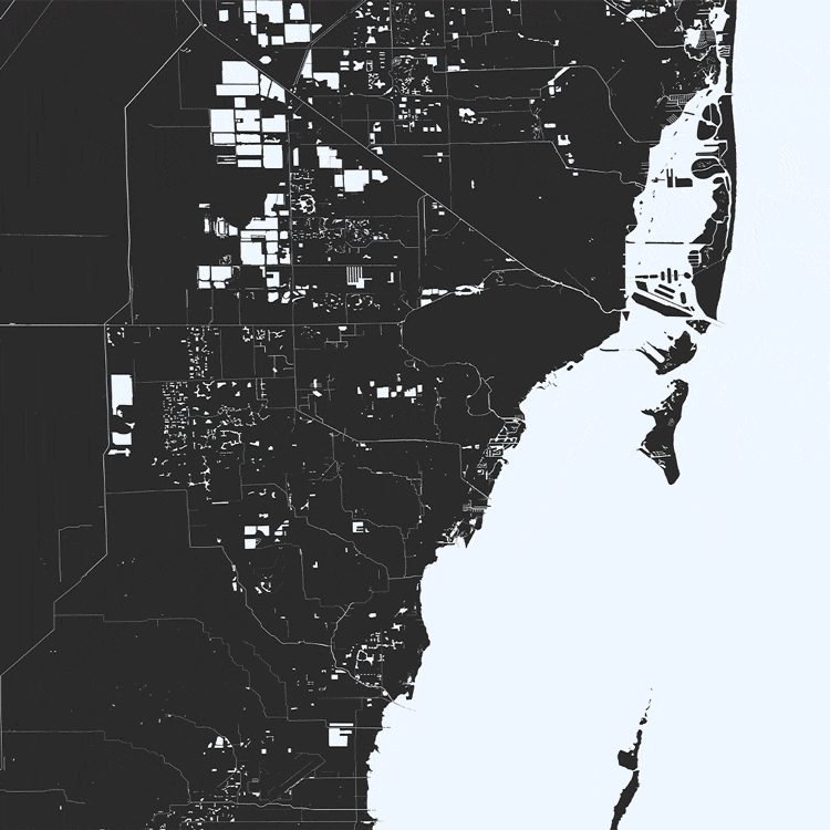 Existing water bodies, urban space, natural areas, and flood zones
Intervention
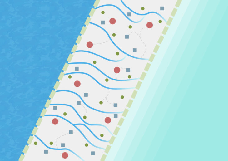
The first step should be to establish an urban development boundary to protect the remaining wilderness moving forward. That urban boundary could then be enveloped by restoring additional wetlands. Existing wetlands around the perimeter should be expanded, and new natural areas may be built in the shallow waters directly off the coast from particularly vulnerable urban areas.
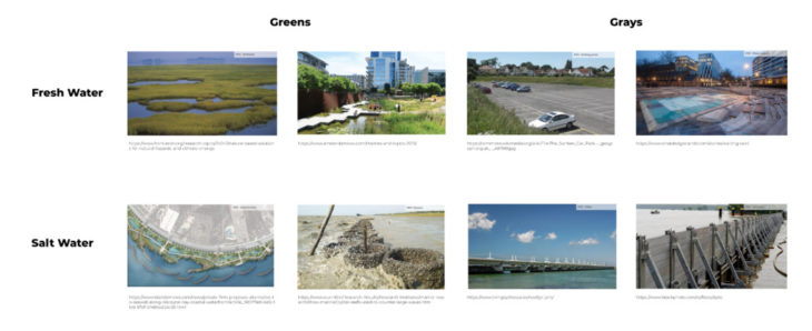
Yet green infrastructure may not be sufficient alone. A blend of green and grey infrastructure is likely necessary. Gray infrastructural solutions exist in many forms:
Levees, dikes, canals: flow control forms to protect urban spaces and allow water to accumulate in designated areas
Water squares: sunken squares which serve as public parks when dry
Green corridors: sunken linear parks which serve as urban connective tissue for pedestrians and cyclists when dry
Additional water storage: above and below grade storage tanks which work to reduce flooding via pump stations
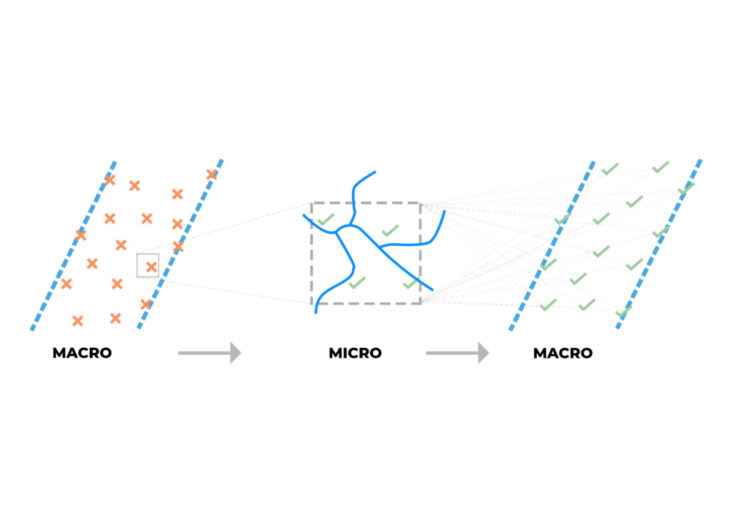
Such interventions should be connected in a dendritic and rhizomatic network of grey and green infrastructure which spans across the urban fabric. The network, from the smallest to the largest scale, should function as one ecosystem of flood water mitigation tissue.
Conclusion
In this project we have explored a case study in flood water mitigation. Looking at Miami’s unique challenges provided a context to use conceptual mapping in order to produce novel and thought-provoking solutions to a hard, complex problem. There are many ways in which the problem could be addressed. There are many existing interventions beyond those explored here, and surely there are many more yet to be invented. More important than the specific solutions, however, is the real need for stakeholder alignment. Implementing solutions in any form will require large, dynamic groups of people to align their interests, collaborate, and problem solve together. That is, first and foremost, the most important challenge to overcome if we wish to avoid the worst outcomes.
Miami provided a unique and engaging context for this project, but the lessons learned here are relevant on a global basis. Billions of people in cities all over the wold face the problem of urban flood mitigation. How we approach the problem is crucial- with both green and grey infrastructure, with both local context and global foresight, and with pervasive stakeholder alignment. Fortunately, cities have proven again and again throughout history, to be extremely resilient. May the next century of urban development be fruitful, revolutionary, and successful as we tackle the most challenging problems and build the future.
Miami Waterproof is a project of IAAC, Institute for Advanced Architecture of Catalonia developed in the Master in City & Technology 2021/22
Students: Karim Abillama, Ocean Jangada, Pushkar Runwal, and Lucas Zarzoso Hueck
Faculty: Manuel Gausa and Nicola Canessa
Sources
Climate Central – Sea Level Rise Risk Zone Map
NY Times – Tokyo Flood Tunnels
Miami Government – Storm Water Masterplan