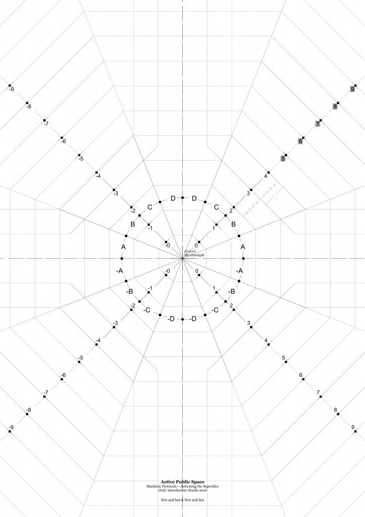
In order to create the unit of measurement for mapping these archetypal intersections of Barcelona we observed the most common use of this area within the context of the ‘Super Manzana’, which will restrict the passage of motorized vehicles. Our result was the width of the sidewalk, which was specifically designed with the needs and dimensions of the pedestrian, who will be reclaiming these areas. Using this dimension, we traced an octagon over the space and off-set the outline by the width of the sidewalk. In addition, by using a simple – and + system with numbers and letters we have been able to map specific coordinates. We believe that this has allowed us to create a comprehensive grid over the space.
Moving forward, we would like to use this system as a template to map the cyclists who are running red lights, and cyclists who are going against traffic by riding on the sidewalk. As bicycles will always be fast moving, they will replace cars as the largest threat to the pedestrian. Anyone who has been to the Netherlands will understand the dangers and guidelines that exist. We believe that it will be interesting to research the future of the relationship between the pedestrian and the cyclist in a city with reduced automotive activity.