Master in City & Technology 2020/21 – Term III
Seminar Name: Urban Intelligence – Data-driven Spatial Planning
Total Hours: 30 hours
Faculty: Andy Bow, Bruno Moser, Laura Narvaez Zertuche
Credits: Foster + Partners
Abstract
This seminar examines urban design through the lens of data-driven planning. Data and technology do not create or solve problems but give individuals an opportunity to resolve them when it is used in an open and collaborative way. The concept of intelligent city (smart city) promotes the idea of digitalization to support the complex environments of a city by means of informatic platforms and digital networks, aiming to provide services to local community and ensure active participation of citizens to city decisions. It incorporates elements of sustainability and social inclusion, at the same time being suited to the evolutions of the new internet technologies.
Estonia is one of the top lists of countries to be home of the world’s most advanced intelligent cities. It’s capital, Tallin, considered as “the smart capital of a digital nation”, stands as a global model for them. Following the fall of the USSR and a large-scale cyber-attack in 2007, this small Eastern European nation was forced to reinvent itself. Tallinn’s way to become a smart city revolves around three keywords: accessibility, interoperability, and user-friendliness.
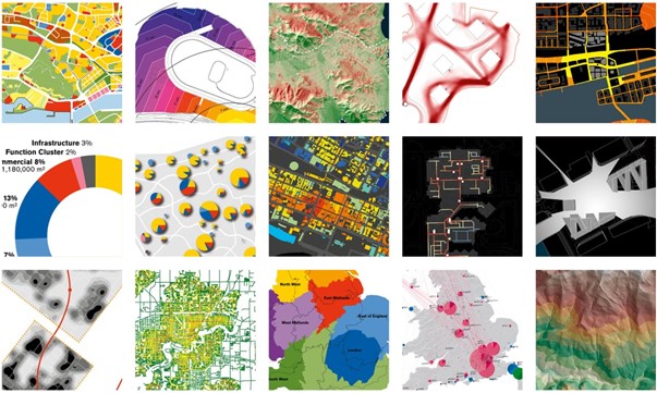
This year we want to explore the case of Tallin as our testbed for understanding urban design and digital development as a combination of interrelated elements that should be designed in a way that enables flexibility to different needs. Spatial data has been used in Tallin in the preparation of several programmes (e.g. movement programmes, river basin management plans, noise containment plans) and guidelines, as well as in environmental impact assessments. However, there hasn’t been direct links between urban planning decisions on the one hand and the relevant source data, research or spatial data analysis on the other. Data-driven spatial planning provides an opportunity to improve the rationale and transparency of design decisions concerning the organisation of urban space.
Our main focus of urban intelligence is the concept of circular economy and agro-city. It will be developed through a series of presentations and practical workshops that offer urban design theories and practical data-driven methods as ways for thinking cities as intelligent systems. The resulting work from this seminar will form part of the exhibition in the Tallinn Architecture Biennale (TAB) in 2022, curated by the Estonian Centre for Architecture.
Credits: Foster + Partners
Learning Objectives
At course completion the student will:
1. Understand and analyze the urban context of a city, including historical and current challenges.
2. Potential applications of smart city solutions and their limitations.
3. Be able to identify areas related to city management/city planning where digital technologies can bring benefits for communities and their social environmental and economic impact.
4. Be capable to design a real-situation project at proof of concept level, where open data usage is involved as a vehicle to solve a city challenge.
Faculty

Dr. Andy Bow is a senior partner and a deputy head of studio. He studied architecture at the Mackintosh School of Architecture, Glasgow. As a student, he won numerous awards including the Glasgow School of Art Newberry Medal and the City of Glasgow Silver Medal for Architecture. After graduating in 1988 he moved to London.
Andy has always had keen interest in teaching and inspiring the next generation of architects and designers. In 2000, he was a judge of the RIBA Bronze and Silver student medals and for ten years was an RIBA External Examiner at the Bartlett School of Architecture.
He has lectured and been a guest critic in over 30 schools of architecture around the world, most recently at Yale University, SciArc, UCLA, Pratt Institute, University at Buffalo and University of Oslo. Andy is currently a visiting professor at University College London and University of Innsbruck and has been a regular Eero Saarinen visiting Professor at Yale University.
He is an ARB registered Architect and became a Fellow of the Royal Incorporation of Architects in Scotland in 2011. In June 2014, he was awarded an honorary doctorate from the University of Glasgow for his lifelong contribution to architecture.

Bruno Moser heads up of the practice’s Urban Design Group, which focuses on all aspects of urban planning. His team consists of specialists from a range of backgrounds – including design, real estate, sociology and landscape architecture. Together they work across scales, from the analysis of the setting of a single building to masterplan and strategic planning.

Dr. Laura Narvaez is an Associate Partner in the Urban Design Group at Foster + Partners. She graduated with a Bachelors in Architecture in 2004 and a MSc in Urban Design and Sustainable Development in 2006 from Tec de Monterrey, Mexico. She later gained a MSc in Advanced Architectural Studies and a PhD in Architecture and the Built Environment from the Space Syntax Laboratory at the Bartlett School of Architecture, UCL in 2015.
Laura has practiced in Mexico and the UK in architecture, master planning and urban research projects for over 15 years. She has lectured internationally and been guest critic most recently at University of Oregon, University of Birmingham, University of Porto, Pontificia Universidad Catolica de Chile, ETH Zurich, and Bartlett School of Architecture, UCL. She is currently a contributor and advisor of Urban AI – an international multi-disciplinary think tank that investigates the ethical modes of governance and sustainable uses of artificial intelligence in cities.
Laura leads people movement and spatial data analytics within the Urban Design Group for informed decision-making in masterplanning projects. She develops urban design strategies for a wide scale of designs, from new cities to complex buildings, with an integrated approach using agent-based behaviour modelling of cities and buildings to model key indicators related to accessibility, microeconomics, movement data and pedestrian forecasting as an input to design projects.
