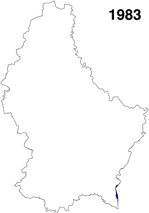
Flood risk is the most important natural risk in terms of both the amount of damage and the prevalence across the country In Luxembourg. The worst floods that the country experienced over the past 40 years were in the winter of 1983, 1993, and 1995.
Luxembourg flooding history
Due to heavy rains in 2016, floods occurred in the south in early summer and in the north in the middle. The main reason for floods in shallow waterways are precipitation, sometimes combined with snowmelt and frozen or saturated soils.
The aim of this project was to identify the critical factors affecting flooding in vulnerable areas. First of all, the average annual precipitation was taken into account. It defines August as the month with the heaviest rainfall while the period from April to May is practically rainless. To achieve a better understanding, work with CSV files and other geo-located data was carried out. Python was used as a tool to visualize the information.
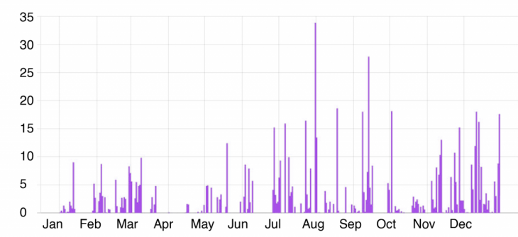
the average amount of precipitation in Luxembourg
Flooding issue can lead to real consequences when it involves people and their property. Due to urbanization amount of this kind of territory increased significantly in the 20th century. Flood-vulnerable areas are intensive using while awareness of the risk of flooding is low that makes the potential of damage even higher.

Luxembourg city area
A “flood risk” is defined as the combination of the probability of a flood and the potential negative consequences for human health, the environment, cultural heritage, and economic activity associated with a flood.
There was an attempt to show dependence on flood risk and the lowest areas of Luxembourg as another key factor for flooding risk. In the map, the digital elevation model was used for calculating areas with a higher possibility of having floods base on altitude. Blue color defines the most vulnerable areas while yellow is for the least. The bright yellow line explains the scenario of the flood risk which shows the floodplain of a modeled 10-year flood event. As far as most flood-vulnerable areas are located in the intersection of these two analyzes representation the conclusion of the relation of elevation and flood risk can be made.
Different tools such as reclassification and slope analysis have been used during the work on the project.Defining areas in Luxembourg with a high possibility of flooding with help of the DTM model
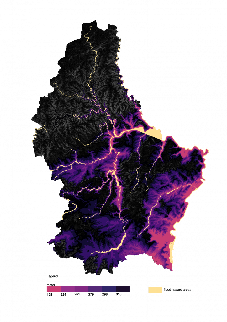
Source: Geoportal of the Grand-Duchy of Luxembourg
Analysis of potential flood-vulnerable areas in Luxembourg is a project of IAAC, Institute for Advanced Architecture of Catalonia developed at Master in City & Technology in 2020/21 by student: Arina Novikova, and faculty: Diego Pajarito