 CONCEPTS AND CONTEXT
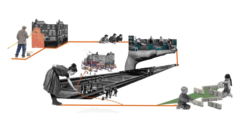
Segregation is the act or policy of separating people from different groups and treating them in a different way1. As any other sociological concept, segregation translates itself into the physical space as well, materializing inequalities. As urban segregation is a vast phenomena, the analysis lens used for this study in order to narrow down the issues, is related to urban mobility. Nowadays the high usage of private transportation is one of the most obvious aspects where the social and physical aspects of this process manifest themselves in the city. Thus, this project aims to study punctual urban strategies to joust segregation caused or perpetuated by private cars in the urban scenario of Greater London. By measuring, cataloging, defining strategies and an application method, Jousting Segregation Started Kit has as its final objective the creation of a starter kit of interventions to catalyze changes in segregated areas of the urbanity towards a city without cars.
THE INDEX
Understanding Greater London Scenario
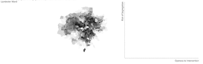
Greater London is one of the most cosmopolitan cities in the world, presenting a great variety in the socio economic spectrum. In order to identify patterns of segregation in the urban tissue of the city, a series of demographic indicators were analyzed individually to create a base acknowledgment of the current situation. All of the data presented has the London Ward scale as its spatial domain.
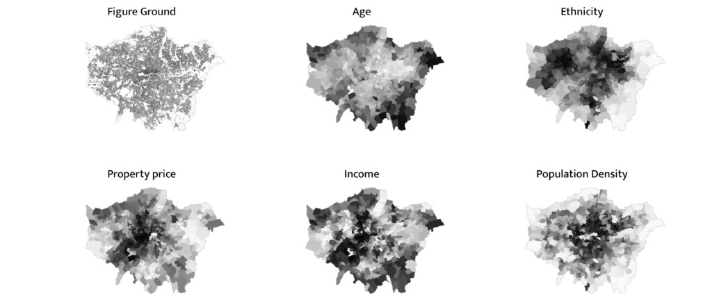
With a thural analysis, some of the categories analyzed were combined in order to create a more readable output of the demographic data that indicates segregation in the city. Working with ethnicity rates, density, rise of propriety prices and rise of income overtime, two main indexes were created, following the data structure calculation shown below:
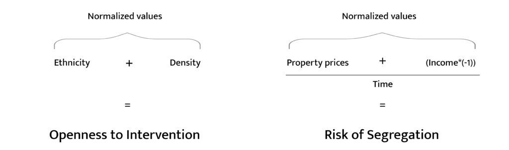
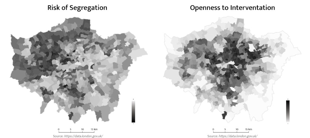
Openness to Intervention and Risk of Segregation maps were created for each ward of London that, and, when merged into one single map, can paint a picture of the distribution of segregation in the city. The combination of these two represent the main index produced for this study: the Suitability of Intervention Index which rates each ward of London in relation of the need of intervention and also the opness to it when it comes to urban segregation tackling measures.
THE CATALOG
Taxonomy of segregated spaces in the city
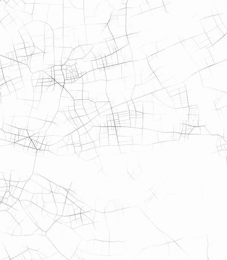
Once the demographic datasets were summarized the physical aspect of segregation was the next step to understanding this process in relation with the city. Therefore, for the analysis of the urban tissue of Greater London and, for understanding how it may translate and affect the distribution patterns of segregation throughout the city, three London Wards were selected for a spatial analysis: Spitalfields and Banglatown Ward, Saint Pancras and Somers Town Ward and Hampsted and Town Ward.

These three areas were analyzed with the Space Syntax tool that provided a quantitative analysis of the network. The two main indicators used for categorizations were Integration and Choice.
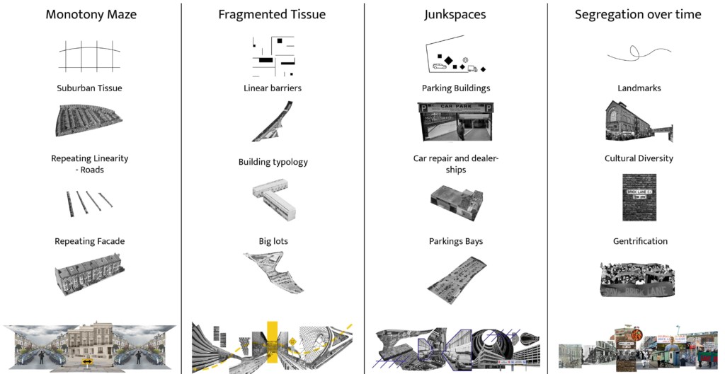
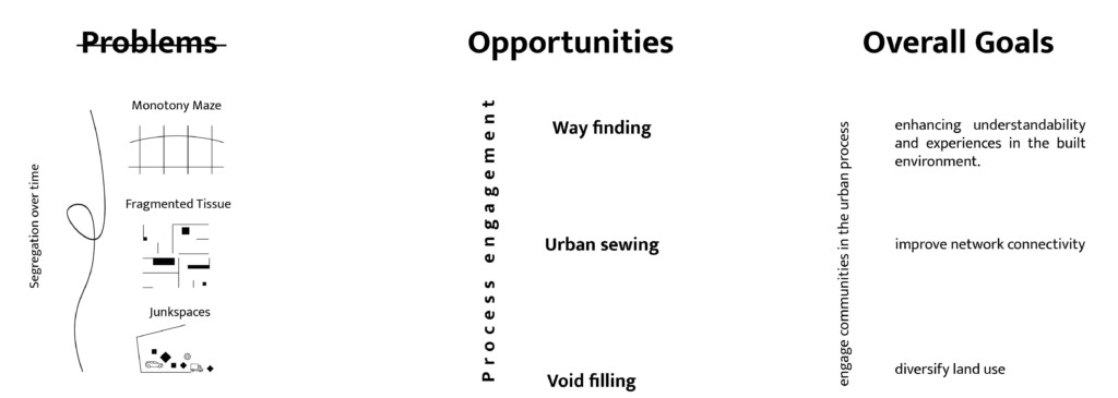
Clustering out the integration and choice indicators, four conceptual figures were created to understand how the urban tissue can affect the segregation process in the city. Combining high and low rates of the space syntax analysis, four so-called problem-opportunities were identified: the monotony maze, the fragmented tissue, segregation over time and junk spaces.
THE TOOLBOX
Strategies towards interventions against urban segregation
After cataloging and defining the problems to be dealt with, the Away with Segregation Toolbox was created with the objective of providing general accessibility to the benefits of a more inclusive city without cars.
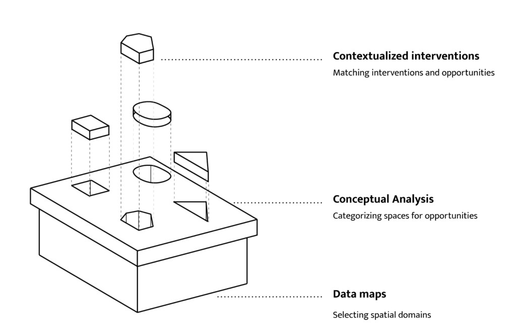
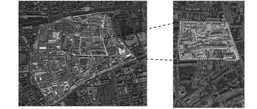
The application of the Toolbox, as it takes into consideration the specificity of each place to be applied, was studied in bigger depth in the Spitalfields and Banglatown Ward, relating specifically to the fragmented tissue problem-opportunity. For the identification of the Fragmented Tissue areas inside the Ward, the indicators of choice and integration were combined, showing the least connected areas inside it.
By analyzing the urban fabric of the ward also in relation to the presence of high streets, the historical changes and road hierarchy, some connections inside the urban fabric were proposed, focusing primarily on rejoining the tissue in order to desegregate some critical parts of the ward. These intended connections were then corroborated by space syntax, showing how punctual changes in the network can positively affect the whole Spitalfields and Banglatown Ward.
THE STARTER KIT
Jousting segregation Starter Kit
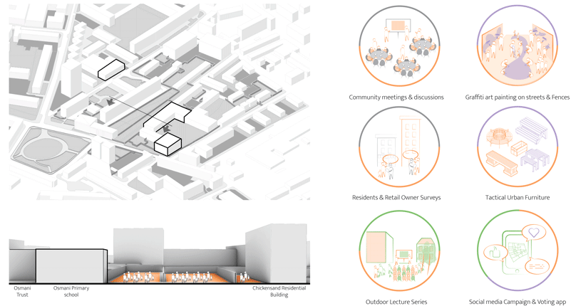
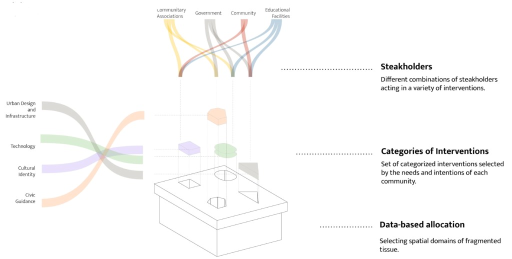
Focusing on one of the intended connections, the challenge now was to identify which interventions and who are the players of the possible changes to be made inside the current urban dynamic of the Ward. The Osmani Hub was then selected for further analysis.
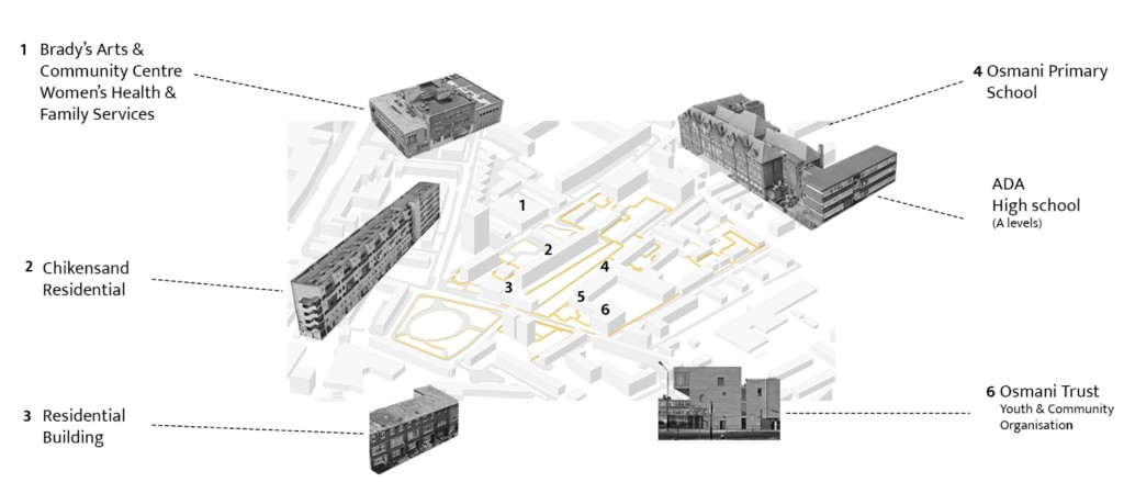
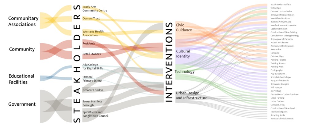
The final punctual interventions and the role of the stakeholders can be summarized in this Sankey chart. It shows the possible fluxes and relationships between the categories of stakeholders and the typology of the interventions proposed. Using the Osmani Hub as an example, the same categorized flow structure could now be the base for exploiting the process to other wards. Communitary Associations, the Community itself, Educational Facilities and the Government were the categories of stakeholders related to the four typologies of intervention: Urban Design and Infrastructure, Technology, Cultural Identity and Civic Guidance.
Based on a three-phase process, the Osmani Hub welcomes the Starter Kit to joust segregation. In the first phase tactical urbanism and community engagement were translated in the interventions shown in the image below, bringing together all the four categories of stakeholders into a common ground to discuss and gradually start the change process. Phase two is where the spatial transformation begins by removing fences and repurposing small car park spaces. The main goal at this stage is to create a sense of belonging related to these new spaces by bringing the community together and exploring their own specific values. Phase three is represented by the bigger changes in the tissue, such as the replacement of one of the buildings in order to consolidate the new connections proposed by the reframing of the network structure. This step sets the final changes of the proposal that will surely be reinterpreted and in constant change, whereas they are a part of the urban dynamics.
The starter kit, summarized, has the means to aggregate the stakeholders and the typologies of interventions in order to set the right environment for the community to have the possibility of equally enjoying the benefits of a city without cars.
THE DISTRIBUTION
Expanding the Toolbox
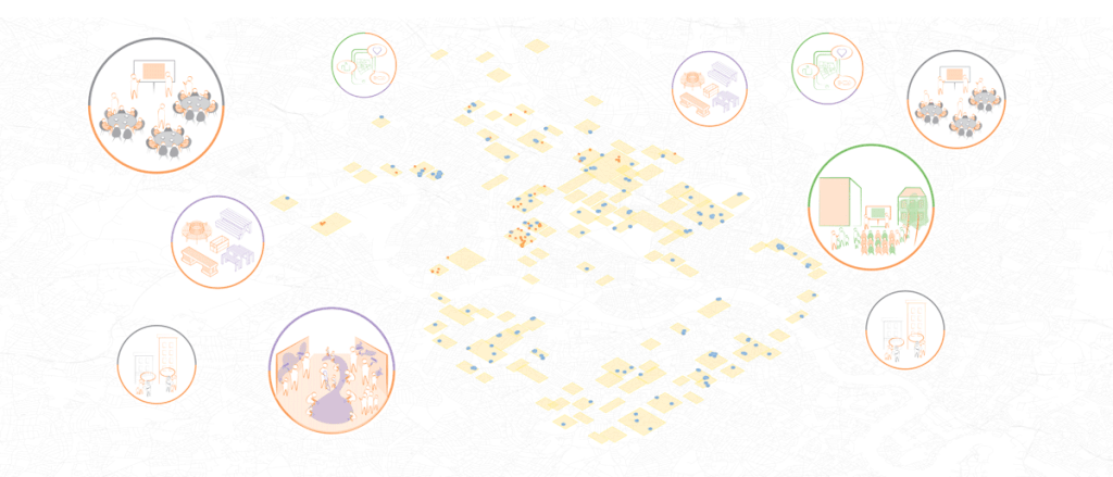
By setting the Starter Kit as a scalable tool that can be adapted to different contexts, the expansion of the applicability of it was studied. Using the indicators of the space syntax analysis set to define the fragmented tissue in the city, clusters of low connectivity areas were found on a larger scale.

In the clusters of fragmented tissue, educational facilities and community associations were mapped, relating the possible stakeholders which could receive and make use of the Starter Kit. Lastly, the three step intervention scenario could happen in all of these localities, creating a vast network of punctual interventions towards a more inclusive city without cars.
Jousting Segregation Starter Kit is a project of IAAC, Institute for Advanced Architecture of Catalonia developed Master in City and Technology in 2021/2022
Students: Júlia Maria Veiga, Kishwerniha Nagoor Meeran Buhari and Maria Augusta Kroetz
Faculty: Eduardo Rico, Iacopo Neri and Mathilde Marengo