Island DNA
For this project we wanted to understand the urban networks of towns that exist on islands and their relationship to the coast . We were curious about the effect of the confined landmass would have on the network and would network connect to important facilities such as ports. We studied 6 towns for their meshedness, closeness , betweeness and orientation. the towns themselves were selected based on how close where they to the shore and their dominating economy.
From these analyses we generated a fictional town on an artificial island to further investigate the relationship between the urban network and the coastline.
Island Typology
Proximity to Continental Landmass
We noticed that there are two types of islands
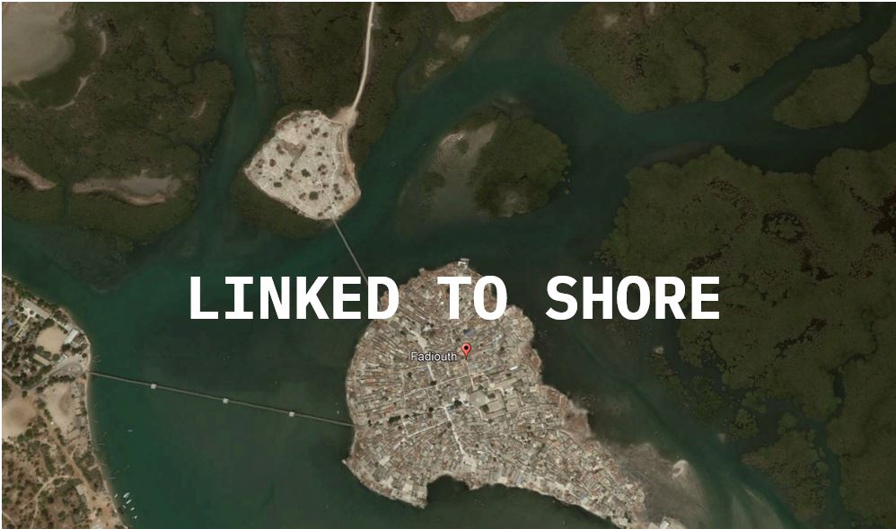
- those that are linked to the shore
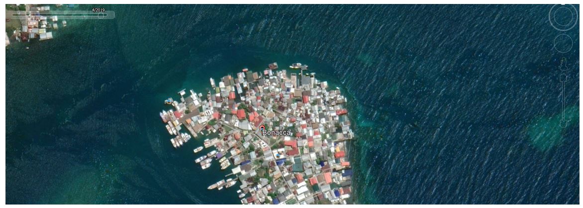
- And those that are completely floating

Economic Activity
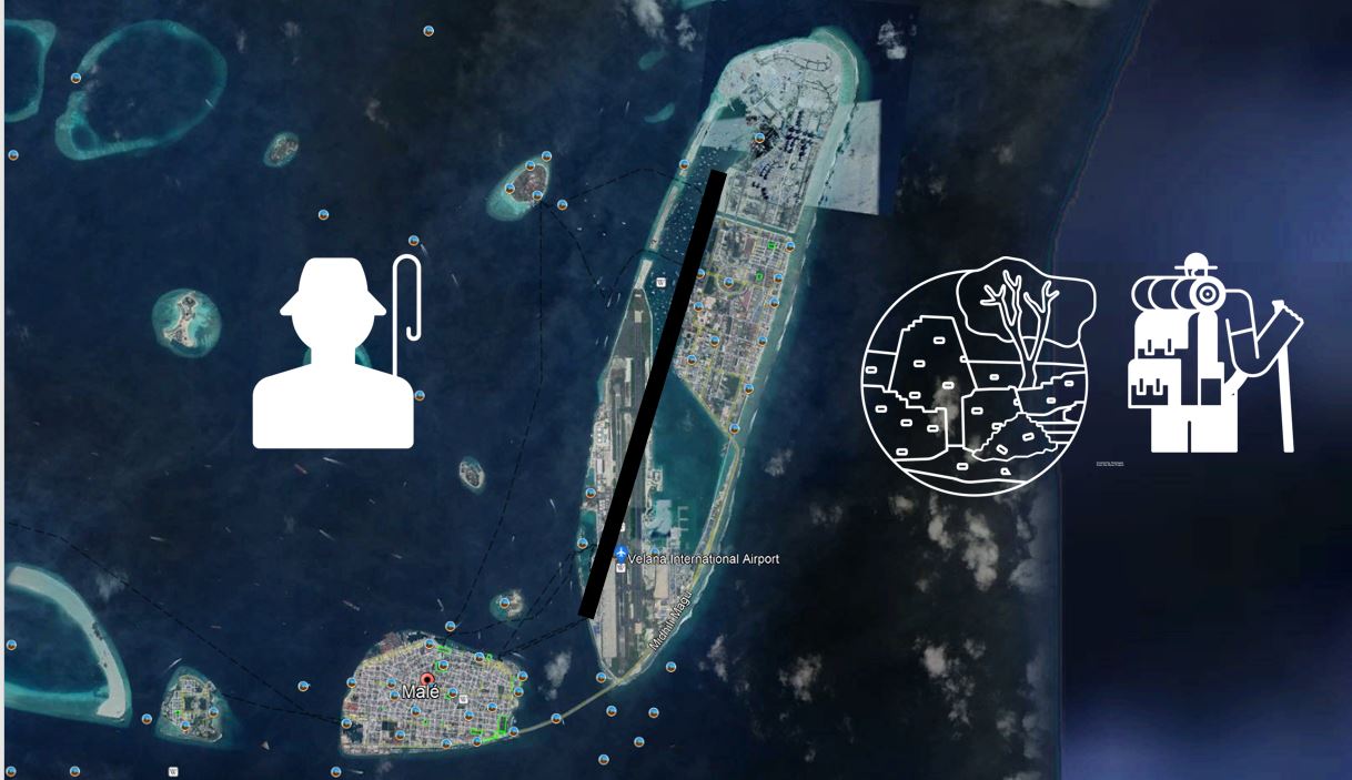
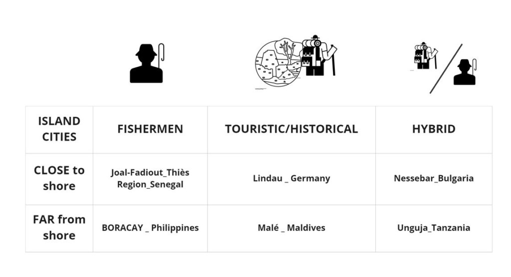
We observed some islands to have a dominating fishing industry while others relied on tourism
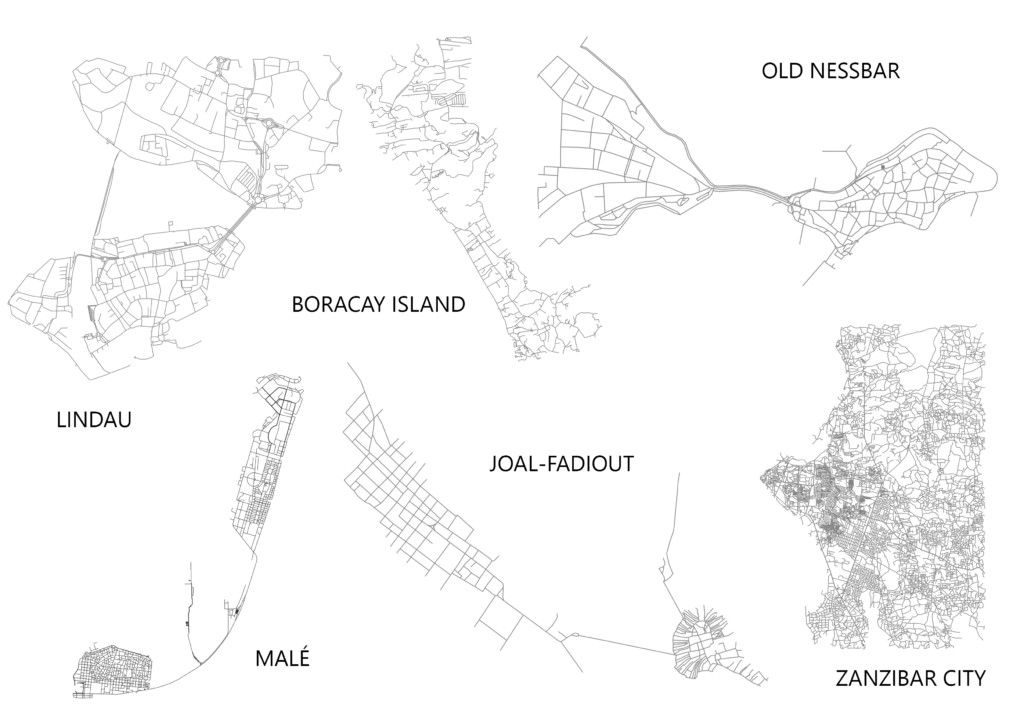
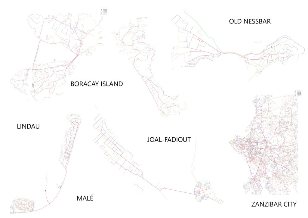
Dataset
Based on our observations we compiled a list of 6 islands towns that satisfied our search criteria which is explained in the diagram below
Urban Features
Common urban features found in all of these towns
- Roads depend on topography
- Old urban fabric always relates to the fishing sites and to the harbor
- The organic dispatch of the old town contrasts with the new town grid layout
- Recurrent centrality of religious buildings.
- Recurrent Fortifications.
- Sports facilities & parks.
Network Analysis
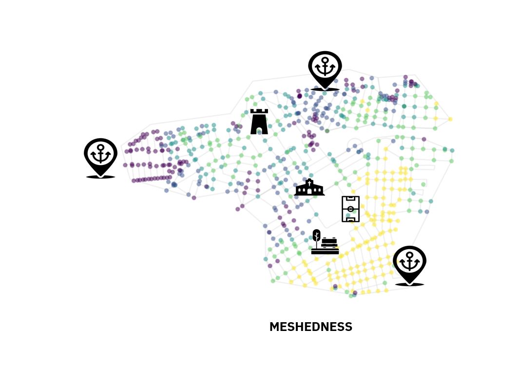
Meshedness
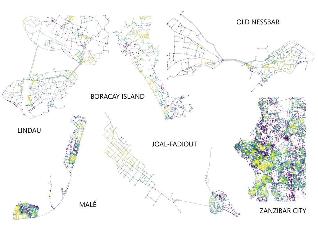
Meshedness is high in the new districts that are made of rectilinear grids, so they’re more connected, and also it gets denser the more we get close to the sea.
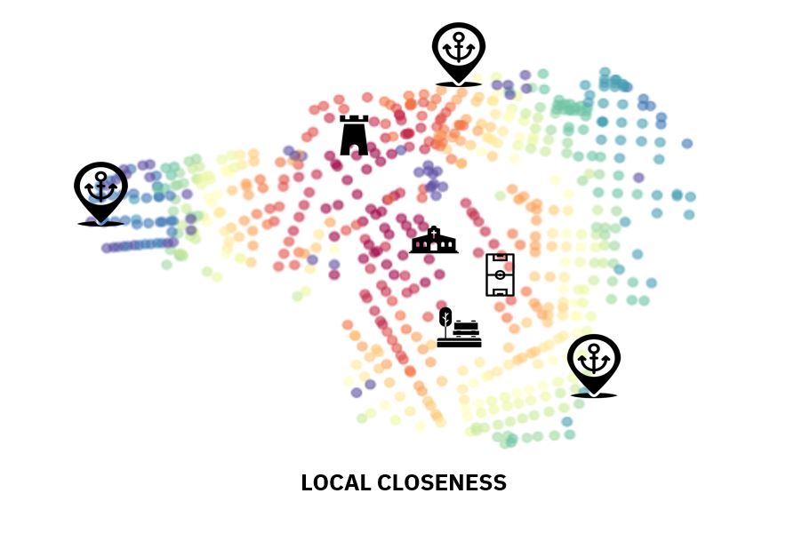
Local Closeness
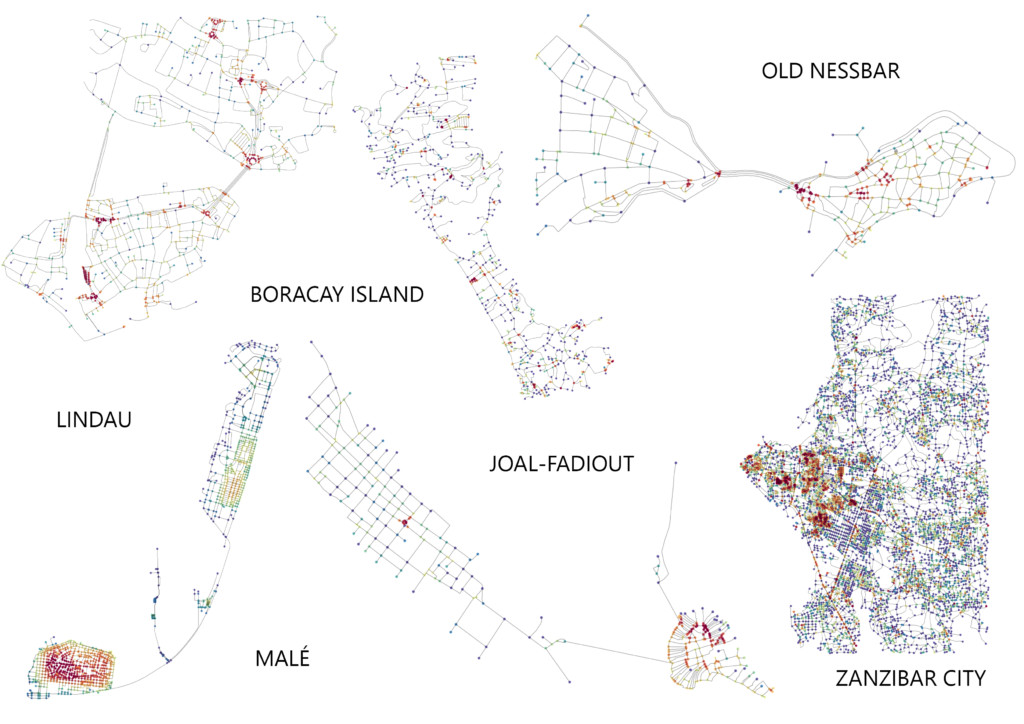
The nearer to the shore, the shorter are the roads which makes the areas near the fishing parts zone the most dense.
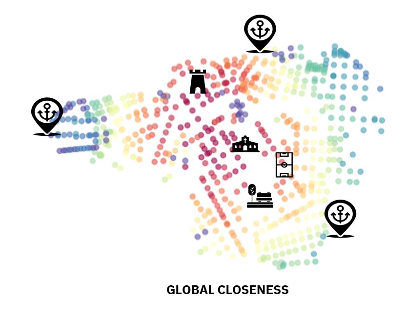
Global Closeness
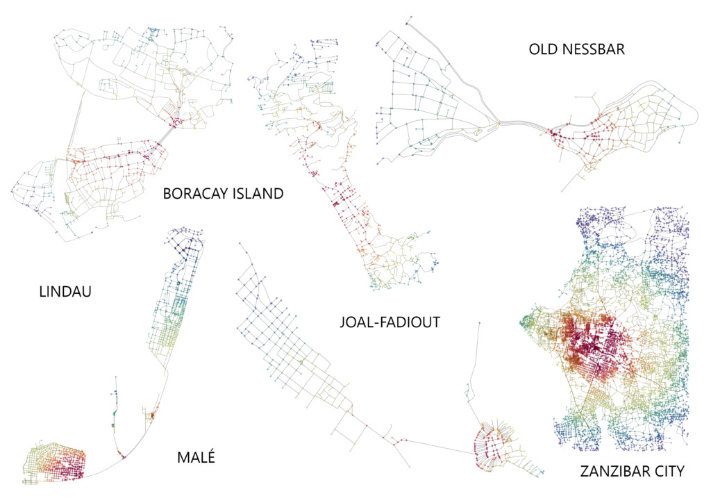
Global closeness indicates the beating heart of the islands. And for each type we can see the specificity.
Betweeness based on Edges
And the best pedestian zones would be those in yellow, the shortest paths, they’re located near the shore
Orientation

We wanted also to check the orientation to understand the growth pattern. Because of the limited land area, growth is everywhere, that means there is a almost a general lack of directionality.
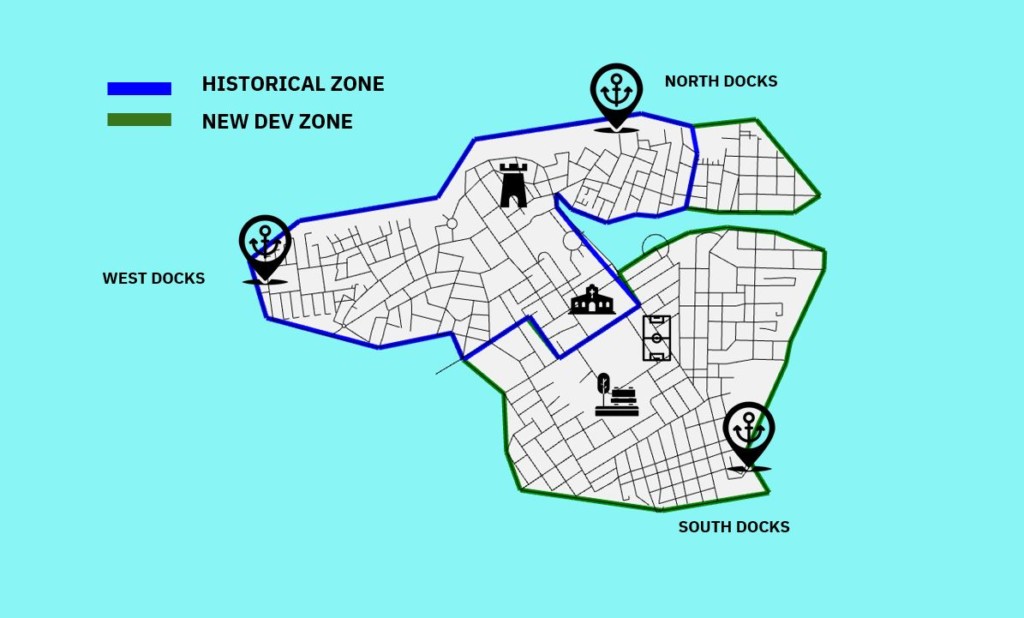
Jazira
Our island is hybrid, it’s a very small but old one, that has a historical part, and a new development part. We made it by stitching parts from our analysis islands.
Here we can see the zoning in regards to its constituents.
A place of worship in the middle next to a fort, and 3 distinctive docks
We also wanted to create a cut deep to see how the island would react to an invading sea.
Jazira- Network Analysis
From this new analysis we can see that the fort and the temple are the beating heart of the island. With a very distinctive density happening in the new town


Island DNA is a project of IAAC, Institute for Advanced Architecture of Catalonia developed in the Master in Advanced Computation for Architecture & Design 2021/22 by students: Mahmoud Ramdane and Mohammad Daniyal Tariq and faculty: David Andres Leon, Dai Kandil.
: