Introduction
The purpose of this exercise is to find spatial patterns that can influence insecurity and crime in different places in downtown Guadalajara at the level of the pedestrian.
Simulating different routes in different, taking into consideration their possible 360 degree visualization through different risk areas and the special characteristics of site.
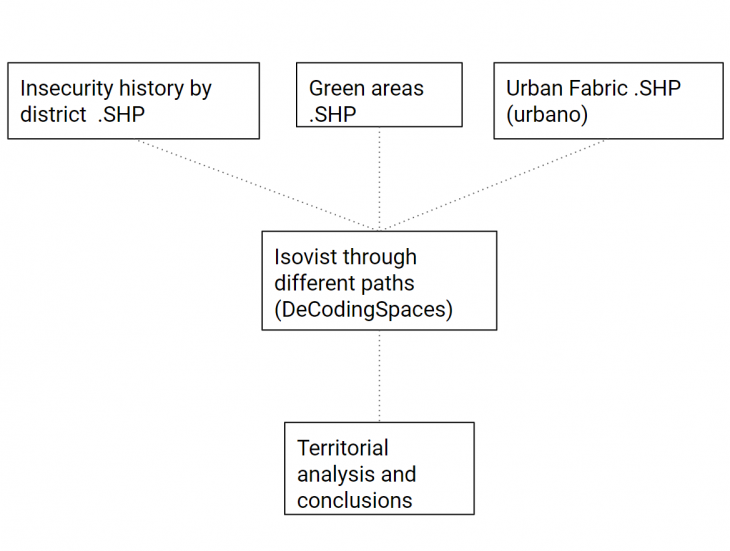
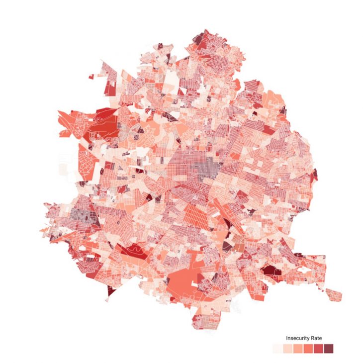
It was used data from the web portal of Guadalajara state about insecurity due to the number of crimes and was analyzed on different scales and compared with information about green areas.
Qgis and Rhino with Grasshopper were used as resources to made different analyses through the diferent paths of uran fabric in areas at risk due to insecurity
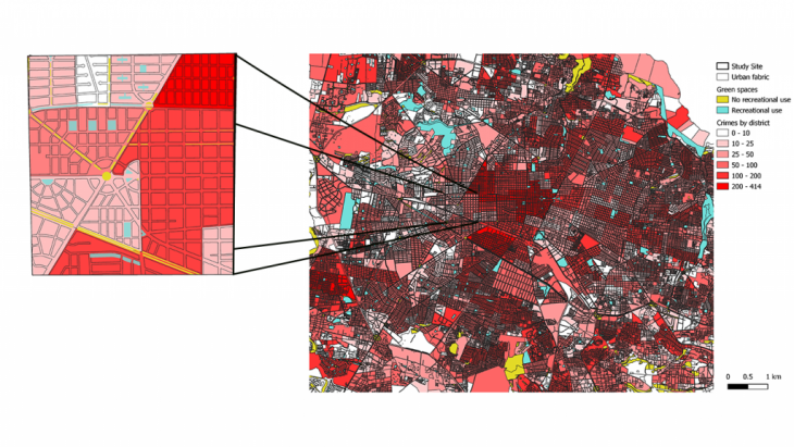
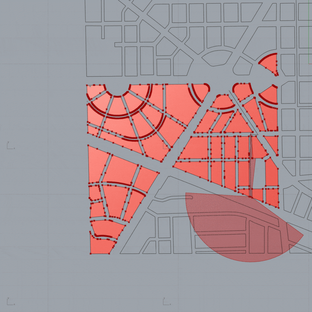
Fig 1
 Being with the high quantity of criminal incidents, it can be concluded that given the narrowness of the urban factory and the remoteness with green areas it reduces the peripheral visibility which makes a site more vulnerable
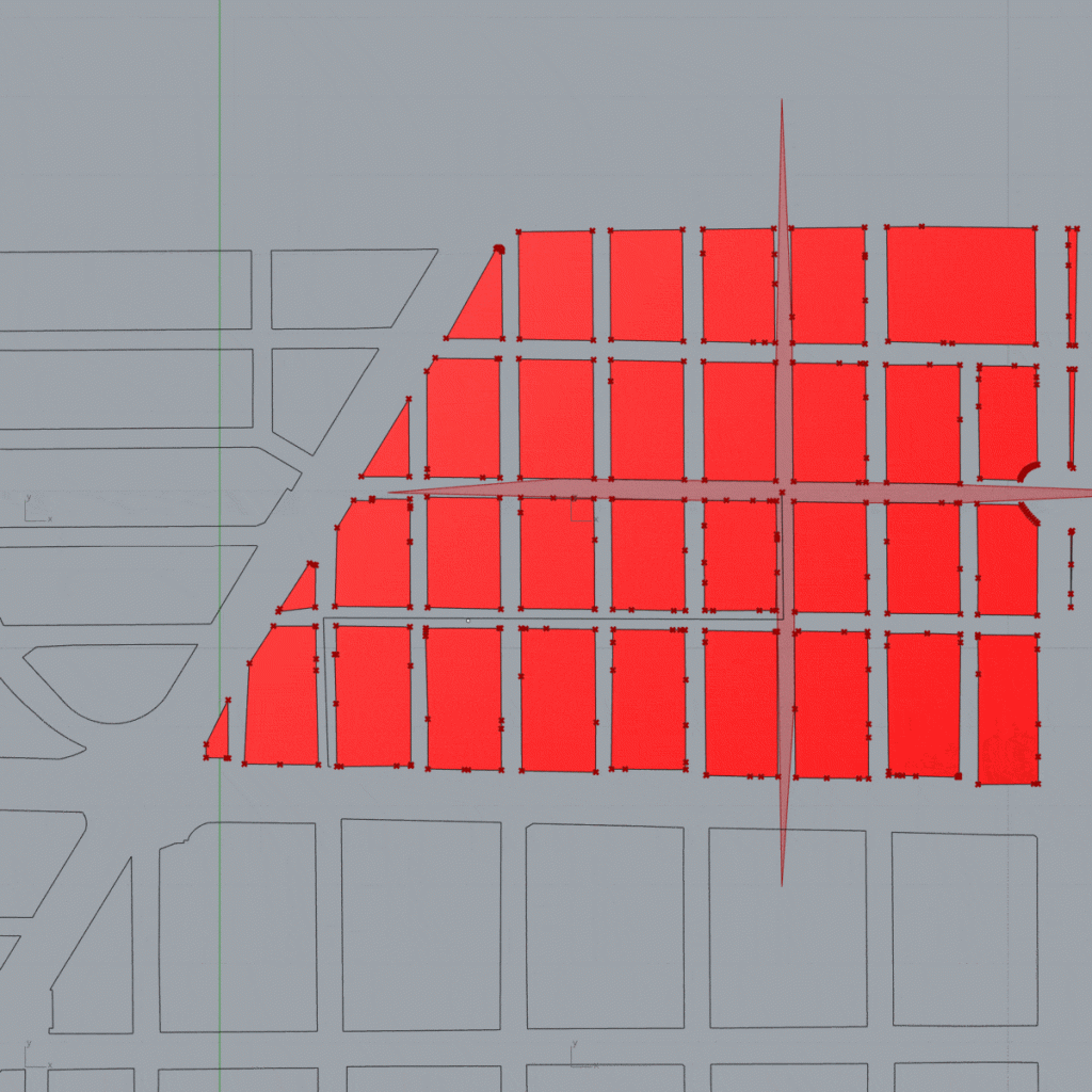
Fig 2
Wider streets and their connectivity to main streets help to have a better peripheral view which affects crime reduction
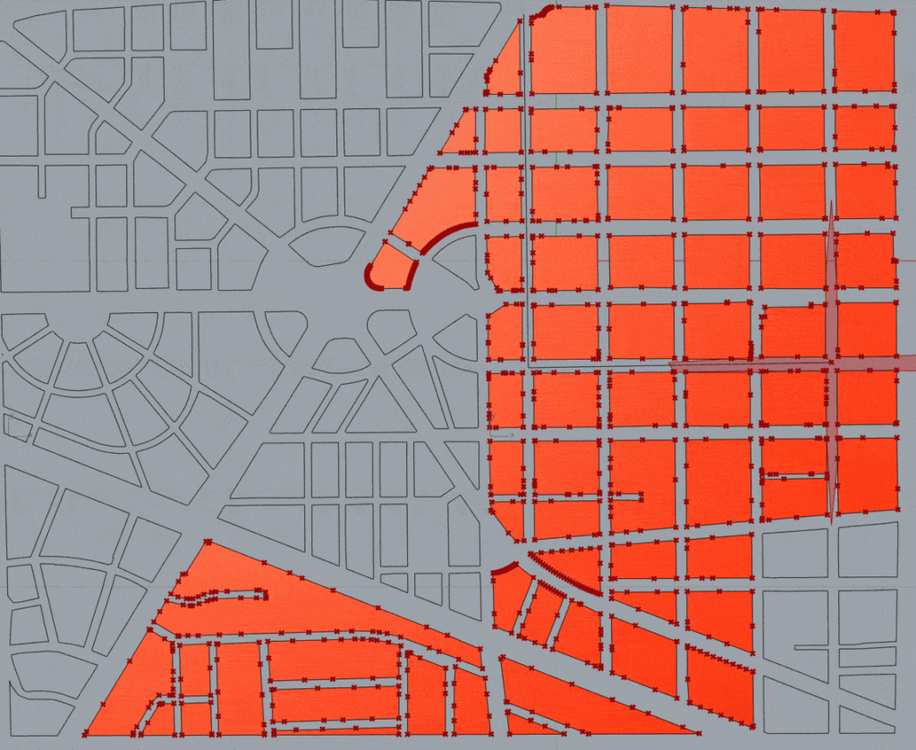
Fig 3
The site of the compared ones with more green areas and connectivity to wide roads should make this one of the safest sites although its visibility is reduced in sections by the urban factory.
Fig 3
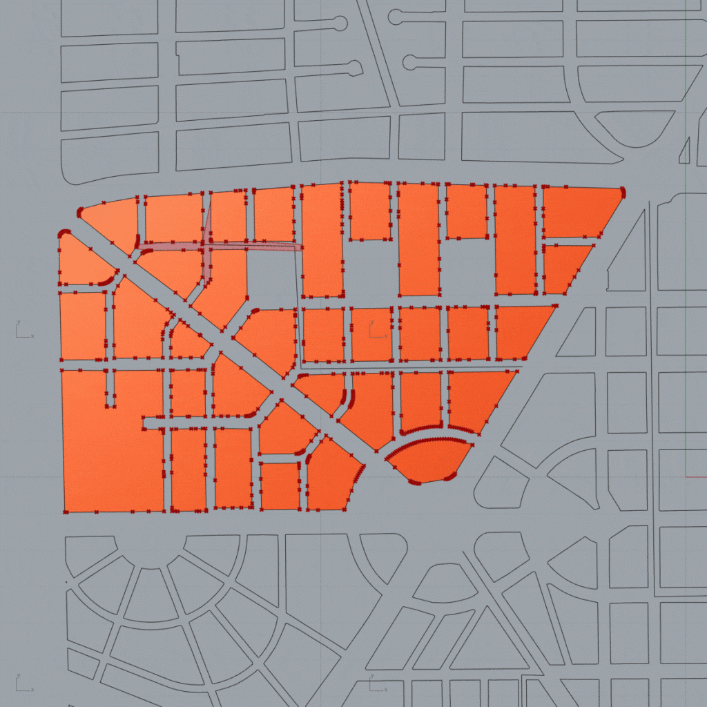
Distributed green areas, wide roads in its periphery and a radial urban factory make this site the one with the widest visibility and therefore the less insecure of the analyzed.
Sources
https://datos.gob.mx/busca/dataset?res_format=SHPhttps://datos.jalisco.gob.mx/
Insecurity analysis through sight paths is a project of IAAC, Institute for Advanced Architecture of Catalonia developed at Master in City & Technology in 2020/21
By student: Miguel Tinoco
Faculty: Eugenio Bettucchi & Iacopo Neri.