MANIFESTO
The project proposal for the El Guinardo site focuses on preserving the existing greenspace, providing a connection passage, and creating a point of interest for the neighborhood of El Guinardo.
The project aims to reprogrammed the site as a passage that will facilitate an organic and interactive urban experience for residents, tourists, children and companion animals. Overall, this passage will become a socially interactive node that merges the traditional use of public space within the local context and modern lifestyle.
CONTEXT ANALYSIS
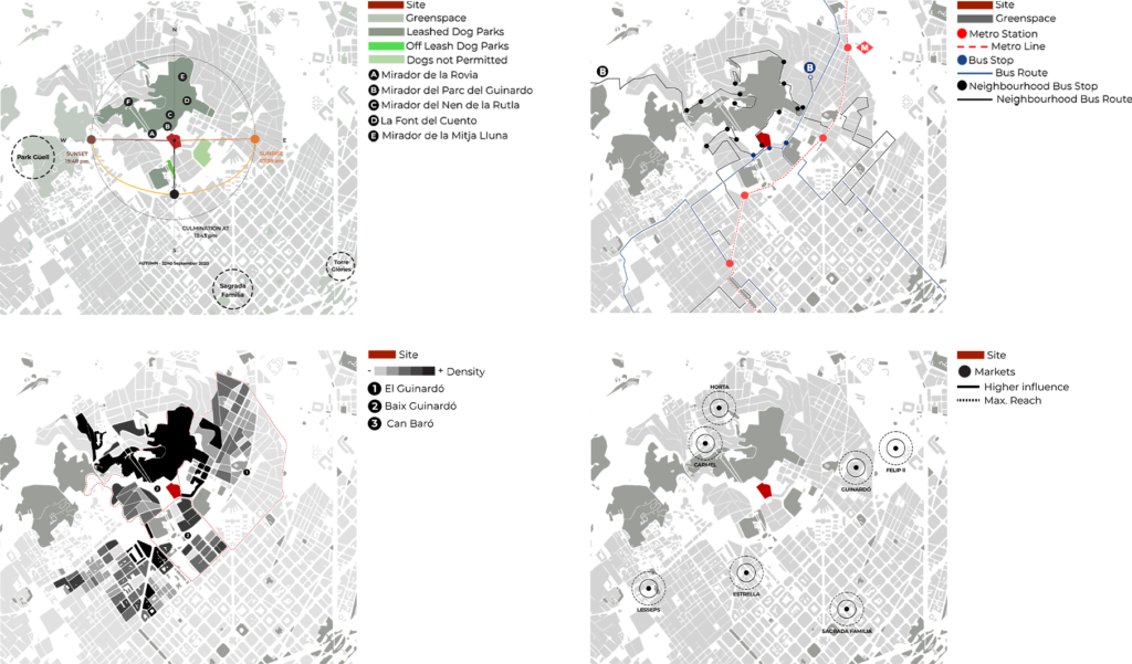
To begin the context analysis of the site, the team went to visit the site. During the site visit the team investigated the different views from the elevation as well as the surrounding context. Along with potentially protecting the existing cat colony, it was discovered that there was a lack of outdoor leisure space and areas for dogs off leash by talking to locals around the site. Due to this, the team mapped out the existing dog parks as well as the surrounding points of interest, most notably Parc del Guinardo which is connected to the top of the site. While Parc del Guinardo offers the neighbourhood a large outdoor space, dogs must be on leashes, it is highly elevated and removed from the residential area and has a tourist demographic. Further investigation was done to discover how connected the site is by mapping the surrounding greenspaces, metro stations, bus stops and neighbourhood bus stops. It was discovered that the surrounding greenspaces are only connected by the neighbourhood bus, thus the concept of creating a more accessible greenspace and one that acts as a bypass to provide a connection between the greenspace and the city was developed. While conducting secondary research it was also evident that the neighbourhood was missing a market. Markets are incredibly important to the city of Barcelona and tie into the culture of the city. There are surrounding markets however their influence does not reach a large portion of the neighbourhood and the existing market in El Guinardo was renovated into a supermarket. In addition, the team investigated the interaction of the surrounding environment as the site not only connects the city to the greenspace but also acts as a connection between three different neighbourhoods; El Guinardo, Baix Guinardo and Can Baro. Moreover in the context analysis, the team referenced a study of density immediately surrounding the site and discovered that this area is one of the most densely populated areas in Barcelona which further supports the notion of needing additional outdoor leisure space. Based on the development of the context analysis and the general direction of the potential programming opportunities a sun analysis of the site was conducted to support that the site is conducive to an outdoor leisure space.
SITE ANALYSIS
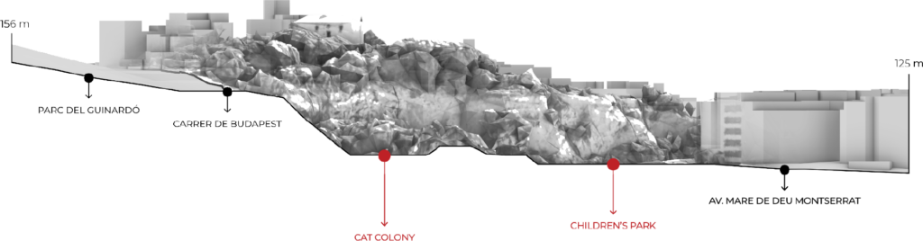
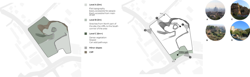
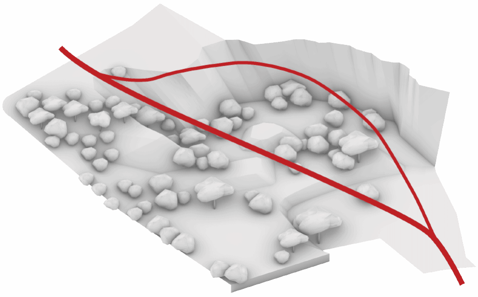
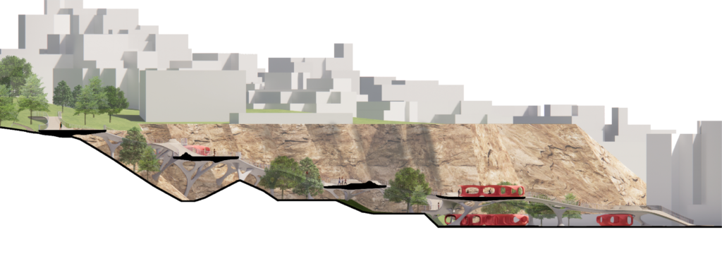
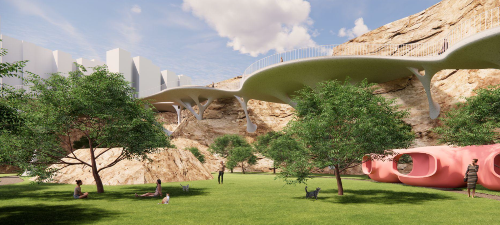
As the gradually elevated site is located at a potential hinge point between the local residential district and the tourist attractions, the team proposes to reprogram the site as a passage that facilitates an organic and interactive urban experience by integrating the existing non-human living organisms into the regular urban activities, while also taking the advantage of the site’s topographical features. The section visually describes the elevation and topographical characteristics of the site in conjunction with the immediate context; specifically the Parc del Guinardo as well as locates the current programs on the existing site. As the site is topographically complex the different levels were grouped together to better understand the characteristics of the site and the potential the site has for development.
CONCLUSIONS AND OBJECTIVES

To center the development of the project the team produced three main objectives: Preserve the existing conditions of the site, maintain the greenspace and highlight the cliff, provide a passage that will facilitate an organic and interactive urban experience while taking advantage of the sites topographical features, and finally to create a space that will serve as a leisure and commercial nucleus for the neighbourhood, as a connection to the surrounding points of interest and an overall destination.
PROGRAMS AND CIRCULATION
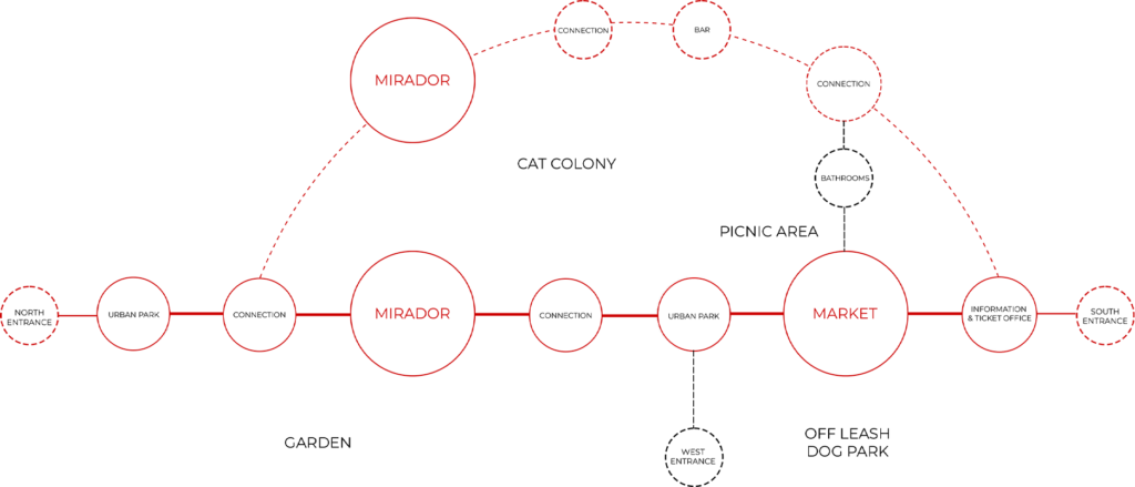
Based on the research the team conducted and the objectives we have set out to reach, a program was developed to give order and function to the different areas of the site. It was also vital that the connection paths were centered around and did not disturb the existing cat colony in an attempt to preserve it. The program is centered around the idea of having two different connections; a bypass and one designed for leisure. The bypass is vertical and in red whereas the leisure route is arched and dashed to signify that it is secondary and a slower connection path.
CONCEPT
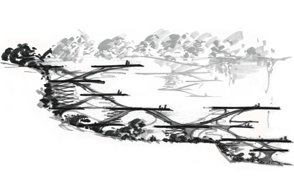
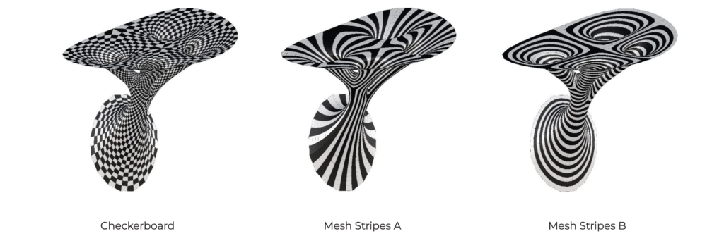
The concept of the module was derived from this preliminary sketch illustrating the topography of the site and both the vertical and horizontal connection that the site called for.
DESIGN PROPOSAL
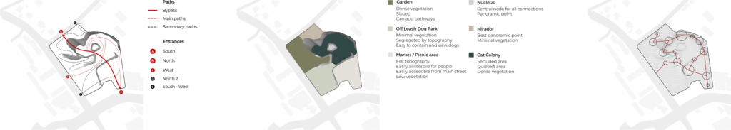
The design proposal began with the idea of the bypass connecting the south access of the site which is located near the main road and the metro/bus stations to the north access of the site which is connected to the Parc del Guinardo and a local attraction, Bunkers. From the main bypass, secondary paths were developed to connect the west access and provide a secondary connection for leisure connected to the north and south accesses and centered along the cliff. Further, tertiary paths were developed along the site to other potential accesses and along the existing topography in conjunction with the bypass and secondary connections. From there, the team developed different zones according to the topography and connection paths proposed. The zones were created according to the different functions of the site based on the attributes of each area; a garden with dense vegetation and topography conducive to paths, an off leash dog park with minimal vegetation which is segregated by topography, a market with a flat elevation near access and low vegetation, mirador with the best panoramic point, and cat colony with dense vegetation and seclusion. Two elevated paths will connect the North, South and West entrances of the site. In order to obtain a constant but gradual slope, a triangular grid is overlaid on the site. This grid is then utilized to define both the paths and the platforms which will hold a number of different functions.
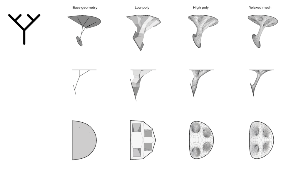
CATALOG: MODULE A // PLATFORMS
CATALOG: MODULE B I // SUPPORT
CATALOG: MODULE B II // SUPPORT
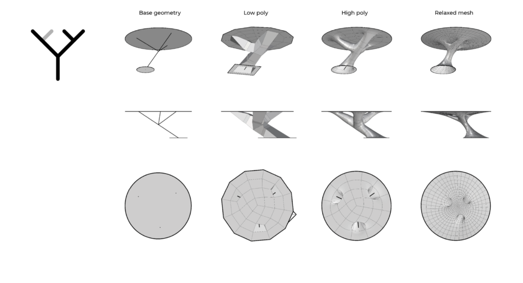
CATALOG: MODULE B III // SUPPORT
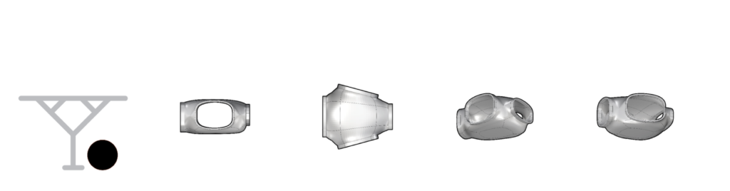
CATALOG: MODULE C // CABIN
AGGREGATIONS

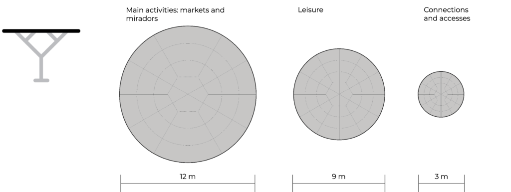
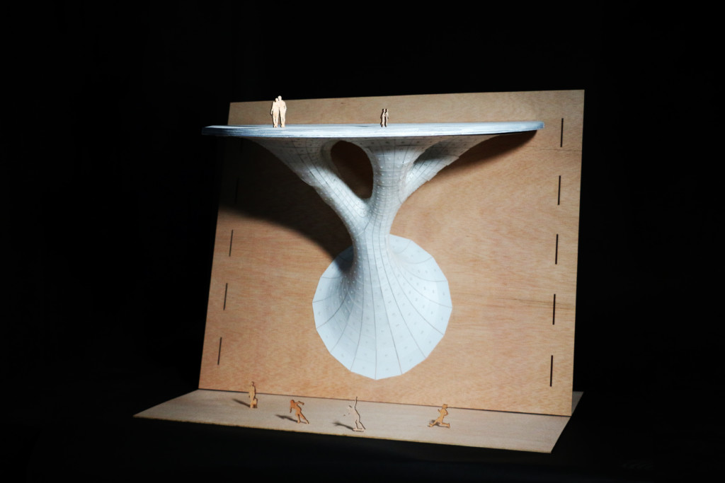
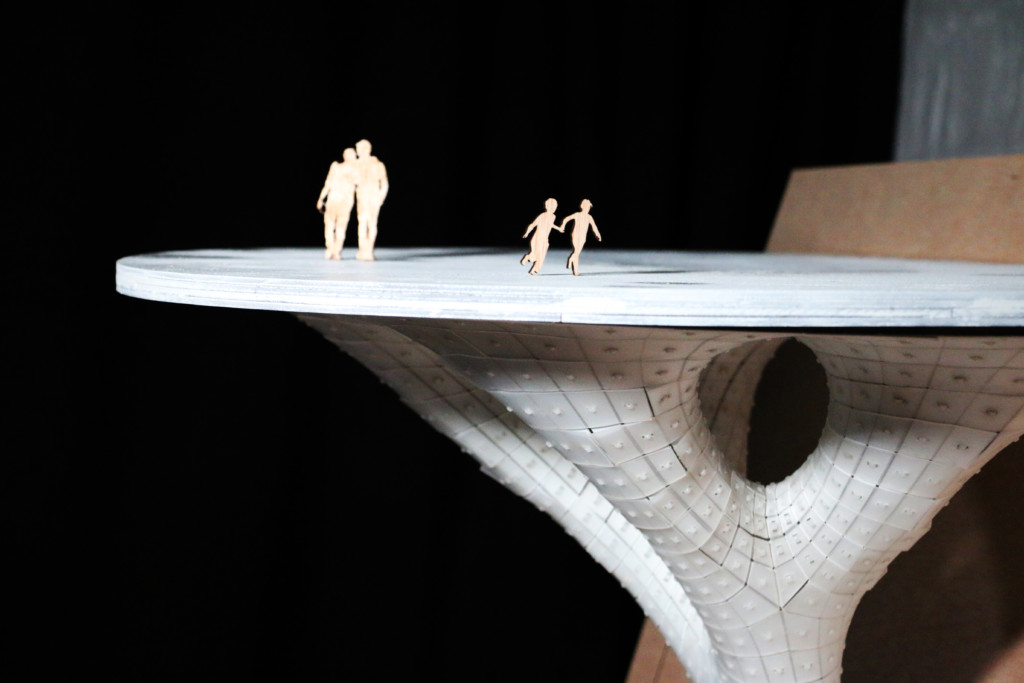
The module development focused on three different modules; Module A: the platforms, Module B: the supports and Module C: the market. Module A: the platform, are also organized in a hierarchical matter, primary, secondary, and tertiary, and are assigned based on the function. The different platforms were placed strategically across the site to optimize support from the cliff as well as optimize the distance between the two main entrances to create the bypass. The platforms are flat circles that will rest upon module b: the supports.
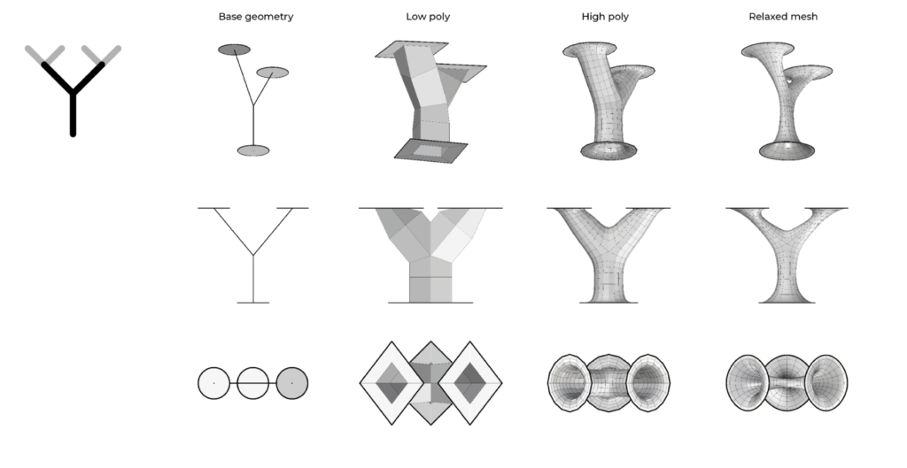
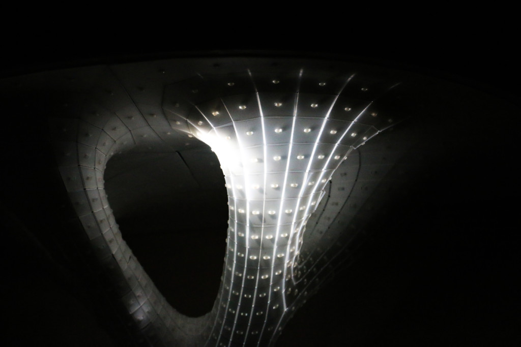
Module B: the supports are subdivided into three different modules depending on the type of support. Module B I: is support with two branches for linear platforms and ramps, Module B II: is support with three branches for small or slender platforms, and Module B III: is support with four branches for large or cantilevered platforms. The support modules were developed through an algorithm and adapt to the angle of the topography below.
Module C: is modular cabins for the market, miradors and cat colonies used to populate the site and create a decentralized market. The inspiration for this module was taken from the state of the art project K67, which is a similar module market system which are compact, modular kiosks that can accommodate almost any function and can be placed anywhere which creates a decentralized form of market that can be scattered along any urban connections.
SPACE PROGRAMMING
The space programing development began with the two circulation paths on the 3D site to visually merge the horizontal and vertical connection. From there, the platforms were placed in accordance to the paths and the grid to establish the connections between the platforms. Next, the platforms were connected to each other, creating the bypass and additional paths through the platforms. The support Modules were then added underneath the platforms and ramps based on the type of support needed. Finally, the site was populated with the Module C: Market as well as the inclusion of the circulation paths on the site.
MASTERPLAN
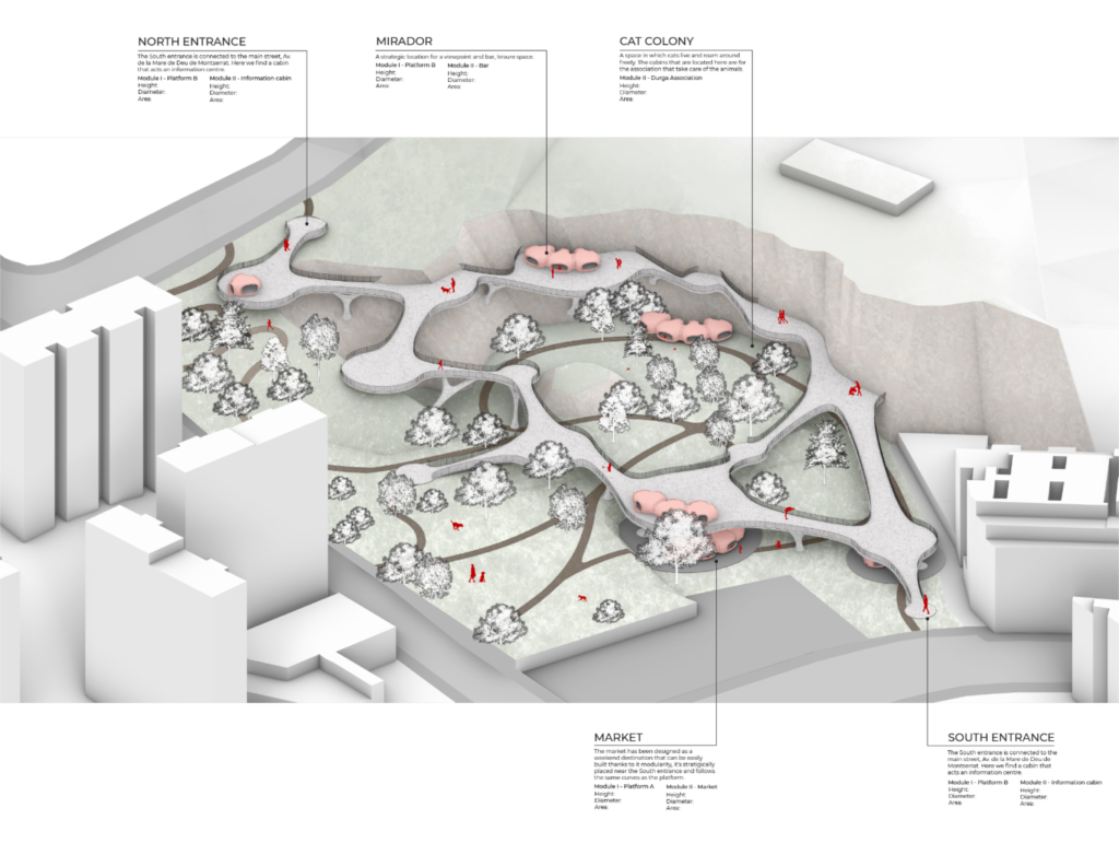
The proposal drawing masterplan is a cohesive look at all of the project elements together, the modules are coded to communicate which platform and which supports are being utilized in the area. In addition, the masterplan illustrates the functions and activities of each space through the population of each space.
SECTION
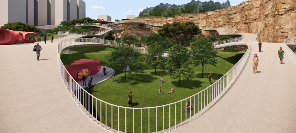
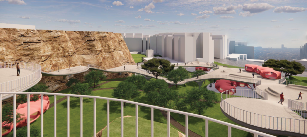
RENDERS
FABRICATION
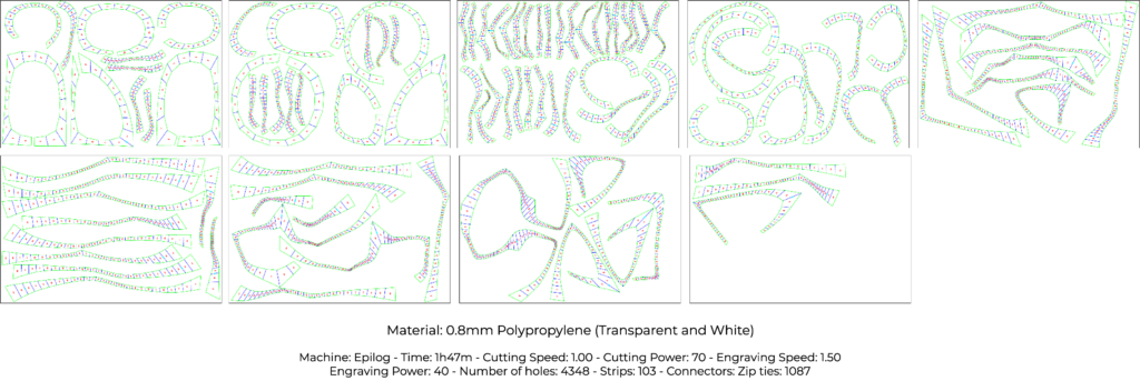

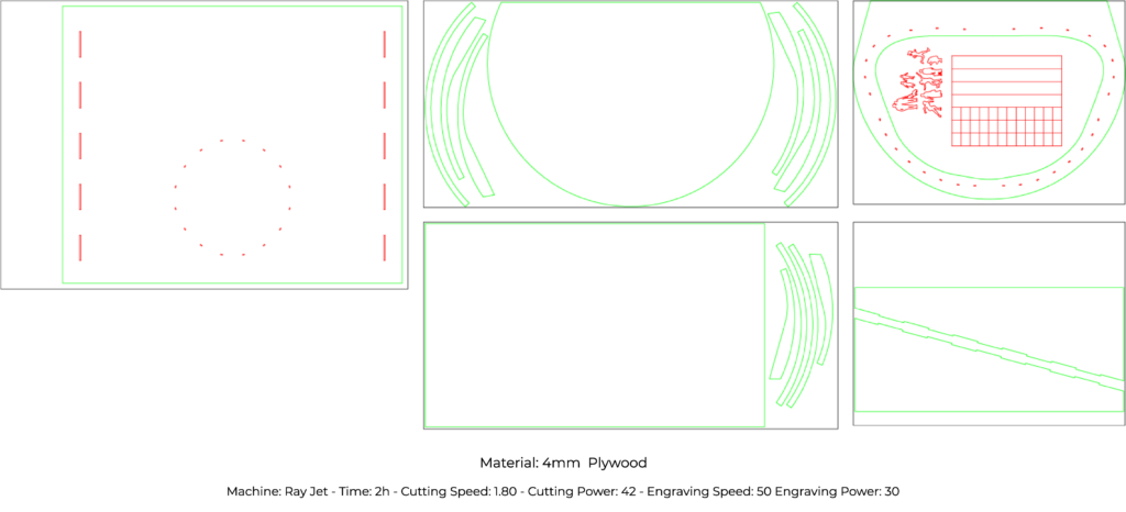
The fabrication of this model was completed using a method of laser cutting polypropylene into vertical and horizontal strips, generated from a grasshopper script, and fixing them together with zip ties. The model of the singular module was then attached to a plywood support in order to simulate the effect of the module supported by the cliff on the site.
FINAL MODEL
Green Bypass is a project of IAAC, the Institute for Advanced Architecture of Catalonia, developed during the Master in Advanced Architecture (MAA01) 2021/2022, by students: Morgan O’Reilly, Enlin Guo, Furio Magaraggia, Alexandru-Aurelian Girtan and Ariadna Giménez. Faculty: Rodrigo Aguirre. Faculty assistant: Ivan Marchuk. Student assistant: Hairati Tupe.
