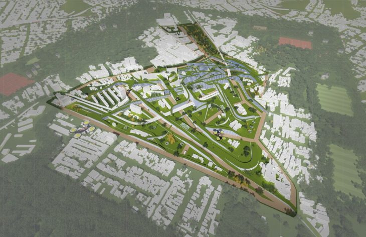
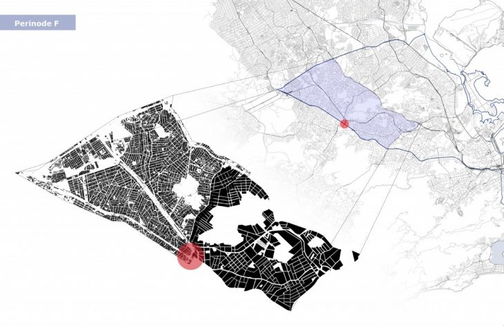
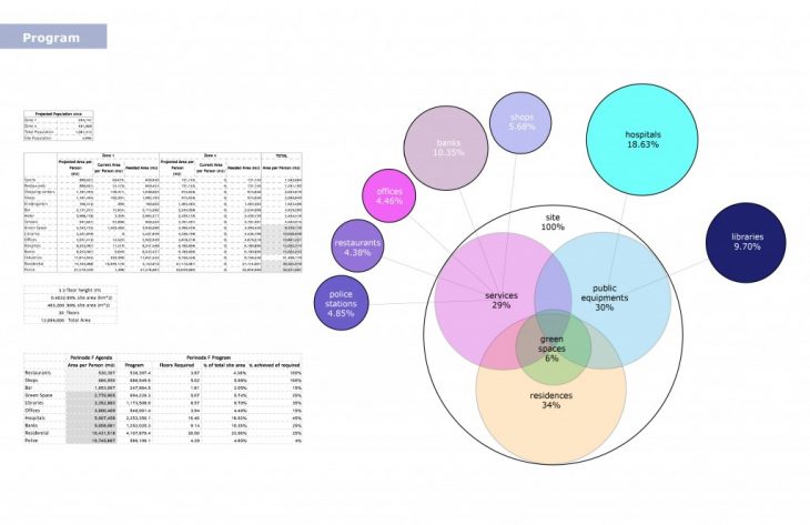
This studio’s aim is using peripheral zones of the city to decentralize the central build of Rio de Janeiro to distribute areas of social activity, public equipments and services, and economic opportunities. This project’s development focused on specified zones 5 and 7 to the north-west, at Perinode F.
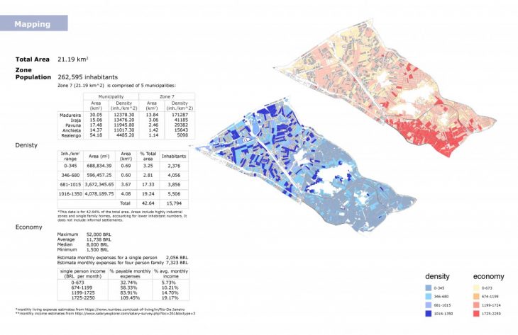
Before planning, current conditions and data of the site were collected and analyzed. Projected programming are set for the zone’s population increase by the year 2050.
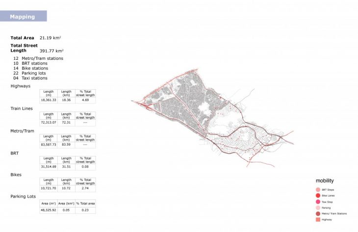
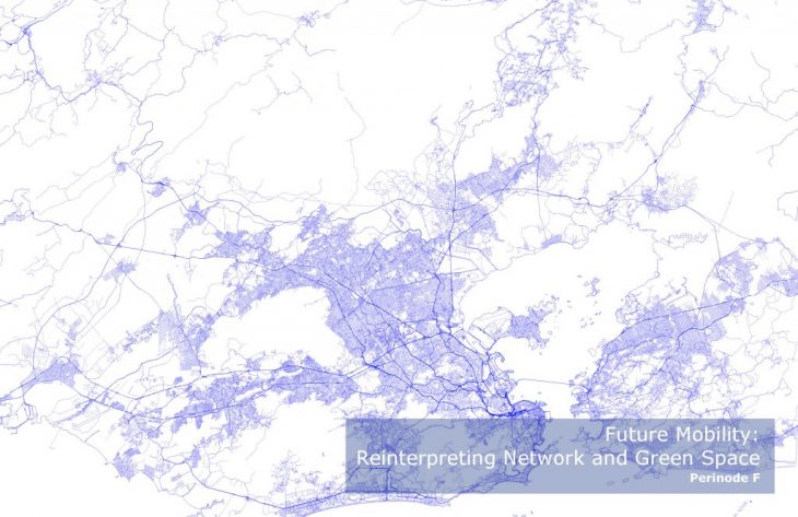
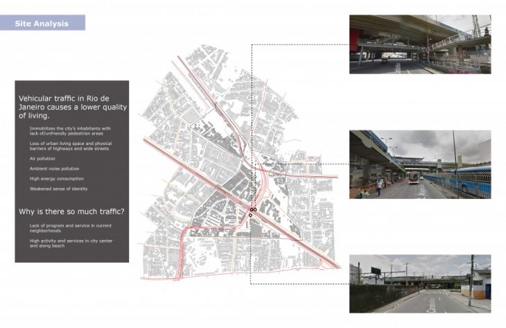
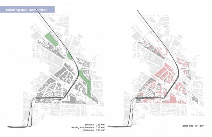
At perinode F, there are two main features: one being the conjuctions of different levels of mobility (mainly the railway and highway), which greatly affect pedestrianism and vehicular traffic, and the other being a proliferation of unused expanses, abandoned buildings and unused parking lots .
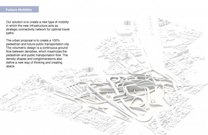
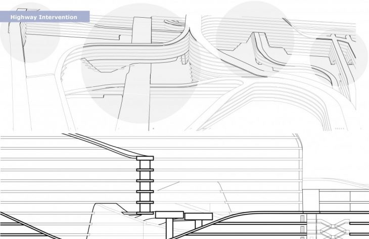
This lack of pedestrianism and high vehicular traffic congestion due to lack of mobility infrastructure became fundamental to the project. The solution was to create a new type of mobility in which the new infrastructure acts as strategic connectivity network for optimal travel paths.
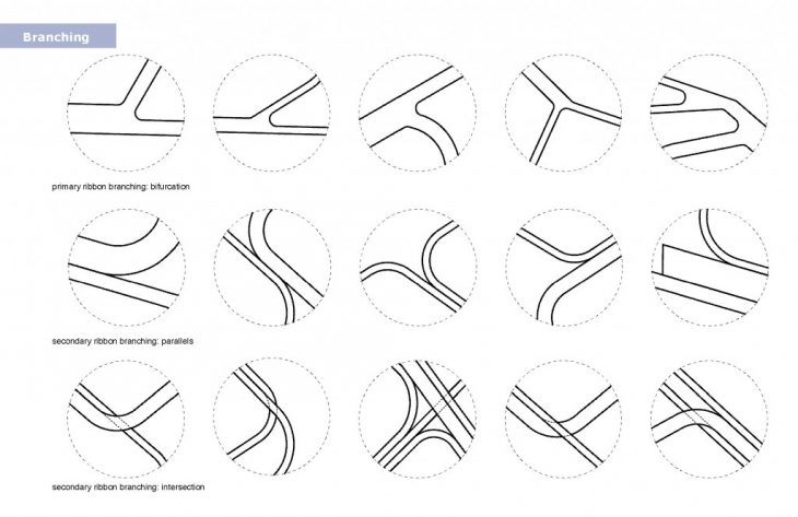
First, a grid system was constructed by setting points of interest or entrance around the site every 0.25 km. They are interconnected by using lines of shortest distances, and mapped the intersections of each line. From the conglomeration of point densities, the main thoroughfare system was defined, and the secondary lines were used to fill the interior grid.
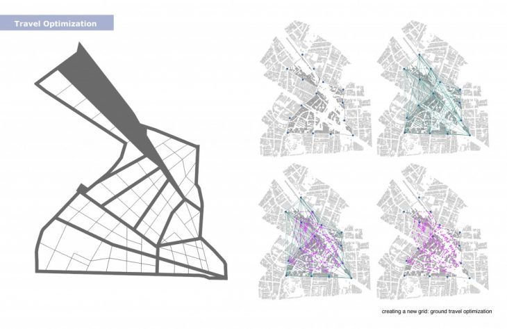
The second grid utilized the same points of interest and additional interior grid points. A genetic algorithm was used to optimize the path of least travel through all the points, so that this network could serve as the public transportation network within the site.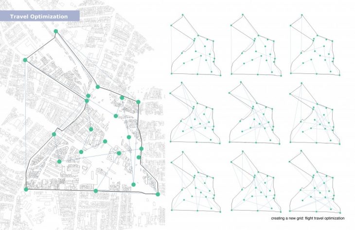
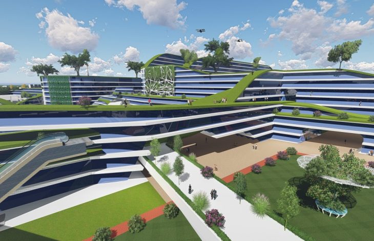
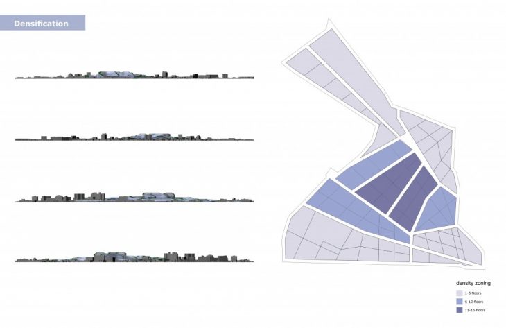
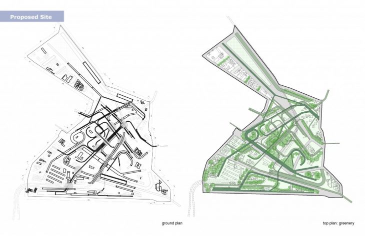
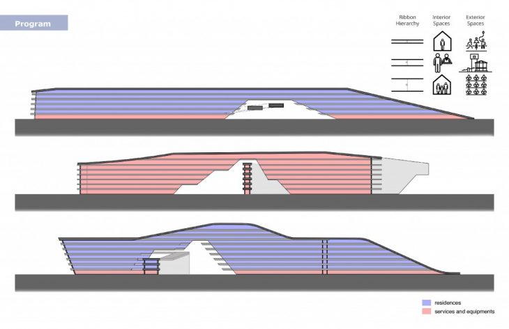
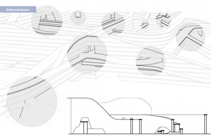
Densification occurs on the xy-plane in plan, but also in the z-plane. Our infrastructure is centrally densified around the perinode, and radially spreads to surrounding infrastructure to create a graduate integration of existing and proposed.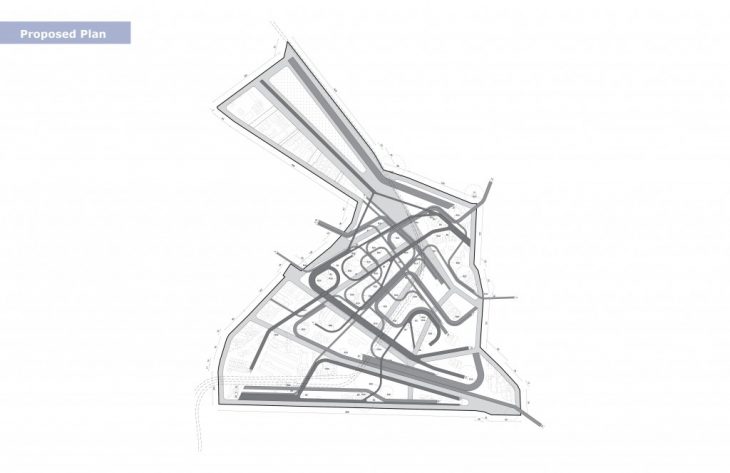
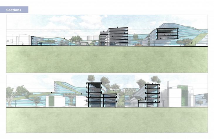
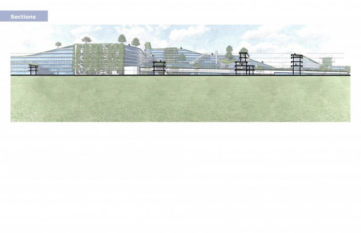
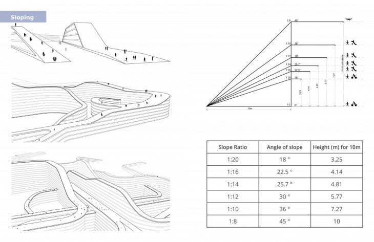
The mobility follows this vertical densification with several layers. Below ground level, a high speed rail system is submerged to liberate the site from impeding railways. At ground level, the new grid perforates the proposed infrastructure for continuous and optimal ground movement. The roofs of the infrastructure create an artificial topography of parallel mobility space which interconnect several program layers generating a sense of dynamism.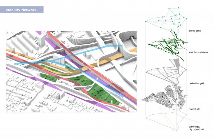
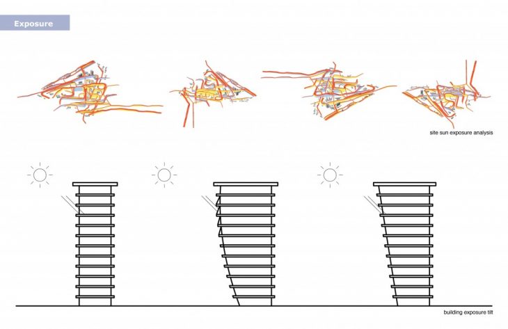
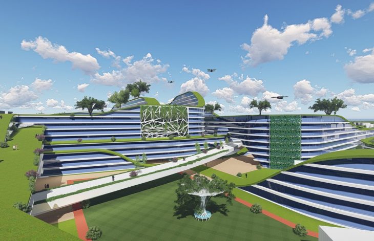
The solar exposure of the site was analyzed to find the facades with highest exposures: on these high exposures, tilted facades or facade treatments are assigned to lower exposure as well as break the monotony of the line-curve-line plan typology.