Abstract:
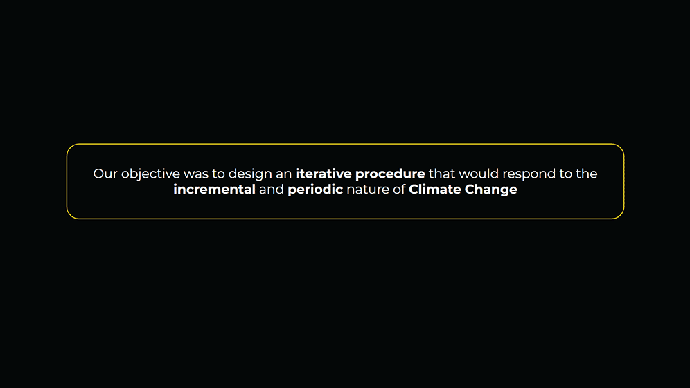
In the context of a changing climate, notions of a stable urban climate outdated. This work aims at developing, and validating, an iterative methodology that would allow for an incremental approach to designing and adapting the bioclimátic infrastructures within the built environment. Our methodology was designed as a climate-responsive, multivariable, multi-temporal procedure. We consider it essential to address the change of specific variables through time and our ability to affect the expression of those variables through our design strategies. We’ve integrated the response of those variables back into the design workflow in order to allow for iterative optimization and validation procedures.
Context:
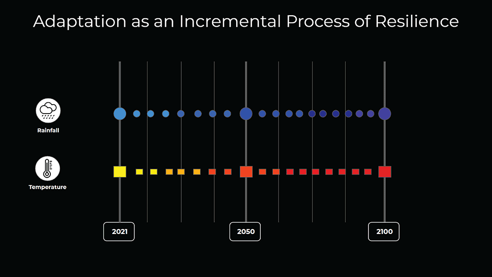
Resilience can be defined as “the capacity to recover quickly from difficulties; toughness.” but for this works respond for “the capacity of adapting through time” for that reason talk about the expectancy in the future and the consequences of climate change, is talking about one of the most important topics worldwide. Search for Environmental Ecology strategies and nature-based solutions that help the city to be resilience is the main topic developed in this project, because of that we research the expectancy growth of temperature and the decreasing rainfall projection made by the city council of Barcelona and understanding that climate is not a linear process through time we ask the question how we can Adapt, create a resilience city with sustainability?
Main challenge:
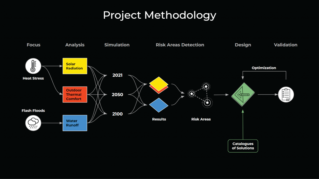
Talking about the axis of climate change is comprehend that is a complex problem where variables can be affected by multiple factors, so we synthesized the main challenges to understanding better the starting point and then we subdivide the challenges of climate change to focus only on two main axes which were heat stress and flash floods, and how the answer can be merged with a natural answer by adding biodiversity of trees and then creates a chain attractor of actors like animals, pollinators, etc, by the new green infrastructure.
Project Methodology:
Once we select the two main challenges we analyzed the future scenarios by creating simulations for 2050 and 2100 which are the years of expectancy growth of temperature and the increasing water runoff, whit that we create a map of the risk areas of the district in San Martí which is the area where the project took place, by intervening the risk areas we re-analyzed again the simulations to compare the results and finally create with that a catallogue of design strategies and solutions that can be implemented on-site.
Heat Stress:
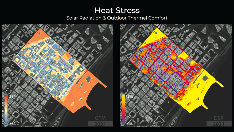
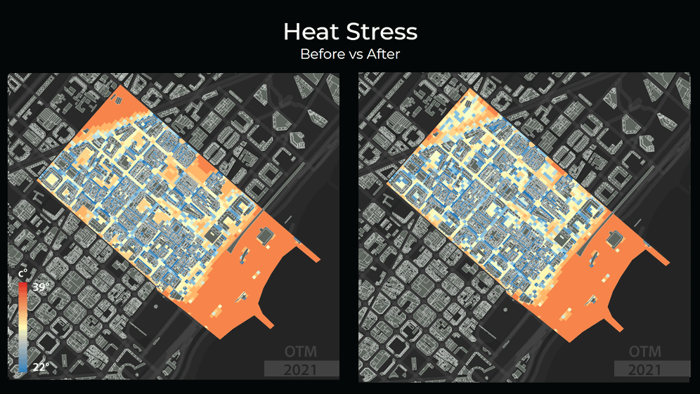
For calculating and analyzed heat stress, we manipulate an EPW file which is an EnergyPlus Weather data which is mainly used for environmental simulations of climate, by using a program called “Elements” we modify the temperature and radiation by the expectancy of growth of Barcelona’s city council which are 2° celsius for 2050 and 3.2° celsius for 2100, then by using grasshopper with the plug-in call “ladybug” we create simulations for Direct Solar Radiation and Outdoor Thermal Comfort.
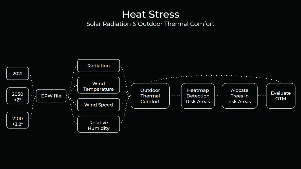
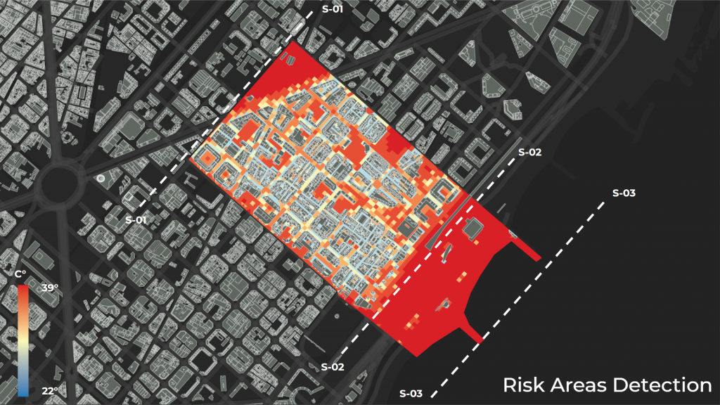
Comparing how is going to be the behavior in the future we can have a central idea of the main risk areas to intervene in the district of San Martí in specific the area of Poblenou. The Outdoor Thermal Comfort is measuring the temperature in the ambiance and the Direct Solar Radiation the percentage of heat sun in the surface.
With the map of risk areas, we create sections to divide the urban fabric from the beach zone and then we focus the interventions between the sections S-01 and S-02, to reduce heat stress inside the district.
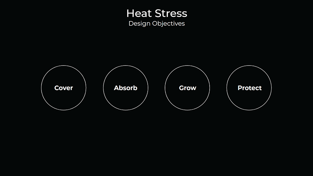
For the intervention we study the possibility to create 4 main axes of action by one single element which is the trees, these main design objectives are:
- Cover
- Generates shadow to increase walkability inside the zone or area
- Absorb
- Mitigate the direct solar radiation impact
- Grow
- Adapt to the area through time as a metabolic element
- Protect:
- Creates a Barrier to make safe the user or building not just for heat stress
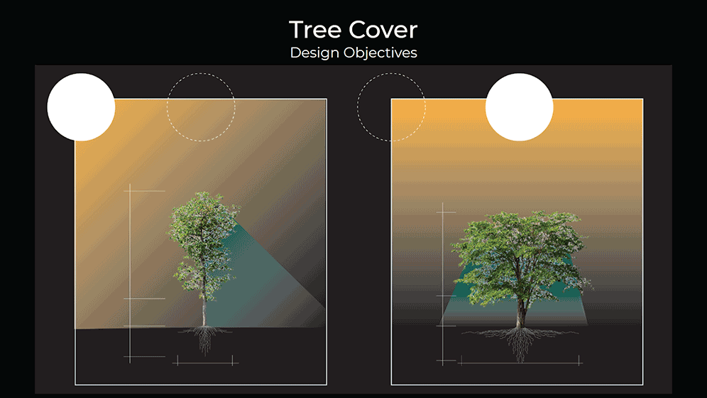
We use the concept of “urban canopy” as the main strategies to mitigate the increasing temperatures and that consist to use the right tree in the right place, for that reason we create a catalogue of trees that can be used according to the zone needs, som of then is taller but with a small circumference and it helps better to refresh facades on buildings, or we can use other trees which long circumference, that allows increasing the shadow and can be located in public space or pedestrians streets.
Finally, we located the new trees inside the risk areas by selecting in the mesh the higher results of Outdoor Thermal Comfort, and re-distribute inside of those areas points that represent a tree from the previous catalogue.
Validation Heat Stress:
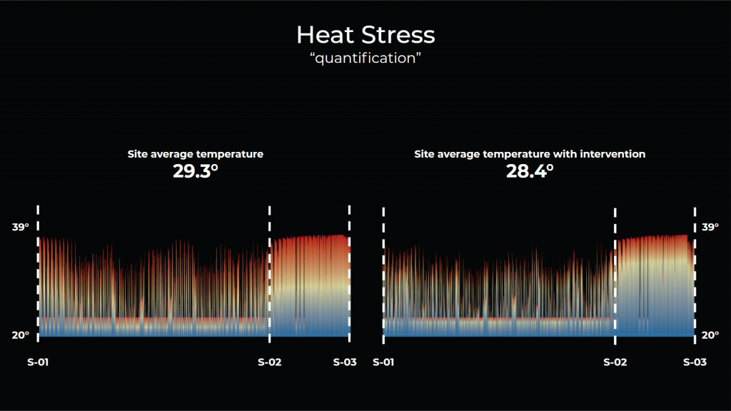
So then we simulate again to compare the new results with the previous analysis to see if there is an improvement in the area and if the quantity of trees is enough to create a symbolic change.
Finally, we analyzed the data created by “ladybug” in the area and compare the graph from the previous analysis and the intervention, by creating an average we discover that the new tree areas have been decreased 0.9° celsius which is a significant change for the increasing temperature.
Flash Floods
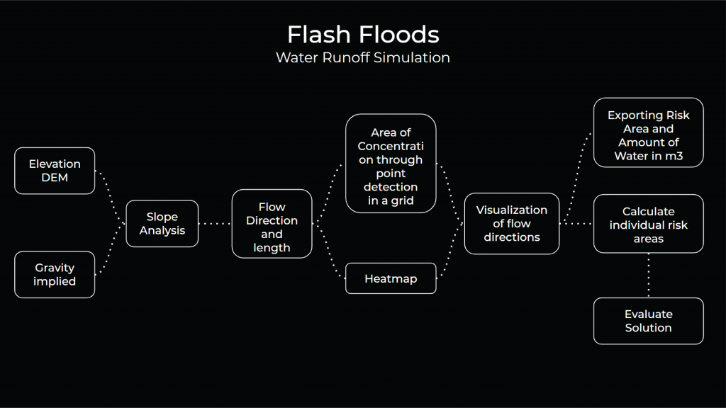
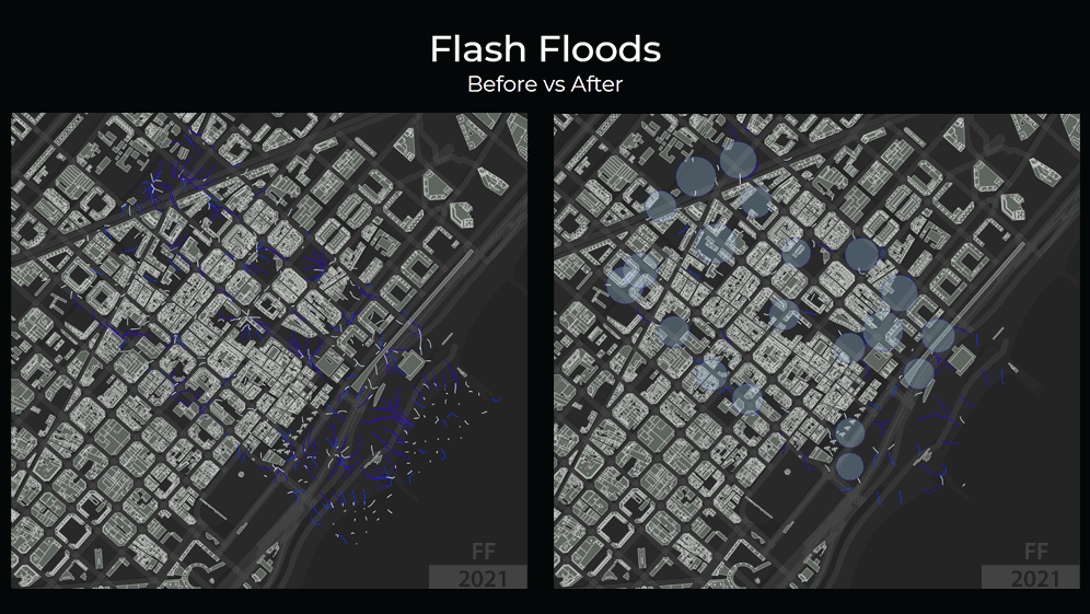
Flash floods are most of the time caused by rivers, basins, and irregular rains, which the focus here is the water runoff of flash floods caused by irregular rains. As part of our analysis we made. For the analysis what we did is that take elevation data of the site in Rambla De Poblenou and applied buildings layers plus gravity, from there the slope and of the land has been analyzed with and produced a grid which calculated risk areas and heat map to visualize then with visualization done with the length of the water runoff. From there the two visualizations happened, based on grid data and heatmap the sponge nodes (which is the strategy to propose delay, protect, store and release on time) had been allocated on risk areas to evaluate the solution.

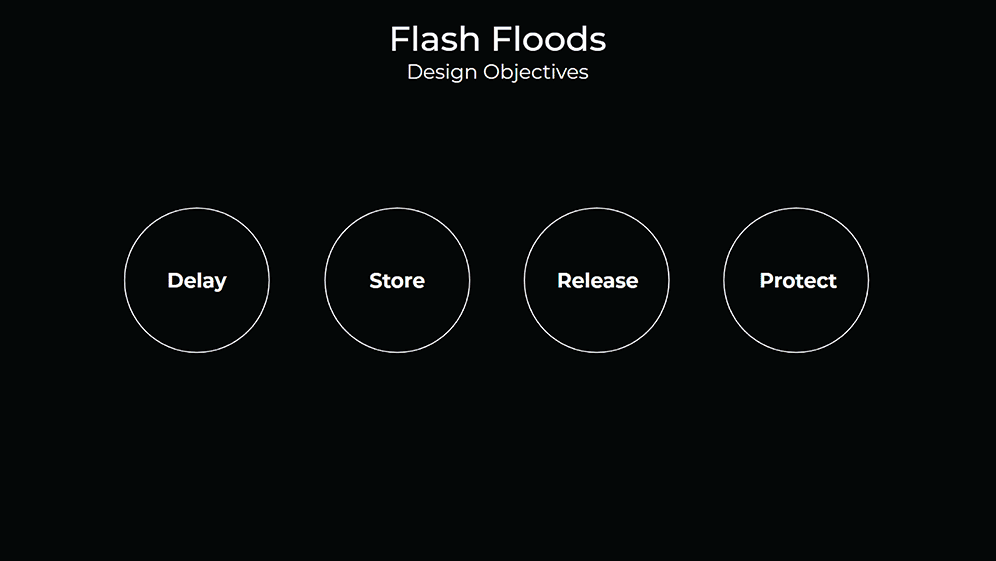
The main strategies are based on the concept of “sponge city” which are:
- Delay
- Retain water from high zones by creating some storage or filter water gain into the terrain
- Store
- Allow citizens to use the water from the rainfall
- Release
- Adapt the city water filtering by increasing the green areas
- Protect:
- Creates a Barrier to make safe the user and building from flash floods
By the detection of risk areas, we locate every strategy into the Poblenou area in form of circles, In which every circle represents one different strategy of sponge city design, that prepares the scenario for validation simulation.

Validation Flash Floods:
As part of the validation, we juxtaposed both before and after the proposal to see the results as obvious in the risk area in which sponge nodes allocated there are a notable amount of water stores.
- Flash flood event 200mm/24h
- 276,673 m2 intervened.
- 5,334,600 lts collected in the intervention.
- 2.37 days of water for Sant Marti inhabitants.
- The whole year rain 658mm
- 182,050,834 lts collected by the intervention.
- 823.65 days of water for Sant Marti inhabitants.
Complement Content:

(click Image)
Resume video for the project:
<p>
</p>
Environmental Ecology – Adapting Barcelona is a project of IAAC, Institute for Advanced Architecture of Catalonia developed at Master in City & Technology in 2020/21 by students: Mario Gonzalez, Sasan Baharami, Miguel A Tinoco, Matteo Murat, and Ivan Reyes and faculty: Angelos Chronis, Iacopo Neri, Mahsa Nikoufar and Androniki Pappa