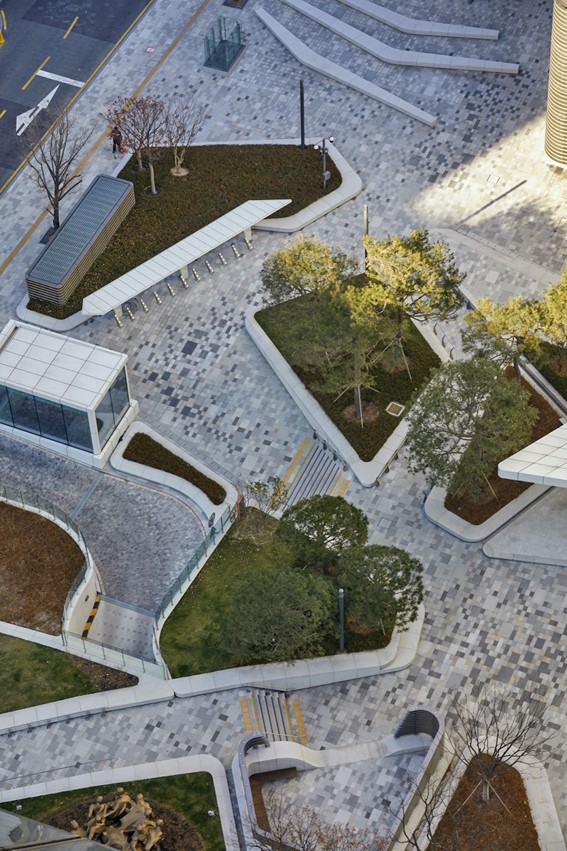
CONTEXTUALIZATION
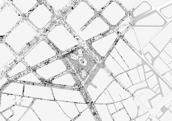
The selected site for our project is Plaza Catalunya; we started with general research into the character of the Plaza. Currently it serves as a transport and mobility hub, being a major connecting point for the metro, airport buses, city buses, bicycles, and pedestrian traffic. Noted are the wide lanes that direct traffic on the North-West and South-East borders of the Plaza, while the other streets mostly serve tour buses, the airport shuttle bus, and taxis. Furthermore, the elevation of the Plaza itself makes it difficult to see from the outside, and most of the pedestrians choose to walk on the outside sidewalks. This analysis led us to identify existing inefficiencies in the Plaza.
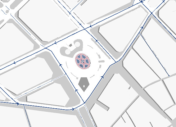
Mobility flows in and around the Plaza.
PROBLEM STATEMENT
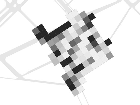
In our order further analyse the existing problems and inefficiencies, we divide the Plaza into a grid to look at the patterns in different concentrated areas.
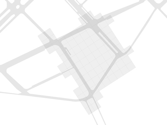
Our analysis grid of Plaza Catalunya.
We identified two main issues in Plaza Catalunya, one static and one dynamic. The static issue was a lack of visibility. Running an isovist analysis from each centroid of our analysis grid, we could identify the worst areas regarding visibility into the centre of the Plaza. The worst areas were revealed to be concentrated on the four corners of the Plaza, specifically where pedestrians gather at the outside crosswalks and in particular the Eastern corner.
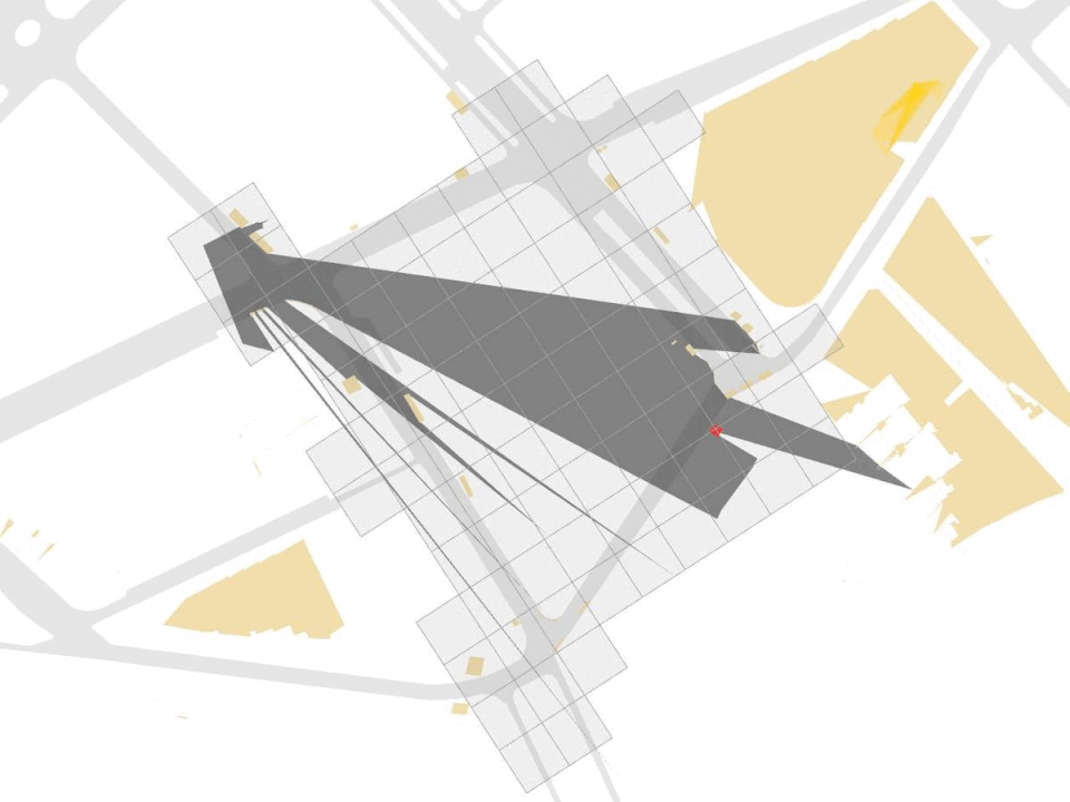
Isovist Analysis of the Plaza.
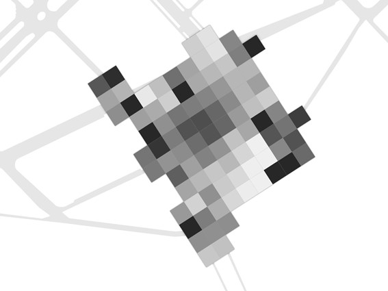
Visibility Grid based on isovist.
The dynamic issue we identified was inefficient pedestrian flows. Using data from over the course of 7 days of pedestrian counts in the Plaza, we could see where congestion is the worst; plotting this on our analysis grid, again it is seen that the four corners that experience the most pedestrian flows.
Pedestrian counts over 7 days.
Pedestrian density grid and flow interpretation based on count.
Combining the static and dynamic issues, we overlapped the two grids showing visibility concerns and pedestrian congestion problems to find an area that could stand to benefit the most from intervention. This led us to the Eastern corner of the Plaza.
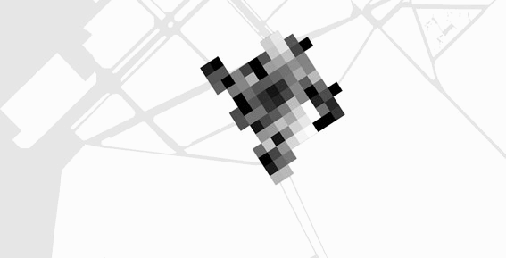
Overlap of pedestrian flows + visibility concerns lead us to identify our intervention corner.
INTERVENTION ZONE
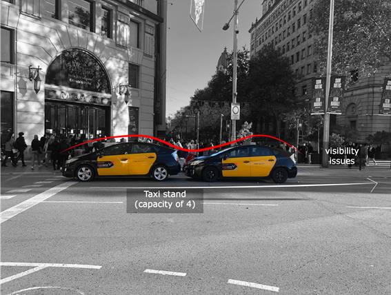
The eastern corner consists of an intersection between one of the main through roads of the Plaza and the pedestrian street of Portal de l’Angel, which then turns into a road divided by a median that is primarily used as a stop for taxis and the stop for the Airport shuttle buses.
There are three crosswalks on this intersection. The first connects the Plaza to Portal l’Angel, and experiences heavy pedestrian traffic as well as cars, taxis, and buses passing through every green light. The second connects Portal l’Angel to the outside sidewalk near El Corte Ingles; even thought it is half the length of the first, it experiences even more pedestrian traffic. Vehicles passing here are mainly private cars or taxis. The third crossing is unique as it connects the Plaza to El Corte Ingles, and is divided by a median. It is used much less frequently due to the amount of bus and taxi pick up here, and many people jaywalk.
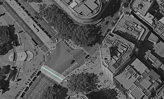
Location of crosswalks in the selected intersection.
At street level, we also identify what is directly related to our static and dynamic issues. An infrequently used taxi stand and motorcycle parking, as well as unused phone boxes, hinder visibility from outside the Plaza. The confusing lack of direction at the end of Portal l’Angel as a pedestrian leads to congestion at the corners.

Our analysis of these issues leads us to see opportunity for an intervention that will make this corner of the Plaza more efficient.
FOUR-TIERED INTERVENTION
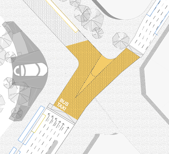
Our intervention consists of four tiers; the first is elevating the intersection and crossings so pedestrians can easily reach the square. The second is to remove the unused taxi and motorcycle parking to improve visibility. The third is to design and colour pedestrian paths to nudge people into the square to utilise the diagonal crossing. The fourth is to extend the elevation along the connecting street and create a shared surface to encourage foot traffic and horizontal crossing, while still maintaining the necessary Airport shuttle and taxi stands.
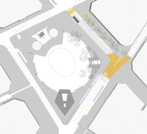
Masterplan proposal of Plaza Catalunya.
Masterplan proposal of selected intersection.
We keep two lanes on the side of El Corte Ingles and move the Airport shuttle stand up the street and the taxi stand behind it, so travellers coming to and from the Plaza still have this easy connection. The rest of the lanes now are pedestrian friendly, with visual barriers removed. The masterplan also integrates the use of the ‘Panot’ tiles of Barcelona, which hold cultural and historical significance. By taking pieces of the tiles as inspiration, we create a new pattern to represent a new space in the city. These tiles are placed strategically to nudge pedestrians across the new raised crossing, and across the shared surface.

Our proposal leaves room for further development into the use of Plaza Catalunya as a diagonal crossing to further ease the congestion of the four corners.
‘Elevating’ Plaza Catalunya is a project of IaaC, Institute for Advanced Architecture of Catalonia developed at Master in City and Technology, in 2021/2022 by:
Students: Karim Abillama, Maria Augusta Kroetz, Julia McGee, Weronika Sojka, Lucas Zarzoso Hueck.
Faculty: Federico Marcantognini, Francesca Arcuri