This thesis project proposes an urban model solution to ease road traffic gridlocks and bottleneck junctions, by using an on-demand drone-etaxis with the aim of integrating the mobility network in a 3D urban grid. Drone-etaxis are autonomous, electrical, affordable, environmentally friendly, offering flexible routes, and offer time saving solutions for transporting people from point A to point B in a matter of minutes.
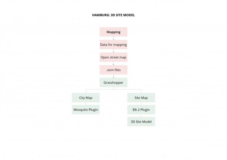
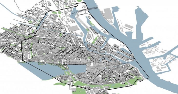
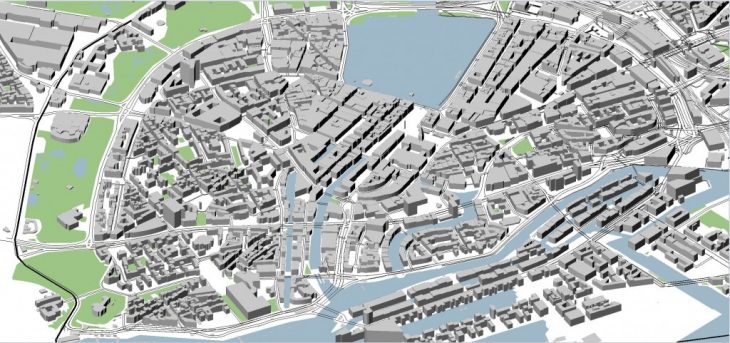
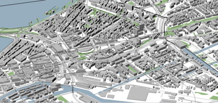
Therefore it is important to produce the complete 3D model of the site, the area of the site is 9.5 sq.km and it is approx. 4×2 km. thus the chosen method was to do it through elk2 plugin the detailed mapping is obtained by open street maps, in the .osm file format. This file is then inserted into grasshopper to get the data of the site.
Computational Design Workshop
Tutors: Rodrigo Aguirre
Student: Sayali Avhad