[ECHO]nnecting WALTHAMSTOW | Habitat defragmentation
During the Internet of Cities Studio, the main interest focused on drive-in nature; so we aimed to tackle the problem of fragmentation as a principal challenge facing biodiversity in greater London. In the light of considering London a car-free city, the main objective is to give all species what was unrightfully taken from it, “their home”. To reverse the habitat loss phenomenon, transforming the road network into ecological corridors shows a great opportunity in connecting the fragments in the Waltham Forest borough.
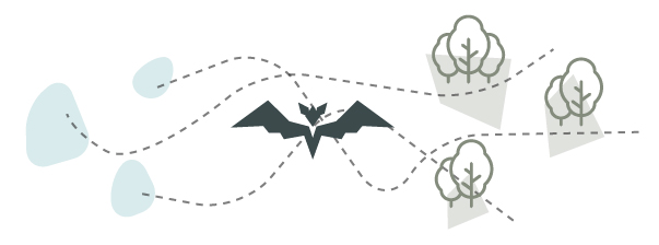
We adopted the mutualistic symbiosis relationship, which guided us to consider Bats more than bio indicators. They were chosen as activators of this connectivity, seeing their remarkable commuting pattern from roosting to foraging habitats, from water features to dense forests’ tree canopies.
OBJECTIVE
[ECHO]nnect WALTHAMSTOW project studies and visualizes humans and bats movements along the Walthamstow Wetlands area. This ecological connectivity will result from both the shortest and greenest paths. It potentially links three key wetlands locations to each forest fragment in proximity – consequently redefining the once-thriving ecological corridor.METHODOLOGY | PSEUDOCODE
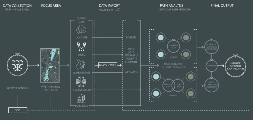
Visual description of the analytical process from data collection to ultimately identified scenario.
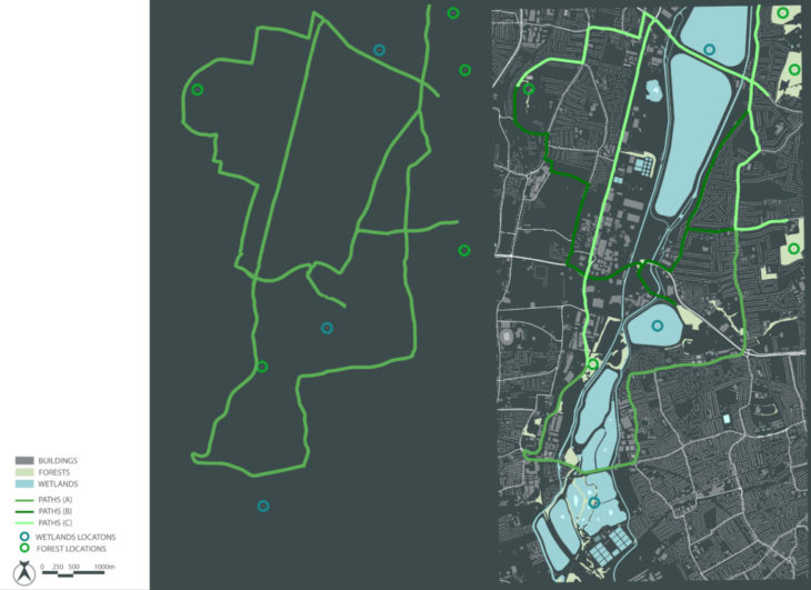
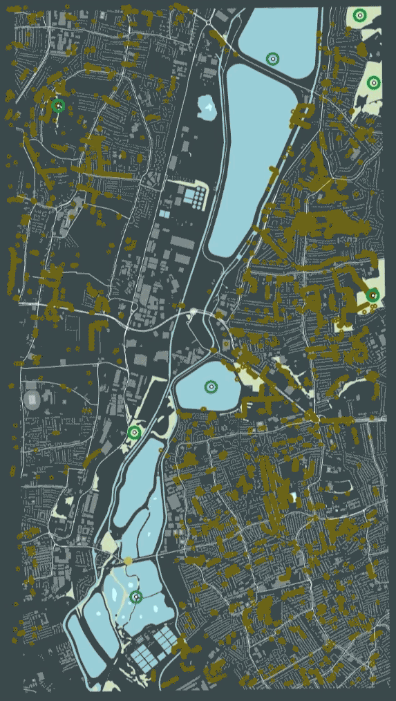
AREA OF STUDY
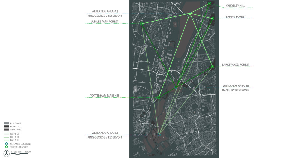
Let us scale down our study to the A406 highway area, cutting through the Epping forest that was once expanded by the lea river. We categorized the forest fragments to adequately link them between each other , and with the nearest water bodies in that area.
ANALYSIS I – SHORTEST PATHS
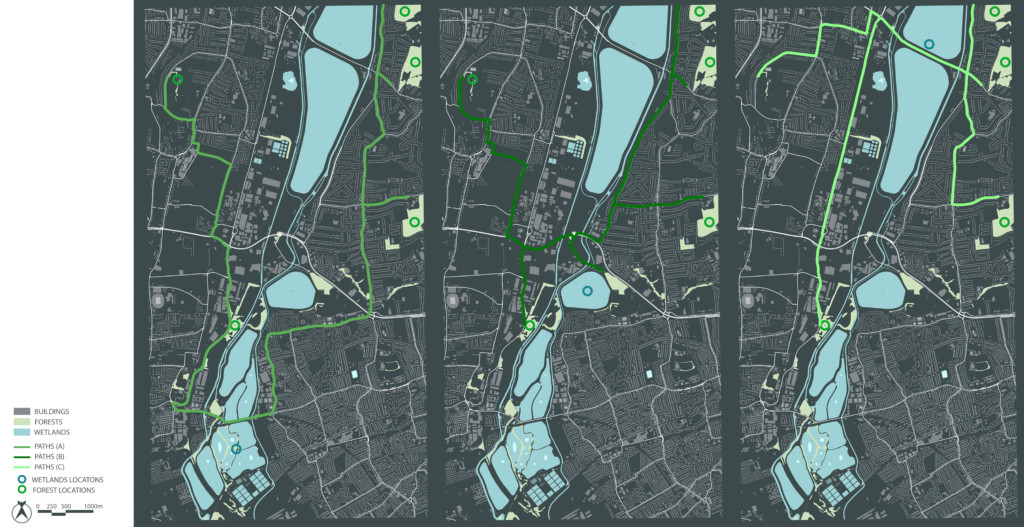
The first output identifies the shortest paths generated using the grasshopper component, following the road infrastructure network, based on OSM.
In addition to that, we thought it would be better to merge an important component with the designated paths: roads with bats favorite trees alignments.
ANALYSIS II – GREENEST PATHS
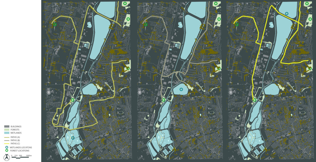
The second output focuses on generating the shortest paths using as a network the roads from OSM merged with the Trees layer from Urban Atlas. The aim is to enhance the bats commuting routes.
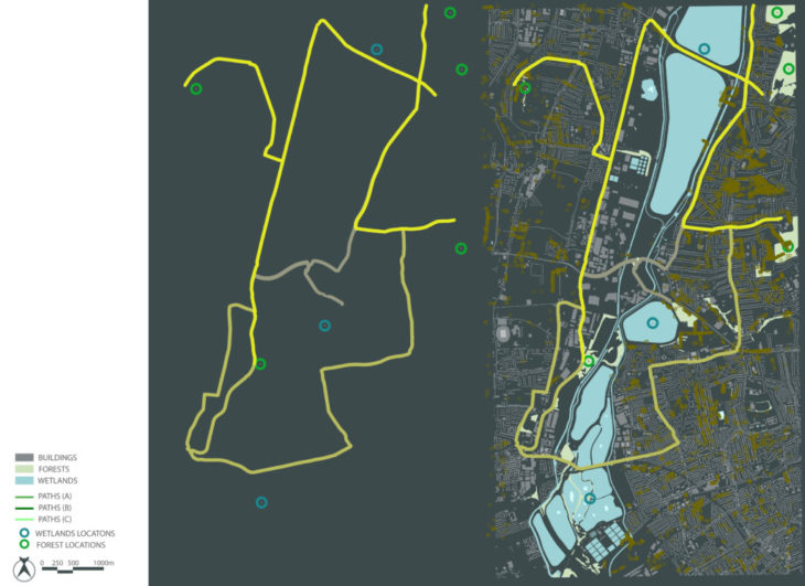
SYNTHESIS
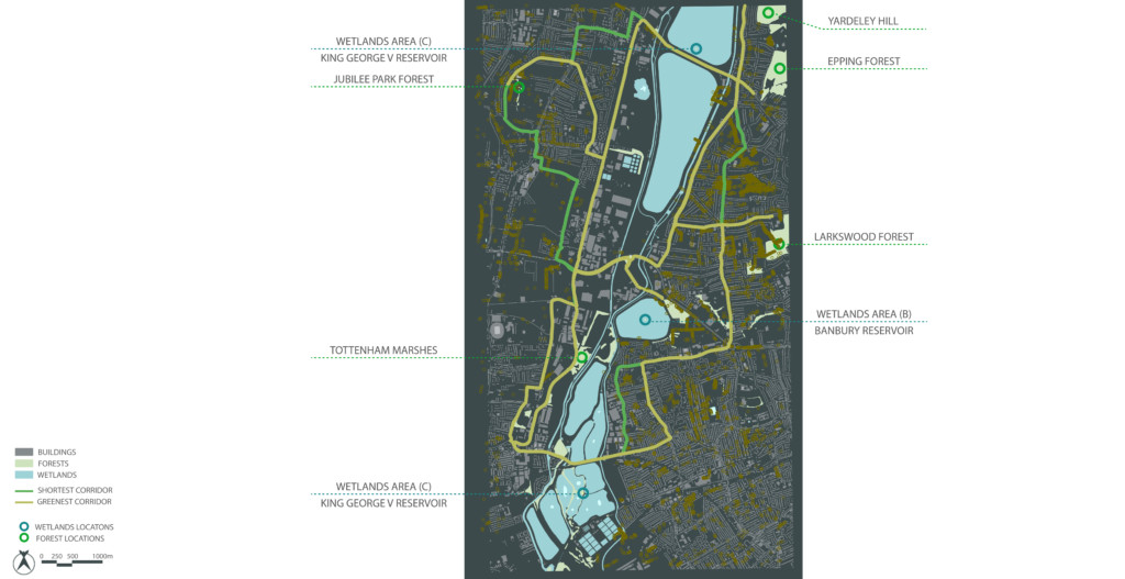
The connectivity analysis helps understand the ecological corridor as a transitional space where all species, including humans, interact, coexist and survive together. The shortest and greenest paths overlap mostly but also present unique individual routes. This study helps identify and implement adequate types of trees for every segment. It ensures connectivity optimization either to ease and support bats commute routes or create green enjoyable walkable spaces.
Data Source: Open Street Map & Urban Atlas
[ECHO]nnecting Walthamstow | Habitat defragmentation is a project of IaaC, Institute for Advanced Architecture of Catalonia
developed at Master in City & Technology in (2021/2022) by:
Student: Joseph Bou Saleh
Faculty: Eugenio Bettucchi and Iacopo Neri