‘DRIVE IN NATURE’
In a world without cars, we are left with empty infrastructure. We ask ourselves the question, what problems did this infrastructure cause, and how was it harming the ecology of the city?
INITIAL ANALYSIS
We began to research fragmentation. Fragmentation is defined by natural areas that are divided by manmade infrastructures, such as roads or buildings. We mapped the fragmentation in London and overlapped the natural forest areas to see how natural environments have been affected. We found that a vast majority of forests are in the highly fragmented category. This gave us the idea to drive back nature by connecting these fragmented areas.
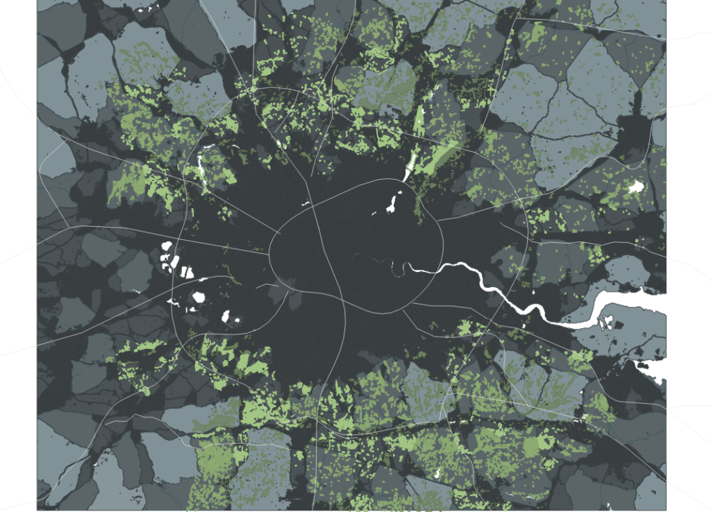
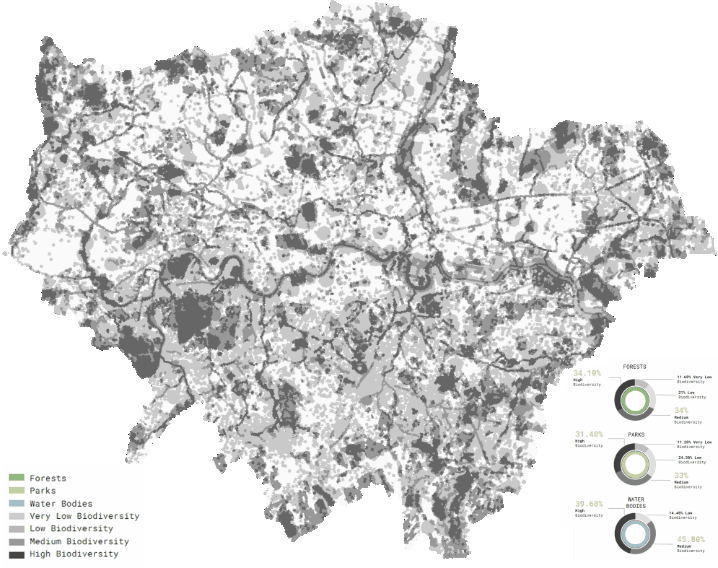
We began to research indicators of fragmentation, which led us to examine biodiversity in London. Taking three main ecological entities, forests, parks, and waterbodies, we found that a vast majority of these entities in London were in areas classified as medium or highly biodiverse. Thus, we use biodiversity as an indicator of how we will tackle the issue of fragmentation.
ECOSYSTEM SERVICE AGENTS
The next step was to select an activator of biodiversity in order to create these. This led us to research bats as ecosystem service agents. Without bats, an ecosystem would collapse, as bats act as fertilizers, pollinators, and pest control. Bats as an activator make sense in London because of the conservation efforts in play there, namely the Bat Action Plan, as bats are considered a ‘celebrity species’ and are protected by law. Many municipal organizations and communities are stakeholders in bats as a species. We further research bat roosting + foraging habitats to indicate what specific measures need to be included in the intervention.
LAND ANALYSIS
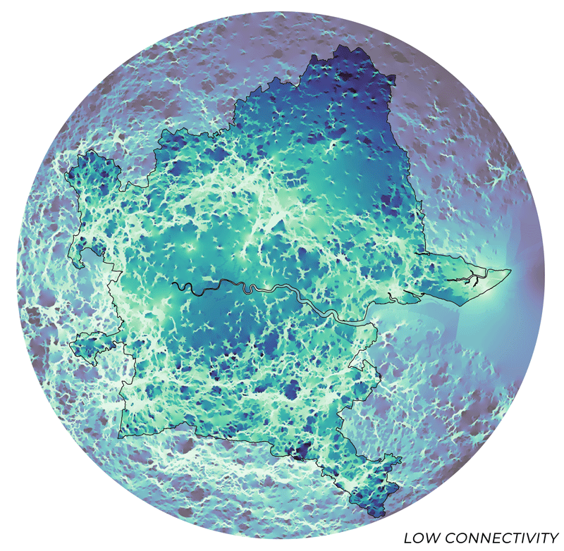
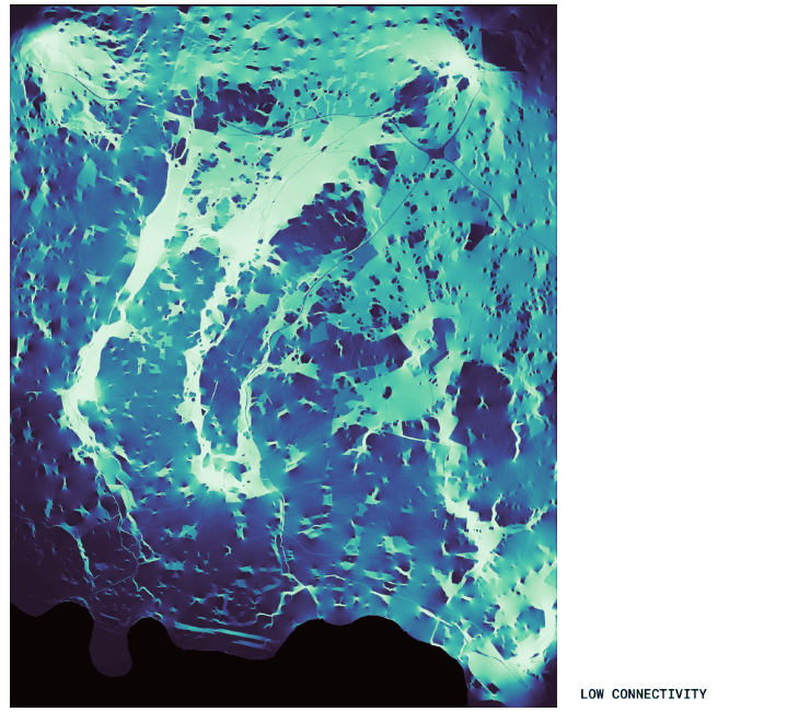
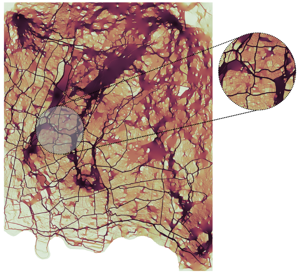
Landscape connectivity simulation of Greater London and surrounding areas; we identify high potential connectivity in the Epping Forest area.
This led us to our land analysis. In order to identify the area of our intervention, we run a landscape connectivity simulation, between water bodies, forests and urban parks, in the Metropolitan area of London. The results showed the area of Epping Forest. We identified the different types of land that exist in the area. We found that all of the entities that we researched in relation to biodiversity are present – forests, parks, and waterbodies. By further analysis of the types of fragmentation settings affecting this area, we identified 6 main categories, ranging from natural areas getting crucially minimized by urban settlements, to totally disconnected by road infrastructure. These investigated types led us to understand what sort of intervention is needed to directly combat each issue.
We also looked into the community characteristics of the area – we used a measure of consumer vulnerability, which takes into consideration a person’s employment, age, and income, among other factors, and details how vulnerable a person living in that area is. On one side of the Epping Forest Area is a wealthier area and on the other side IS a lower-income neighbourhood. These are connected by a portion of the A406, which is the Northern part of one of the ring roads around the city.
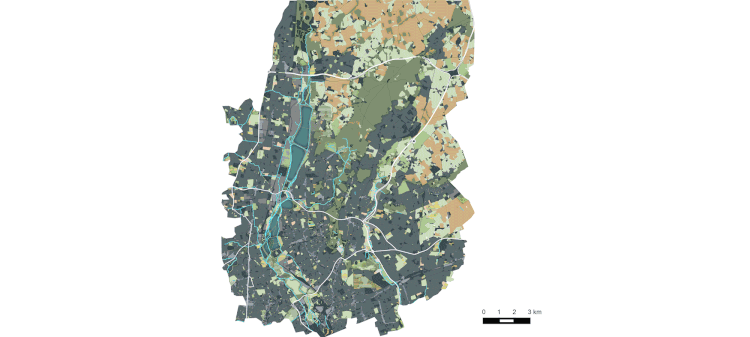
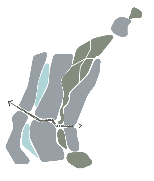
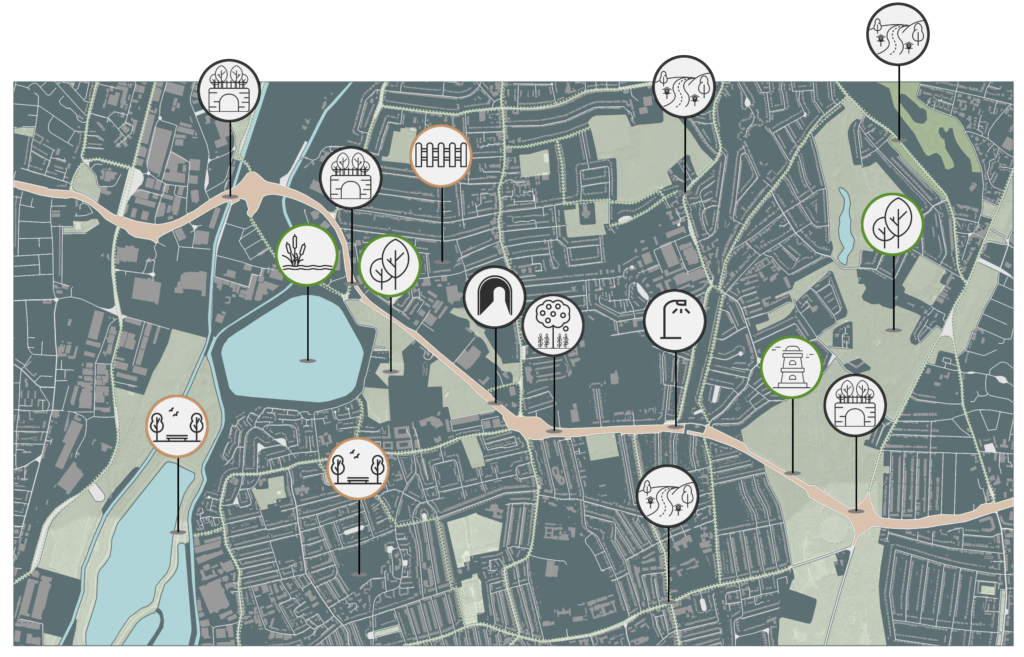
Landscape connectivity simulation on the micro-scale of the Epping Forest area.
After understanding the land uses, fragmentation types, and community analysis, we ran a simulation in regards to the connectivity again at this micro scale to identify potential ecological corridors in this area. By identifying these possible corridors we found the areas with the highest potential and approached these as potential intervention zones.
PROPOSAL
We started our proposal by dividing our time frame into three phases. In the first phase, we introduce the first set of interventions, to create the core. In the second, building on this, we enhance the core with more diverse intervention in diversified networked areas, and in the final phase is when we expand into the macro scale.
CATALOGUE OF INTERVENTIONS
We adopted the concept of setting a system for the catalogue of interventions. These are created based on the analysis of bats as ecosystem service agents in London and the analysis of the Epping Forest area. There are three different types of intervention, some for urban settlements, some for repurposing current infrastructure, and some for the natural areas. These all serve the purpose of encouraging bats as agents in the area leading consequently to enhancing biodiversity and helping combat fragmentation.
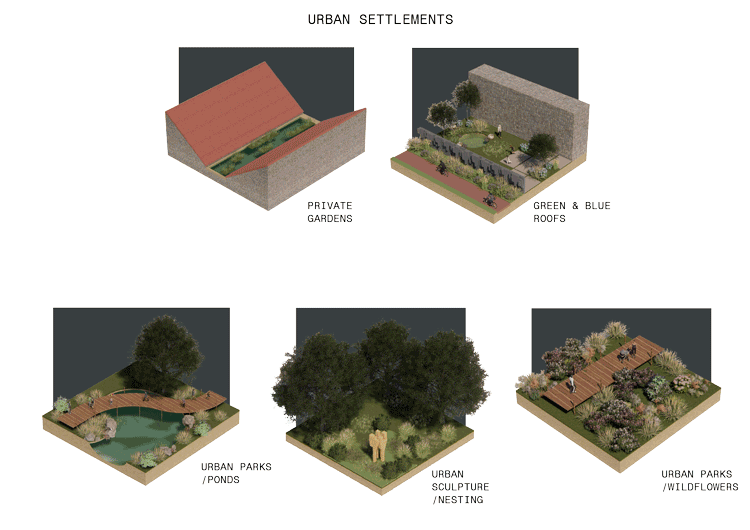
Catalogue of Interventions
APPLICATION
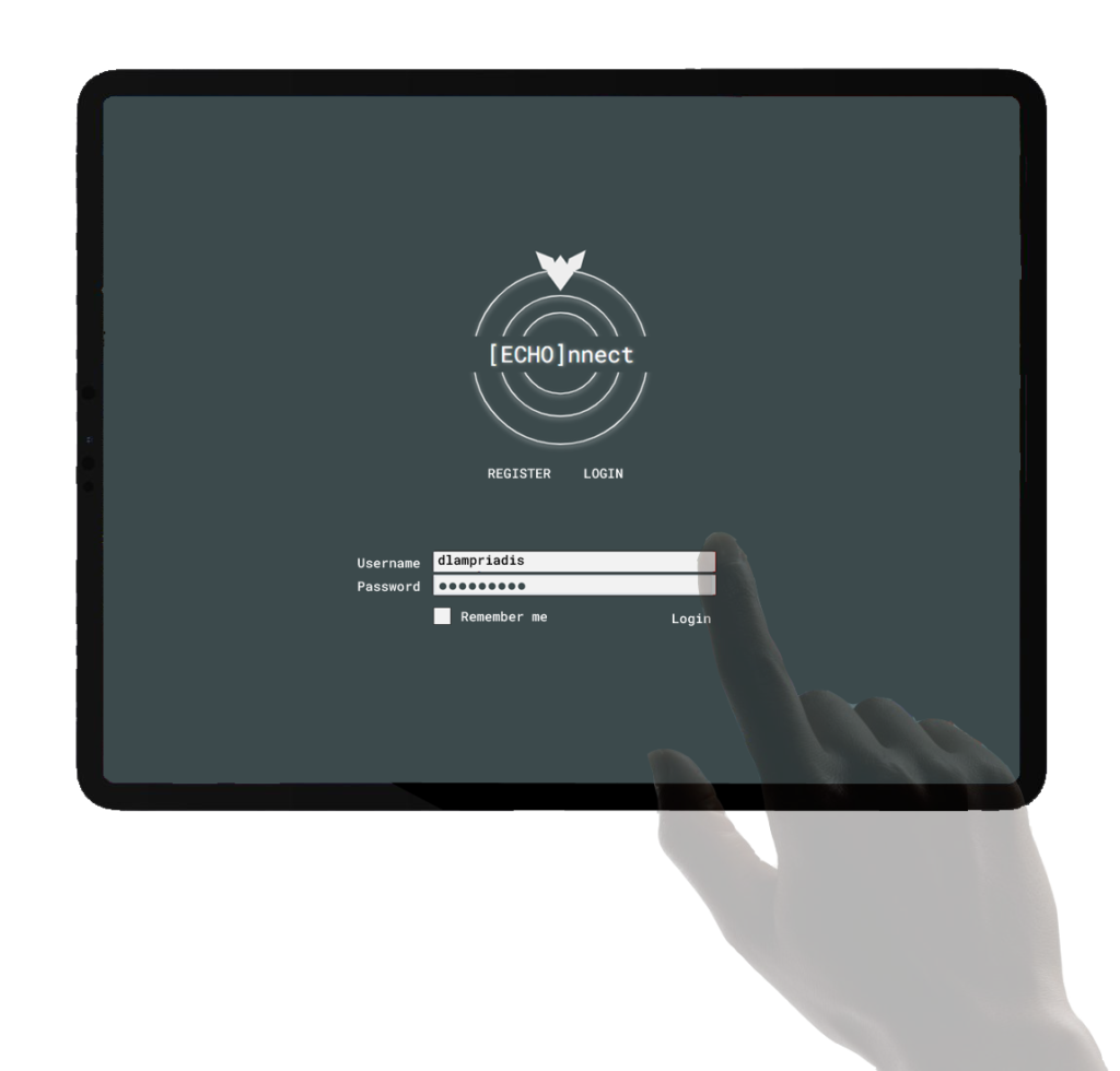
An important part of our proposed intervention is an application for the communities in the area to use. Part of the Application is an immersive AR game. The user will be able to set their location and identify potential intervention areas happening within a walkable distance; they can go to the location solo or in groups and use the catalogue presented earlier, to see the intervention most suitable to that area. They can gain ‘points’ by restoring part of the ecological corridor.

IMPLEMENTATION
Based on our timeframe, we researched how these tools and interventions will be adopted in the Epping Forest area?
We ran a final connectivity simulation just in this area and identified the A406 as the biggest potential connector between lands without current use, urban parks, forests and the wetlands areas to act as an ecological corridor. Thus, we focus our intervention along this road.
Landscape connectivity simulation – leads to identify the A406 trunk road as a potential ecological corridor.
Analysing the area and identifying spots based on the current land use and community there, we found places that different items from our catalogue of interventions could go. Beyond just the catalogue, since the A406 also serves as a connection route between the lower and higher-income communities, we identified potential employment opportunities related to the interventions. Here we can see the direct benefits to the community, both from the enhanced ecological connectivity, the bats as a celebrity species for the community to interact with while they are promoting biodiversity, and the economical benefits of the bats and the interventions proposed.
Proposed interventions
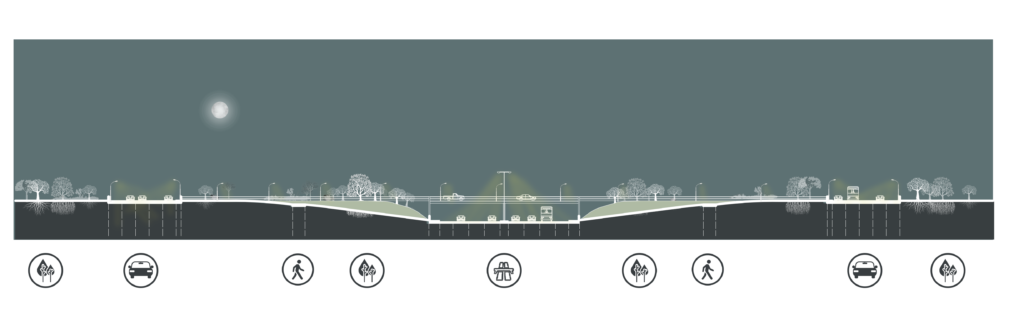
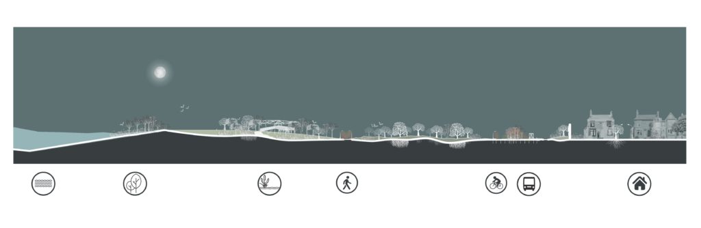
Section AA – Before
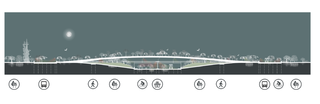
Section AA – After
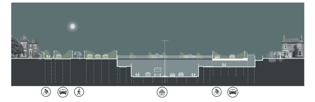
Section BB – Before
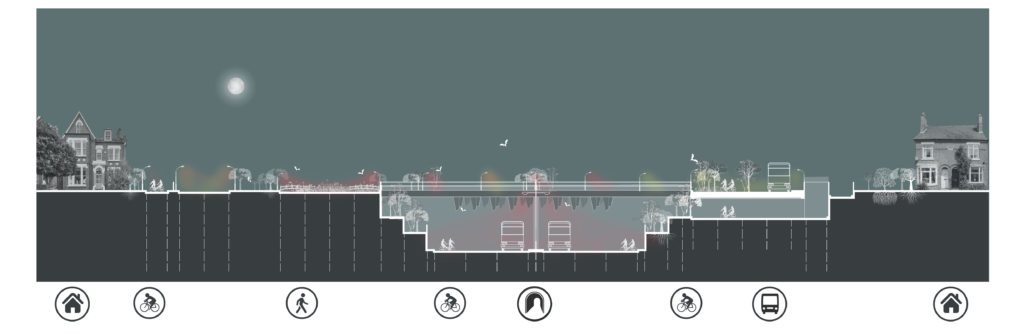
Section BB – After
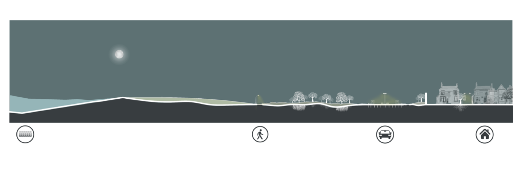
Section CC – Before
Section CC – After
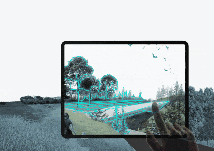
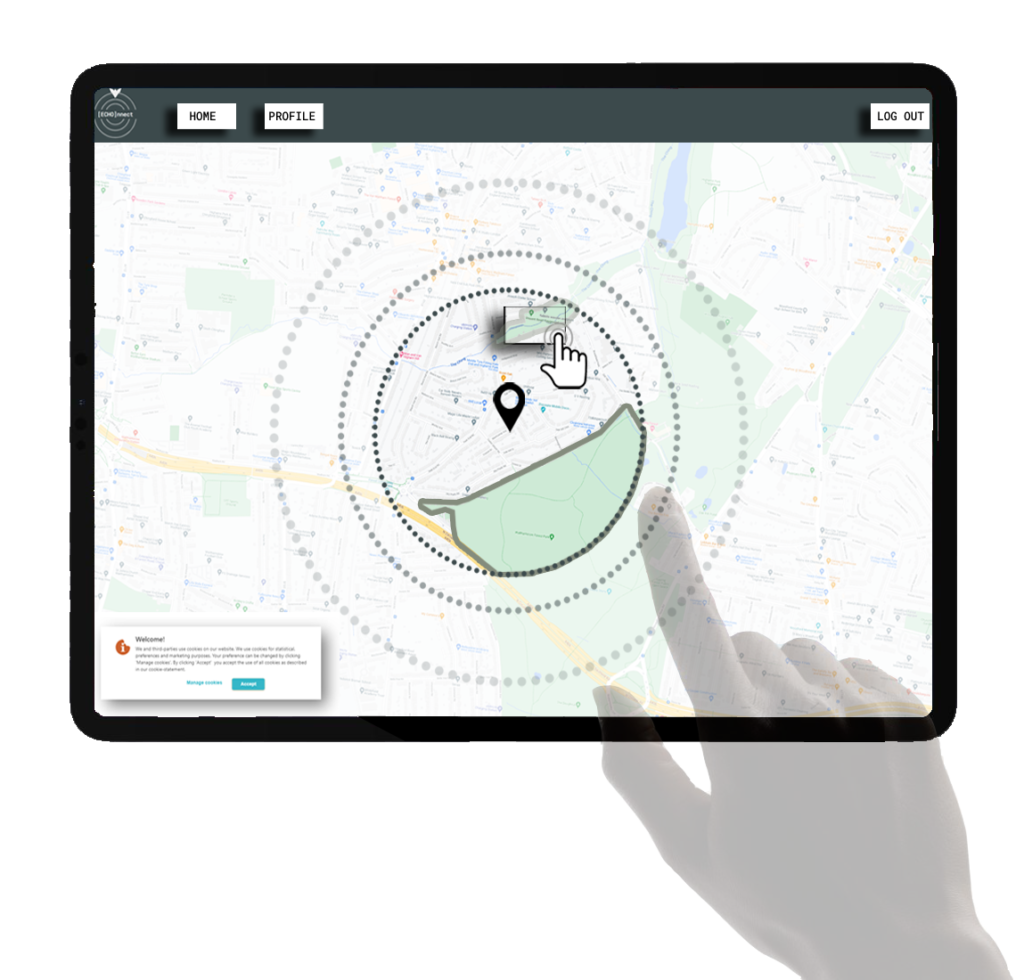
Artistic impression of the application’s graphical interface.
[ECHO]NNECT is a project of IaaC, Institute for Advanced Architecture of Catalonia developed at Master in City and Technology, in 2021/2022 by Students: Dimitrios Lampriadis, Joseph Bou Saleh, Julia McGee, Kriti Nirmal and Faculty: Mathilde Marengo, Eduardo Rico, Iacopo Neri