Abstract
This project is developed to support the Internet of Cities Studio, where our group takes the challenge to increase habitat connectivity around cities in Luxembourg. Therefore, the existing accessibility and awareness to urban green spaces are of specific analysis focus.
Taking a town with potential riparian habitat corridor in Luxembourg (fig.1), the project explores how different means of travel affect the cognitive accessibility of urban green spaces.
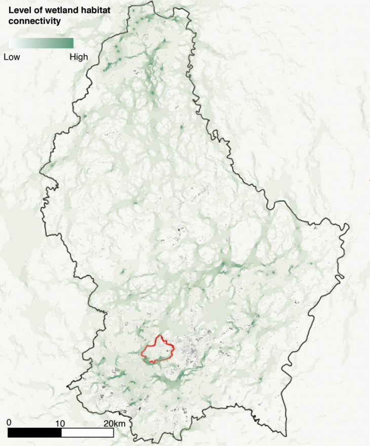
Wetland connectivity map in Luxembourg and location of Bertrange
Methodology
Pedestrian road network and land use data is obtained and cleaned from osm data of Bertrange, Luxembourg.
The project applies distance decay function provided by DecodingSpaces Toolbox as a main tool to present the change of interest with different speed of travel. The parameter is based on an empirical finding that “Beta = 0.00217 simulates pedestrian movement” by Handy and Niemeier (1997).
Output
The changing parameter starts from Beta=0.0000 (interest from car drivers) to Beta = 0.0021 ( interest from pedestrians) with the graph visualising the decreasing interest within 500m.
It is discovered that with the speed decreasing, more and more awareness is directed to deeper paths. In terms of pedestrian experience, a slower walking speed would create more “green encounters”.
Decoding cognitive awareness to urban green spaces is a project of IAAC, Institute of Advanced Architecture of Catalonia developed at Master in City and Technology in 2020/21 by student: Dongxuan Zhu and faculty: Eugenio Bettucchi and Iacopo Neri