OVERVIEW
This project aims to find an imaginary space where the borders between two neighbouring countries influence the urban planning of specific cities. As a case study, we take the border between the United States and Mexico, specifically that of the city of Tijuana. Thus creating the Nueva Tijuana, an imaginary city with connections that are born from the nodes that converge through the border union of San Diego and Tijuana.
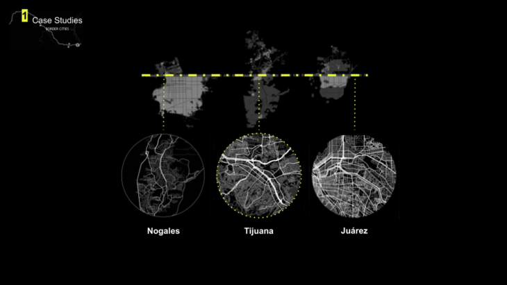
CASE STUDY
We took three case studies, Nogales – Tijuana – Juárez, focusing on Tijuana as a zone of intervention.
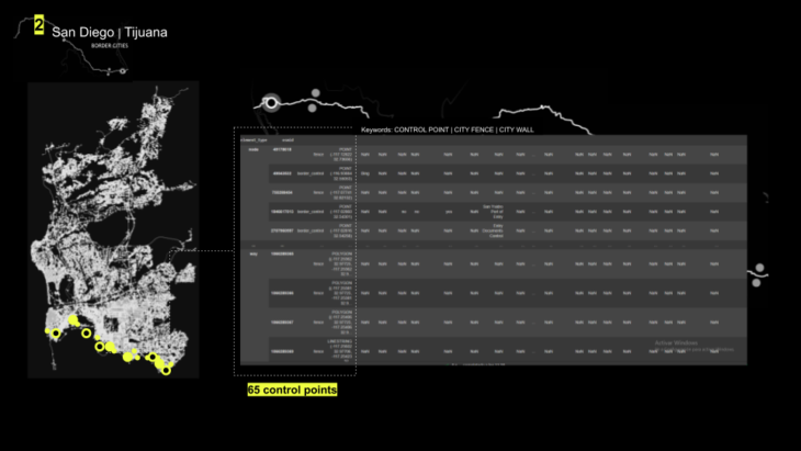
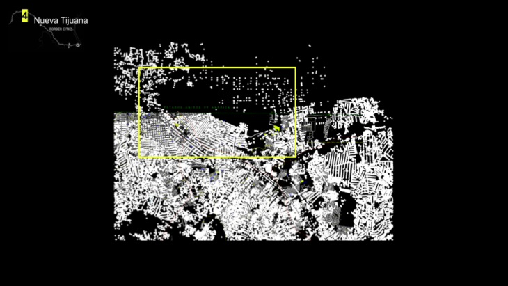
We analysed both San Diego-Tijuana control points and coordinates to geolocate them
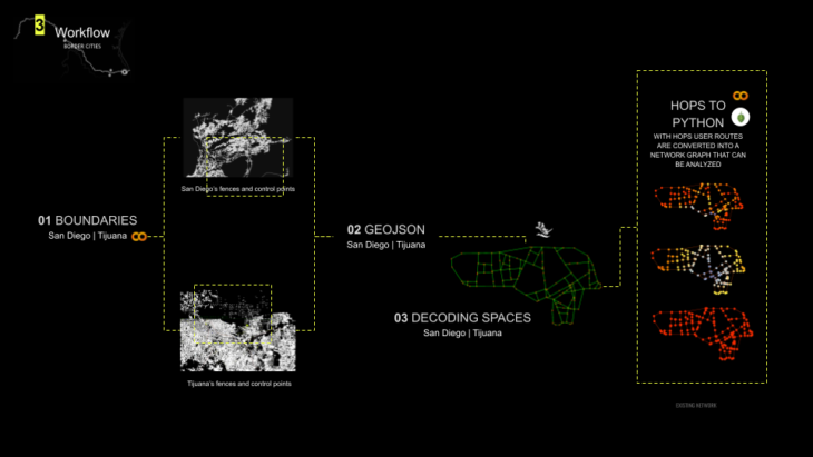
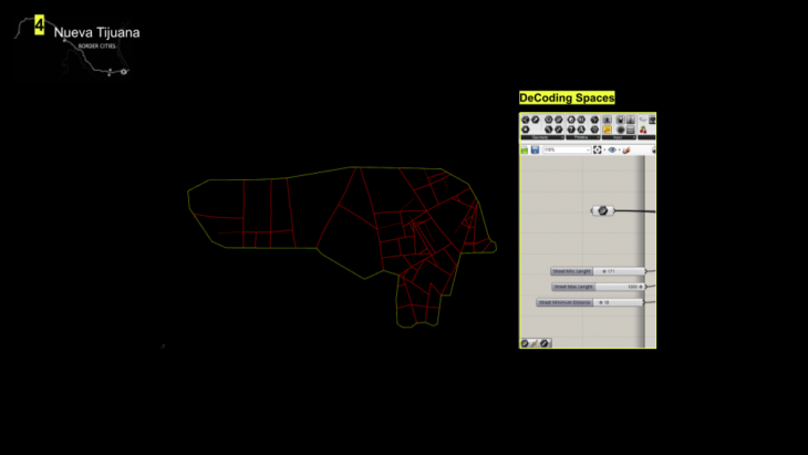
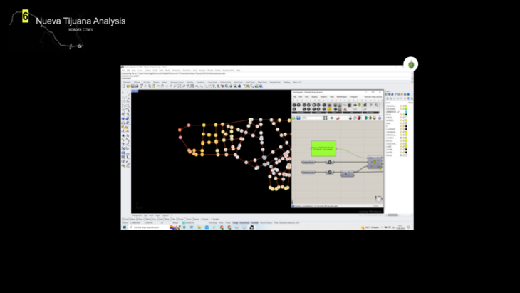
Our workflow considers first, control points and border boundaries to then create a geojson file with both data. Second, we passed this information to Rhino-Grasshopper to the decoding spaces plug-in. Finally converge this data using hops to create a network graph.
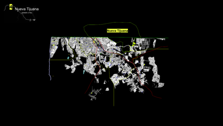
We selected a portion of both cities to propose a city in between
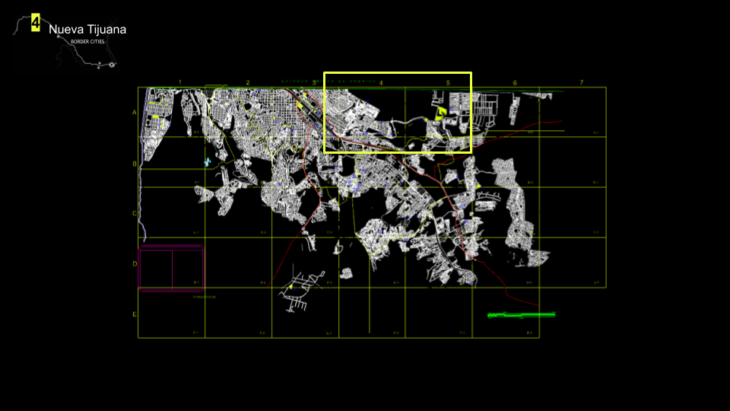
This we called Nueva Tijuana, which connects San Diego and Tijuana street network, utilising Tijuanas informal tissue to be connected with additional public services.
Both street networks create a new composition
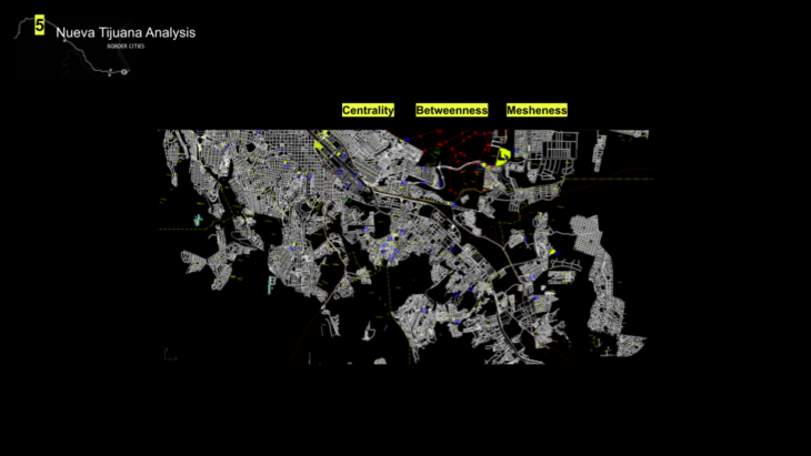
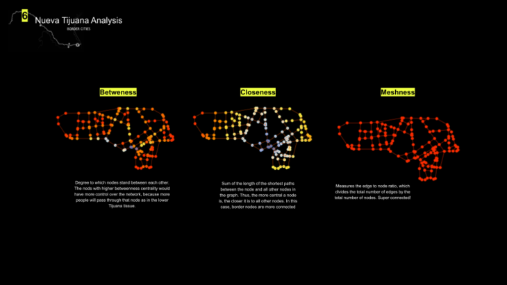
We use hops to test the centrality, betweenness and meshness of the new proposal
The Nueva Tijuana Analysis, was done with five different options of connectivity, selecting the most suitable one for the new city implementation, breaking the nodes of US border and creating new paths that connect both cities.
CREDITS
Crossing the Border is a project of IAAC, Institute for Advanced Architecture of Catalonia developed at Masters in Advanced Computation and Design (MaCAD) in 2021/2022 by students: Irene Martin // Pablo Jaramillo and faculty: David Leon // Dai Kandil