Agricultural holdings have to adapt to the changing meteorological conditions and the varying situation of the markets for agricultural products.
Introduction
Being crop output the one major of the agricultural industry at basic prices this project combines a map with the different agricultural uses in order to identify the types of crops in the territory and next to it is synthesized a database about Output of the agricultural industry at basic prices comparing the products among them over the years.
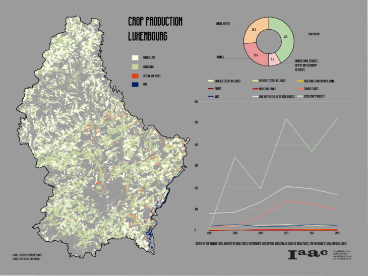
Also the map as a territorial resource shows the proportion between income and spatial location which shows a repetitive pattern throughout the country with the opportunity to diversify for the benefit of producers the continuity of their practices and in balance with the environment.
Crop Production Luxembourg is a project of IAAC, Institute for Advanced Architecture of Catalonia developed at Master in City & Technology in 2020/21
By student: Miguel Tinoco
Faculty: Diego Pajarito.