ABSTRACT
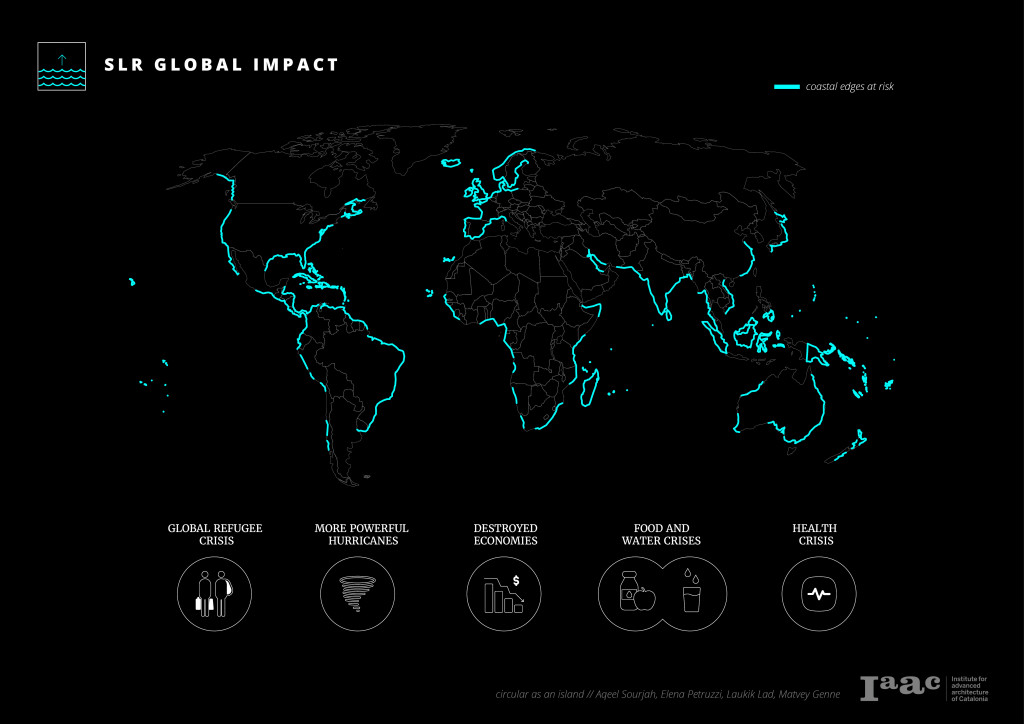
According to the UN, around 40% of the world’s population is threatened by the rise of sea level and other climatic conditions associated with it. Circular as an Island is a two-part computational system of monitoring and adapting contexts affected by sea-level rise. The case study of the Funafuti island (capital of the Tuvalu atoll) is used to develop the framework for resource monitoring, evaluation, and adaptation. The atoll faces severe sea-level rise impacts within the next 100 years. Furthermore, there is causation to other environmental issues such as coastal erosion, salinization of soil, and flooding.
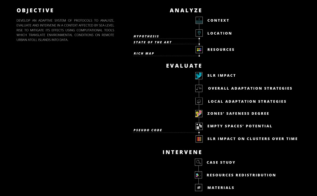
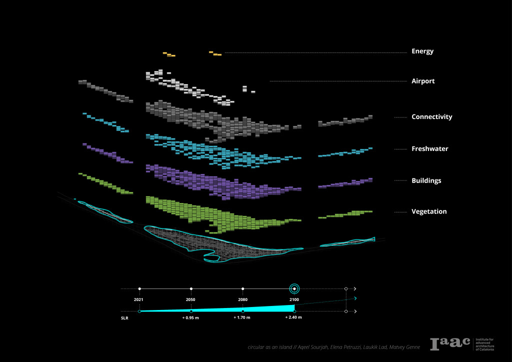
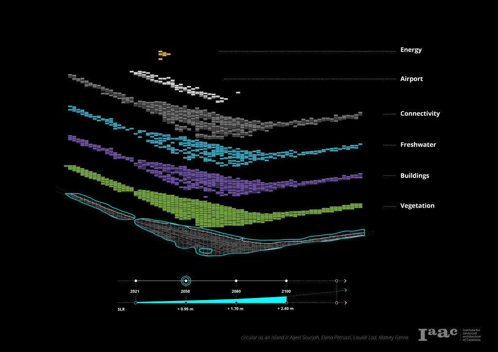
Primarily, the research looks at the identification and localization of vital resources for the survival of the island. This is followed by analyzing the risk level of depletion of the identified resources. The constantly changing environmental conditions make dynamic adaptation a key feature of the project. Advanced computational tools such as NDVI, Semantic Segmentation Machine Learning, and Elk help cater to the reiterative nature of the analysis, bringing in a dynamic approach to visualize changes in the environment in real-time. The resources on the island are categorized into six main parts: vegetation/agriculture, buildings and building materials, energy, connectivity, and water supply.
Secondly, the project uses the data compiled during the continuous analysis stage to develop protocols for the island. The aim is to propose informed development strategies based on incremental design scenarios to mitigate the effects of sea-level rise and maximize the welfare of the island’s inhabitants.
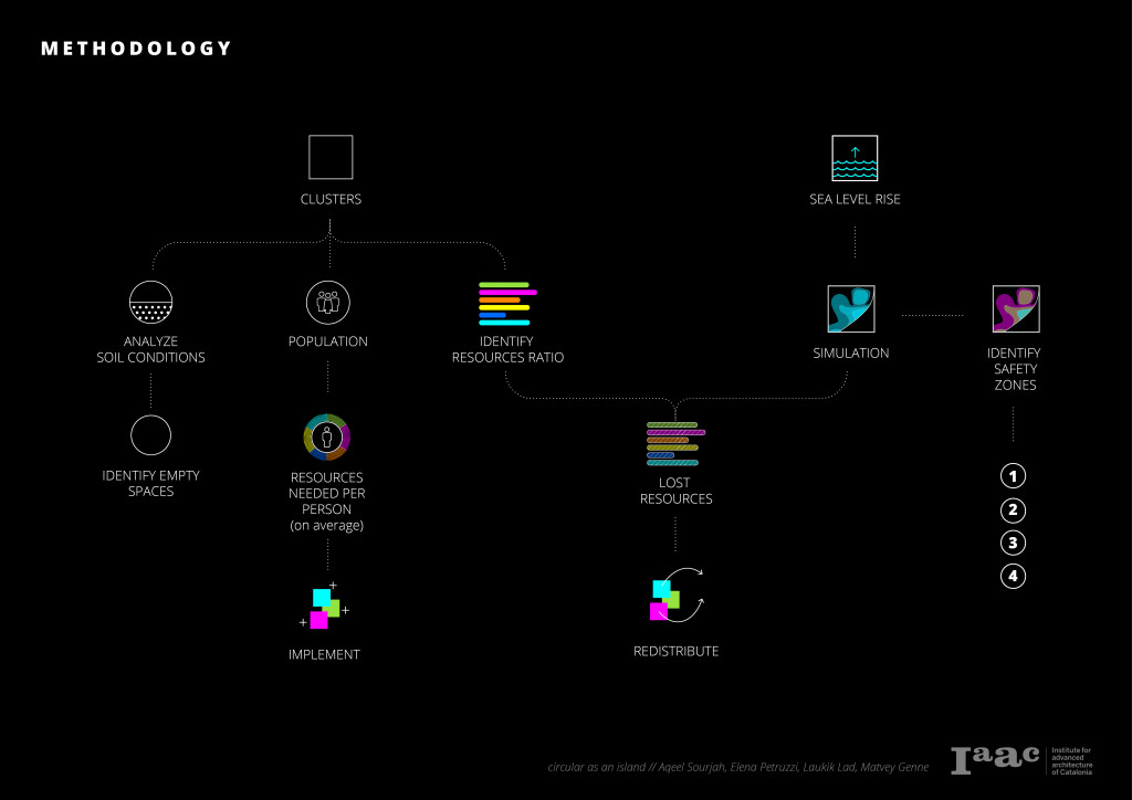
An algorithm is developed first to discretize the island into clusters, classify the resources into these clusters, and finally identify how vulnerable each cluster is to sea-level rise. The vulnerability is assessed by considering areas that would be affected by sea-level rise according to a projected timeline.
Finally, the project aims to provide protocols for improving the welfare of the inhabitants while mitigating the effects of sea-level rise. The proposed protocols are classified into four categories: Adapt, Retreat, Protect and Preserve. According to the analysis of data received from the algorithm and the external contextual forces, the developed strategy would specify the appropriate protocols that are to be implemented. As part of catering to maximize welfare conditions of the inhabitants in the future amidst sea level rise, the project also looks into ideal living conditions to use as a benchmark for the project.
CONTEXT
Sea level rise is caused primarily by two factors related to global warming: the added water from melting ice sheets and glaciers and the expansion of seawater as it warms. As humans continue to pour greenhouse gases into the atmosphere, oceans have tempered the effect. The world’s seas have absorbed more than 90 percent of the heat from these gases, but it is taking a toll on our oceans. Experts predict a rise of around 2.4m by the year 2100, affecting different countries around the world on different scales.
According to the UN, around 40% of the world’s population is threatened by the rise of sea level and other climatic conditions associated with it. Sea level rise would cause a widespread global refugee crisis worldwide while also causing more hurricanes to destroy livelihoods and economies and cause widespread water, food, and health crises.
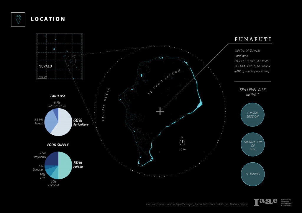
LOCATION
Tuvalu is a group of 9 urban atoll islands with around 12000 people located in the pacific ocean. Tuvalu could be one of the first nations to be significantly impacted by rising sea levels due to global climate change. These islands already face the full force of the sea during high tide, where constant flooding and soil salinization added to the already limited resources make a living on the island difficult. Funafuti island (capital of the Tuvalu atoll) is used to develop the framework for resource monitoring, evaluation, and adaptation.
RESEARCH QUESTION
How can computational tools help us translate environmental conditions on remote urban atoll islands into data and make informed decisions to develop adaptive strategies to mitigate effects of the rising sea level in the long term?
METHODOLOGY
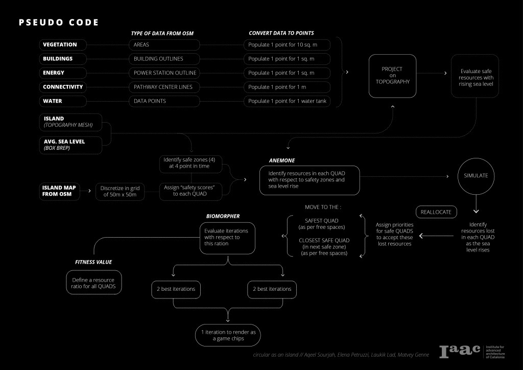
The project first identifies resources that are important for the continuous habitation of the island. These resources are categorized into six main parts; Vegetation, Fresh Water Sources, Connectivity, Energy, Built Area, and Building Materials. After which, the following tools are used to analyze these resources to convert the physical environment into data points: Rhinoceros 7, Grasshopper, Semantic Segmentation Machine Learning, NERO, ELK, Open Street Maps, Google Earth and Government Publications.


CATEGORIES
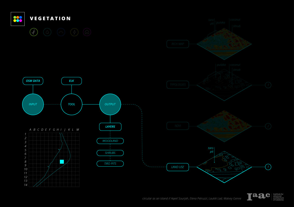
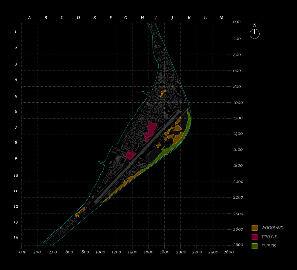
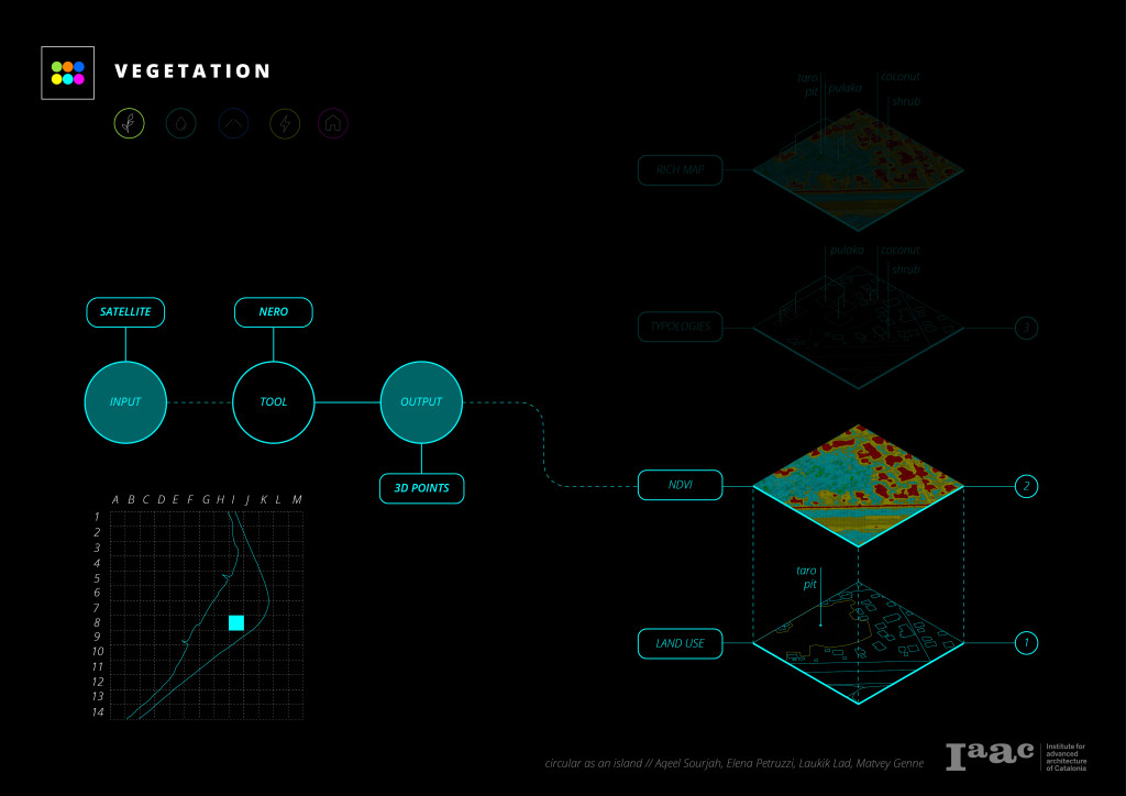
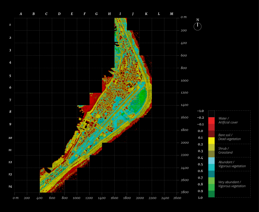
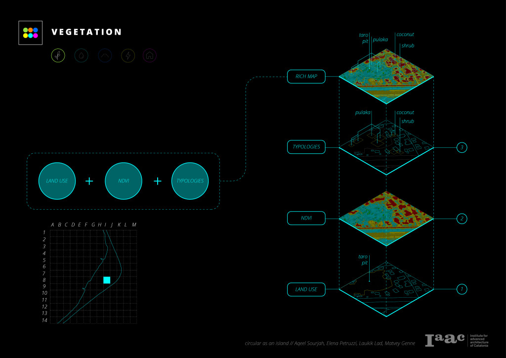
VEGETATION
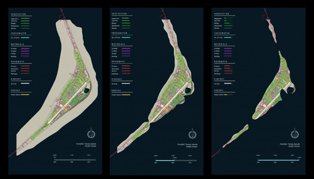
Vegetation is an essential resource that helps determine the suitability for life to live in a particular context. The Data on vegetation was collected first through the use of open street map data which was run through the elk plugin in grasshopper to get an output of the land use of the island. After which google earth satellite images were processed through Nero, which uses NDVI (Normalized Differential Vegetation Index) to output the quality of the vegetation. Semantic segmentation machine learning algorithms were then trained and used to identify and understand the type of available vegetation. All the data collected was then uploaded onto a rich map as superimposed layers.

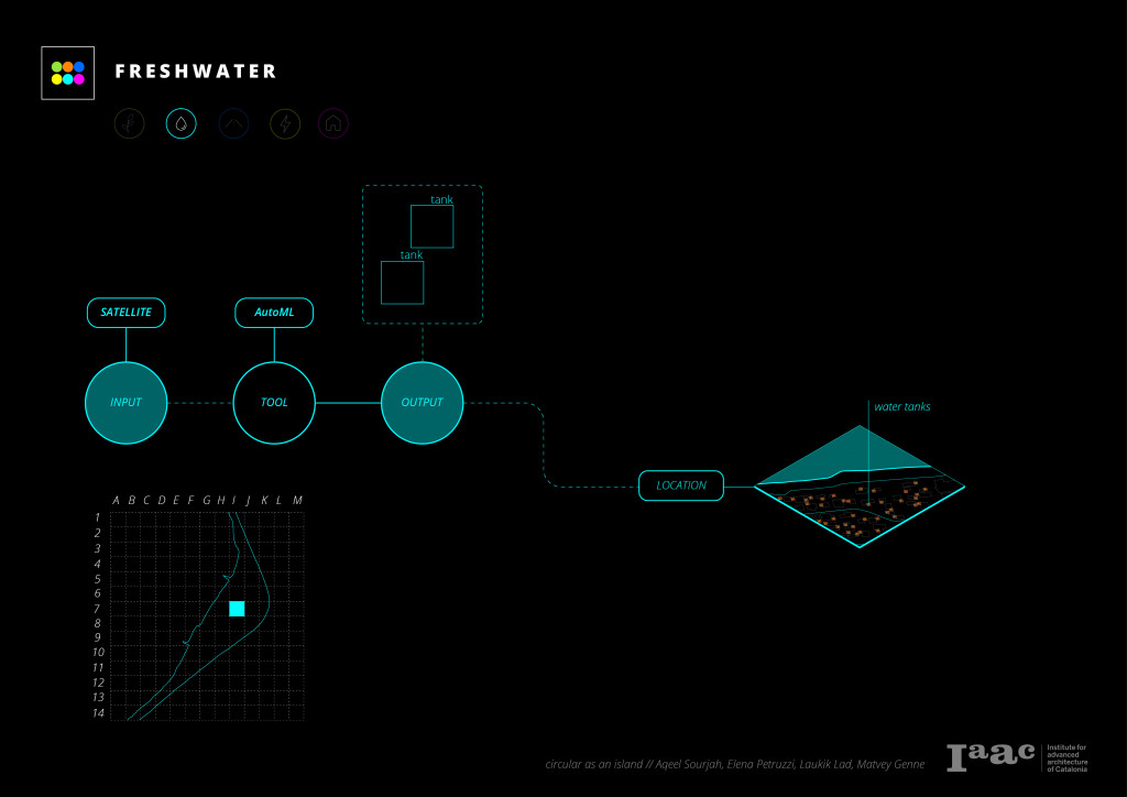
FRESH WATER
Freshwater is an essential resource for human life to exist in a context. Freshwater is usually supplied through rivers, lakes, and the collection of rainwater. In this case study, we identified that freshwater was primarily supplied by collecting the rainwater into private collection tanks in every household. The project uses Auto ML, a machine learning algorithm provided by Google, to identify these tanks using satellite images to identify the quantity of the tanks to understand the amount of water consumed. The shape of the tank is used primarily to train the machine learning algorithm to make this identification.
CONNECTIVITY
The project uses open street map data processed through the grasshopper component ELK to map out connectivity throughout the island.
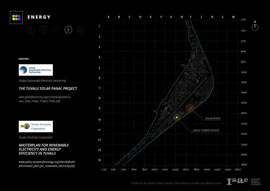
ENERGY
Energy is usually supplied to a context via a centralized delivery system. However, sometimes this delivery system can be localized to each household. The energy provided to a context also heavily relies on how it is produced. The most common ways in which energy is produced are through fossil fuel generators and renewable energy sources. The project takes on a more analog approach by referring to official documents that government agencies publish to identify the energy consumption and map out the source of energy, which are then manually updated onto the rich map.
BUILDINGS
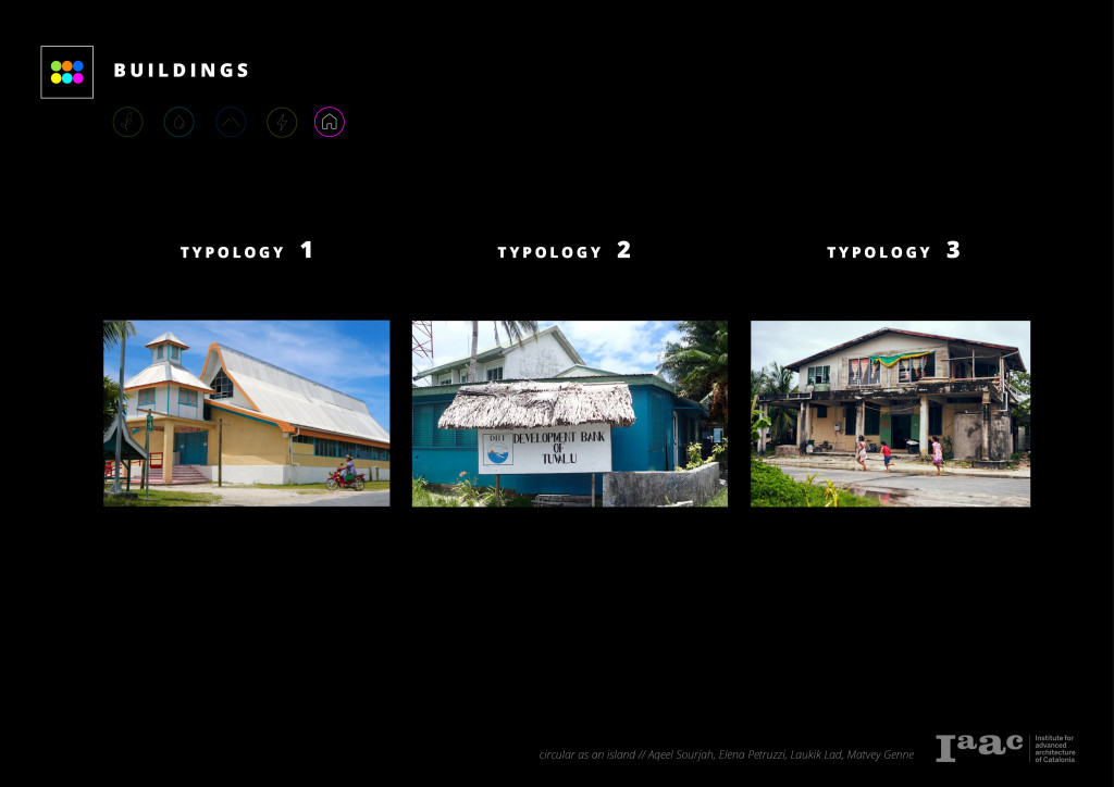
Two approaches are used to collect data in this category. Firstly, Identifying the different footprints of the building through satellite images allowed the classification of three typologies: single building, administrative building, and social building consisting of 2-3 joined structures. The use of OSM data once again processed through the grasshopper plugin ELK helped verify this data to make it more accurate. Using these data collection methods to compliment each other helped mask lapses of accuracy in each method.
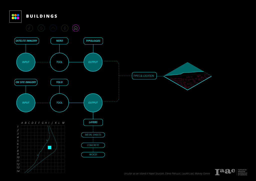
BUILDING MATERIAL
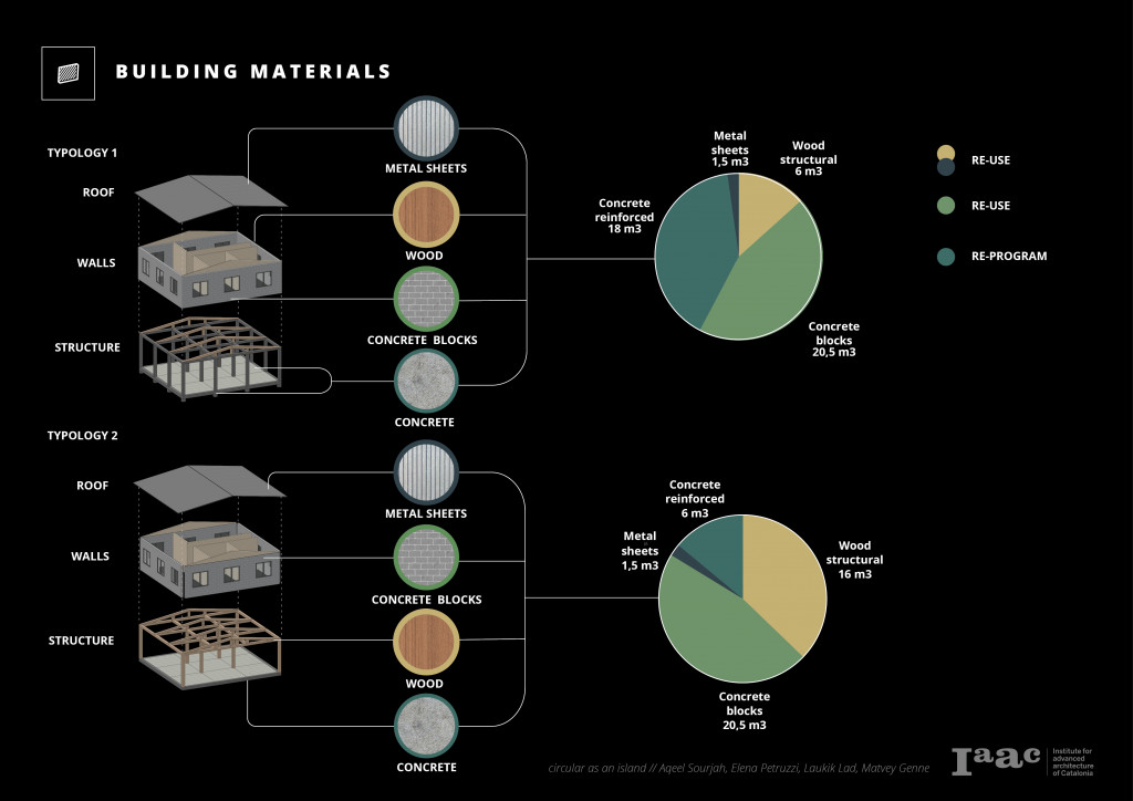
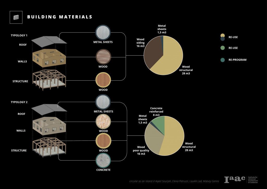
The three building typologies were deconstructed to the ideal material data rich models to map out the use of the material as a ratio against type and square foot area. These ideal models were created after observing and analyzing photographic and video material that was uploaded by individuals on the internet. The reusability of existing building materials is something that can be looked at for a resource scarce context like Tuvalu. By analyzing the building material against the sea level rise simulation, demolition can be pre planned and help maximize the reusability of the material already available on the island.
LIMITATIONS
The methodology derived from this project has some limitations when it comes to data collection. Some of these limitations are that the data collected vary in accuracy across the different categories while also considering the building and material category generalized typologies mean lack of accountability for customized structure. Some of these limitations can be addressed via higher resolution satellite images from companies like MAXAR and European Space Imagery and using onsite data collection methods like aerial photography, street view photography, and surveys.
SEA LEVEL RISE IMPACT
Data collected from the analysis is then translated into a rich map. This rich map is then run against a sea-level rise simulation to analyze and estimate the loss of resources and land during a specific amount of time. This simulation helps the project define safety zones according to a given timeline to categorize the protocols that can be taken. Moreover, this is to be used as a tool to continuously update and monitor the effects sea-level rise has on the case study or any other context with the same issue.
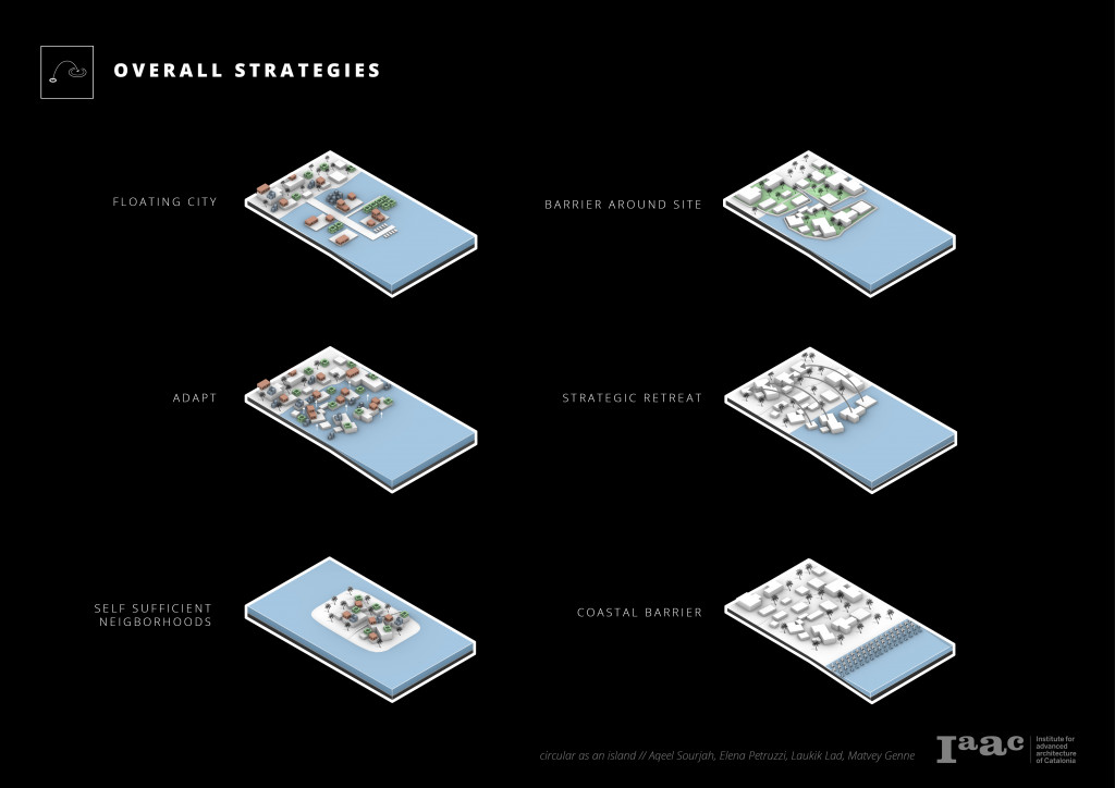
STRATEGIES
General strategies to mitigate the effects of sea level rise in a given context are divided into four different categories.
- Adapt
- Retreat
- Protect
- Preserve
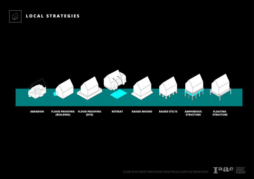
According to the analysis of data received from the algorithm and the external contextual forces, these strategies will specify the appropriate protocols that are to be implemented in a particular context. The project also looks at strategies at a micro level that can be implemented according to the analysis of data received from the algorithm and its need in a given context.
PROTOCOLS
METHODOLOGY
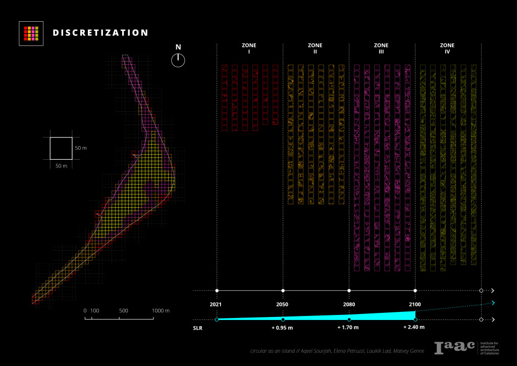
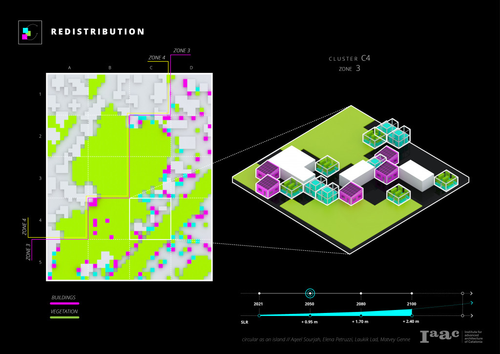
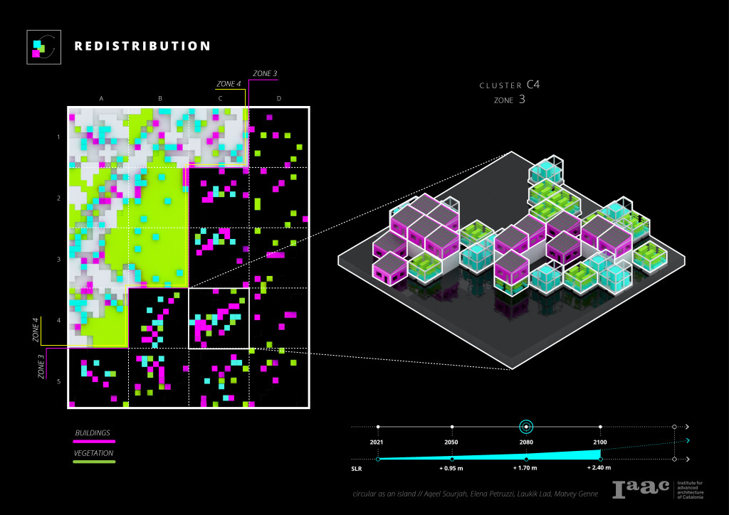
To develop protocols to adapt the strategies to mitigate the effects of sea-level rise, the rich map that was developed was discretized into a cluster of 50mx50m. The population, amount of resources, and soil conditions are then analyzed in these individual clusters.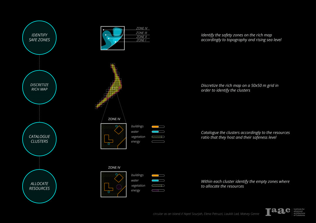


REDISTRIBUTION
CONCLUSIONS
VISION 2100
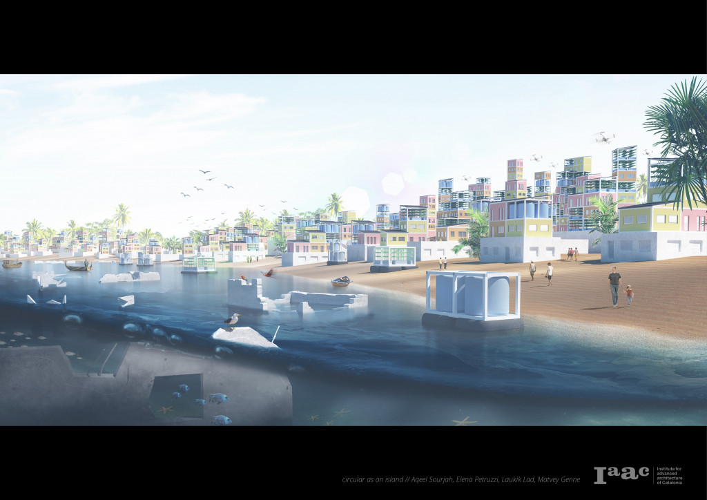
PROJECTION
VIDEO
FULL PROJECT
CoRAAL 1.0 is a project of IAAC, Institute for Advanced Architecture of Catalonia developed at Master in Advanced Architecture in 2020/21 by
Students: Elena Petruzzi, Aqeel Sourjah, Laukik Lad & Matvey Genne
Faculty: Areti Markopoulou, David Andrés León & Raimund Krenmüller
Faculty Assistant: Nikol Kirova
