Master in City & Technology Second Year 2020/22 – Term III
Workshop Name: Cityplain – Cloud-Computing Urban Ecosystems Design
Total Hours: 6 hours
Faculty: Eduardo Mayoral González
Syllabus
Urban population growth is the most critical socio-economic and environmental challenge on the planet and there is a lack of tools to address it adequately. Therefore, we have developed CITYPLAIN.
The current urban population is 50% of the total and by 2050, it will rise to 70%. Consequently, 100 new cities will be built from scratch, 25.000 city extension projects will be planned and 500 million housing units will be built. The total investment estimated to carry out this process is $40 trillion and the environmental impact it may produce, could be immeasurable if cities are not properly planned, designed and managed.
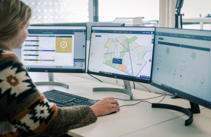
CITYPLAIN is the first cloud-computing tool for the AEC industry to design mixed-use residential city extensions, including the residential fabric, the road network, open spaces, facilities and tertiary uses. It radically reduces time and costs by integrating the urban and architectural scales through standardised patterns, modular components and industrialised constructive systems. Moreover, it enhances urban fabric performance by generating and optimising multiple design scenarios according to functional, environmental and socio-economic indicators.
Therefore, CITYPLAIN improves and accelerates decision-making processes to give rise to better urban ecosystems.
Learning Objectives
At course completion the student will learn how to:
– Use CITYPLAIN to design city extensions.
– Create projects and scenarios within the tool.
– Import a site and enter the required program for it.
– Generate the urban structure and the mobility network of define a structural masterplan.
– Allocate all the different land uses (residential, open spaces, facilities, tertiary uses and parking) to define a detailed masterplan.
– Generate non-residential and residential building typologies (enclosed blocks, open blocks and towers).
– Obtain a territory balance table containing all the figures needed to evaluate a masterplan proposal.
– Calculate all the functional, environmental and socio-economic KPIs implemented in the tool.
– Compare different masterplan scenarios.
– Enter all the data needed to calculate the cost of a masterplan proposal.
Faculty

Eduardo Mayoral is an architect (2004) and doctor (2012) from the University of Seville. He completed the “Master in Sustainable City and Architecture” (2006) at the IUACC in Seville, the “Master in Advanced Architecture” (2008) at the IaaC in Barcelona, and the “Master in Advanced Architectural Design” (2009) at the GSAPP from Columbia University in New York; where he also completed the “Research on Advanced Architecture” program (2010).
Eduardo is an expert in Parametric and Algorithmic Design Technologies, Urban Planning and Advanced Sustainable Architecture. Since 2005 he has worked in different architectural offices. He has been doing so at Citythinking since 2016 as Chief Technology Officer since 2018. He is responsible for the CITYPLAIN project, which consists of developing a cloud-computing tool to design Residential Urban Districts.
Citythinking is an urban and architectural consultancy specialised in designing comprehensive solutions and managing the construction of sustainable city models and affordable multi-family housing within city extensions. It has more than 25 years of national and international experience in planning and urban planning and the standardisation and industrialisation of architecture and construction.
