BACKGROUND
New York City is one of the most famous cities in the world, serving as the birthplace for many large cultural movements and hosting landmarks easily recognizable from modern media. Spread over five boroughs, the city is called home by over 8.8 million people and is the workplace of many more. One of the most diverse and densely populated cities in the world, it has long been considered a creative hub for arts, sciences, and innovation alike, which gives us many interesting factors to consider in the analysis of its composition.
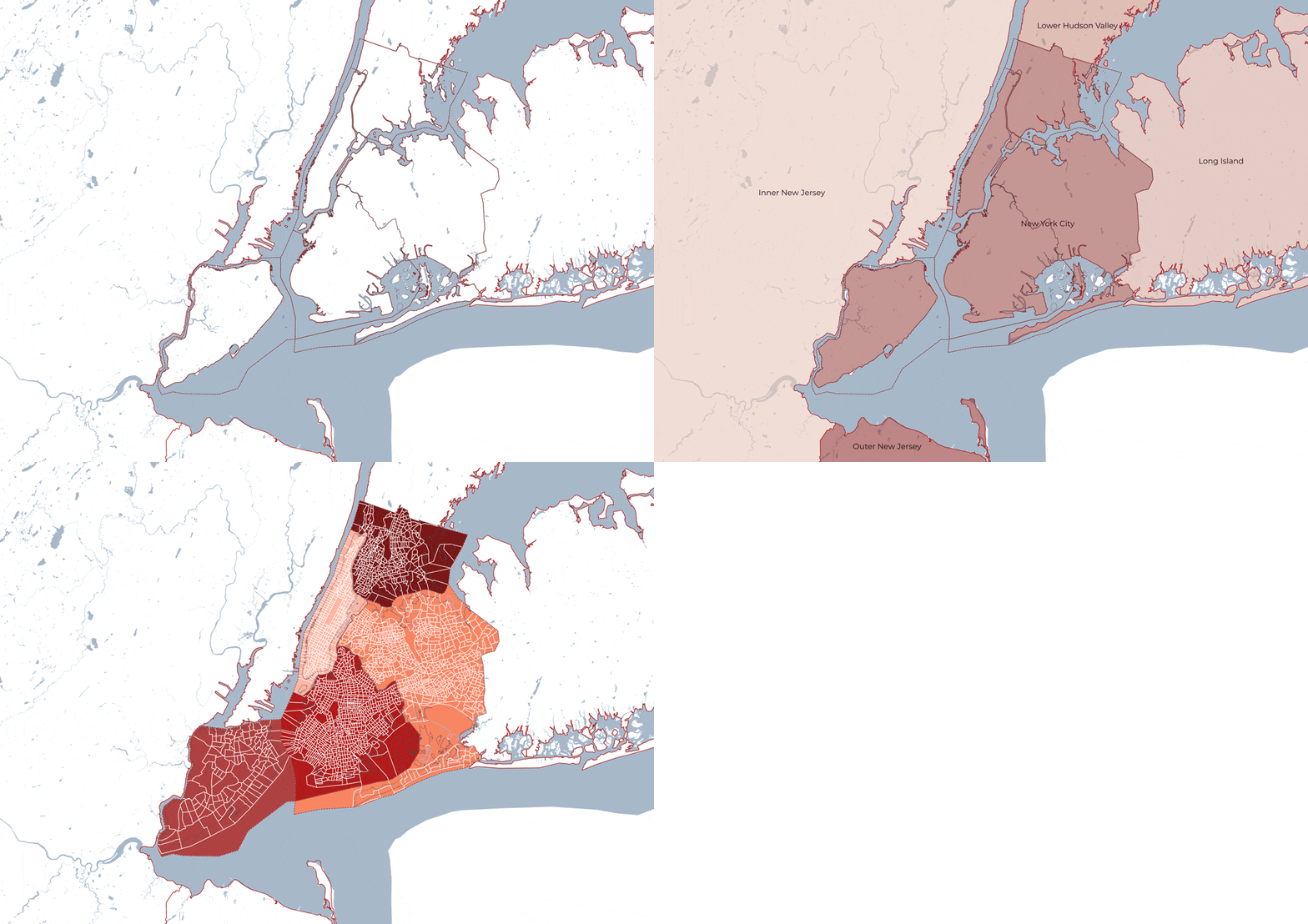
Metropolitan Area

Mobility Systems
ANALYSIS
In order to formulate our ideas of a conceptualized future New York City, we first researched the physical, economic, and social layers that form the structure of the city. After looking at a variety of variables, we recognized several layers that also represented some of the main challenges that New York is facing as a city in the present day. The first we addressed is mobility and connectivity; many people who work in the city commute from the metropolitan area or surrounding areas. Having a significant part of the workforce as non-residents led us to the layer of transport connectivity. Second, we analysed the threats posed to the waterfront due to the climate crisis. By mapping projected sea level rises, we thought to enhance the conditions of the waterfront area and surrounding harbour to address this. Finally, our analysis led us to our main layer of environmental protection and green areas. Most of the city is densely urbanised and there is an overall lack of green space in the city.
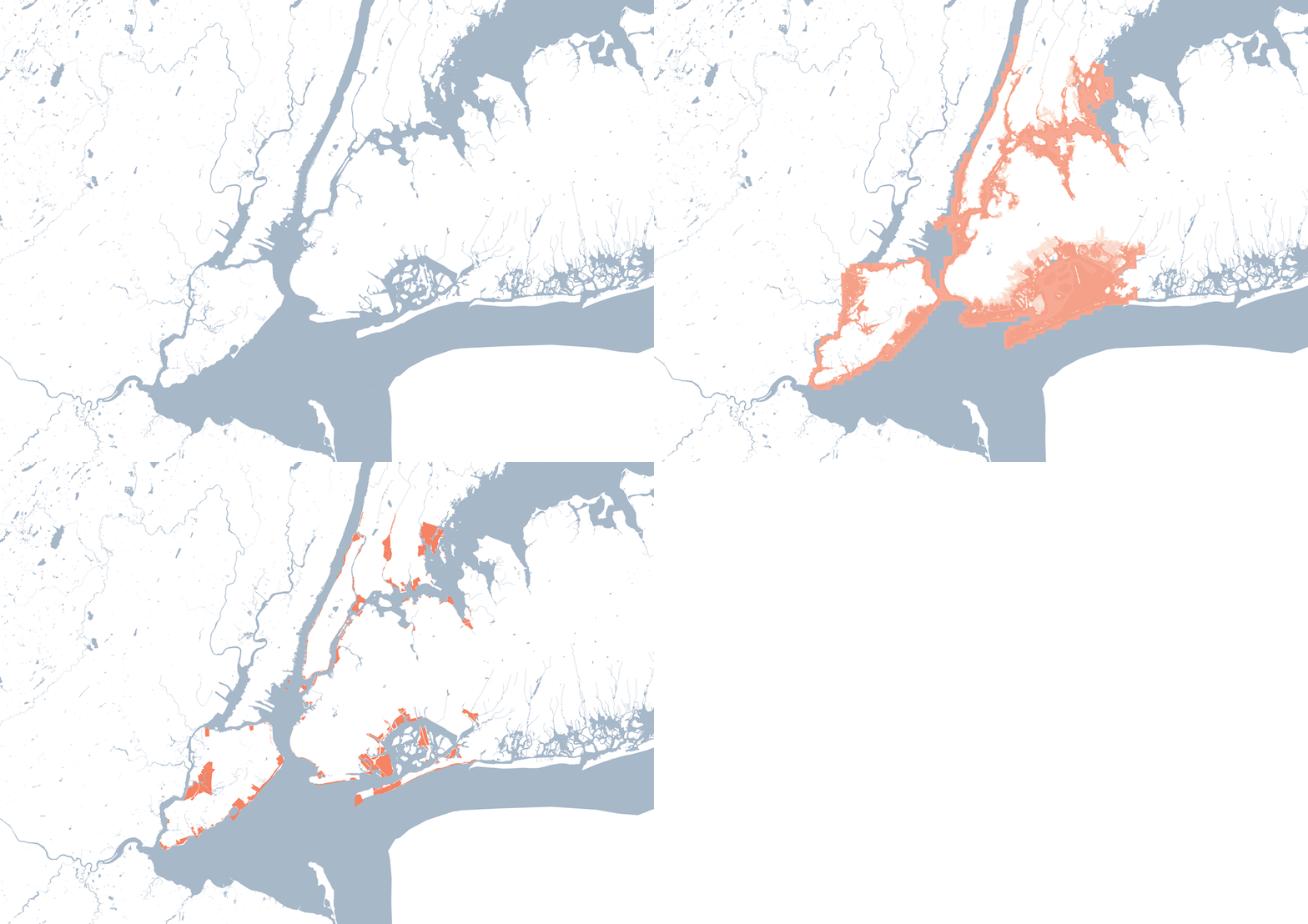
Waterfront Infrastructure
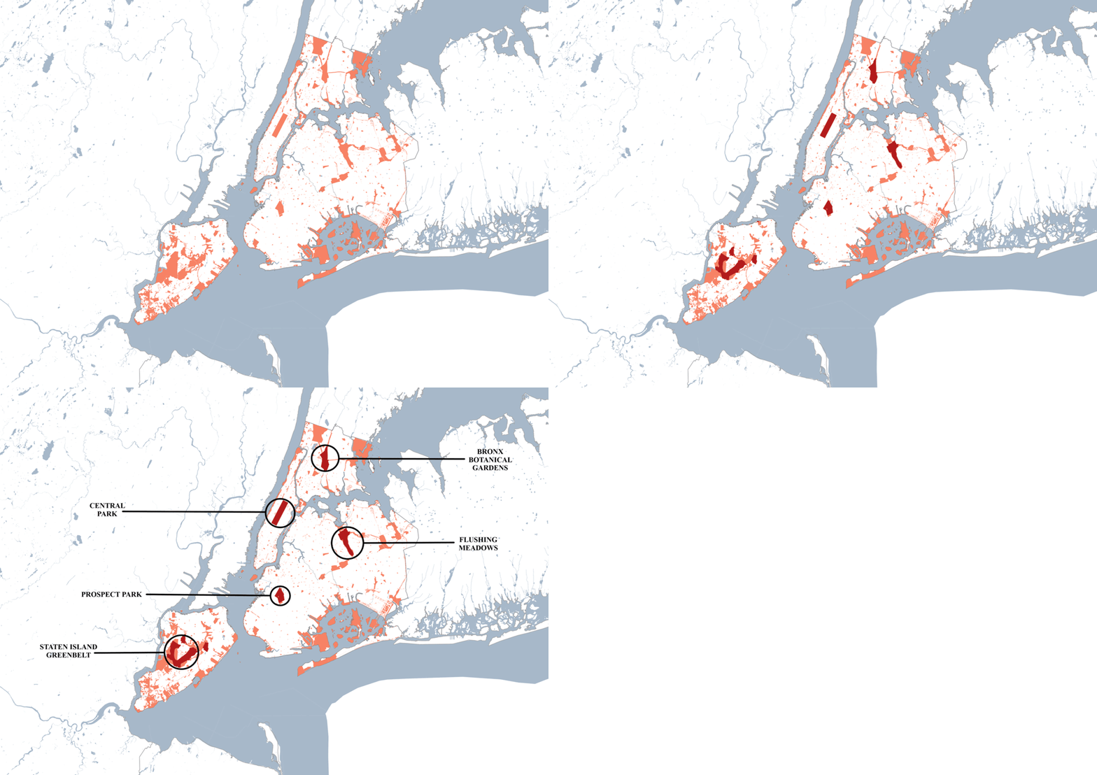
Green Space & Identified Parks

Analysis Summary
PROPOSAL
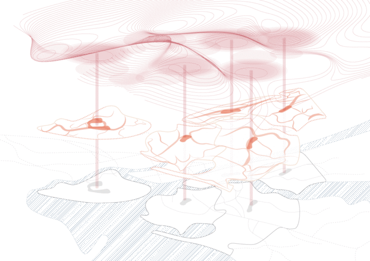
While Manhattan’s Central Park is the most famous, our analysis led us to identify five ‘Central Parks’, each one serving as an anchor for connectivity spread through the city.
We focus on the relationship between the three identified layers – mobility, the waterfront, and green spaces. We approach New York as a city of islands, where each borough has its own ‘Central Park’. They serve as focal points for the sprawl of green space within the boroughs, further dividing the islands and creating green ecological corridors. The five identified central parks act as catalysts, yielding smaller green spaces around it, resulting in a green landscape web spread within and between each borough.

Five Central Parks
An important aspect of these corridors stemming from the ‘Central Parks’ is the connection they give to the waterfront; the need for efficient mobility options and more environmentally friendly commute options for commuters and residents can be addressed by repurposing the waterfront areas. We identify zones prone to flooding due to higher sea level rise and propose to repurpose the area not just as a protection layer but a development serving the public, making the entire waterfront a landmark or an attraction.
We also identified spaces on the waterfront to serve as focal points for heightened connectivity. Not necessarily physical, these connections could be realised visually, functionally or through these physical transport connections over or under water.
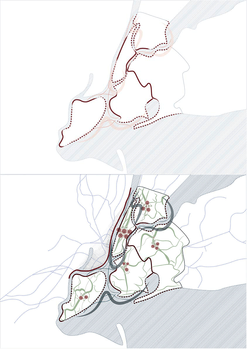
Proposed Connectivity
3-D Proposal
CONCLUSION
Our main idea was to address the challenges revealed to us by examining the layer composition of the city. We chose to address the challenges they revealed by viewing New York as a webbed system with five central parks as opposed to having one borough that serves as the central node. Our proposal will allow for heightened connectivity while addressing the issues of green space scarcity and waterfront infrastructure.

A City of Central Park(5) is a project of IAAC, Institute for Advanced Architecture of Catalonia developed at Master in City & Technology in 2021
Students: Jiyun Lee, Gayatri Agrawal, and Julia McGee
Faculty: Manuel Gausa and Nicola Canessa