Abstract
In the sphere of a rewilding project, with a creation of a new ecological corridor in the region of El Vallès (Catalonia), the analysis of data related to the abandoned crops has been crucial to the development of the project.
In order to go deepen and better understand this territory, the analysis is based on the subdivision of the abandoned crops inside the new corridor. This categorization deals with the location of the crops and the analysis of their surroundings, if they are in relation with the natural or with the anthropogenic ecosystem and the result is the classification in five categories.
The further step consists of the generation of a scatter graph, based on the correlation with the surface of each crop, and the production of histograms, in order to allow to do considerations and elaborate different strategies for the development of the project.
Introduction
The approach to a new project always requires a preliminary analysis of the territory in which it is included and big data represent a powerful tool to go deepen and understand better the area subject of the study.
The project in question is concerning the creation of a new ecological corridor in the region of El Vallès (Catalonia), few kilometres far from Barcelona, and is part of a rewilding programme.
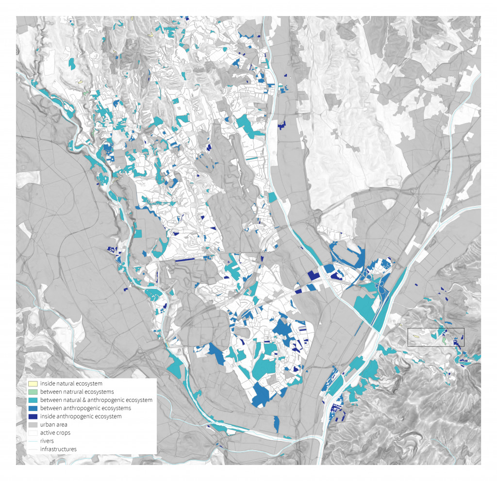
Categorization map.
Methodology
The site of the project is a densely inhabited plain, where cities are separated by large cultivations and industrial districts, entirely surrounded by wide protected natural areas.
The increasing number of abandoned crops is one of the first aspects that caught our attention. Especially because to return areas of land to a wild state, abandoned lands could be considered a great opportunity.
In a broader view, they can also be considered part of the production of waste, typical of anthropogenic ecosystems. So, they can be a way to connect man to nature, to get closer and merge the two ecosystems, opening a new circuit taking advantages especially from the services produced by our interventions.
Moving on the borders of the natural and the “urbanised” ecosystems and given the wide variety of land uses in the area, we considered very important to deepen the relationships among crops and their surroundings.
We selected five categories, from the crop inside a unique natural or anthropogenic ecosystem, to the ones that are in a way part of an ecotone among different ecosystems. So, this categorization allows to identify the location of each crop, depending on the type of ecosystem it is in contact with. This represents just a first step for the analysis of the area, and it is a clear way to find and add more information to support our project.
In fact, thanks to the information obtained it was possible to move to the second step of the analysis, processing all the information we were able to collect. We used these data to generate a scatter graph, putting in correlation the categories with the surface of each crop. The algorithm developed in Python allowed also to produce histograms, and the whole of this results let us to ensure considerations and to start elaborating different strategies for the development of the project.
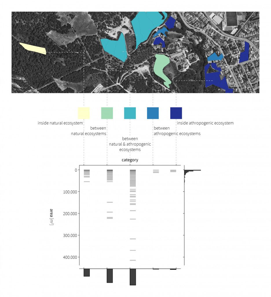
Correlation between categories and areas of abandoned crops in the new ecological corridor of El Vallès.
Conclusions
The use of this tools revealed themselves a key passage in the design process, not only at the initial level but it can be implemented and can guide designers in the development of a project. In fact for us this method is only the initial part of a wider work, a good starting point because it allows to know the characteristics of each crop and to define the most appropriate design choices, but obviously it needs to be empowered in order to give a valid support during the entire design process.
Source: Institut Cartogràfic i Geològic de Catalunya.
CATEGORIZE > ANALYZE > PROJECT is a project of IAAC, Institute for Advanced Architecture of Catalonia developed in the Master in City & Technology in 2020/21 by student: Matteo Murat, and faculty: Diego Pajarito.
